ES:Jaén Mapping Party
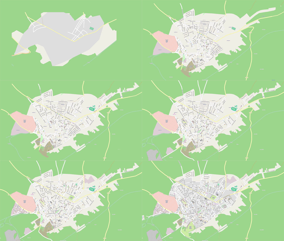
Animación del render antes, dia del mapping y semana posterior:
Before, mapping day and week after render animation:

We will host a extended mapping party at Baeza, Jaén, just prior to the "Geographic Week" to be held afterwards. This mapping party will not only help complete the map, but by inviting professional paleotards cartographers and topographers, we will discuss how the techniques and data compare.
Dónde y cuándo / Where and when
Tendrá lugar en el Paraje Natural de la Laguna en Baeza, Jaén.
El mapeo sera en Baeza ciudad y en el Paraje.
Se editarán y subirán los datos en las aulas de la Escuela de Hostelería
La fecha es: del viernes 15 al domingo 17 de Abril de 2011. Las fechas están cerradas, para poder reservar un espacio en la sala de ordenadores y en el albergue local.
El horario de cada dia esta por cerrar pero podría ser algo así.
- Viernes noche: bienvenida, reparto de sectores, chequeo de los equipos.
- Sábado
- mañana: toma de datos del Paraje
- mediodía: comida cortesía de la Escuela de Hostelería.
- tarde: taller de JOSM y subida de datos del Paraje
- Domingo
- mañana: toma de datos de Baeza.
- mediodía: tapeo/comida libre
- tarde: taller de JOSM y subida de datos de la ciudad.
- Domingo noche o Lunes: a casa
We'll hike through the Paraje Natural de la Laguna, in the municipality of Baeza.
Then we will upload the data in the facilities of the local ospitality school.
Dates are: from friday april 15th until sunday 17th 2011. These dates are firm, in order to reserve a slot for the computer facilities and a local hostel.
Schedules for each day are not firm, but could look like this:
- Friday evening: Meeting, designation of sectors, equipment check.
- Saturday
- morning: Survey the Paraje Natural
- lunch courtesy of Escuela de Hostelería.
- afternoon: Potlatch/JOSM workshop to upload the data from the Paraje
- Sunday
- morning: Survey the city of Baeza
- afternoon: Potlatch/JOSM workshop to upload the data from the city
- Sunday night or Monday trip home.
Por qué / Why
La Diputación Provincial de Jaén organiza una Semana Geográfica del 25 al 29 de Abril. Este mapping party es un evento semioficial de esa semana. Uno de los objetivos es mostrar a cartógrafos profesionales como funciona OSM. Será una oportunidad única de intercambiar conocimientos y aprender unos de otros.
The local government of Jaén will hold a "Geographic Week" during april, 25th-29th. This mapping party is a semi-official detached part of that week. One of the goals of the mapping party is to show to professional cartographers how OSM works.
Quién / Who
El portal de inscripción es en mapping party Baeza 2011 aparte podéis dejar vuestro nombre aquí para saber cuantos osmeros van :
Please make sure you close your inscription at mapping party Baeza 2011 also you can leave your name here so we know how many osmers will attend.
Ivansanchez(debido a horarios del nuevo trabajo due to schedules of new job)- sergionaranja
- Lendulado
- jdmanjon
- Add yourself with ~~~
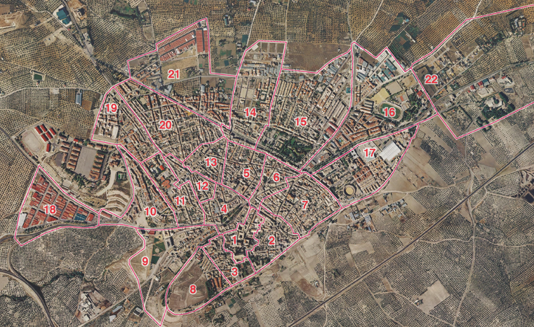
Al final asistieron al mapping party mas de 100 personas que se dividieron en 22 equipos para la toma de datos que duró 3 horas el 20110417
More than 100 people assisted to the mapping party that where divided in 22 teams, that surveyed the village in 3 hours on 20110417.
Contacto / Contact
- La Coordinación se hará a través de la lista española de correo
información oficial en mapping party Baeza 2011 y mapeandobaeza.
- Coordination is being done at the spanish osm list
official info at mapping party Baeza 2011 and mapeandobaeza.
