Software/J2ME
< Software
(Redirected from Java Platform, Micro Edition)OpenStreetMap software running on the Java ME (formerly J2ME) platform.
Software list
General information
| Name | Screenshot | Creator | Platform | Display map | Navigate | Make track | Monitor | License | Price | Languages | Version | Description |
|---|---|---|---|---|---|---|---|---|---|---|---|---|
| 8motions [1] | 8motions Ltd. | yes | yes | yes | no | nonfreeProprietary | free | EN | ?
|
Dead? | ||
| Ape@map [2] | 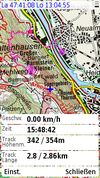
|
Onyx Technologie | Java ME,Android | yes | no | yes | yes | nonfreeproprietary | free | EN | ?
|
|
| BT747 [3] | 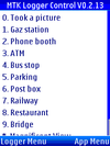
|
Dirk Haase, Mario De Weerd, Thomas Mohme | Java ME, Linux, Mac OS, Palm, Windows, Windows Mobile | no | no | yes | yes | GPL | free | DE; EN | 2010-08-13 2.x.1769 |
MTK GPS chip sets only! |
| Endomondo [4] | 
|
yes | no | no | no | nonfreeProprietary | free | ?
|
?
|
An app for recording and logging workouts. It also allows seeing the position on an OSM map. | ||
| GPS Track for J2ME [5] | 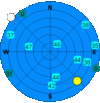
|
Dana Peters | Java ME | no | no | yes | no | GPL | free | EN | ? 1.1 |
|
| GPSed Mobile Application [6] | 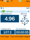
|
GPSed.com | yes | no | yes | no | nonfreeproprietary | free | EN | ? 3.7 |
Client for gpsed.com but works without this service, too | |
| GpsMid [7] | 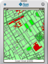
|
Harald Mueller, Kai Krueger, S. Hochmuth, Markus Baeurle, Jyrki Kuoppala & others | Java ME; Android | yes | yes | yes | yes | GPLv2 | free | EN; DE; FI; CS; PL; RU; FR; IT; ES; SK | 2012-09-08 0.8.2 |
very portable navi for Android and J2ME mobile phones, uses offline vector maps, audio navigation |
| HotSpot Navigator [8] | 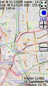
|
Oleg Chubarev | yes | yes | yes | no | nonfreeproprietary | nonfree15$ | EN | 2011-04-25 0.5.2 |
FON Wi-Fi Spots over OSM tiles | |
| LoroDux [9] | 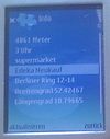
|
Lulu-Ann | Java ME | no | no | no | no | GPL | free | DE | 2010-10-14 alpha |
Routing for visually impaired/blind users |
| Map Mobile Navigator [10] | 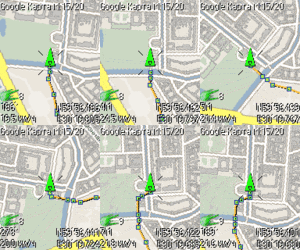
|
Pavel Raev | Java ME | yes | yes | yes | yes | nonfreeproprietary | free | 12+ | 2011-05-03 4.8.14 |
|
| Mobile Atlas Creator [11] | 
|
Java ME | yes | no | no | no | GPL | free | ?
|
2011-06-21 1.9b6 |
Tiles export for lot of mobile offline nav tools | |
| Mobile GMaps [12] | 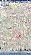
|
Christian Streng | Java ME | yes | yes | yes | no | nonfreeCC-nc-nd | ?
|
EN | 2009-08-22 1.42.01 |
|
| Mobile Trail Explorer [13] | 
|
Tommi Laukkanen | Java ME | yes | no | yes | yes | GPL | free | 5 | 2009-03-24 1.14 |
|
| RoadMap Editor [14] | 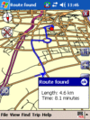
|
FreeMap Israel | Java ME | yes | yes | yes | no | GPL | free | EN; HE | ?
|
Fork of RoadMap |
| ShareNav [15] | 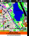
|
Jyrki Kuoppala, S. Hochmuth, Kai Krueger, Harald Mueller, Markus Baeurle & others | Android; Java ME | yes | yes | yes | yes | GPLv2 | nonfree€2.99 on Google Play Store (may vary depending on local taxes) | EN; DE; FI; CS; PL; RU; FR; IT; ES; SK | 2012-11-12 0.8.8 |
very portable navi for Android&J2ME mobile phones, uses offline vector maps, audio navigation |
| SikaSimplex [16] | 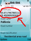
|
Antti Järvinen | Java ME MIDP-2.0 with JSR179 | no | no | yes | no | GPL | free | EN | 2009-09-08 0.0.1 |
Log Roads directly to OSM |
| TrackMyJourney [17] | Stephen Dartnall | yes | yes | yes | yes | nonfreeproprietary | nonfree12/18 EUR for 6/12 months | EN | ? 0.8.0 |
Limited Free Version Available | ||
| TrekBuddy [18] | 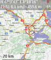
|
Ales Pour (Kruch) | Java ME, Android | yes | yes | yes | yes | nonfreenonfree | free | EN, localizations | 2014-07-29 1.2.6 |
Highly customizable navigation/map display tool |
| VGPS [19] | 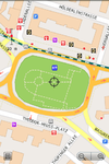
|
Digital Mobile Map | Android; Java ME | yes | yes | no | no | nonfreeproprietary | nonfree5$ | EN | 2011-11-28 8.0 |
OSM and Garmin offline map with routing turn-by-turn navigation for Android and J2ME mobile phones |
| We-Travel [http://Main We-Travel.biz site] | 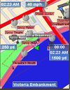
|
Java ME | yes | yes | yes | no | nonfreeproprietary | free | EN | 2010-02-09 0.9.12 |
Highly modular and customizable navi | |
| Wisepilot [20] | 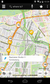
|
Appello | yes | yes | no | no | nonfreeproprietary | nonfree€1.79 monthly | EN; DE; ES; FR; SV; and much more | 2014-04-03 5.0.2 |
online turn-by-turn navigation |
Map display features
| Name | Shows map as vector | Shows map as bitmap | Stores map-data on-board | Stores map-data off-board (downloads from internet) | Rotate map | 3D view |
|---|---|---|---|---|---|---|
| 8motions | no | yes | no | yes | no | no |
| Ape@map | no | yes | yes (cache) | no | yes | no |
| Endomondo | ?
|
?
|
no | yes | ?
|
no |
| GPSed Mobile Application | ?
|
?
|
?
|
?
|
?
|
?
|
| GpsMid | yes | yes | yes | yes | yes | yes |
| HotSpot Navigator | no | yes | yes | yes | no | no |
| Map Mobile Navigator | no | yes | yes (cache) | yes | yes | no |
| Mobile Atlas Creator | no | yes | no | yes | no | no |
| Mobile GMaps | no | yes | yes (cache) | yes | yes | no |
| Mobile Trail Explorer | no | yes | yes (cache) | yes | no | no |
| RoadMap Editor | yes | no | yes | no | yes | yes |
| ShareNav | yes | yes | yes | yes | yes | yes |
| TrackMyJourney | yes | yes | yes | yes | yes | yes |
| TrekBuddy | no | yes | yes | no | yes | no |
| VGPS | yes | no | yes | no | yes | no |
| We-Travel | yes | yes | yes | no | ?
|
yes |
| Wisepilot | yes | yes | no | yes | yes | yes |
| Name | Navigate to point | Find location | Find nearby POIs | Navigate along predefined route | Create route manually | Calculate route | Calculate route without internet | Car routing | Bike routing | Foot routing | Turn restrictions | Navigation with voice | Keep on road | Works without GPS |
|---|---|---|---|---|---|---|---|---|---|---|---|---|---|---|
| 8motions | yes | yes | no | ?
|
?
|
?
|
?
|
yes | no | no | no | no | no | ?
|
| GpsMid | yes | yes | yes | no | no | yes | yes | yes | yes | yes | yes | yes | no | yes |
| HotSpot Navigator | yes | no | yes | ?
|
?
|
?
|
?
|
no | no | no | no | no | no | yes |
| Map Mobile Navigator | yes | yes | no | ?
|
?
|
?
|
?
|
no | no | no | no | no | no | ?
|
| Mobile GMaps | ?
|
yes | yes | ?
|
?
|
?
|
?
|
no | no | no | no | no | no | ?
|
| RoadMap Editor | yes | yes | no | ?
|
?
|
?
|
?
|
?
|
?
|
?
|
no | no | ?
|
yes |
| ShareNav | yes | yes | yes | no | no | yes | yes | yes | yes | yes | yes | yes | yes | yes |
| TrackMyJourney | yes | yes | yes | ?
|
?
|
?
|
?
|
yes | yes | yes | ?
|
no | yes | partial |
| TrekBuddy | ?
|
?
|
?
|
?
|
?
|
?
|
?
|
?
|
?
|
?
|
no | no | no | yes |
| VGPS | yes | yes | yes | no | ?
|
yes | ?
|
yes | no | no | yes | yes | yes | yes |
| We-Travel | yes | yes | yes | ?
|
?
|
?
|
?
|
yes | yes | yes | ?
|
yes | ?
|
?
|
| Wisepilot | yes | yes | yes | ?
|
?
|
?
|
?
|
yes | no | yes | yes | yes | ?
|
no |
Track making features
| Name | Customizable log interval | GPX format | KML format | NMEA format | All formats | Geo-tagged notes | Geo-tagged photos | Geo-tagged audio | Fast POI buttons |
|---|---|---|---|---|---|---|---|---|---|
| 8motions | yes | yes | yes | no | gpx;kml | yes | yes | no | no |
| Ape@map | yes | yes | no | yes | gpx;nmea | yes | no | no | no |
| BT747 | yes | no | no | no | GPX, KML, CSV, HTML, PLT, TRK | no | yes | no | yes |
| GPS Track for J2ME | yes | yes | yes | no | gpx;kml;csv | no | no | no | no |
| GPSed Mobile Application | ?
|
yes | no | no | gpx;proprietary | ?
|
?
|
?
|
yes |
| GpsMid | yes | yes | no | yes | gpx;nmea | no | yes | yes | yes |
| HotSpot Navigator | no | no | no | no | bin | no | no | no | yes |
| Map Mobile Navigator | yes | yes | yes | yes | gpx;kml;nmea;ozi | yes | yes | no | yes |
| Mobile GMaps | ?
|
?
|
?
|
?
|
?
|
?
|
?
|
?
|
?
|
| Mobile Trail Explorer | yes | yes | yes | no | gpx;kml | yes | no | yes | yes |
| RoadMap Editor | ?
|
?
|
?
|
?
|
?
|
?
|
?
|
?
|
?
|
| ShareNav | yes | yes | no | yes | gpx;nmea | yes | yes | yes | yes |
| SikaSimplex | yes | yes | no | no | gpx | yes | no | no | ?
|
| TrackMyJourney | yes | yes | yes | yes | gpx;kml;nmea;csv;txt;ozi | yes | yes | yes | yes |
| TrekBuddy | yes | yes | no | yes | gpx;nmea | yes | yes | yes | no |
| We-Travel | yes | yes | yes | no | gpx;kml | yes | yes | no | yes |
Monitoring features
| Name | Show current track | Open existing track | Altitude diagram | Show DOP value | Satellite view | Show live NMEA data | Send current position via SMS | Upload current position |
|---|---|---|---|---|---|---|---|---|
| Ape@map | yes | yes | yes | ?
|
yes | no | yes | yes |
| BT747 | yes | yes | yes | yes | yes | yes | no | yes |
| GpsMid | yes | yes | yes | yes | yes | yes | yes | no |
| Map Mobile Navigator | yes | yes | yes | yes | yes | no | yes | yes |
| Mobile Trail Explorer | yes | yes | yes | yes | yes | no | yes | yes |
| ShareNav | yes | yes | yes | yes | yes | yes | yes | no |
| TrackMyJourney | yes | yes | yes | yes | yes | yes | no | yes |
| TrekBuddy | yes | yes | yes | yes | yes | no | no | no |
OpenStreetMap editing features
| Name | Add POIs | Edit / Delete POIs | Edit arbitrary tags of existing OSM objects | Edit geometries | Support imagery offset DB | Upload to OSM |
|---|---|---|---|---|---|---|
| GpsMid | yes | yes | yes | not directly, will open web browser editor for area | ?
|
yes |
| ShareNav | yes | yes | yes | not directly, will open web browser editor for area | ?
|
yes |
Other
Some small applications, which can't display OSM map, but maybe useful for mapping.
- AFTrack (Symbian OS, $32)
- creates tracks, shows speed, altitude. Exports in a number of formats.
- GETrack [21] (Java ME, $13.99)
- logs your location at a variety of intervals. Exports the data in a number of formats, including GPX on some Nokia phones.
- gpspys60 [22] (Symbian OS/Python)
- dumps the NMEA-0183 lines into a file that works with most bluetooth GPS receiver.
- Loadstone (Symbian OS)
- a useful navigational tool for everyone, it is particularly useful for blind and visually impaired people using screen readers.
- LocateMe (Java ME)
- shows direction to a target, satellite view and live NMEA data.
- Mobimap [23] (Java ME, BSD-3-clause)
- city navigator with bundled vector city maps converted from MapInfo format into its own format.
- Mobile Street Map [24] (Java ME)
- shows prepared prepared from OSM map converted [25] to own ".mapth" format. Has predictive search for streets.
- Navlet [26] (Java ME)
- shows current position, HDOP value, live NMEA data and sends SMS.
- Nokia Location Tagger [27] (Symbian OS)
- can geotag photos on some Nokia phones.
- PyS60Editor (Symbian OS/Python)
- an OSM editor.
- trakkcor [28] (Java ME)
- uploads current position to a server.
- Run.gps (Win CE)
- uploads tracks and current position to a server.
- SikaSimplex (J2ME, GPL)
- Datalogger that uploads logged tracks to OSM server.
- Explorers Tracker by CEALogs (Symbian S60 3rd & 5th Ed. OS, $11.90. Free 30 day trial version.)
- creates tracks, shows direction and distance to local places, shows speed, altitude. Free PC utilites transfer data to and convert to KML.
- Mom - Mobile Open Mapper
- GpsMid - free software, licensed under GPL, has also preliminary routing support
- 8motions - Free software, commerciale lincense under request, can be used to render OSM data and KML/GPX data on top of OSM but also to create GPX informations to be used to create OSM maps
- Mgmaps - gratis, licensed under Attribution - NonCommercial - NoDerivs Creative Commons license.
- LoroDux - GPS Software with OSM POIs for the blind