Kerala/Grants/HOTBoosterGrant2023/Proposal/Openstreetmap in Global Science Festival Kerala
'Geographic insights via OpenStreetMaps'
Your project
The Global Science Festival Kerala (GSFK) 2024 is Asia’s largest thematically curated science exhibition. It is a unique platform that aims to bring together scientists, artists, students, and science enthusiasts worldwide to celebrate science. The organizers contacted the OSM Community Kerala to have a talk on OSM as a part of the Citizen Science Initiatives
Describe the local challenge your project is addressing
Citizen science involves the participation of volunteers in scientific research, typically in collaboration with professional scientists or scientific organizations. There is a natural synergy between citizen science and OpenStreetMap.Citizen science projects often involve collecting spatial data that can be added to OpenStreetMap. For example, volunteers might track wildlife sightings, monitor water quality, or document changes in land use. This data can complement existing information in OSM and improve the map's accuracy and completeness. By working together, volunteers can leverage their collective expertise and resources to address complex challenges and create valuable resources for research, advocacy, and decision-making.
Describe your project
The collaboration between citizen science and OpenStreetMap demonstrates the power of crowdsourcing and community engagement in generating, sharing, and utilizing geospatial data for diverse purposes. By introducing OSM among the volunteers we are trying to have a platform for the knowledge sharing between the communities.
Describe your sustainability plan
Continuing the collaboration between citizen science and OpenStreetMap involves several key steps to further enhance the synergy between these two initiatives:
- Identify Common Goals: Establish clear goals and objectives that align with the interests and priorities of both the citizen science community and the OpenStreetMap community. Identify areas where the data collected through citizen science projects can contribute to improving and updating OpenStreetMap, and vice versa.
- Engage Stakeholders: Engage stakeholders from both the citizen science and OpenStreetMap communities, including researchers, volunteers, organizations, and decision-makers. Foster open communication channels and collaboration platforms to facilitate discussions, exchange ideas, and coordinate activities.
- Promote Integration: Explore ways to integrate citizen science data into OpenStreetMap and vice versa. Develop tools, workflows, and protocols for sharing, validating, and incorporating citizen science data into OSM, ensuring compatibility with existing data standards and quality assurance processes.
- Provide Training and Support: Offer training and support to citizen scientists and OpenStreetMap contributors to enhance their skills and capabilities in data collection, mapping, and analysis. Provide guidance on best practices, data quality standards, and community guidelines to ensure the accuracy, consistency, and reliability of the data contributed.
- Facilitate Collaboration Events: Organize collaborative events, such as mapping parties, hackathons, workshops, and conferences, where citizen scientists and OpenStreetMap contributors can come together to exchange knowledge, share experiences, and work on joint projects. These events can help foster a sense of community, build relationships, and catalyze new collaborations.
- Develop Shared Resources: Create shared resources, such as tools, datasets, documentation, and tutorials, to support collaboration between citizen science and OpenStreetMap. Develop open-source software, plugins, and APIs that facilitate the integration and analysis of citizen science data within the OpenStreetMap ecosystem.
- Promote Use Cases: Showcase successful use cases and applications that demonstrate the value and impact of integrating citizen science and OpenStreetMap data. Highlight examples where combined datasets have been used for research, planning, advocacy, or decision-making to inspire further collaboration and adoption.
What are your community-defined project goals, and how do you define project success?
- Increased Data Coverage: One goal could be to increase the coverage and detail of geographic data in OpenStreetMap through contributions from citizen science projects. Success in this aspect could be measured by the amount of new data added, such as new roads, buildings, land use classifications, or points of interest.
- Data Quality Improvement: Another goal might be to improve the quality and accuracy of spatial data in OpenStreetMap by validating and verifying contributions from citizen science projects. Success could be measured by the percentage of data that meets predefined quality standards or passes validation checks.
- Community Engagement: A goal could also be to foster engagement and participation within the citizen science and OpenStreetMap communities. Success could be measured by the number of active contributors, the diversity of contributors, or the level of collaboration and interaction among community members.
Partnerships
A key goal for many citizen science and OpenStreetMap projects is to promote openness and accessibility in geographic information. Success could be measured by the availability of data in open formats, the adoption of open-source tools and standards, or the inclusivity of the project in terms of language, culture, and accessibility.
Ultimately, project success should be defined in collaboration with stakeholders and should reflect the overarching goals, values, and priorities of the community involved. Regular evaluation and feedback mechanisms are essential for assessing progress towards these goals and adapting strategies as needed to achieve them.
Describe who will use your data
Public usage of data and sharing are core principles of both citizen science and OpenStreetMap initiatives, reflecting a commitment to openness, collaboration, and democratization of geographic information. These efforts contribute to a more informed and engaged society by empowering individuals and organizations to access, use, and contribute to a wealth of spatial data resources.
Describe any other partnerships and collaborations you plan to mobilise or establish for the purpose of the project
Efforts are made to educate the public about the value of open data and how it can be used for research, education, advocacy, and decision-making. Outreach activities such as workshops, training sessions, and community events help to raise awareness about the availability and potential applications of the data sets generated by citizen science and OpenStreetMap projects.
Expansion
Public usage of data and sharing are core principles of both citizen science and OpenStreetMap initiatives, reflecting a commitment to openness, collaboration, and democratization of geographic information.
Project plan and budget
Budget breakdown
- Travel, To and fro (4 Persons) - 5000
- Stay, 1 days (4 Persons) - 4000
- Food, (4 Persons) - 1000
Project plan
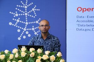
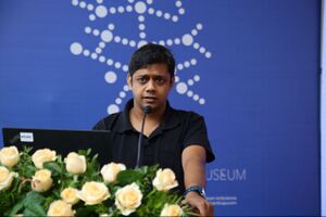
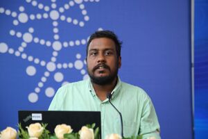
Talk given on the presentation listed below:
File:Harnessing_Citizen_Science_Through_OpenStreetMap.pdf
Participants
From OSM Community
- Akhil Krishnan S
- Manoj Karingamadathil
- Jinoy Tom Jacob
- Athul RT
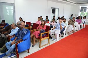
As attendees
- Males : 23
- Females : 17
Declaration
By submitting this form to OpenStreetMap Kerala Team, you certify the information contained in this application is correct, and that if you are awarded a grant, you will use it only for the purposes described above. You will provide written documentation and receipts for all of your expenses to Humanitarian OpenStreetMap Team to demonstrate this. You understand that the decisions made by the Booster Grant facilitation committee are final.
Akhil Krishnan S, ![]() Akhilan (on osm, edits, contrib, heatmap, chngset com.)
Akhilan (on osm, edits, contrib, heatmap, chngset com.)
Endorsements
Community members are encouraged to endorse your project request here!


