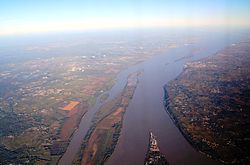
Key:estuary
Jump to navigation
Jump to search
 |
| Description |
|---|
| A part of a river's water body where the tide comes in. |
| Group: marine |
| Used on these elements |
| See also |
|
| Status: in use |
| Tools for this tag |
A tidal river (such as the Hudson up to Federal Dam, or the Thames up to Teddington Lock) is called an estuary.
You may add the tag estuary=yes in such a case.
See also Proposal:Tidal Rivers.