Key:farmyard
Jump to navigation
Jump to search
 |
| Description |
|---|
| For mapping special types of farmyards |
| Group: agriculture |
| Used on these elements |
| Documented values: 1 |
| Requires |
| Status: in use |
| Tools for this tag |
Special types of farmyards, such as ![]() Feedlots, can be distinguished from other farmyards by this tag, which is added to a farmyard feature tagged as
Feedlots, can be distinguished from other farmyards by this tag, which is added to a farmyard feature tagged as landuse=farmyard
Common values
| Value | Comment | Photo |
|---|---|---|
feedlot
|
for a |

|
stockyard
|
for a |

|
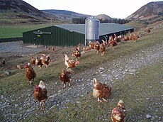
poultry
|
for a farmyard area used for raising poultry, usually chickens, for meat or eggs. | 
|
fur
|
for a farmyard area used for raising fur animal, usually minks, foxes, ferrets . | |
dairy
|
for a farmyard area used for raising cows for milk. | |
| user defined | See all commonly used values on Taginfo |