Key:lock:height
Jump to navigation
Jump to search
| Description |
|---|
| Drop height of a ship lock |
| Group: waterways |
| Used on these elements |
| Useful combination |
| Status: in use |
| Tools for this tag |
|
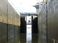
Drop height or lifting height of a ship lock.
How to map
The mapping of a lock and its components is described on the wiki page lock=*.
