Leicester
| V・T・E |
| latitude: 52.631, longitude: -1.128 |
| Browse map of Leicester 52°37′51.60″ N, 1°07′40.80″ W |
| Edit map |
|
External links:
|
| Use this template for your locality |
Leicester is a city in Leicestershire at latitude 52°37′51.60″ North, longitude 1°07′40.80″ West.

.
Leicester 162353![]() 162353 is a city and unitary authority in the East Midlands region of England. Together with the non-metropolitan county of Leicestershire it forms the ceremonial county of Leicestershire.
162353 is a city and unitary authority in the East Midlands region of England. Together with the non-metropolitan county of Leicestershire it forms the ceremonial county of Leicestershire.
Progress
Leicester can be divided neatly into pie segments, based on the river, the railway, and the major roads which meet at the city centre (A6, A47, A50).

| Region | Bounded by | Status |
|---|---|---|
| 1: City centre | area inside A594 | believed done apart from a few cul-de-sacs and footways/arcades. one-way system needs verifying. |
| 2: Belgrave, Rushey Mead, St Matthew's | between river and railway | St Matthew's, St Marks, western Belgrave complete. Eastern Belgrave/Rushey Mead todo. Needs checking around Thames Tower. |
| 3a: Northfields, Thurnby Lodge, Hamilton | between railway line and Uppingam Road (A47) | 90% done. Hamilton industrial estate todo. |
| 3b: Highfields, Evington, Stoneygate | between Uppingham Road and London Road (A6) | through roads done; Evington/Spencefield/Rowlatts Hill/North Evington/Crown Hills/Evington Valley/South Highfields, Spinney Hills, Highfields, Stoneygate DONE |
| 4: Clarendon Park, Knighton | between London Road and railway (south) | Done |
| 5: Aylestone, Saffron Lane Estate | between railway and river | bare. section north of Raw Dykes Road/Counting House Road believed done. |
| 6: Braunstone, Narborough Road | between river and A47 | section east of Fosse Road and north of railway line 90% done. rest bare. |
| 7: New Parks, Westcotes | between A47 and A50 | bare. Tudor Road area done. |
| 8: Beaumont Leys | between A50 and river | bare |
Main roads and junctions
All main roads and junctions are believed to be done except:
- A50 - needs naming around Groby.
Railway lines
- Leicester is on the Midland Main Line. this is tagged.
- The Birmingham-Peterborough line has junctions with the MML north and south of Leicester. these are tagged.
- The Great Central Line extended through Leicester as well. the northern part of this is a heritage railway, which is tagged down to Birstall. Where is the actual southern terminus of this (Leicester North)? Since I wasn't sure I tagged it just down to Station Road in Birstall. Apparently access to Leicester North is via a road off the ringroad called The Sidings.
- The southern section of the Great Central Line has been tagged railway=dismantled. most of this is the Great Central Way, a footpath/cyclepath. this needs cycling down.
- There is a bridge by Braunstone Gate/Western Boulevard (the Bow String Bridge) which was associated with the railway. The council may have to tear it down, but it's still standing for the moment. Acquire this.
- railway line to Coalville/Byurton. This still exists but is freight only. goes west from Southfields. Have traced from landsat/NPE. details of the junction with the MML unclear.
Rivers and canals
The Soar and Soar Navigation are done. Not all weirs and locks are marked.
No other major rivers in Leicester itself, until one gets to the Wreake, but a variety of little brooks.
Areas of new(ish) development
- Hamilton
- Hamilton is done as of 20 December 2007.
- there is still active housebuilding in the area. Saxthorpe Road, Mundesley Road, Brompton Road, Fencote Road, Kepwick Road, Heritage Road (north) are not yet complete.
- additionally, there is development near the spur of road just near to Hope Hamilton School
- Bede Island South
- done. development appears complete.
- Filbert Street stadium
- Lineker Road mapped through site. site not entirely developed yet. no obvious extra roads.
- Freemen's Meadow
- south of Upperton Road, between Soar and Great Central Way
- did what was there. more under development.
- Towers site
- Went as far as I felt comfortable with. More stuff at the end of Herongate Road looks like under construction.
- have both ends of Herongate Road now, but is not yet a through road as middle section fenced off
- Blackbird Road
Known missing
- Footpaths off Upper Hall Close, Netherhall
- Footpath between Scraptoft Lane and Cardinal's Walk
- Footpaths (2) between Uppingham Road and Wintersdale Road
- many footpaths in the Northfields estate, around Forest Road, Buckland Road, Brighton Road, Holkham Avenue, Bramall Road, etc
- bridleway between Hamilton Way and Hamilton, possibly on original line of Thurmaston Lane
- Gamel Walk, off Gamel Road
- footpath north from Lower Keyham Lane
- footpaths in the Rowlatts Hill estate, including Ambassador Walk (off Ambassador Road), Birkenshaw Walk, Cross Walk, Botley Walk, Godston Walk, Chalgrove Walk, Garsington Walk, Radstone Walk
- footpath leading to Beatty Avenue from Uppingham Road
- Smith Dorrien Road
- footpaths in the Tudor Road estate
- South Highfields
- Evington Footpath (part)
- Gordon Avenue
- at least one other random mews?
- Bartholomew Street (most)
- St Matthews/St Marks
- various random footpaths, including Cotman Walk, Somerscales Walk, Housman Walk, Rawsthorne Walk, Keays Walk,
- Station Street
Parks & open spaces
| Park | Location | Status | Footpaths | Facilities |
|---|---|---|---|---|
| Abbey Park | north of city centre | exists | a few done | not done |
| Appleton Park/Peebles Way Nature Area | Rushey Mead | not done | not done | not done |
| Aylestone Hall Gardens | Aylestone | not done | not done | not done |
| Aylestone Meadows | Aylestone | not done | not done | not done |
| Aylestone Road Recreation Ground | Aylestone | not done | not done | not done |
| Beaumont Park | Beaumont Leys | not done | not done | not done |
| Bede Park | west of city centre | exists | Done | Done |
| Braunstone Park | Braunstone | exists | not done | not done |
| Castle Gardens | west of city centre | exists | done | n/a |
| Castle Hill Country Park | northwest of city | not done | not done | not done |
| Cossington Recreation Ground | Belgrave | exists | not done | not done |
| Craven Recreation Ground | Northfields | exists | not done | not done |
| Downing Drive Open Space | Evington | not done | not done | not done |
| Elston Fields (aka 'Tick Tock Park') | ? | not done | not done | not done |
| Evington Park | Evington | exists | done | done |
| Knighton Park | Knighton | not done (runs into racecourse and golf club) | not done | not done |
| Humberstone Community Gardens | Humberstone | not done | not done | not done |
| Humberstone Park | Humberstone | exists | not done | not done |
| Lily Mariot Gardens | Rowlatts Hill | exists | not done | not done |
| Monks Rest | Humberstone | exists | not done | not done |
| Nelson Mandela Park | Braunstone | exists | not done | not done |
| Netherhall Road Open Space | Netherhall | exists | not done | not done |
| Ocean Road Open Space | Thurnby Lodge | exists | not done | not done |
| Prebend Gardens | Highfields | exists | not done | not done |
| The Rally | northwest of city centre | exists | a few done | not done |
| Rushey Fields Recreation Ground | not done | not done | not done | |
| Sedgebrook Road Open Space | Evington | done | not done | not done |
| Shady Lane Arboretum | south of Evington | exists | mostly done | n/a |
| Sparrow Park | Uppingham Road | exists | not done | not done |
| Spinney Hill Park | Highfields | exists | not done | not done |
| Stokeswood Park | Groby Road | exists | not done | not done |
| Thirlmere Street Gardens | Walnut Street | exists | not done | not done |
| Tudor Park | west of city centre | exists | not done | not done |
| Victoria Park | southeast of city centre | exists | some done | not done |
| Watermead Country Park | Birstall/Thurmaston | exists (cudely) | some done | not done |
| Western Park | Dane Hills | exists | not done | not done |
| Willowbrook Park | Thurnby Lodge | exists | not done | not done |
Golf courses:
- Birstall - done from landsat
- Glen Gorse - done from landsat
- Oadby - runs into Racecourse/Knighton Park, needs site visit to determine borders between these, as hard to guess from landsat
- Scraptoft - done from landsat - borders may not be right
- Humberstone Heights - done from landsat
- Leicestershire - done from landsat
where does the golf course stop and the Shady Lady Arboreutem start?boundary with Shady Lane Aboretum determined on site visit- footpath going through Leicestershire Golf Club to acquire
- Western Park - todo
Surrounding villages and towns
- Scraptoft - done
- Thurnby - done
- Bushby - done
- Houghton on the Hill - 75% done
- Stoughton - marked
- Stretton Magna
- Stretton Parva
- Oadby - marked
- Great Glen - marked
- Burton Overy - marked
- Newton Harcourt - marked
- Wigston Magna - small parts done
- South Wigston - 50% done?
- Glen Parva - marked (in right place or not?)
- Blaby - marked - possibly someone working on it
- Whetstone - done
- Countesthorpe - marked
- Cosby - marked
- Narborough - marked
- Littlethorpe
- Enderby - marked
- Braunstone - marked
- Leicester Forest East - marked
- Kirby Muxloe - marked, some roads added.
- Ratby - marked, principle through roads added.
- Glenfield - marked, principle through roads added
- Groby - 50% done, occausionally worked on.
- Anstey - marked
- Newton Linford - marked
- Cropston - marked
- Thurcaston - marked
- Birstall - large parts done. complete?
- Wanlip - marked
- Thurmaston - marked
- Syston - marked
- Queniborough - marked
- Barkby - marked
- Barkby Thorpe - marked
- Beeby - marked
- Keyham - marked
Nearby towns and areas
- Ashby/Coalville
- Hinckley
- Kibworth
- Loughborough - nearly complete, as is a good section of countryside between Leicester and Loughborough
- Melton Mowbray - barely there
- Market Harborough - barely there
- Rutland - nearly complete, one or two odd bits
Mapping Party
There was a mapping party on the 7th of March 2009 the link to which can be found here
Progress
-
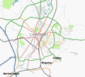 April 9, 2007
 -
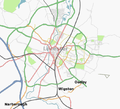 April 17, 2007

