Limestone Way
The Limestone Way runs for about 50 miles from Castleton to Bonsall near Matlock, and then down to Rocester in Staffordshire. There's also a leg from Bonsall into Matlock. The distinctive scenery of the route is limestone - dales, outcrops and castle kopjes.
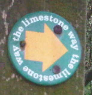
There are two path signs for the Limestone Way - an older one showing a ram, and the newer text-only one shown above.
Progress
Complete! The whole route has been walked, added to OSM and added to relation 50287![]() 50287.
50287.
A GPX file of signposts has been uploaded - search for the tag "Limestone_Way". They're few and far between (and sometimes pointing the wrong way) at the southern end, so the route to join the Staffordshire Way in Rocester has been guessed at based on the most logical route into Rocester from the southernmost signpost near node 945492051.
