This article or section may contain
out-of-date information. The information may no longer be correct, or may no longer have relevance.
If you know about the current state of affairs, please help keep everyone informed by updating this information. (
Discussion)
| LocationWizard
|
|
|
| Author:
|
LocationWizard.com team
|
| License:
|
Proprietary (85$)
|
| Platforms:
|
Windows, Windows XP, Windows 7, and Windows Vista
|
| Status:
|
Broken
|
| Version:
|
1.1 (2011-07-30)
|
| Language:
|
English
|
| Website:
|
http://locationwizard.com/
|
| Programming language:
|
C++
|
|
Map multiple addresses, find nearby client
|
Features
| Feature
|
Value
|
| Map Display
|
| Display map
|
yes
|
| Map data
|
raster
|
| Source
|
online
|
| Rotate map
|
no
|
| 3D view
|
no
|
| Shows website
|
?
|
| Shows phone number
|
?
|
| Shows operation hours
|
?
|
| Routing
|
| Routing
|
no
|
| Create route manually
|
?
|
| Calculate route
|
?
|
| Create route via Waypoints
|
?
|
| Routing profiles
|
foot
|
| Turn restrictions
|
no
|
| Calculate route without Internet (Offline routing)
|
?
|
| Routing providers
|
?
|
| Avoid traffic
|
?
|
| Traffic Provider
|
?
|
| Navigating
|
| Navigate
|
no
|
| Find location
|
yes
|
| Find nearby POIs
|
no
|
| Navigate to point
|
no
|
| Navigation with voice / Voice guidance
|
no
|
| Keep on road
|
no
|
| Lane guidance
|
?
|
| Works without GPS
|
no
|
| Navigate along predefined route
|
?
|
| Tracking
|
| Make track
|
no
|
| Customizable log interval
|
no
|
| Track formats
|
gpx
|
| Geotagging
|
no
|
| Fast POI buttons
|
yes
|
| Upload GPX to OSM
|
no
|
| Monitoring
|
| Monitoring
|
no
|
| Show current track
|
no
|
| Open existing track
|
no
|
| Altitude diagram
|
no
|
| Show POD value
|
no
|
| Satellite view
|
no
|
| Show live NMEA data
|
no
|
| Show speed
|
no
|
| Send current position
|
no
|
| Editing
|
| Add POIs
|
yes
|
| Edit / Delete POIs
|
no
|
| Add way
|
no
|
| Edit geometries
|
no
|
| Edit arbitrary tags of existing OSM objects
|
no
|
| Edit relations
|
no
|
| View notes
|
?
|
| Create notes
|
?
|
| Edit notes
|
?
|
| Work offline
|
no
|
| Support imagery offset DB
|
?
|
| Upload to OSM
|
no
|
| Rendering
|
| Renderer output formats
|
no
|
| Accessibility
|
| Accessibility support
|
no
|
| Complete non graphics text output
|
no
|
| Braille interface
|
no
|
| Exploration modus
|
no
|
| Public Transport mode
|
no
|
| Danger Warnings
|
no
|
| Screenreader
|
no
|
| Screenreader languages
|
no
|
|
|
LocationWizard
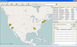
Location Wizard allows you to plot multiple locations on a map from any datasource (e.g. DB, Excel or flat file). Enables searching for customers within a certain radius of a particular location.
Development
Develped using Qt cross-platform framework by Nokia. It can run on many platforms. Main development is done under Linux, but main target is Windows currently.
More Information
Website: http://locationwizard.com/
Screenshots: http://locationwizard.com/tour/
