Maluku Peduli: OSM training and mapping for disaster response communities in Maluku
It is important to note that so far, the spread of OSM training has been focused in Western Indonesia. In Maluku, training was conducted in 2016 with the majority of participants coming from government institutions. Therefore, OSM training for the youth community in Maluku is essential, as they are grassroots movements that directly engage with communities at various levels, especially at the grassroots level. Maluku Peduli, as a volunteer youth community with experience in social and emergency response activities in Maluku, has minimal utilization of spatial data in its activities. Therefore, this training is much needed and is attended by various youth communities actively involved in disaster response in Maluku.
From this training, participants are expected to contribute to OSM and utilize its data for creative visualization of their work, particularly in understanding the aspects of disasters in areas that have experienced significant impacts and high intensity in the past, such as Tehoru Subdistrict which has a history of tsunamis and earthquakes that left deep trauma for the community. In 2019, there was a small earthquake and tsunami in this area. We worked there for almost a month, but there are still many improvements that we feel need to be made for disaster mitigation planning. The intended improvements can start with mapping the infrastructure in Tehoru Subdistrict. The large area (40572 ha) and 10 villages pose challenges if mapping is done conventionally. However, with remote mapping using OSM, this can be realized. In the end, we hope that participants can contribute to OSM and utilize its data for creative visualization of their work. We also hope to map Tehoru Subdistrict and utilize its data for disaster mitigation purposes at the community level.
Solution
The main target of this training is to improve the local community's understanding in Maluku about the importance of spatial data usage in disaster management. This is due to the lack of facilities such as computers and digital skills in this community. Therefore, the training is conducted by targeting 15 participants from 10 communities in Maluku. These participants are invited directly from their organizations as they are actively involved in disaster response activities in Maluku. However, some participants were unable to attend the training due to not having laptops or being away from Ambon. As a result, the participant recruitment strategy was modified by opening online registration. A total of 26 people registered for this activity (including those invited and those who registered online). 18 people were selected and confirmed to attend the training, but only 15 people were present for the training.
Among all the participants, none of them are familiar with the world of Geographic Information System (GIS). There is only one participant who has experience with land navigation (using a compass). This requires the training material to be delivered in a simple and unhurried manner.
The training activities went well, but there were changes to the timeline that was planned in the proposal. These changes were discussed and consulted with the Maluku Peduli team and mentors, taking into consideration the effectiveness of the activities and the efficient use of the budget. Significant changes occurred in the removal of the mapping party agenda, which involved mapping buildings and roads in Tehoru District online. To overcome this, Maluku Peduli, with the assistance of POI, created a mapping task in the HOT tasking manager (#14172). Then, the material and practice of OpenStreetMap (OSM) using this tasking manager were conducted. This way, a separate day for the mapping activity was not required.
In addition to being taught about the importance of contributing to OSM, participants were also encouraged to create relevant maps (individual projects) based on the focus of their organizations. Initially, the majority of participants did not have a clear picture or idea of what map they would create.
Implementation
OSM Training
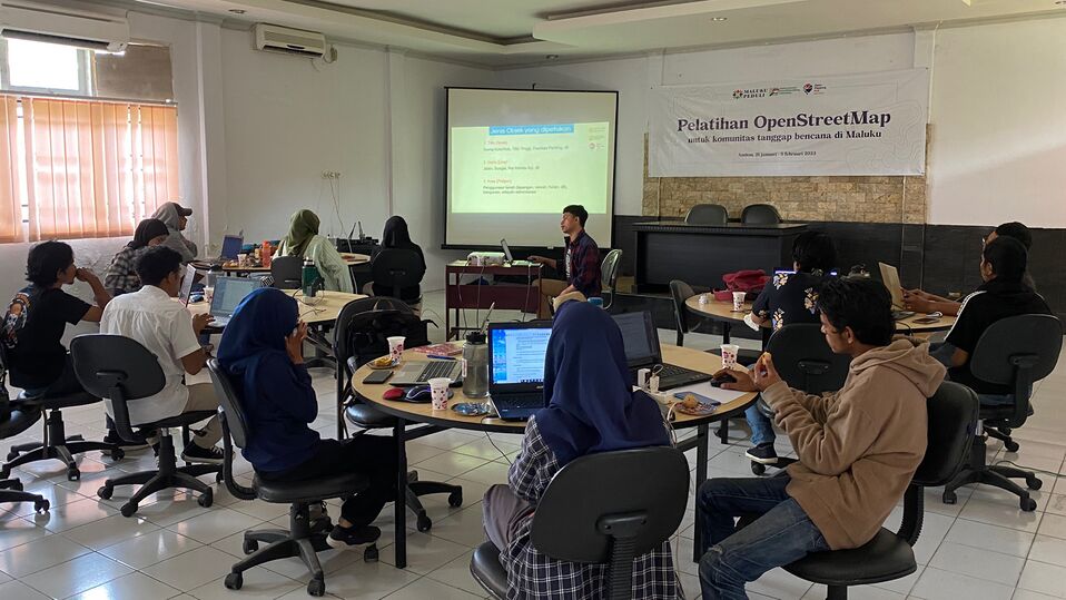
This training was attended by 15 participants and took place over two days (January 21-22, 2023) with a focus on introducing the importance of spatial data in disaster management. The training covered an introduction to OpenStreetMap (OSM) and the use of ID Editor and JOSM for contributing to OSM. For practical exercises, participants used the HOT Tasking Manager to map Tehoru District. On the last day, there was a presentation and practice on collecting spatial data using GPS, Field Papers, and Avenza Maps.
Field Survey Training
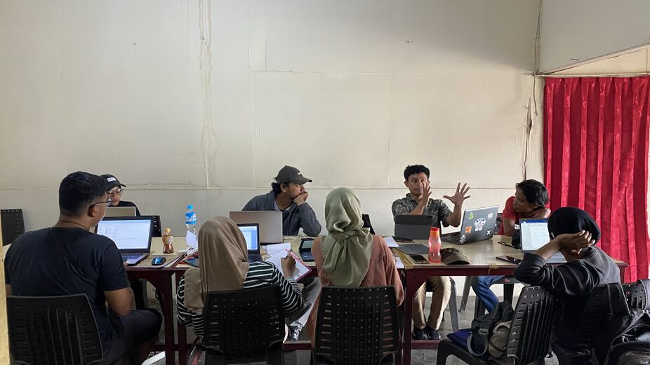
This training was attended by 20 participants, including the organizers. Initially, the training was scheduled for only one day (January 28, 2023), but due to insufficient time to upload data to OpenStreetMap (OSM), an additional special class was added the next day for this purpose. The practical exercises started with a review of mapping techniques in OSM, followed by instructions on field paper printing. The initial plan was to conduct the mapping exercise only in Lorong Tahu, Batu Merah Village, Ambon. However, as the number of participants was considered too large for such a small area, the participants were divided into three groups to map three different locations, including Lorong Tahu, Batu Merah Dalam, and Batu Merah Kepala Air.
These three locations are still within the same Batu Merah Village, and the selection of additional locations was based on the fact that they are located in the flood-prone area of the Batu Merah river, which experiences annual flooding. The training was conducted using Avenza Maps, field papers, and data collection forms. Specifically, the Lorong Tahu group also used drones to obtain up-to-date images of the location after a fire incident. On the second day, half-day practical exercises were conducted, with the main goal of uploading data to OSM, followed by a mapathon in Tehoru and drone practice for groups that had not yet done so. At the end of the activity, there was a demonstration on installing QGIS and creating a base map for Avenza Maps using QGIS.
QGIS Training
A total of 12 participants attended the activity, which took place on February 4-5, 2023. The material focused on introducing the basics of GIS, QGIS introduction and operation, how to download OSM data, and creating a map layout. The main goal of this material was to enable participants to create a simple map using QGIS. However, there were challenges that caused the training to progress slowly. Some participants were absent, and some laptops were not compatible with the installed applications, resulting in missing plugins or different interface displays. In the future, it is hoped that all participants will use the same version of QGIS to avoid such setbacks. To overcome the gaps in material coverage, one of the participants was asked to record their screen for a QGIS tutorial video, which was then shared with other participants. At the end of the activity, there was a discussion and presentation of map creation ideas by participants as individual projects.
Field Survey
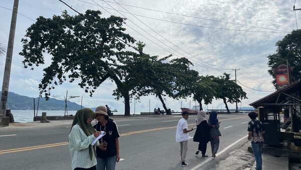
Not all of the initial participants who attended the previous OSM training were able to participate in the field survey. This was because some participants were unable to continue with the field survey activities. To replace the participants who were unable to join the field survey, other Maluku Peduli volunteers were invited to join the field survey. Along with the youth group in Tehoru Village, a total of 22 people were involved in this activity. The survey was conducted from February 24 to 27, 2023.
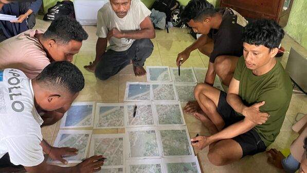
On the first day (February 24, 2023), all participants were re-taught how to collect field data using Avenza Maps, Field Papers, GPS, and Data Collection Forms. Then, practical training was conducted in Tehoru Village (field basecamp) in groups, combining participants from the previous OSM training and new participants who had not yet attended the training. In the evening, a technical meeting for the field survey was held. The division of survey areas and sub-teams in Tehoru sub-district was reviewed due to errors in identifying villages and hamlets during the team meeting in Ambon.
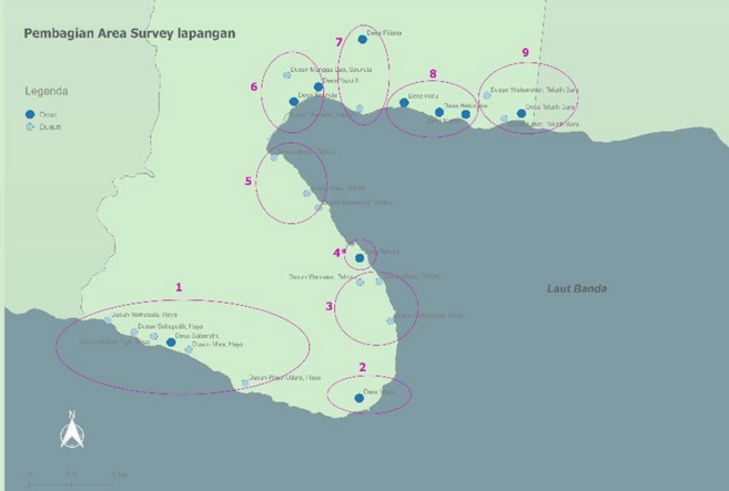
The division of survey areas was not based on administrative boundaries, but rather on the comparison of the size of settlements and the distances between them.
On February 25, the second day of the survey was carried out smoothly. However, there was some rejection in Yaputih village because they had not received a letter of endorsement from Tehoru sub-district. The survey in this village was continued on the third day. On the third day, all the survey data was immediately copied and uploaded to OpenStreetMap. On February 27, the Maluku Peduli team, along with the youth from Tehoru, agreed to stay for one more day to teach the youth about OSM and other digital skills, while the surveyors from Ambon (12 people) returned home.
Outcomes
For the Community:
- Important infrastructure in Tehoru District has been mapped through field surveys. Distribution maps of important infrastructure in 10 villages in Tehoru District have been successfully created.
- The location of the fire in Lorong Tahu, Batu Merah village has been mapped using OSM and drones. Before and after images of the fire have been obtained. Spatial data has been utilized in organizational activities. Layout maps and visualizations of the survey area division in Tehoru District have been successfully created.
- Financial and activity reports have been compiled according to grant standards. Financial and activity reports for this OSM training have been successfully prepared.
- Encouraging collaboration with disaster response communities in Ambon. Collaboration has been established between Maluku Peduli and Shelter Expeditions (one of the participants in the OSM training activity) in conducting Basic Map and Compass Training on February 19, 2023. Encouraging the formation of an OSM chapter in Maluku.
For Activity Participants:
- Familiarity with OSM and contribution to OSM. 20 people have created OSM accounts and contributed to the tasking manager to map Tehoru District or participated in field surveys.
- Increased awareness of the importance of GIS in community work. Training participants are able to present individual map ideas related to their organizational work.
- Practical examples of using OSM data for emergency response in Maluku. Raising awareness among the community to collaborate and utilize open data.
- Creating simple maps using QGIS. Out of the planned 14 map ideas, only 4 participants have successfully created their map layouts before the end of the OSM training activity.
Outputs
- An increase of more than 10 new mappers in Maluku, with 20 people having OSM accounts.
- Maps of infrastructure in 10 villages in Tehoru District.
- Maps of before and after the fire in Lorong Tahu, Batu Merah village, Ambon.
- Over 10 maps produced by participants as individual projects. Only 4 maps were produced.
- Mapping of more than 2486 buildings, 12 km of road networks, and over 10 schools and 20 mosques.
| Indicator | Contribution after Februari 28 2023 | Notes |
| Results | ||
| Outputs | ||
| #number of building mapped and validated | 2486 buildings | https://tasks.hotosm.org/projects/14172/stats/ |
| #km roads mapped | 12 km | |
| #participants | 31 | |
| #maleparticipants | 17 | |
| #femaleparticipants | 14 | |
| #localcommunity participants | 13 | |
| #OSMAccounts | arvanameth
Fitri Marssy Sri Raini achym dermawanigo Wiwin Putnarubun rhifalld kamalsilawane20 Marasabessy ian lasaiba afrizal tutupoho Odang Udjur FajarMarssy fiki soulisa TARIINA norma pattiwaellapia OM BUCE vivi nukuhaly imayalodes Christa |
|
| #newmappers | 20 | |
Challenges
- Preparation and Communication Stage: The main challenge in this stage is the limited time for communication with the target participants, which results in participants not having enough time to provide training equipment such as laptops. As a result, participant selection for the training is done through online registration.
- OSM Training: The initiative to create a tasking manager for mapping Tehoru Subdistrict was delayed by the Maluku Peduli team, resulting in mapping only starting on the second day of the training.
- Field Survey Exercise: Many obstacles were encountered during this practice, such as data collection forms that only focused on essential infrastructure, resulting in other data being recorded without standardization or forms. Participants were still confused about using field papers, and the collected location data was not consistent (some were tracking, some were just points). This feedback was obtained through joint evaluation between the participants and the Maluku Peduli team.
- QGIS Training: Technical obstacles were encountered, such as participants' laptops being incompatible with the latest QGIS version. Additionally, different versions of applications were used, resulting in different interfaces. The training materials were presented as live demos, so participants who were late or absent could not catch up.
- Field Survey: Delay in submitting activity reports resulted in delayed disbursement, causing the field survey to be postponed by two weeks from the planned time. This also resulted in incomplete documentation of the field survey as the Maluku Peduli team responsible for it had to handle fund disbursement in Ambon while the team was already in the field. Previous training participants were also unable to participate in the field survey due to the lack of certainty and sudden departures for the survey. There is a need for a person/team in charge of validating or checking the data collected during the field survey and when uploading it to OSM. This has an impact on map layout, as there is a significant amount of data that was not uploaded to OSM. Non-spatial data collection was done using paper forms, and the data was uploaded to OSM without feedback. However, upon checking by the Maluku Peduli team, there were errors and unclear handwriting on the scanned results of the data collection forms. Administrative boundary mapping could not be done to the maximum extent because during the survey, there were protests against the installation of boundary poles by the Forest Area Stabilization Agency in almost all villages in Tehoru Subdistrict. Field survey refusal occurred in Yaputih Village, but with an approach by Pemuda Tehoru, mapping was successfully carried out the next day. Infrastructure mapping was hampered by many of the collected data not being updated in OSM, and many buildings and roads were not recorded during the mapping in the tasking manager. As a result, the Maluku Peduli team had to remap in OSM and upload the collected data.
Sustainability
It is expected that the data collected from this activity can be used for further analysis, particularly in the context of disaster management. We have gathered data on the locations of gathering points used by the community during disasters, as well as government-designated evacuation routes. We plan to visualize this data in the form of maps and update the data in OpenStreetMap. We have conducted a brief OSM training for the youth in Tehoru, and we plan to continue and conduct further training sessions utilizing the computer lab facilities at SMA Tehoru. As per our plan to promote the establishment of a POI (Point of Interest) chapter in Maluku, we are committed to continuing our contribution in using OSM data and encouraging active participation from participants of various disaster response communities. Even though the training activities have ended, we plan to continue with pending activities such as presenting individual map results and field surveys using our own funds. This presentation will invite representatives from organizations involved in the series of activities, so that the results of the training can be disseminated to a wider audience and inspire them to further utilize spatial data and OSM.