Mapforge
Jump to navigation
Jump to search
| Mapforge | ||||||||||||||||||||||||||||||||||||||||||||||||||||||||||||||||||||||||||||||||||||||||||||||||||||||||||||||||||||
|---|---|---|---|---|---|---|---|---|---|---|---|---|---|---|---|---|---|---|---|---|---|---|---|---|---|---|---|---|---|---|---|---|---|---|---|---|---|---|---|---|---|---|---|---|---|---|---|---|---|---|---|---|---|---|---|---|---|---|---|---|---|---|---|---|---|---|---|---|---|---|---|---|---|---|---|---|---|---|---|---|---|---|---|---|---|---|---|---|---|---|---|---|---|---|---|---|---|---|---|---|---|---|---|---|---|---|---|---|---|---|---|---|---|---|---|---|
| Author: | Digitaltom | |||||||||||||||||||||||||||||||||||||||||||||||||||||||||||||||||||||||||||||||||||||||||||||||||||||||||||||||||||
| License: | GNU AGPL (free of charge) | |||||||||||||||||||||||||||||||||||||||||||||||||||||||||||||||||||||||||||||||||||||||||||||||||||||||||||||||||||
| Platforms: | Web and Android | |||||||||||||||||||||||||||||||||||||||||||||||||||||||||||||||||||||||||||||||||||||||||||||||||||||||||||||||||||
| Status: | Active | |||||||||||||||||||||||||||||||||||||||||||||||||||||||||||||||||||||||||||||||||||||||||||||||||||||||||||||||||||
| Version: | (2024-07-30) | |||||||||||||||||||||||||||||||||||||||||||||||||||||||||||||||||||||||||||||||||||||||||||||||||||||||||||||||||||
| Language: | English
| |||||||||||||||||||||||||||||||||||||||||||||||||||||||||||||||||||||||||||||||||||||||||||||||||||||||||||||||||||
| Website: | https://mapforge.org | |||||||||||||||||||||||||||||||||||||||||||||||||||||||||||||||||||||||||||||||||||||||||||||||||||||||||||||||||||
| Install: | ||||||||||||||||||||||||||||||||||||||||||||||||||||||||||||||||||||||||||||||||||||||||||||||||||||||||||||||||||||
| Source code: | mapforge-org/mapforge GitHub | |||||||||||||||||||||||||||||||||||||||||||||||||||||||||||||||||||||||||||||||||||||||||||||||||||||||||||||||||||
| Programming languages: | JavaScript and Ruby | |||||||||||||||||||||||||||||||||||||||||||||||||||||||||||||||||||||||||||||||||||||||||||||||||||||||||||||||||||
|
An easy to use map editor to create your own maps. | ||||||||||||||||||||||||||||||||||||||||||||||||||||||||||||||||||||||||||||||||||||||||||||||||||||||||||||||||||||
| ||||||||||||||||||||||||||||||||||||||||||||||||||||||||||||||||||||||||||||||||||||||||||||||||||||||||||||||||||||
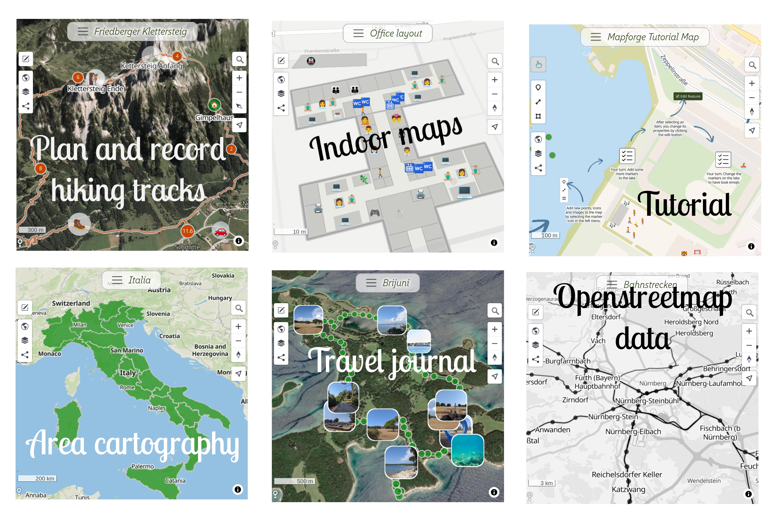
Mapforge is an open source, easy to use GIS software. It's a web application that lets you create and share your places, tracks and events as GeoJSON layers on top of different base maps based on OpenStreetMap. It uses MapLibre GL JS as map library and supports both desktop and mobile.
Features
- Choose your base map: Streets, Satellite, Topographic, Biking
- Add your own data: Import your data from GeoJSON, GPX and KML
- Draw shapes and style them: Add pictures, customize colors, symbols, labels
- Dynamic layers: Use Overpass to add custom layers from OpenStreetMap data
- 3D Terrain: View your map with realistic elevation
- Live updates: Map changes are synchronized via websockets
- Access control: Keep maps private or share with view-only or edit permissions
- Responsive Design: Works well both on desktop and mobile
Screenshots
Usage
See tutorials on https://mapforge.org/docs
Help
Github Forum: https://github.com/mapforge-org/mapforge/discussions
Contribute
Open issues or contribute at https://github.com/mapforge-org/mapforge/discussions
Privacy Policy
No ads, no data sharing: https://github.com/mapforge-org/mapforge/blob/main/docs/privacy.md
External links
- Official site: https://mapforge.org