Maryland State Parks
Maryland State Park & Nature Area Import
This project will integrate recently relicensed public domain Maryland Department of Natural Resources park boundary data. The creator of the project, --ElliottPlack (talk) 17:08, 20 April 2013 (UTC), recently spoke to Dave Foreman about adding MD DNR data to OpenStreetMap at a recent GIS conferece. He stated that all data is "public domain." More information about the agency is on the Contributors#Maryland_Department_of_Natural_Resources page of this wiki.
Community Involvement
The creator, --ElliottPlack (talk) 17:08, 20 April 2013 (UTC), is very involved with the local GIS/OSM community. He contacted other editors in the region and they are excited about this development, as getting good green space boundaries is hard. Other interested parties include asciiphil & mdroads.
Data
The data is mostly ready to go. They are shapefiles. The state agency shapefile attributes include many fields that are not useful to OSM. The URL and Name fields are the only ones kept, and the name is converted to Title Case. Some of the fields are useful for determining the status of the land, e.g. owned or under easement.
Geometrically, the data is split along County jurisdictional boundaries, and along water boundaries. The county boundaries are not needed, as the park is the same on both sides, so the workflow is to join these adjoining areas. There are some 'holes' in some parks where there is private ownership in the middle. Those areas are in a multipolygon and their tagging is checked as needed.
The working data set is on GitHub.
A Note on Easements
Easements are held by the state on privately owned land that places the land in a permanent conservancy status. Therefore, these may be integrated into OSM as nature reserves, as they are lands that will never be developed.
Import Plan
Once approved by the community, there is no plan to import this data en masse. Rather, each polygon or area will be made available to the community to import as they can. An experienced editor can import and massage a county worth of data in around an hour, so this will not take very long in total. This will allow mappers to mind existing data when bringing in park land boundaries. Local mappers will consider the attributes and merge / multipoly the data as necessary.
Workflow
Using JOSM, all tagging is scrubbed and the polygons are merged as needed. Existing areas are checked for overlaps. Often areas have woodland tagging where the park may or may not overlap. I leave that as is. Special care is exercised to make sure the copy/paste of multipolygons work as desired. Editors can copy and paste the shapefiles over to an .osm layer using the opendata plugin, or convert the shapefiles to osm xml with a script.
Tagging
There are a number of debatable tags for green space. The MD DNR dataset contains not only State Parks, but Natural resource areas, and other protected properties. The DNR gives a definition of each in a PDF document on its website (pp 4-5). Based on each description, the areas will be assigned an OSM tag according to the community consensus on what each tag might mean.
The relatively newer Tag:boundary=protected_area scheme will be on each property. In addition, Tag:leisure=park or Tag:leisure=nature_reserve will also be applied for backwards compatibility. For protected_area types, see the next section.
Note: for multipolygons, the relation shall be tagged, not the ways.
Most of the machine tags on the data will be scrapped. Here is a list of the tags on each polygon, and what will become of each:
- COUNTY: delete
- CODE: delete
- LUNAME: change tag to name=, attribute to whatever value is there, Title Case.
- DNRNAME: delete (duplicate)
- MANAGEDBY: change tag to operator=, attribute stays same
- BASECODE: delete
- DESIG: change tag to protection_title=, unabbreviate attribute
- REGION: delete
- WEBLINK: change tage to website=, attribute is the same
- LandIntere: delete
- DNRPCT_O: delete
- DNRPCT_M: delete
- LABEL: delete
- GISACRES: delete
- GISMILES: delete
When done, each parcel should have the following tag (fake data inserted)
- name=Gunpowder State Park
- leisure=park
- boundary=protected_area
- protect_class=4
- protection_title=State Park
- operator=Maryland Park Service
- website=http://www.example.com
Data Dictionary
There are several types of areas in the dataset. The DNR refers to these as Land Unit Designations. Here is a key to what each is, and how to tag on OSM:
| Abbreviation | Full Name | Description | Leisure type | Protect Class |
|---|---|---|---|---|
| SP | State Park | operated primarily for outdoor recreation purposes and open space conservation | park | 5 |
| RT | Rail Trail | linear lands used for a hiking trail | park | 5 |
| SF | State Forest | managed for multiple purposes, including water quality protection, wildlife enhancement, timber, scenic or natural beauty and low-intensity recreation | natural resource | 5 |
| CFL | Chesapeake Forest Lands | specifically acquired and will be retained as working forest. They are managed to produce forest products which help maintain local employment, to protect outdoor recreational values, and for other environmental benefits for the local communities on Maryland’s Eastern Shore | natural resource | 6 |
| NRMA | Natural Resource Management Area | managed by the MPS for the optimal use of the resources on the site, including wildlife management and agriculture. NRMAs do not accommodate intensive recreational uses, and they are typically used for hunting, fishing, wildlife observation and water access | natural resource | 5 |
| NEA | Natural Environment Area | managed by the Maryland Park Service, is generally 1,000 acres or more, and is an area that has significant or unique geological or ecological resources and development is generally confined to trails, interpretive facilities and limited support facilities. | natural resource | 4 |
| WMA | Wildlife Management Area | administered by the Wildlife and Heritage Service, focuses on wildlife management activities and low intensity wildlife-related recreation, including hunting and wildlife observation | natural resource | 6 |
| FMA | Fish Management Area | under the jurisdiction of the Fisheries Service, varies from a highly specialized fish propagation facility to a public fishing pond | natural resource | 4 |
| HCFS | Heritage Conservation Fund Site | includes properties that have been acquired specifically for the protection of identified endangered plant or animal species and significant habitats | natural resource | 4 |
| FT | Fire Tower | Fire Towers | natural resource | 22 |
| MET | Maryland Environmental Trust | Land with an easement for preservation. Easement held by Maryland Environmental Trust, a public land trust. | natural resource | 5 |
| CEDNR | Conservancy Easement Department of Natural Resources | Land with an easement for preservation. Easement held by Maryland DNR. | natural resource | 5 |
| CREP | Conservation Reserve Enhancement Program | Since 1997, Maryland’s Conservation Reserve Enhancement Program (CREP) has helped thousands of Maryland landowners plant streamside buffers, establish wetlands, protect highly erodible land, and create wildlife habitat while providing them with a steady, dependable land rental income. | natural resource | 5 |
Example
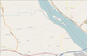
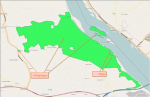
Below are images of an area of Susquehanna State Park that could be imported under this plan.


Coastlines note
It is generally not advisable to overlap the coastline with other lines. Therefore, the practice of splitting the coastline and adding it to a relation for the park / nature land will be observed.
Test
Currently I've added a few parks around Baltimore County, MD as a test. The data looks great, especially because other editors have already added trails, benches, and other park amenities. Now with the green background, these look better. Here is a sample area of Patapsco Valley State Park. Note the level of detail with the multitude of trail data added.
http://www.openstreetmap.org/#map=15/39.2333/-76.7397