PocketEarth
| Pocket Earth Offline Maps & Travel Guides | ||||||||||||||||||||||||||||||||||||||||||||||||||||||||||||||||||||||||||||||||||||||||||||||||||||||||
|---|---|---|---|---|---|---|---|---|---|---|---|---|---|---|---|---|---|---|---|---|---|---|---|---|---|---|---|---|---|---|---|---|---|---|---|---|---|---|---|---|---|---|---|---|---|---|---|---|---|---|---|---|---|---|---|---|---|---|---|---|---|---|---|---|---|---|---|---|---|---|---|---|---|---|---|---|---|---|---|---|---|---|---|---|---|---|---|---|---|---|---|---|---|---|---|---|---|---|---|---|---|---|---|---|
| Author: | GeoMagik | |||||||||||||||||||||||||||||||||||||||||||||||||||||||||||||||||||||||||||||||||||||||||||||||||||||||
| License: | Proprietary (0.99$) | |||||||||||||||||||||||||||||||||||||||||||||||||||||||||||||||||||||||||||||||||||||||||||||||||||||||
| Platform: | iOS | |||||||||||||||||||||||||||||||||||||||||||||||||||||||||||||||||||||||||||||||||||||||||||||||||||||||
| Version: | 3.9 (2024-08-20) | |||||||||||||||||||||||||||||||||||||||||||||||||||||||||||||||||||||||||||||||||||||||||||||||||||||||
| Languages: | English, German, French, Spanish, Dutch, Russian, and Czech
| |||||||||||||||||||||||||||||||||||||||||||||||||||||||||||||||||||||||||||||||||||||||||||||||||||||||
| Website: | http://www.pocketearth.com | |||||||||||||||||||||||||||||||||||||||||||||||||||||||||||||||||||||||||||||||||||||||||||||||||||||||
| Install: | ||||||||||||||||||||||||||||||||||||||||||||||||||||||||||||||||||||||||||||||||||||||||||||||||||||||||
|
OpenGL powered Offline Maps (OSM) and Travel Guides (wikivoyage) with Wikipedia Articles, GPS Track Recording, Online Routing, and other advanced features and customization | ||||||||||||||||||||||||||||||||||||||||||||||||||||||||||||||||||||||||||||||||||||||||||||||||||||||||
| ||||||||||||||||||||||||||||||||||||||||||||||||||||||||||||||||||||||||||||||||||||||||||||||||||||||||
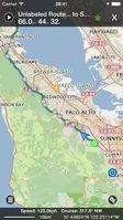
PocketEarth is an app made by GeoMagik LLC for the iPhone, iPad and iPod Touch with an Android version in the works. It renders high quality OpenGL based maps offline using highly compressed OpenStreetMap and NaturalEarth data that the user can download for any city, town, region, or country in the world. It also has geo-localized Wikipedia Articles in several languages and Travel Guides using content from wikivoyage.org that are prepackaged into a single optional download in the app. Available in multiple languages.
It shows much more information on POIs than the standard OSM-website - e.g. opening hours, websites, Bus lines, ...
More information and screenshots are available on the website.
Features
- Offline vector maps using GeoMagik's proprietary OpenGL ES based MagikEngine
- Offline Travel Guides and Wikipedia Articles
- Online routing that can be saved for Offline use
- Public Transport network support with instant highlighting of routes and information
- Multiple stylesheets including a reproduction of the OSM Slippy map
- Adjustable data layers including Hiking and Cycling layers
- Easy access to POI info, including public transit route/line info
- Save favorites lists for easily re-finding things
- Supports English, French, German, Spanish, Dutch, Russian and Czech languages for App Language, Wikivoyage Guides, Wikipedia, and OSM Map Labels.
