Project of the week/2010/Jul 18
This week's project: "Which way home?"

Each time a developer creates an interesting new tool to demonstrate OSM data, mappers use that tool to improve the OSM data. When Andy Allan and Dave Stubbs created OpenCycleMap more of us started mapping cycle paths. The Gosmore routing engine has been available for a while at YourNavigation and even on mobile devices.
Now there is even a demo of...
>>> Gosmore running on the OSM dev server<<<
So the Project of the Week is to use it. We'll be doing several things; testing Gosmore with a little more load, checking our local dataset for routing / connectivity errors, and having fun. Sounds perfect.
Using Gosmore
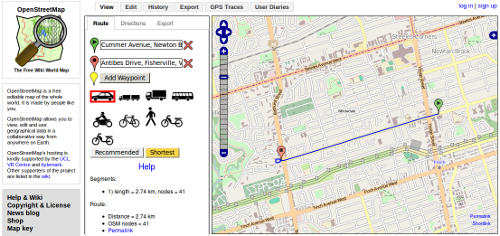
The green and red markers select your origin and destination locations. Click on the marker, then click on the map to place it.
Select your mode of transport by clicking on the car if it is not already selected.
Click the "Recommended" button to find the route selected by Gosmore.
Congratulations. Gosmore has shown you how to get from here to there. Now let's check a few things.
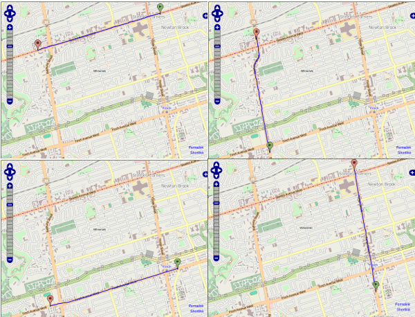
Can people successfully navigate around your neighbourhood? Check the major roads to see if the router will send traffic past your neighbourhood as it should.
Now check some routes within your neighbourhood. Are all of the roads connected as they should be? Is the router able to get visitors into and out of the neighbourhood appropriately, as it was able to get commuters around the neighbourhood? Are all the oneway roads correctly tagged? Do the routes correctly respect any turn restrictions that may be in place? And are all the speed limits tagged so that routers can calculate the expected time of travel?
Now have a look at the mode of transport options and test some pedestrian navigation. That pathway that the kids use to get to school? Is that in OpenStreetMap and does Gosmore give the right routing solution?
Check cycle routing. Are bike lanes in place in the data base where they belong?
Fix the navigation problems you find. You may find roads that are close to other roads but are not connected. Connect them with your editor of choice.
What if I find a Gosmore problem?
Gosmore bugs should be reported on the OpenStreetMap trac bug tracking system. Use your API login to login to trac.
Additional tools to help improve OSM's routing data
In addition to using the routers to check if the data is correct and give the expected routes, there are a couple of other ways and tools that can help verify routing data:
Cloudmade's Navigation debug map style - A slippy map highlighting features relevant to navigation, such as maxspeed and turn restrictions
Skobbler Navigation OpenStreetBugs - A separate [OpenStreetBugs] implementation optimised for routing containing navigation bug reports from Skobbler users
OSM inspector - routing layer - A debug map (Germany only) showing roads who's ends are very close, but not connected as potential errors
