OSM Contributor Mapping Tool - Other languages
OSM Contributor Mapping Tool
|
|
Autor:
|
jawg maps
|
Licença:
|
GNU GPL v3 (grátis)
|
Plataforma:
|
Android
|
Versão:
|
3.0 (2016-09-21)
|
Linguagens:
|
francês, inglês, espanhol, português e ...
|
Site da Internet:
|
https://github.com/jawg/osm-contributor
|
Instalação:
|
|
Código fonte:
|
https://github.com/jawg/osm-contributor
|
Linguagem de programação:
|
Java
|
OSM Contributor Mapping Tool. O mais recente material de modelagem pela equipe jawg, funções de adicionar/editar/apagar para Nós/Caminhos/Comentários. Também pode ser usado com tipos pré-definidos para eventos de mapeamento (http://osm.jawg.io)
|
|
Features
Feature
|
Value
|
Map Display
|
Display map
|
sim
|
Map data
|
raster;vector
|
Source
|
online;cache;offline
|
Rotate map
|
yes;no
|
3D view
|
yes;no
|
Shows website
|
?
|
Shows phone number
|
?
|
Shows operation hours
|
?
|
Routing
|
Routing
|
não
|
Create route manually
|
?
|
Calculate route
|
não
|
Create route via Waypoints
|
?
|
Routing profiles
|
car;bike;foot;wheelchair
|
Turn restrictions
|
sim
|
Calculate route without Internet (Offline routing)
|
não
|
Routing providers
|
none
|
Avoid traffic
|
?
|
Traffic Provider
|
?
|
Navigating
|
Navigate
|
sim
|
Find location
|
sim
|
Find nearby POIs
|
sim
|
Navigate to point
|
não
|
Navigation with voice / Voice guidance
|
não
|
Keep on road
|
não
|
Lane guidance
|
?
|
Works without GPS
|
não
|
Navigate along predefined route
|
não
|
Tracking
|
Make track
|
não
|
Customizable log interval
|
não
|
Track formats
|
?
|
Geotagging
|
note
|
Fast POI buttons
|
sim
|
Upload GPX to OSM
|
não
|
Monitoring
|
Monitoring
|
não
|
Show current track
|
não
|
Open existing track
|
não
|
Altitude diagram
|
não
|
Show POD value
|
não
|
Satellite view
|
não
|
Show live NMEA data
|
não
|
Show speed
|
não
|
Send current position
|
sim
|
Editing
|
Add POIs
|
sim
|
Edit / Delete POIs
|
sim
|
Add way
|
sim
|
Edit geometries
|
sim
|
Edit arbitrary tags of existing OSM objects
|
sim
|
Edit relations
|
sim
|
View notes
|
sim
|
Create notes
|
?
|
Edit notes
|
sim
|
Work offline
|
online;cache;offline
|
Support imagery offset DB
|
não
|
Upload to OSM
|
sim
|
Rendering
?
|
Accessibility
|
Accessibility support
|
none
|
Complete non graphics text output
|
sim
|
Braille interface
|
não
|
Exploration modus
|
yes;no
|
Public Transport mode
|
não
|
Danger Warnings
|
não
|
Screenreader
|
none
|
Screenreader languages
|
none
|
|
|
OSM Contributor Mapping Tool (ou Ferramenta do Contribuinte Mapeador do OSM) ([1]) é um Aplicativo para Android OpenSource para ser usado em qualquer lugar por qualquer contribuinte, e durante eventos de mapeamento. O aplicativo é ou configurável para uma região dedicada, e Tipos da Dados específicos (útil para Eventos de Mapeamento), ou globalmente.
Ele usa uma bifurcação(en) do legado do Mapbox Android SDK(en) e muitas outras bibliotecas de código aberto.
Problemas, comentários e contribuições são bem vindos no repositório do github.
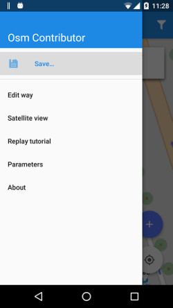
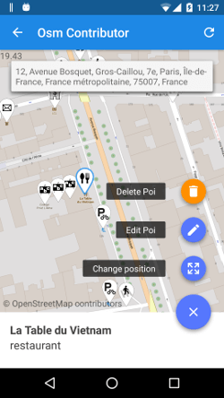
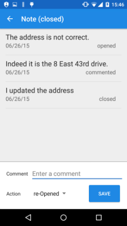
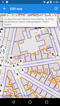
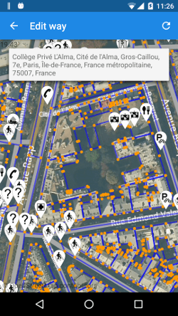
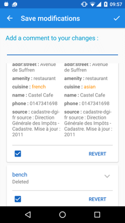
Capturas de tela
Desenvolvimento
O projeto é em código aberto (GPLv3) e o código se encontra no GitHub.
Links externos