QGIS OSM Plugin
| QGIS | ||||||||||||||||||||
|---|---|---|---|---|---|---|---|---|---|---|---|---|---|---|---|---|---|---|---|---|
| License: | GNU GPL | |||||||||||||||||||
| Platforms: | Windows, Linux, and macOS | |||||||||||||||||||
| Status: | Broken | |||||||||||||||||||
| Version: | 1.5 (2010-07-29) | |||||||||||||||||||
| Languages: | German and English
| |||||||||||||||||||
| Website: | http://docs.qgis.org/1.8/en/docs/user_manual/osm/openstreetmap.html | |||||||||||||||||||
| Programming languages: | C++ and Python | |||||||||||||||||||
|
Plugin adding OSM support to QGIS | ||||||||||||||||||||
| ||||||||||||||||||||
| This plugin no longer works with current OSM data, or with current versions of QGIS. QGIS 2.0 integrates OSM as a core functionality, which makes the plugin obsolete. The QGIS page has more details. |
The QGIS OpenStreetMap Plugin is a plugin for the desktop GIS application QGIS. It adds support for OpenStreetMap raw vector data, bringing it in as a layer either from .osm XML file or by direct download from the OpenStreetMap API. It also permits editing and upload back the OSM server. The plugin is at its (TODO: still in the last versions?) early stages of development. As of QGIS it has been superceded by functionality in the QGIS core.
64 bit bug and other development problems

There's a fairly serious bug at the moment. See 'openstreetmap plugin missbehaviour' and 'My lines and polygons have turned to nodes when exported as OSM XML data and imported into QGIS!'. This has appeared recently due to needing 64-bit Identifiers.
...but raises other wider discussion about 'The future of the OpenStreetMap plugin'.
If you are working with any recently added OSM data, you'll need to take a different approach. There are many other approaches, all a bit technical. You can convert OSM data to Shapefiles (or just download pre-generated shapfiles) or convert to various other formats for import into QGIS, or write OSM data into to PostGIS database. There is also a somewhat dirty hack by loading your OSM data first into JOSM, copy and paste the data to a new data layer and then save that layer (whatever you do don't upload it to OSM!). This new OSM file will not have the original ID numbers for each item so it will happily load into qgis.
Installation
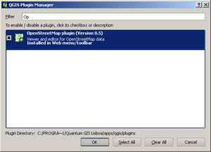
It is a "core" plugin which comes with QGIS when it's first installed, and just needs to be enabled. Go to 'Plugins' menu -> 'Manage Plugins...' and find OpenStreetMap. Tick the plugin to enable it.

Using
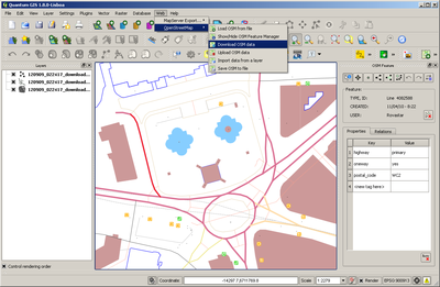
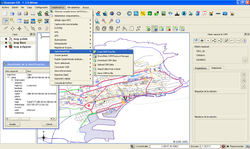
Having installed it you should see a new menu under 'Web' called 'OpenStreetMap'. The same new options are also on the toolbar (OSM icon).

Manuals
In general consult the full manual on the QGIS site.
There is also a short description provided on the Mapperz blog.
Downloading notes
- The 'Download OSM Data' option prompts for bounding coordinates. These default to the current viewport display in QGIS. Load any other layer to get your bearings e.g. an OSM raster layer and then you do a download when you've got a good area on screen (similar to JOSM)
- The coordinates must be in the right SRS for the OSM server (EPSG:900913) See QGIS#Setting the CRS
Attribute/Tag conversion
Data from other vector layers can be imported into the OSM layers, but attribute information does not appear to also be imported.
OSM data do not appear to be readily copied into other vector layers in a similar manner, but entire layers can be exported as shapefiles, with tags concatenated as a single attribute. Also the plugin does not handle multipolygons well - in most cases not at all! Instead you are left with lines instead of polygons
See also
- QGIS OpenStreetMap Plugin manual
- QGIS - More general info on this GIS software
- Question:How to get OpenStreetMap as a raster layer in QGIS? - Using OSM tiles rather than vector data as provided by the OSM plugin.
- [tt_news=1766&cHash=37e0e743d886206ef038f6a0e5088895 Manual in Deutsch]
