Uploads by Achadwick
Jump to navigation
Jump to search
This special page shows all uploaded files.
| Date | Name | Thumbnail | Size | Description | Versions |
|---|---|---|---|---|---|
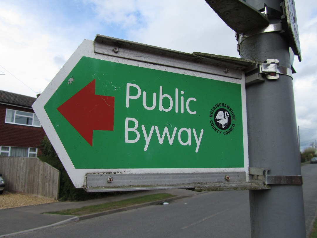
| 10:51, 30 April 2012 | UK Public Byway signpost.jpg (file) |  |
139 KB | Public byway signpost in the UK. The red marker arrow distinguishes it from a restricted byway. | 1 |
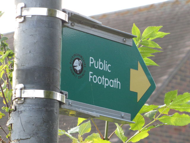
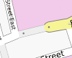
| 10:19, 17 February 2012 | GB EnglandWales Public Footpath Sign 1.jpg (file) |  |
54 KB | Public footpath signage for England and Wales: metal sign with a yellow arrow, green background and what looks like a nonstandard font (it isn't [http://en.wikipedia.org/wiki/Transport_%28typeface%29 Transport], anyway). | 1 |
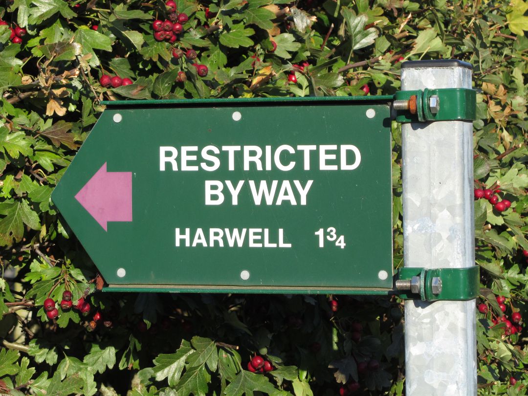
| 22:03, 22 October 2011 | UK Restricted Byway signpost.jpg (file) |  |
199 KB | Restricted byway signpost in the UK. | 1 |
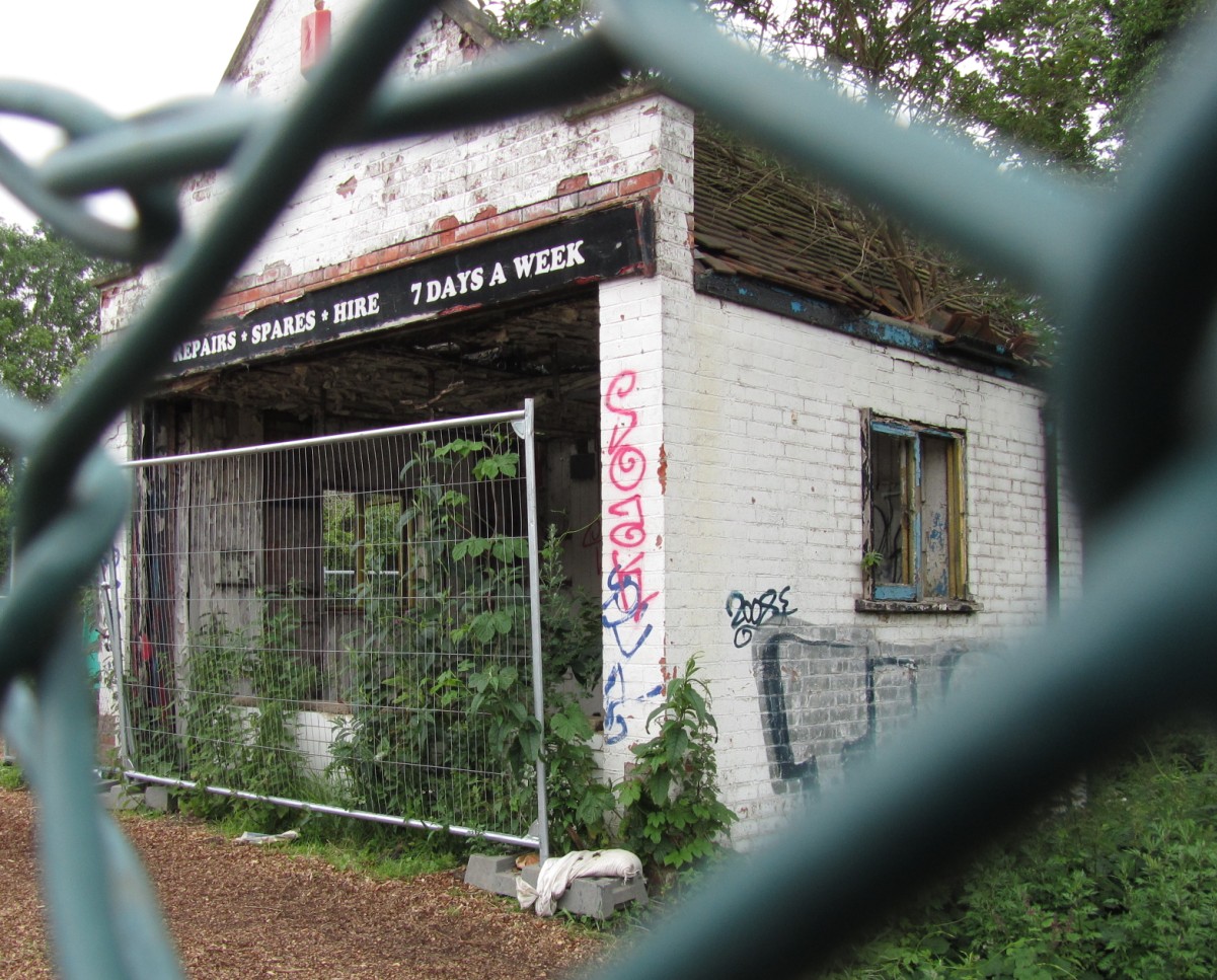
| 19:36, 5 June 2011 | Abandoned-shop-arty.JPG (file) |  |
333 KB | Abandoned shop/repair workshop in Oxford, for illustrating {{key|abandoned}}. I added extra arty, have some chain-link fence. | 1 |
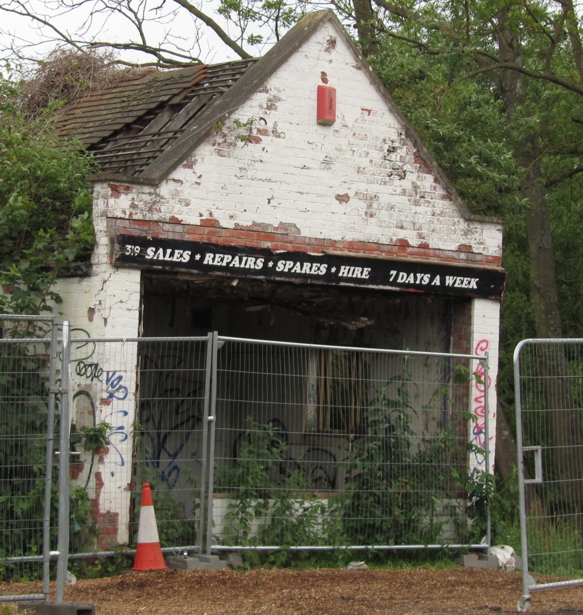
| 19:35, 5 June 2011 | Abandoned-shop.jpg (file) |  |
422 KB | Abandoned shop/repair workshop in Oxford, for illustrating {{key|abandoned}}. | 1 |
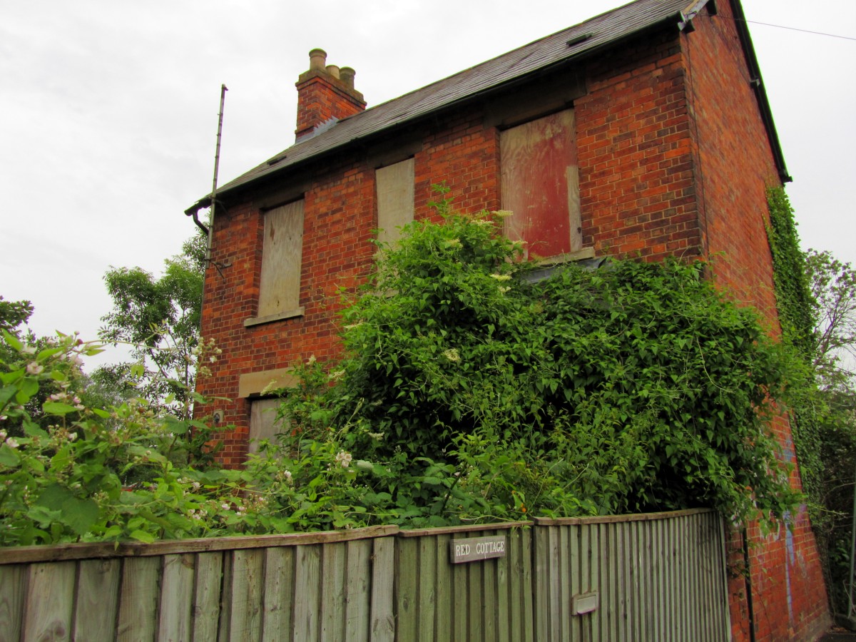
| 19:31, 5 June 2011 | Disused-house.jpg (file) |  |
324 KB | Disused house in Oxford, for illustrating {{key|disused}}. | 1 |
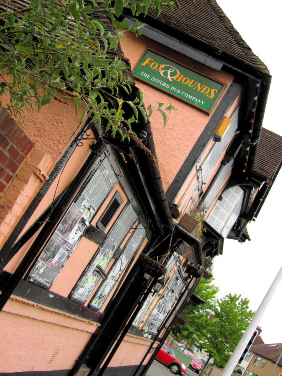
| 19:29, 5 June 2011 | Disused-or-abandoned-pub.jpg (file) |  |
351 KB | Façade of the disused/abandoned Fox & Hounds pub in Oxford, to for illustrating {{key|disused}}. | 1 |
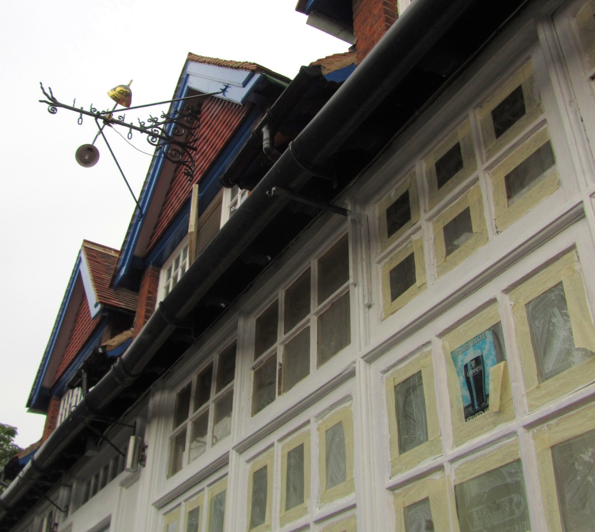
| 19:28, 5 June 2011 | Disused-pub.jpg (file) |  |
225 KB | Façade of the disused Blue Boy pub in Oxford, to for illustrating {{key|disused}}. | 1 |
| 12:58, 19 May 2011 | Collegiate university example.svg (file) |  |
15 KB | Missed a point. Also group the older-sounding fictional college next to the central university area, and be a bit stricter about grid alignment. | 2 |
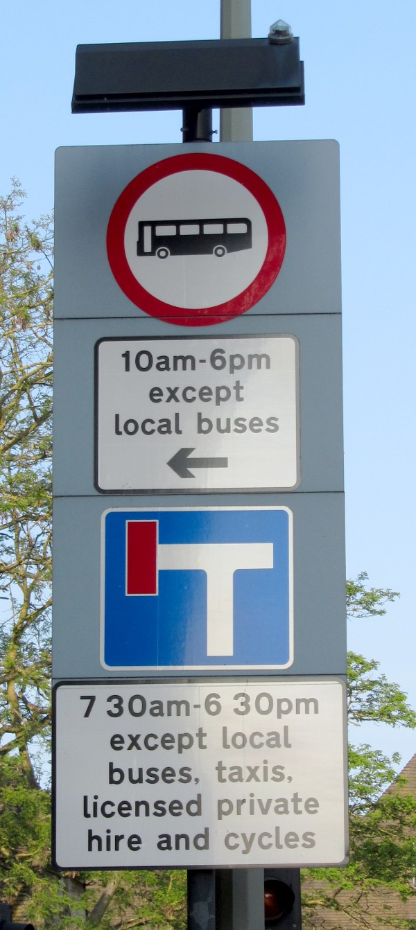
| 22:52, 25 April 2011 | UK no buses except local ones.jpg (file) |  |
181 KB | UK road signage, and another crazy edge case for advanced access schema designers to consider: this totem pole means "no vehicles designed to carry 8 or more passengers or local buses between 10:00 and 18:00. Except for local buses." A local bus is one on | 1 |
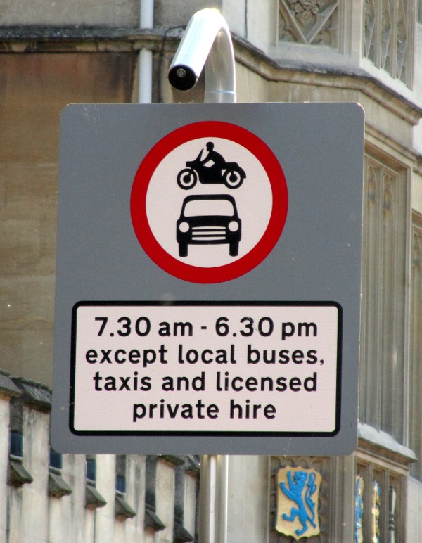
| 21:20, 25 April 2011 | UK motor restriction sign with exceptions.jpg (file) |  |
121 KB | Signage for the "bus gate" in central Oxford's High Street. "No motor vehicles", except buses, taxis and hire vehicles. | 1 |
| 20:35, 25 April 2011 | UK Complex Restriction signage.jpg (file) |  |
225 KB | Lots of complex restrictions for people working on fancy restriction schemas to chew on. UK flavour this time! * Pedestrianised area (no restrictions come from that though, beyond what's spelled out on the totem pole). * No motor vehicles ** except those | 1 |
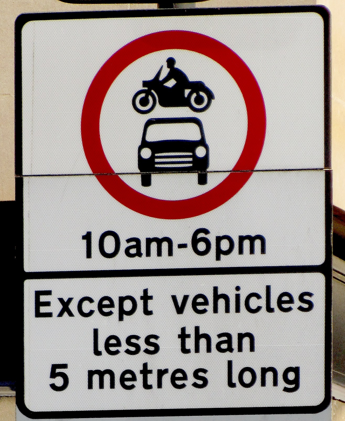
| 20:04, 25 April 2011 | Length and time restriction 2.jpg (file) |  |
819 KB | UK restriction road sign expressing the concept "no motor vehicles from 10:00 to 18:00, except vehicles less than 5 metres long". Close-up of thumb|UK length-based condition | 1 |
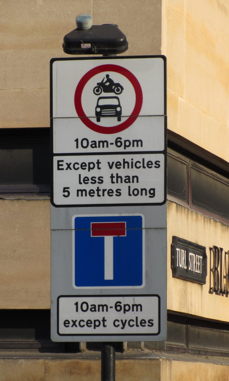
| 19:55, 25 April 2011 | Length and time restriction.jpg (file) |  |
174 KB | UK restriction road sign expressing the concept "no motor vehicles from 10:00 to 18:00, except vehicles less than 5 metres long". The no-through-road informational sign below it applies to a timer-controlled rising bollard further down this road where it | 1 |
| 17:54, 9 April 2011 | Asl tags.svg (file) |  |
12 KB | A suggested method for tagging cycleway=asl near a junction. | 1 |
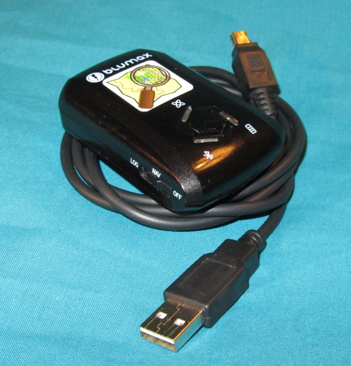
| 21:28, 14 March 2011 | Blumax GPS 4044 logger with OSM sticker.jpg (file) |  |
341 KB | A neat little GPX logger that I use for day-long mapping trips. It's about 43x70x19 mm in size, and takes what seems to be a Nokia 3650 (BL-5C) battery. OSM logo sticker is an after-market extra. The far connector, which plugs into the device itself, is a | 1 |
| 18:55, 13 February 2011 | Street sign uk and folding bike.jpg (file) |  |
184 KB | Street sign in Carterton, UK, with folding bicycle. | 1 |
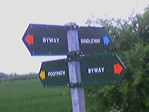
| 11:51, 16 June 2009 | Uk signage byway footpath bridleway.jpg (file) |  |
15 KB | Signpost in Oxfordshire, UK showing the coloured arrows used to denote various legal way-type designations: footway, bridleway, and byway. Sorry for the horrid blurriness, should be nicer when thumbnailed. | 1 |
| 11:46, 19 March 2009 | Cycle barrier osmarender.png (file) |  |
7 KB | How OsmaRender currently renders {{Tag|barrier|cycle_barrier}}. Category:Bicycles | 1 |
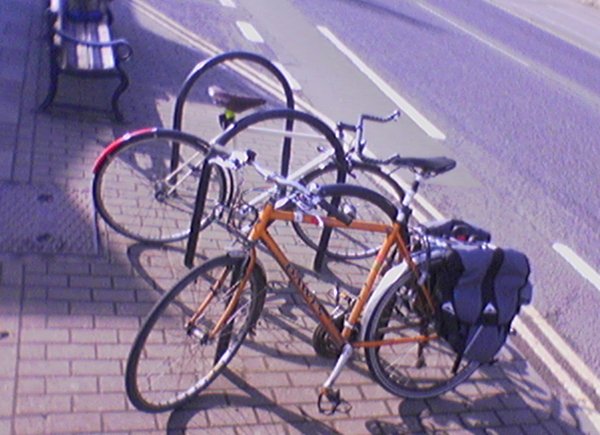
| 01:06, 15 March 2009 | Bike-stands-sheffield.jpg (file) |  |
59 KB | Sheffield stands sample photo. | 1 |
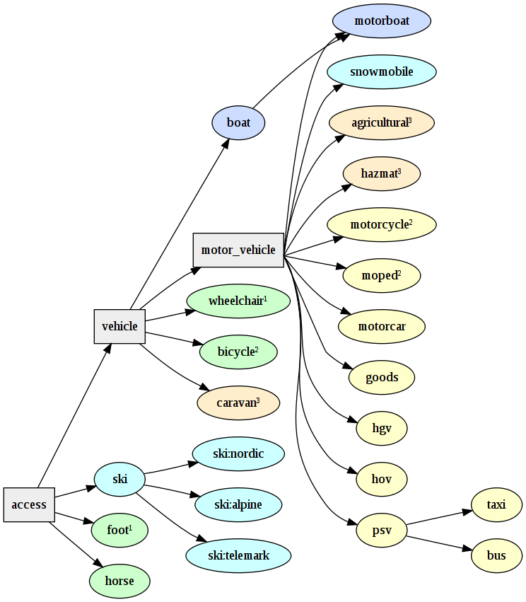
| 18:37, 11 March 2009 | Access modes.png (file) |  |
138 KB | More complete version with horses not having wheels. Best include this as a floating image, given the size. Footnote info: 1, 2: These categories may be treated as equivalent in some jurisdictions. 3: Potentially or always towed, and therefore limited b | 2 |
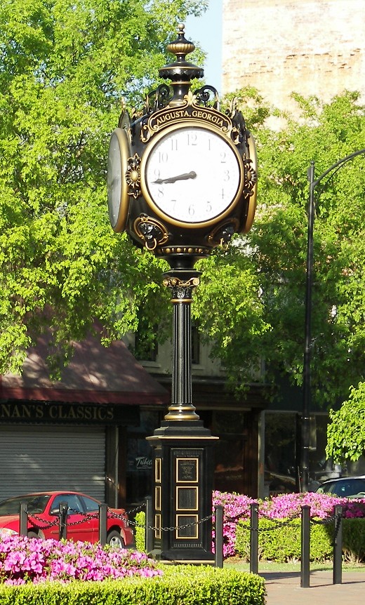
| 20:28, 19 February 2009 | StandaloneClock.jpg (file) |  |
236 KB | Photo by cdharrison on flickr. Creative Commons by-sa 2.0. http://flickr.com/photos/cdharrison/123837016/ | 1 |
| 23:22, 7 February 2009 | RodOfAsclepius.svg (file) |  |
5 KB | Happy, semi-caligraphic rod of Asclepius in Mapnik's "medical purple" colour. Probably we'll want something a bit more geometric, but hey. I like the little guy. | 1 |
| 11:43, 4 February 2009 | 20081204 cycloxmap handout.pdf (file) |  |
1.04 MB | 1 | |
| 14:09, 30 January 2009 | 20090122 cycloxmap handout wiki.pdf (file) |  |
371 KB | Oxford/Cyclox_map_2009 HOWTO and WHATTOMAP handout from 2009-01-22. | 1 |
| 14:08, 30 January 2009 | 20090122 cycloxmap presentation wiki.pdf (file) |  |
1.26 MB | Oxford/Cyclox_map_2009 presentation from 2009-01-22. | 1 |
| 19:37, 20 January 2009 | OxfordCycloxOsmCake.jpg (file) |  |
320 KB | Tentative cake diagram for Oxford, UK. We'll be using this for the Cyclox activities in early 2009, but it could easily be used as a basis for a table of completeness in the new style. | 1 |
| 16:13, 31 October 2008 | Abingdon2008MicroMappingPartyRender.png (file) |  |
70 KB | Party render static-image rendering of the Abingdon/Mapping Party Late 2008. Thanks to all who attended. For version in flashy moving images and fades, have a look at http://uk.youtube.com/watch?v=T-tq7kdDFYQ | 1 |
| 21:30, 27 October 2008 | AbingdonCake.png (file) |  |
59 KB | Composite cake diagram as it evolved during the morning and afternoon sessions. The numbers probably differ from the slices made on the day, and I've included slices for Shippon and Dalton Barracks for later discussions about completeness. | 1 |
| 10:57, 16 September 2008 | Barrier bollard osmarender.png (file) |  |
6 KB | An (interim?) rendering of barrier=bollard in Osmarender. | 1 |
| 20:52, 26 April 2008 | Uk-squeeze-style-barrier-small.jpg (file) |  |
32 KB | What I'm calling a "squeeze" style barrier, sometimes called a "k-barrier" or a "three valleys barrier" (both of which are trade names). | 1 |
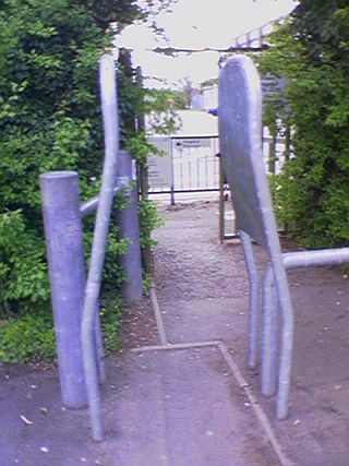
| 17:01, 23 April 2008 | 56 02 17-030408 half.jpg (file) |  |
62 KB | "Chicane" / "zig-zag" barrier on a UK cycle path in Oxford, another style. | 2 |
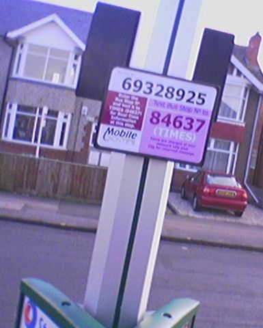
| 16:42, 19 April 2008 | UkOxfordBusStopOxontimePlate.jpg (file) |  |
30 KB | Some but not all Oxford (UK) bus stops carry a small plate containing what is essentially a unique ID number for the bus stop; it appears to be maintained by an organisation calling themselves Oxontime, and would be useful to people with mobile phones. W | 1 |
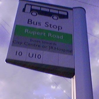
| 16:35, 19 April 2008 | UkOxfordBusStopMainSign.jpg (file) |  |
15 KB | An Oxford bus stop sign, representative of most in the UK. Bus stops are often named after nearby adjoining roads, and often give the general direction of travel as well as the bus route numbers. | 1 |
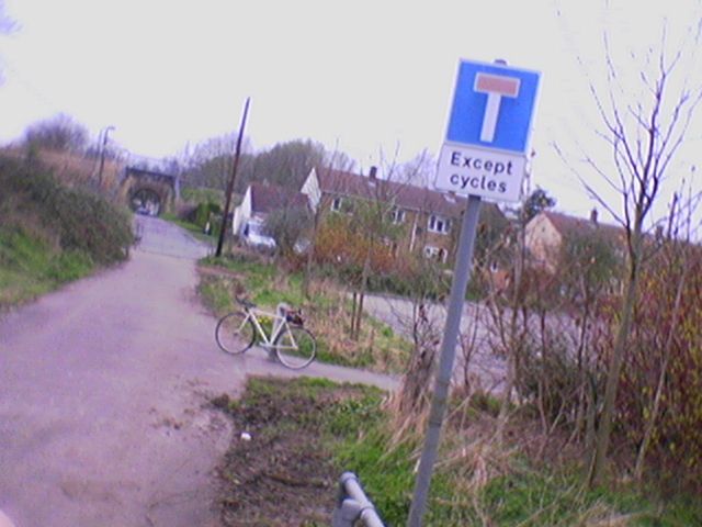
| 00:50, 7 April 2008 | UKDeadEndCycleExemption.jpg (file) |  |
46 KB | A UK dead end (no through road) sign with an exemption for cyclists. A tunnel underneath a railway freight line is visible in the distance. | 1 |
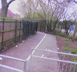
| 00:18, 4 April 2008 | 23 05 17-030408.jpg (file) |  |
223 KB | "Chicane" / "zig-zag" barrier on a UK cycle path in Oxford. Not a kissing gate because the central bar is fixed: it does not swing. | 1 |