Uploads by Jynus
Jump to navigation
Jump to search
This special page shows all uploaded files.
| Date | Name | Thumbnail | Size | Description | Versions |
|---|---|---|---|---|---|
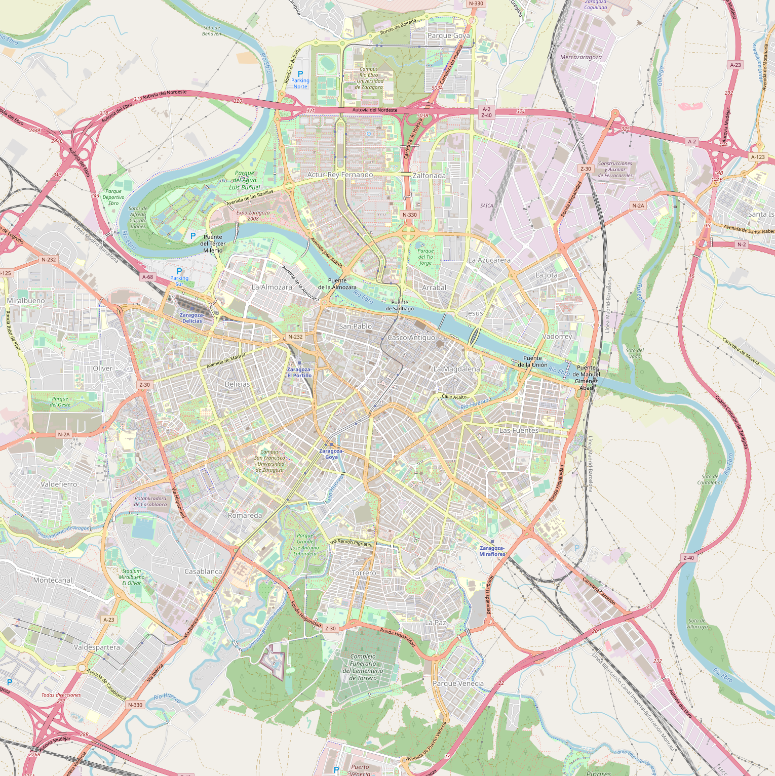
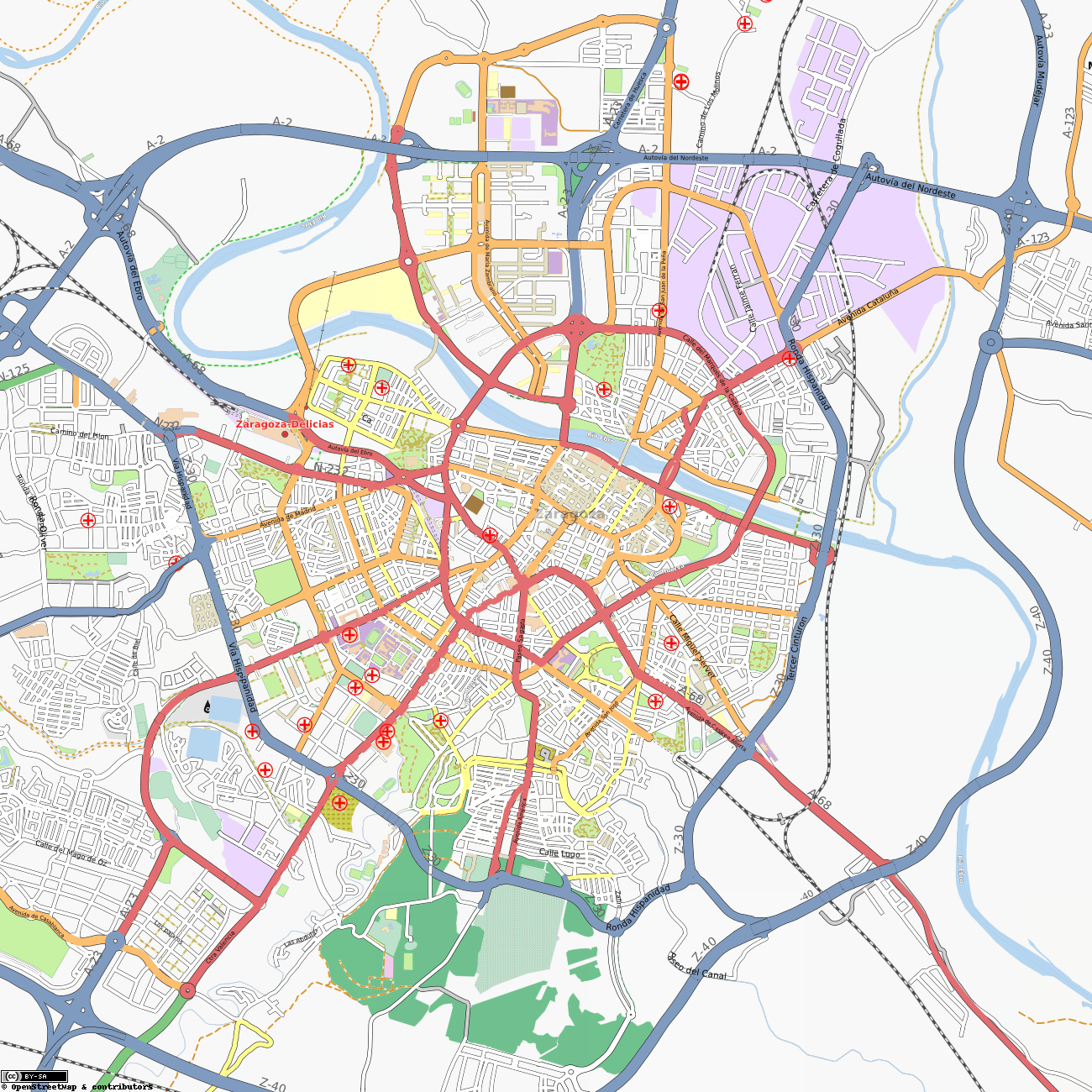
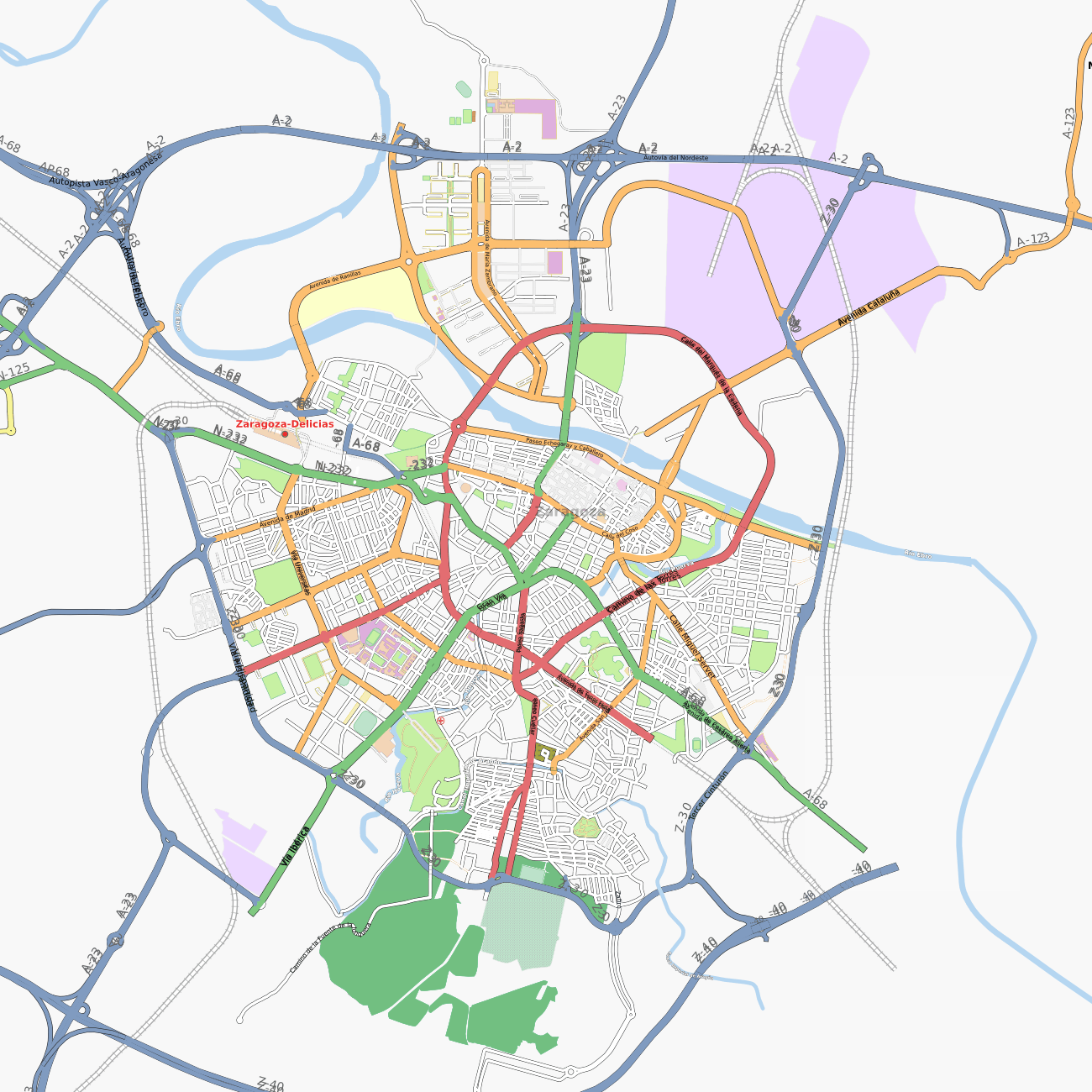
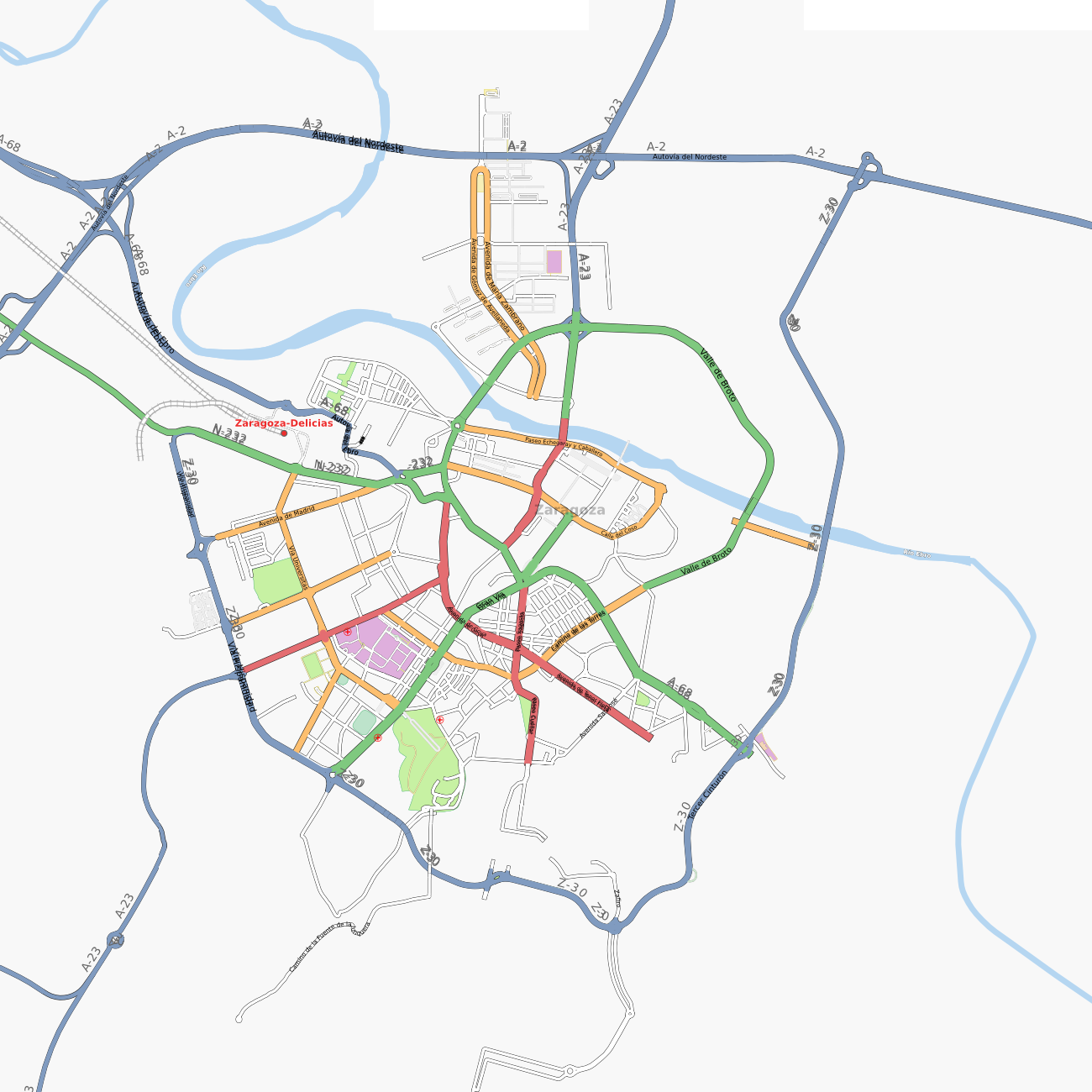
| 22:14, 31 July 2022 | Zaragoza-August2022.png (file) |  |
2.36 MB | == Summary == Source: http://render.openstreetmap.org/cgi-bin/export?bbox=-0.9390735626220703,41.6081908580664,-0.8274078369140625,41.69175782799976&scale=29000&format=png {{OSM Carto screenshot}} | 1 |
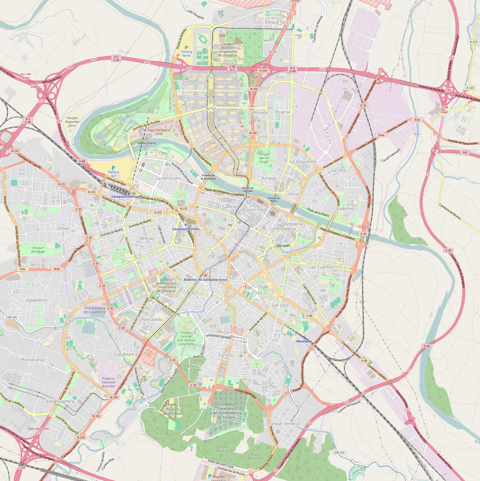
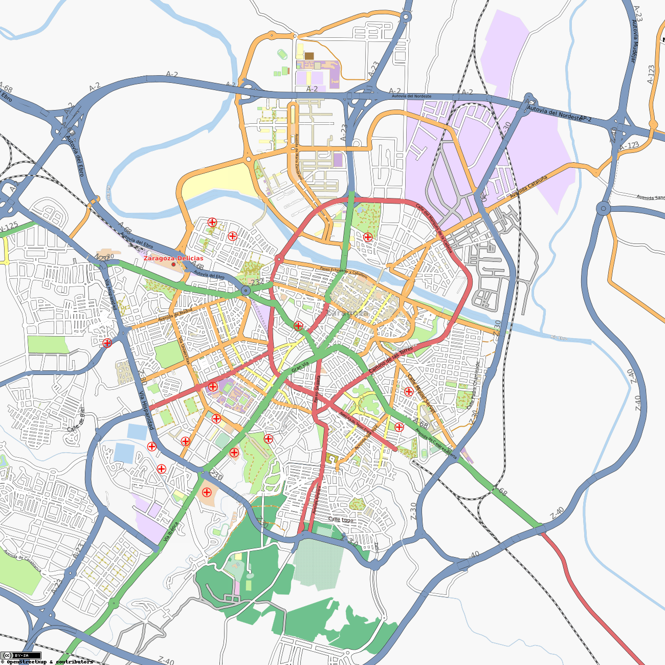
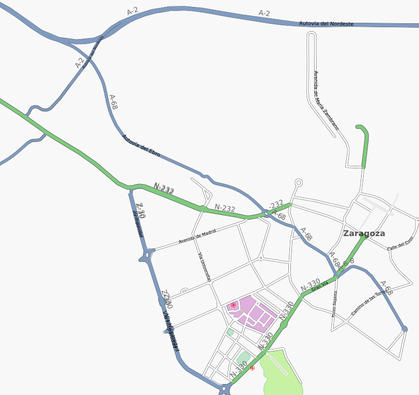
| 09:52, 5 August 2016 | Zaragoza-August2016.png (file) |  |
1.92 MB | == Summary == Source: http://render.openstreetmap.org/cgi-bin/export?bbox=-0.9390735626220703,41.6081908580664,-0.8274078369140625,41.69175782799976&scale=29000&format=png == Licensing == {{ODbL OpenStreetMap}} | 1 |
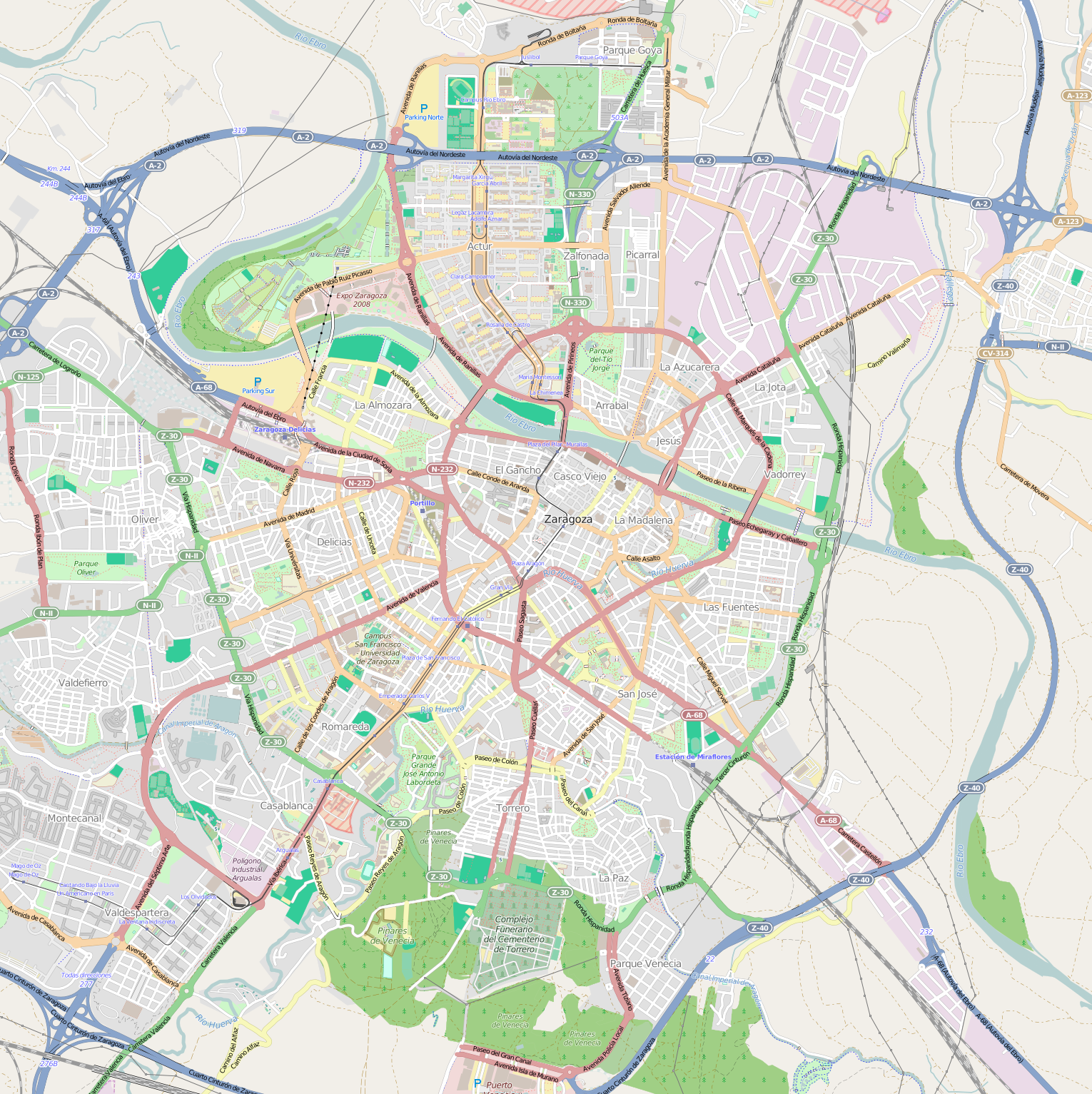
| 14:13, 26 July 2015 | Zaragoza-July2015.png (file) |  |
1.76 MB | Source: http://render.openstreetmap.org/cgi-bin/export?bbox=-0.9390735626220703,41.6081908580664,-0.8274078369140625,41.69175782799976&scale=29000&format=png | 1 |
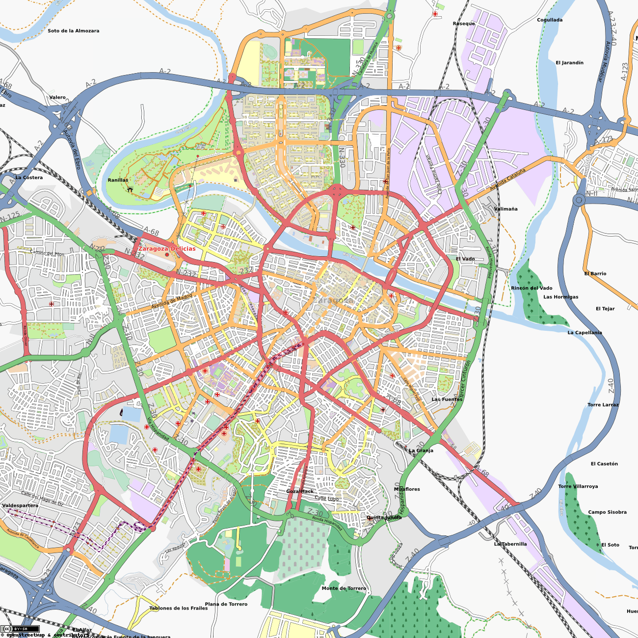
| 11:07, 5 August 2011 | Zaragoza-August2011.png (file) |  |
1.56 MB | Map of Zaragoza, in Spain, as seen in August 2011. Tram has been added. Actur and Expo Zaragoza areas have been greatly improved. Several new sites added. {{mapof|Zaragoza}} | 1 |
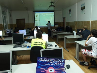
| 14:20, 17 October 2010 | Osm workshop at riojaparty.jpg (file) |  |
34 KB | OpenStreetMap Workshop at RiojaParty 2009 | 1 |
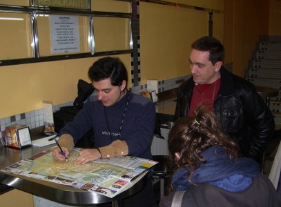
| 14:18, 17 October 2010 | Osm mapping party at soria.jpg (file) |  |
37 KB | OpenStreetMap Mapping Party at Soria. See: Spanish 2nd anniversary mapping party (Soria) | 1 |
| 14:31, 22 March 2010 | Zaragoza-March2010.png (file) |  |
1.4 MB | *[http://tah.openstreetmap.org/MapOf/?lat=41.65&long=-0.883333&z=14&w=1300&h=1300&format=png Source] Map of Zaragoza in OpenStreetMap (2010-03-22) (last snapshot was File:Zaragoza-August2009.png. {{mapof|Zaragoza}} | 1 |
| 18:24, 3 September 2009 | Zaragoza-August2009.png (file) |  |
1.27 MB | *[http://tah.openstreetmap.org/MapOf/?lat=41.65&long=-0.883333&z=14&w=1300&h=1300&format=png Source] Map of Zaragoza in OpenStreetMap (2009-08-31) (last snapshot was Image:Zaragoza-August2008.png. {{mapof|Zaragoza}} | 1 |
| 18:16, 6 June 2009 | Riojaparty2009.png (file) |  |
51 KB | Poster for the RiojaParty 2009 Lan party, featuring an OpenStreetMap Workshop and Mapping Party. | 1 |
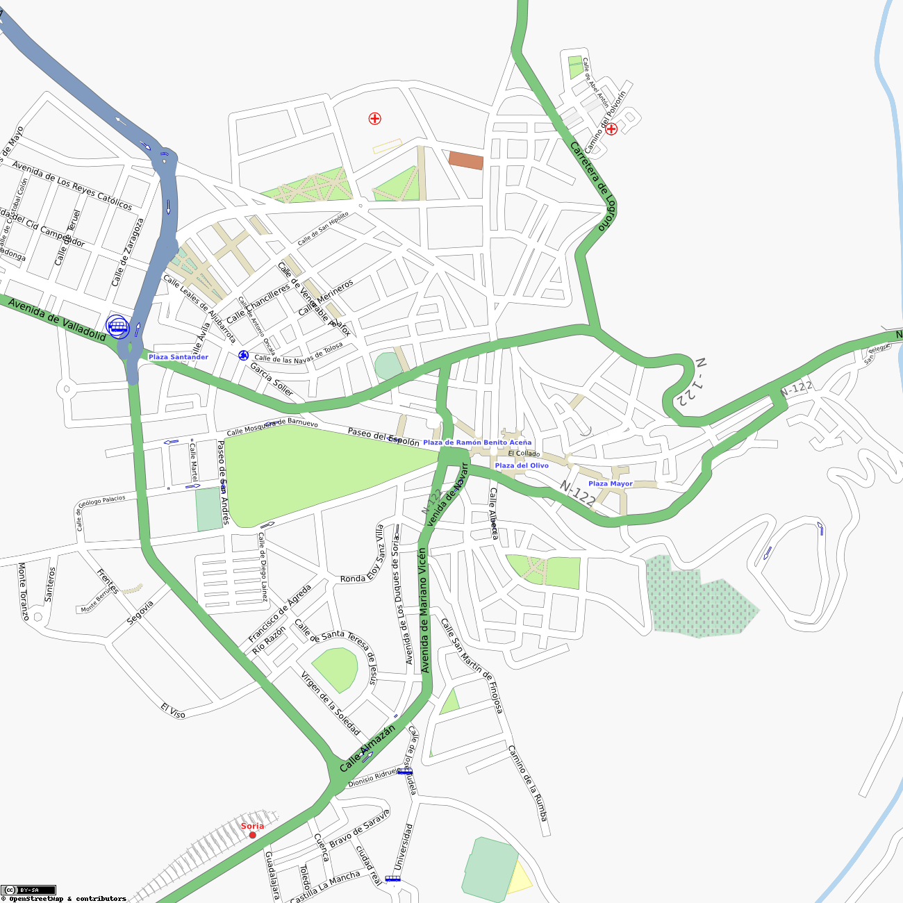
| 17:04, 27 January 2009 | Soria-20090127.png (file) |  |
722 KB | OSM map of [http://www.openstreetmap.org/?lat=41.7642&lon=-2.4691&zoom=14&layers=B000FTF Soria], Spain, on 27th January 2009. [http://server.tah.openstreetmap.org/MapOf/?lat=41.7642&long=-2.4691&z=16&w=1300&h=1300&format=png Source] | 1 |
| 09:30, 15 August 2008 | Zaragoza-August2008.png (file) |  |
963 KB | *[http://tah.openstreetmap.org/MapOf/?lat=41.65&long=-0.883333&z=14&w=1300&h=1300&format=png Source] Map of Zaragoza in OpenStreetMap (2008-08-15). Even more advances since we have reasonable Yahoo! Maps covering (last snapshot was [[:Image:Zaragoza-April | 1 |
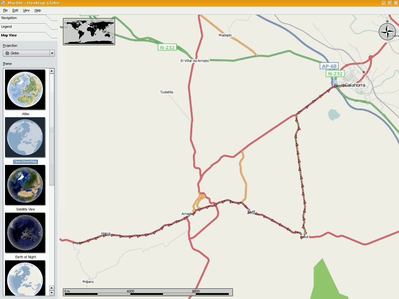
| 18:20, 10 August 2008 | Marble gpx track on osm.png (file) |  |
95 KB | Showing a gpx track loaded on [http://edu.kde.org/marble/ Marble] and using OSM maps. | 1 |
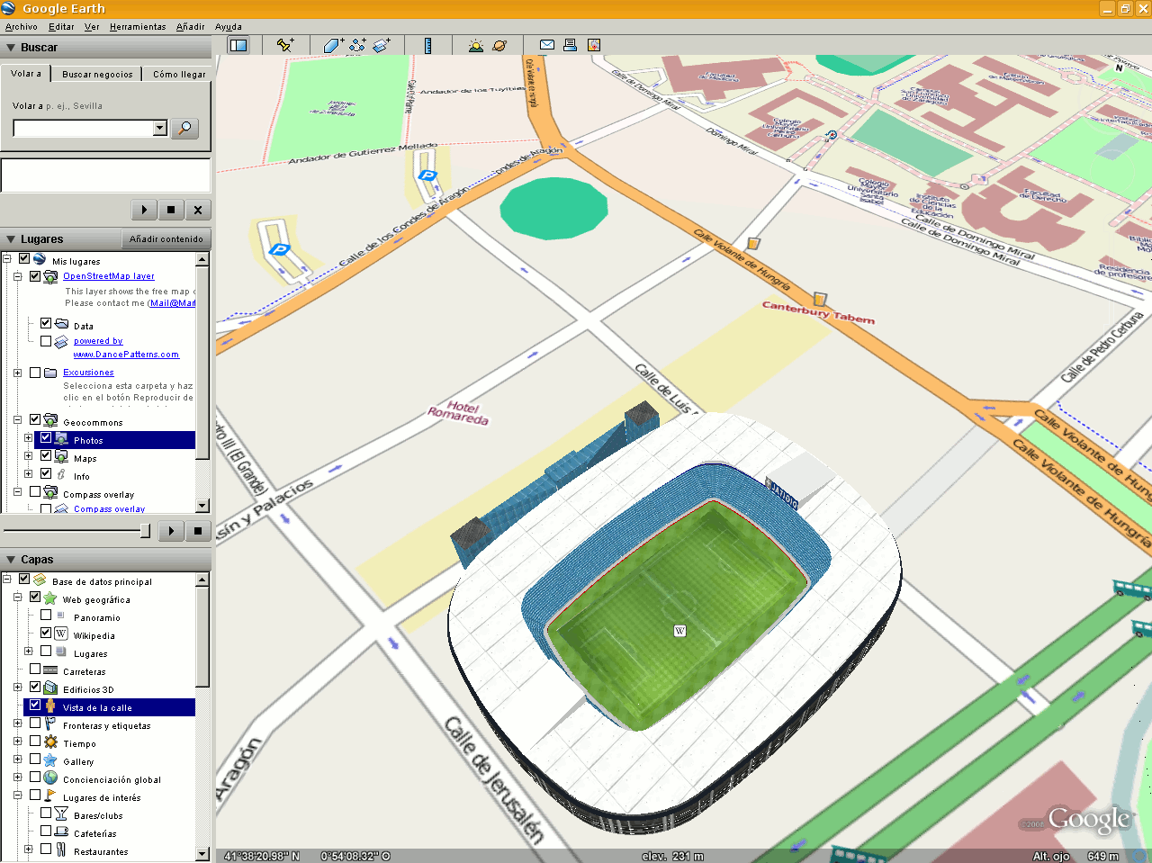
| 18:17, 10 August 2008 | Osm-googleearth.png (file) |  |
166 KB | OSM overlay in Google Earth: View of Romareda Football Stadium in Zaragoza, Spain ([http://www.openstreetmap.org/?lat=41.63647&lon=-0.90183&zoom=16&layers=B00FTF map]) | 1 |
| 10:49, 12 April 2008 | Zaragoza-April2008.png (file) |  |
451 KB | *[http://tah.openstreetmap.org/MapOf/?lat=41.65&long=-0.883333&z=14&w=1300&h=1300&format=png Source] Map of Zaragoza in OpenStreetMap (2008-04-12). Thera have been reasonable advances from last pic, due to the [[Spanish | 1 |
| 18:18, 11 September 2007 | Zaragoza-August2007.png (file) |  |
168 KB | Early mapping of Zaragoza, in Spain, as seen in August 2007. There are many mapping errors and a lot of main streets left. | 1 |