Uploads by SK53
Jump to navigation
Jump to search
This special page shows all uploaded files.
| Date | Name | Thumbnail | Size | Description | Versions |
|---|---|---|---|---|---|
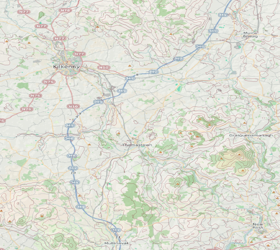
| 15:58, 25 April 2024 | Kilkenny ajt hs100k.png (file) |  |
1.23 MB | {{Information | description=Kilkenny area from SomeoneElse's map style with 50m contours & hypsometric hill shading from SRTM | source=OSM, SRTM | date=2024-04-25 | author=SK53 | other_versions= }} | 1 |
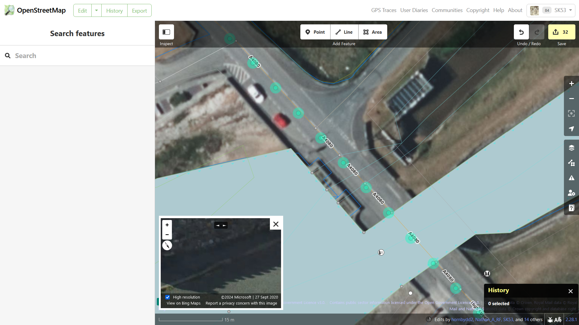
| 20:41, 10 March 2024 | Ocean obscuration-iD.png (file) |  |
1.08 MB | {{Information | description=iD in wireframe mode with the sea obscuring imagery | source=https://www.openstreetmap.org/edit?editor=id&node=10840300089#map=20/53.19201/-4.38482 | date=2024-03-10 | author=User:SK53 | other_versions= }} | 1 |
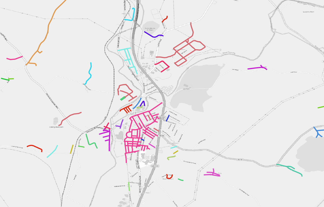
| 17:05, 20 October 2023 | Pa tiger roads2.png (file) |  |
359 KB | {{Information | description=Large scale map of rural Pennsylvania showing clusters of unmodified TIGER roads (approx co-ords -79.16123,40.5210) | source=OpenStreetMap | date=2023-10-20 | author=SK53 | other_versions= }} | 1 |
| 17:00, 20 October 2023 | Pa tiger roads1.png (file) |  |
1.39 MB | {{Information | description=Raw unmodified TIGER roads for Pennsylvania, clustered into contiguous groups | source=OpenStreetMap | date=2023-10-20 | author=SK53 | other_versions= }} | 1 |
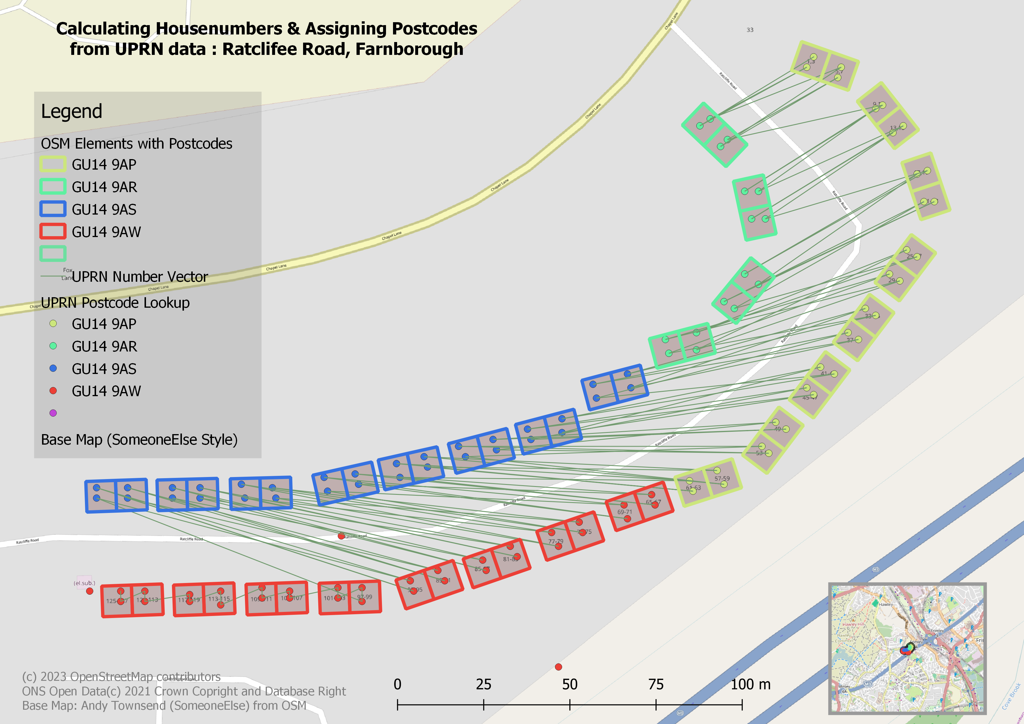
| 17:31, 13 July 2023 | Rat rd uprn pc.png (file) |  |
1.62 MB | add legend, location map, attribution & title | 2 |
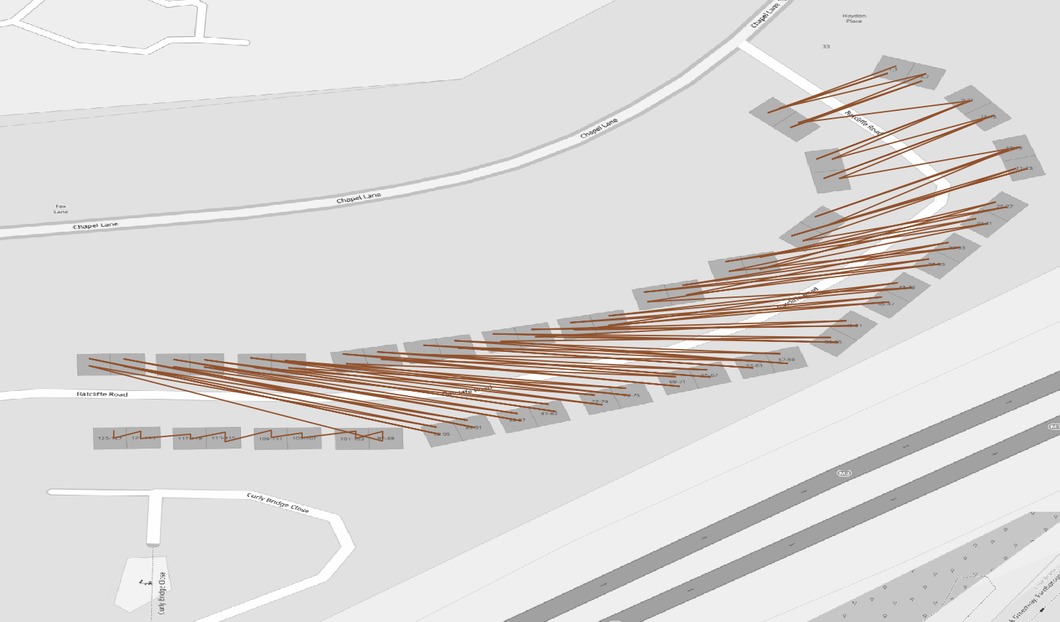
| 22:20, 12 July 2023 | Ratcliffe road uprn vector.png (file) |  |
291 KB | {{Information | description=Vector of UPRNs on Ratcliffe Road | source=ONS UPRN Lookup Open Data (c) 2021 Crown Copyright and Database Right; Basemap: OpenStreetMap tiles by SomeoneElse | date=2023-07-12 | author=SK53 | other_versions= }} | 1 |
| 20:04, 16 May 2023 | Tennis courts eg.png (file) |  |
37 KB | {{Information | description=Comparison of a professional match tennis court (No 1 Court Wimbledon) with a slightly larger polygon of three leisure tennis courts. Data compared in EPSG:27700 and translated to near the grid origin of the projection. | source=OSM | date=2023-05-16 | author=SK53 | other_versions= }} | 1 |
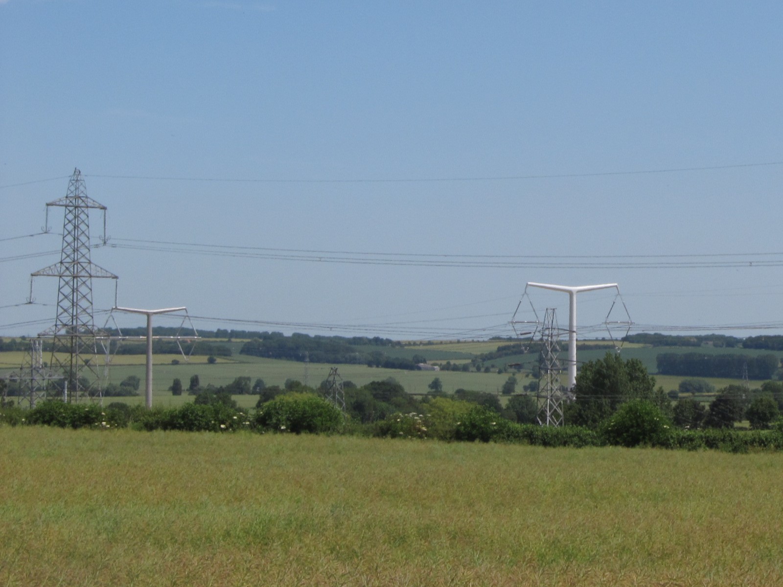
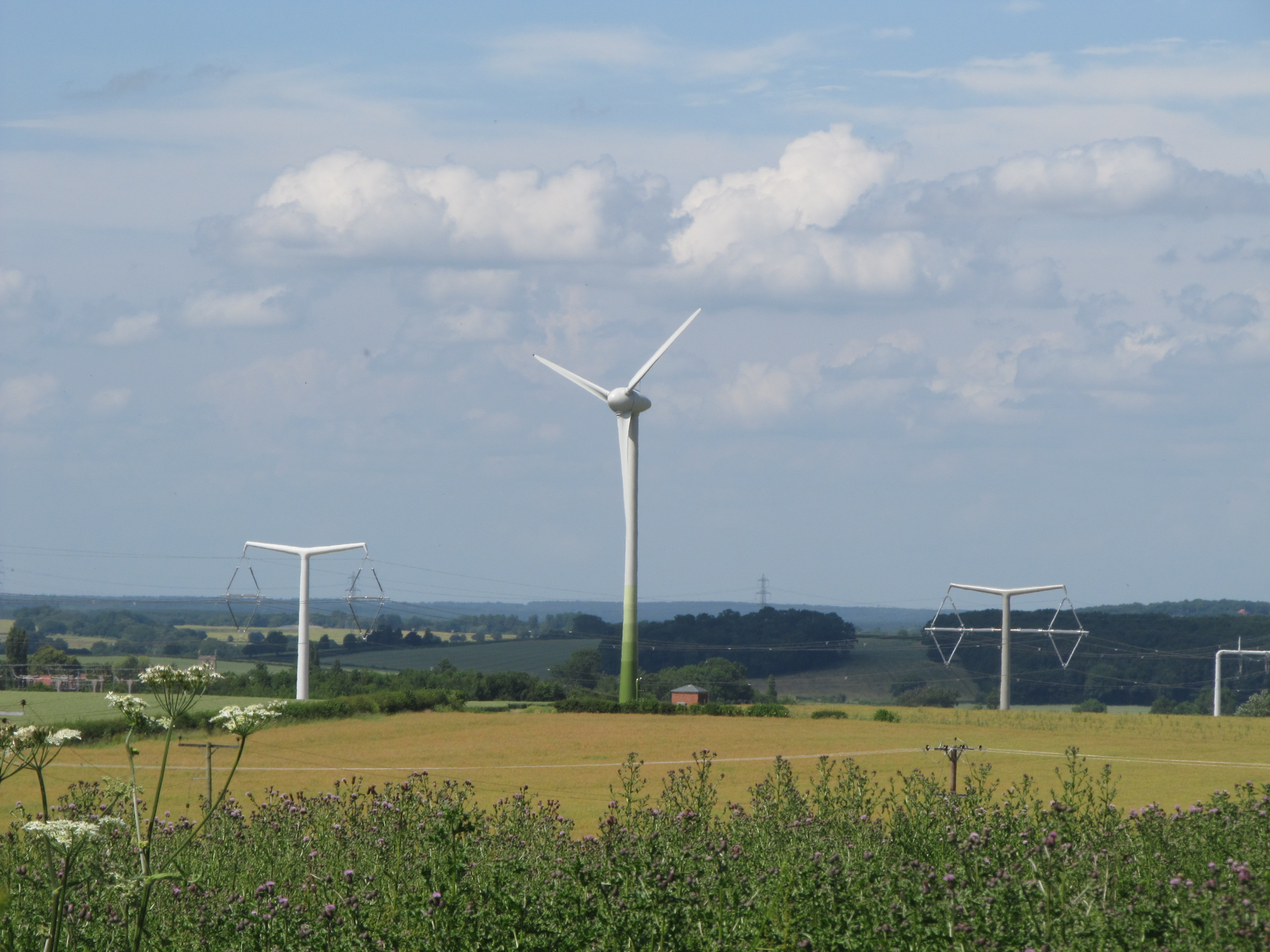
| 13:45, 9 May 2023 | Pylons old and new eakring.JPG (file) |  |
304 KB | {{Information | description=New style "T"-pylons with a selection of older pylons at National Grid's training centre, Eakring, Notts | source=SK53 | date=2015-07-03 | author=SK53 | other_versions= }} | 1 |
| 13:20, 9 May 2023 | New style diamond pylons eakring.JPG (file) |  |
190 KB | {{Information | description=Two new-style diamond pylons at National Grid's training centre, Eakring, Notts | source=SK53 | date=2015-07-03 | author=SK53 | other_versions= }} | 1 |
| 12:43, 9 May 2023 | IMG 9090.JPG (file) |  |
2.38 MB | {{Information | description=New style power pylons at National Grid's training centre at Eakring, Notts (wind turbine too). | source=SK53 | date=2015-07-06 | author=SK53 | other_versions= }} | 1 |
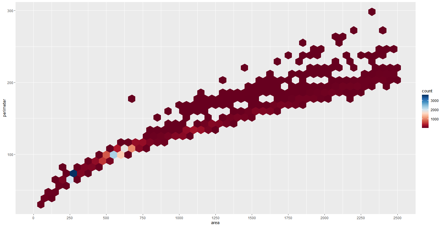
| 16:42, 8 May 2023 | Tennis hexbin.png (file) |  |
20 KB | {{Information | description=Tennis courts area vs perimeter as hexbins. Notable clusters have a different colour | source=OSM | date=2023-05-08 | author=SK53 | other_versions= }} | 1 |
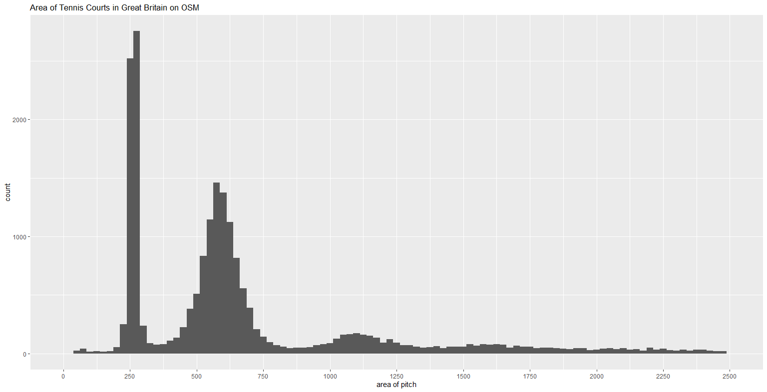
| 19:19, 26 April 2023 | Tennis gb.png (file) |  |
17 KB | {{Information | description=Histogram of numbers of tennis 'pitches' on OSM in Great Britain by area (data ~2021) | source=OpenStreetMap | date=2023-04-26 | author=SK53 | other_versions= }} | 1 |
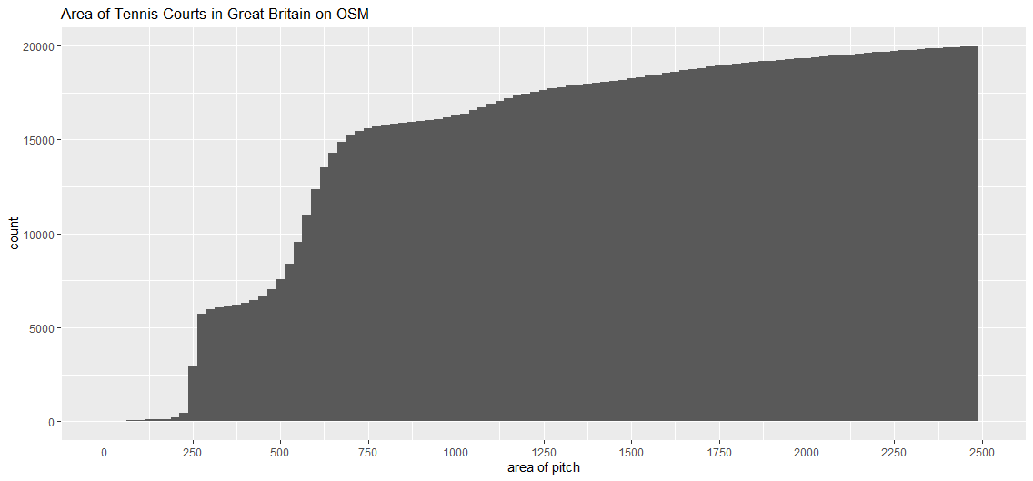
| 19:17, 26 April 2023 | Tennis cumul.png (file) |  |
8 KB | {{Information | description=Cumulative histogram of 20000 leisure=pitch, sport=tennis for GB (data 2021) | source=OpenStreetMap | date=2023-04-26 | author=SK53 | other_versions= }} | 1 |
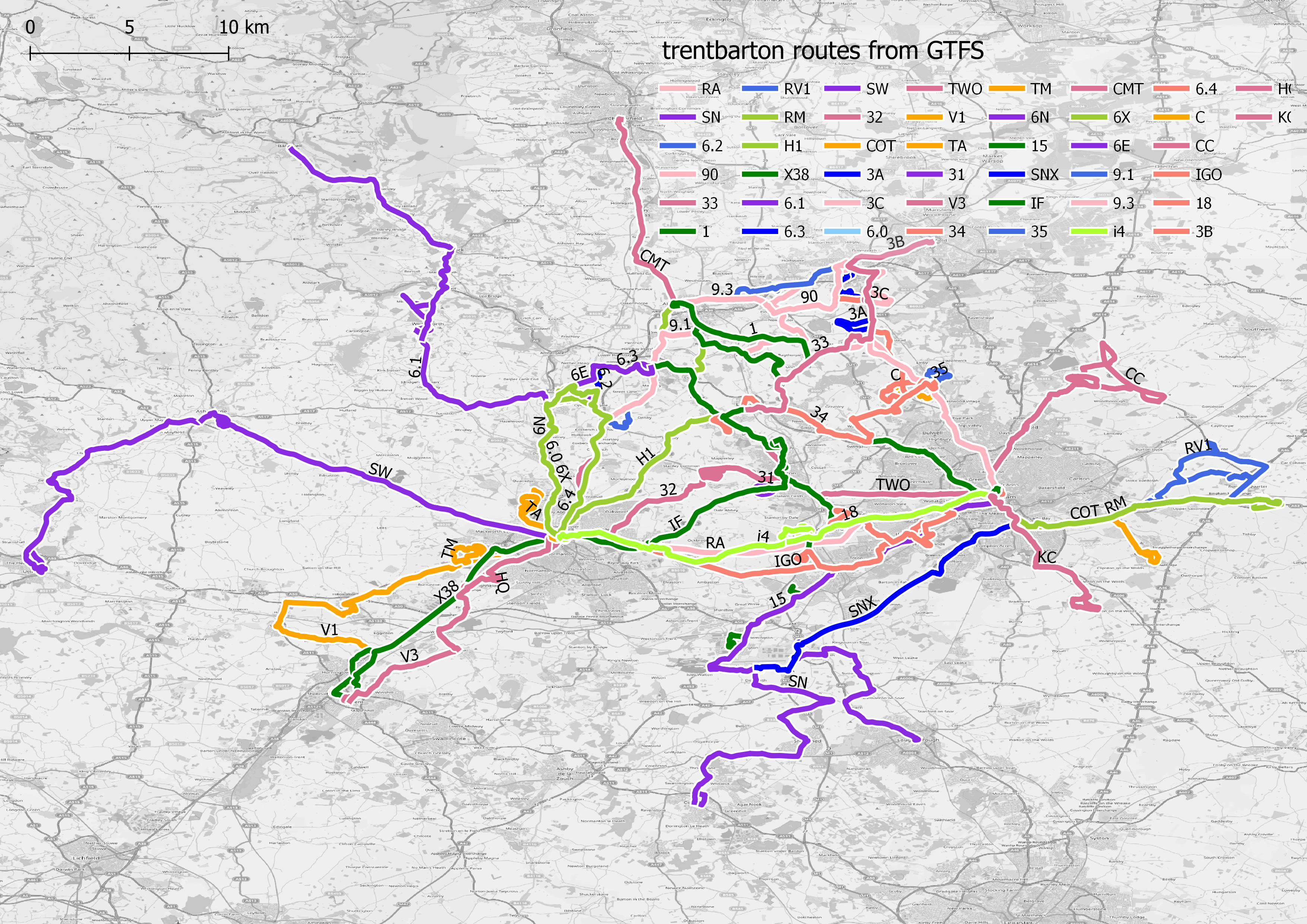
| 15:04, 17 March 2023 | Trentbarton.png (file) |  |
5.53 MB | {{Information | description=TrentBarton bus routes extracted from Open Bus GTFS data using GTFS Go QGIS plugin | source=OpenBus data; OpenStreetMap | date=2023-03-17 | author=SK53 | other_versions= }} | 1 |
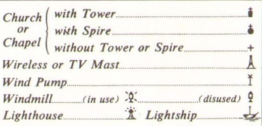
| 21:05, 6 March 2023 | Ordnance Survey One-Inch Sheet 106 Anglesey, Legend signs Published 1962.jpg (file) |  |
35 KB | {{Information | description=Legend showing conventional signs used on Ordnance Survey 7th series maps | source=https://commons.wikimedia.org/wiki/File:Ordnance_Survey_One-Inch_Sheet_106_Anglesey,_Published_1962.jpg | date=2023-03-06 | author=SK53 | other_versions= }} | 1 |
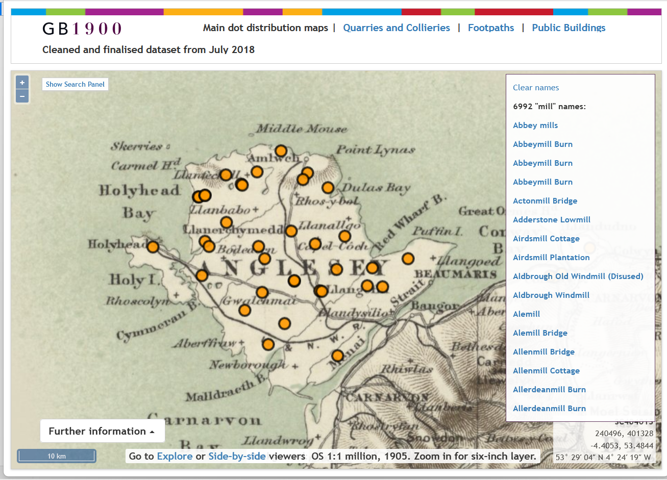
| 20:22, 6 March 2023 | Using gb1900 to find historical places.png (file) |  |
1.17 MB | {{Information | description=A screenshot of the GB1900 page at National Libraries of Scotland | source=National Libraries of Scotland Out-of-copyright map, GB1900 Project (University of Portsmouth) CC-BY data | date=2023-03-06 | author=SK53 | other_versions= }} | 1 |
| 21:33, 17 February 2023 | Emergency bleed control kit.jpg (file) |  |
283 KB | {{Information | description=Emergency bleed control kit on wall of NatWest Bank, Derby | source=SK53 | date=2022-09-27 | author=SK53 | other_versions= }} | 1 |
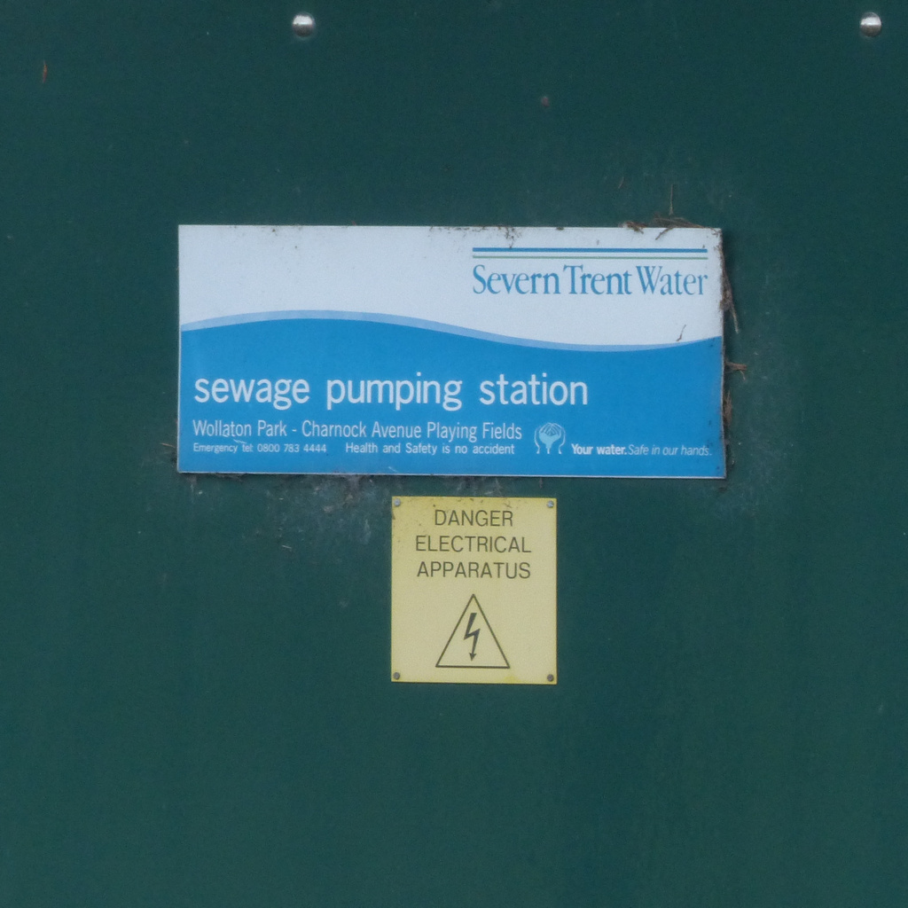
| 14:14, 14 February 2023 | Severn trent-sewage pumping station.jpg (file) |  |
307 KB | {{Information | description=Signage on electrical cabinet on a Severn Trent Sewage Pumping Station : illustrating that determining the suitable name tag is not obvious | source=SK53 | date=2023-0203 | author=SK53 | other_versions= }} | 1 |
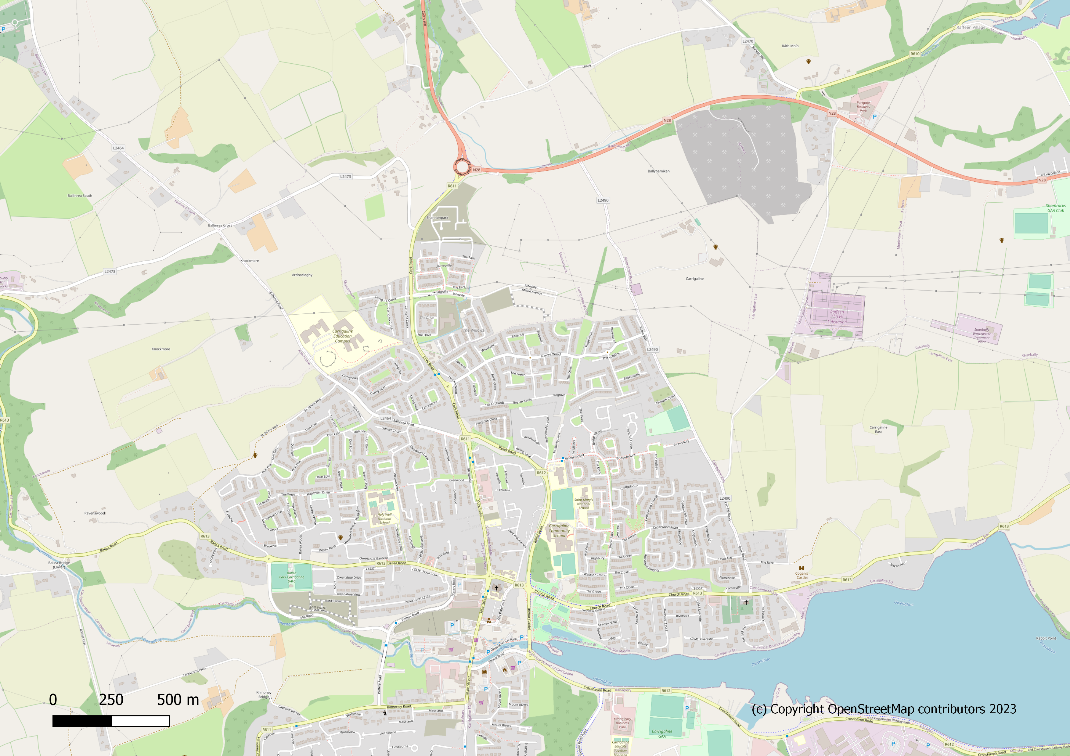
| 14:41, 7 February 2023 | Linda.png (file) |  |
3.92 MB | {{Information | description=Carrigaline from OSM | source= | date=2023-02-07 | author=SK53 | other_versions= }} | 1 |
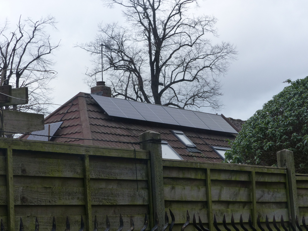
| 10:31, 2 February 2023 | Half-cell Solar Panels.jpeg (file) |  |
375 KB | {{Information | description=Rooftop solar panels using half-cells | source=SK53 | date=2023-02-01 | author=SK53 | other_versions= }} | 1 |
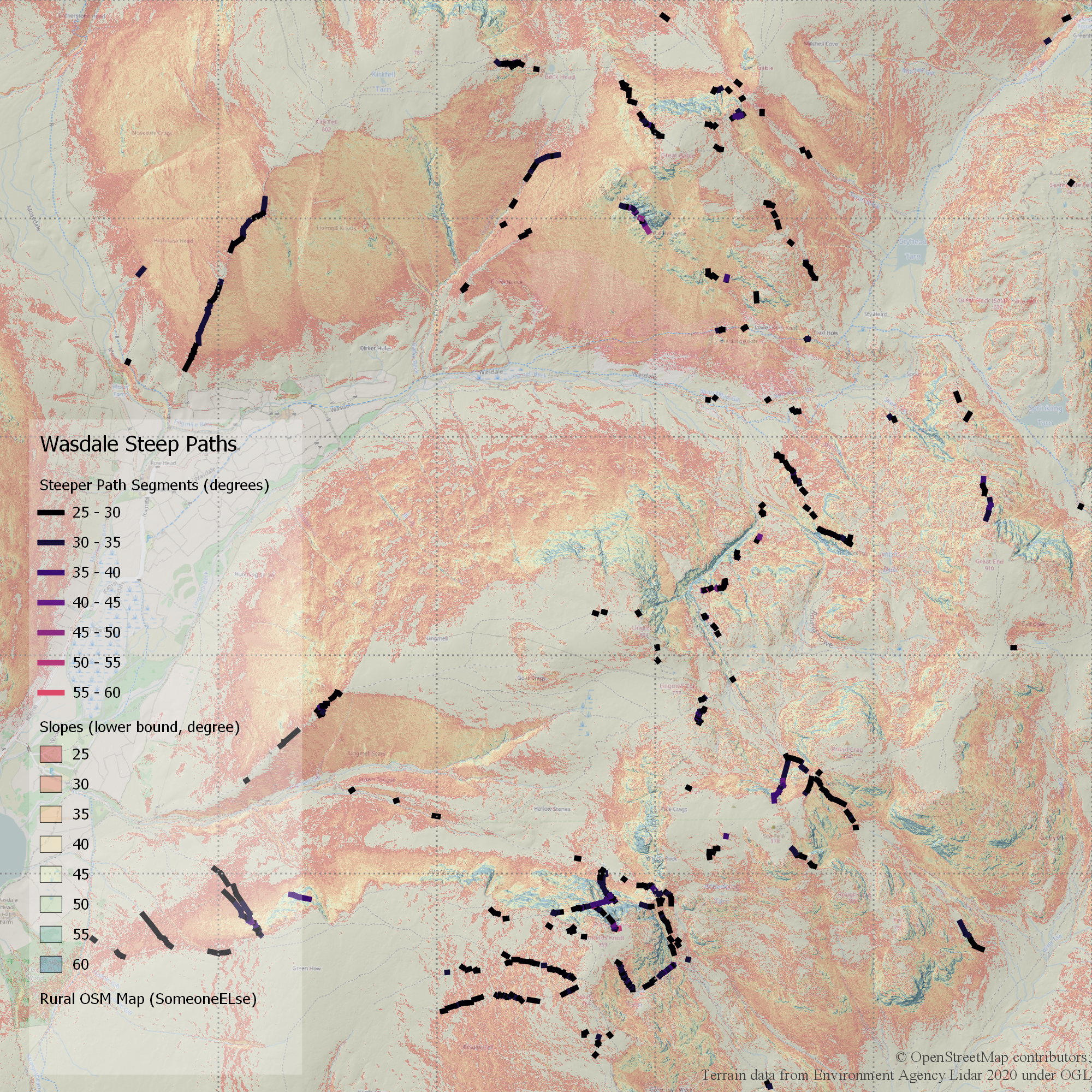
| 20:12, 9 January 2023 | Wasdale steep paths.png (file) |  |
6.63 MB | {{Information | description=Sections of paths mapped on OSM in Upper Wasdale calculated to be steeper than 25 degrees using Environment Agency Lidar data (1m pixels). Scale is 1:25k or 1 pixel = 2.5 m. | source=OpenStreetMap; Environment Agency Lidar Open Data | date=2023-01-09 | author=SK53 | other_versions= }} | 1 |
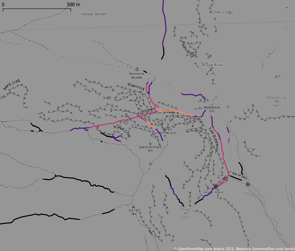
| 13:47, 8 January 2023 | Scafell steep paths.png (file) |  |
208 KB | {{Information | description=Steep paths around Scafell in the English Lake District (brighter - steeper) | source=OpenStreetMap; OS OpenData Terrain50 | date=2003-01-08 | author=SK53 | other_versions= }} | 1 |
| 15:09, 14 December 2022 | Old lenton colour coded by edit age.png (file) |  |
593 KB | {{Information | description=An area of the Nottingham suburb of Lenton with ways coloured by edit age | source=Overpass Turbo | date=2022-12-14 | author=sk53 | other_versions= }} | 1 |
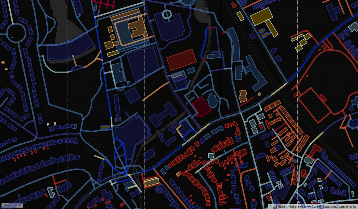
| 16:44, 2 December 2022 | Central Manchester buildings by age.png (file) |  |
597 KB | {{Information | description=Central Manchester showing buildings colour-coded by age, cf. with original work By Frankie Roberto | source=OSM; [https://overpass-turbo.eu/s/1oxM Overpass-turbo ] | date=2022-12-02 | author=SK53 | permission=CC-BY-SA | other_versions= }} | 1 |
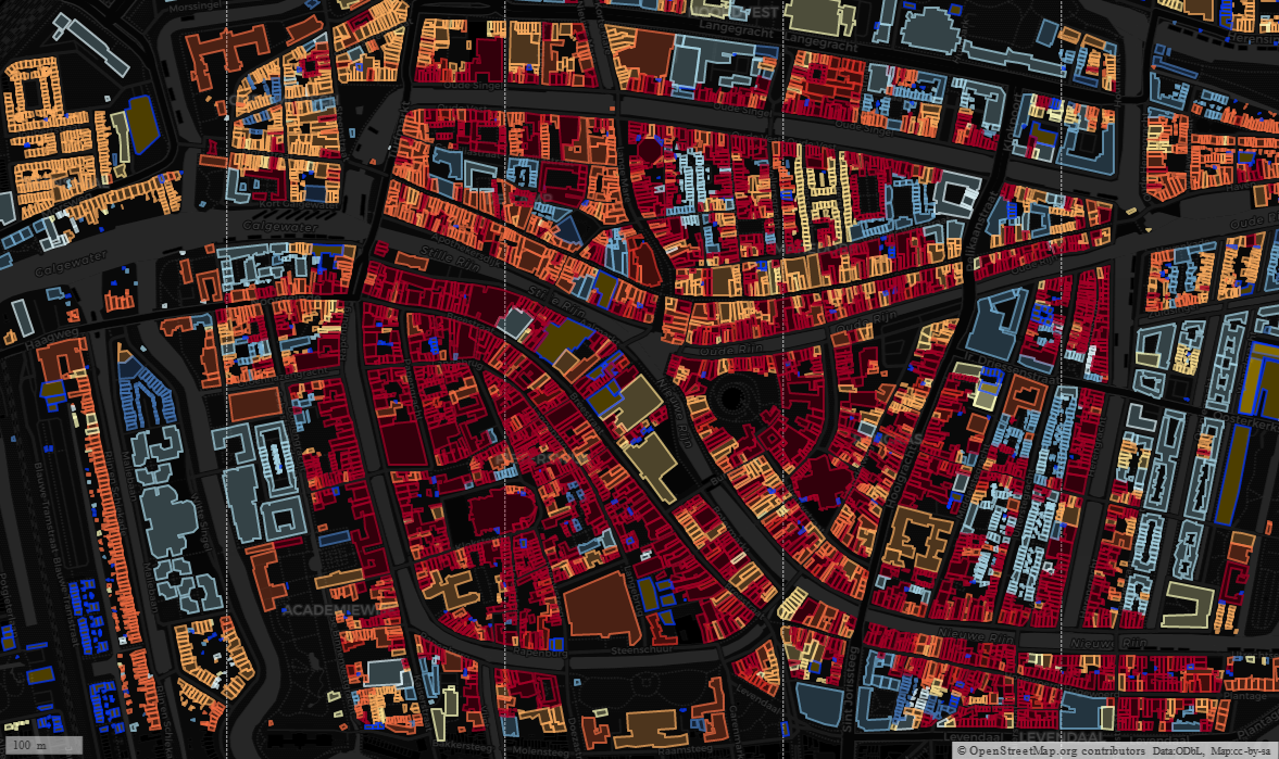
| 10:39, 30 November 2022 | Age of building Leiden.png (file) |  |
1.22 MB | {{Information | description=A map of building age in Leiden, The Netherlands. Colour coding is based on that at http://code.waag.org/buildings/ | source=OpenStreetMap, start_date from BAG import | date=2022-11-28 | author=SK53 | permission=CC-BY-SA | other_versions= }} | 1 |
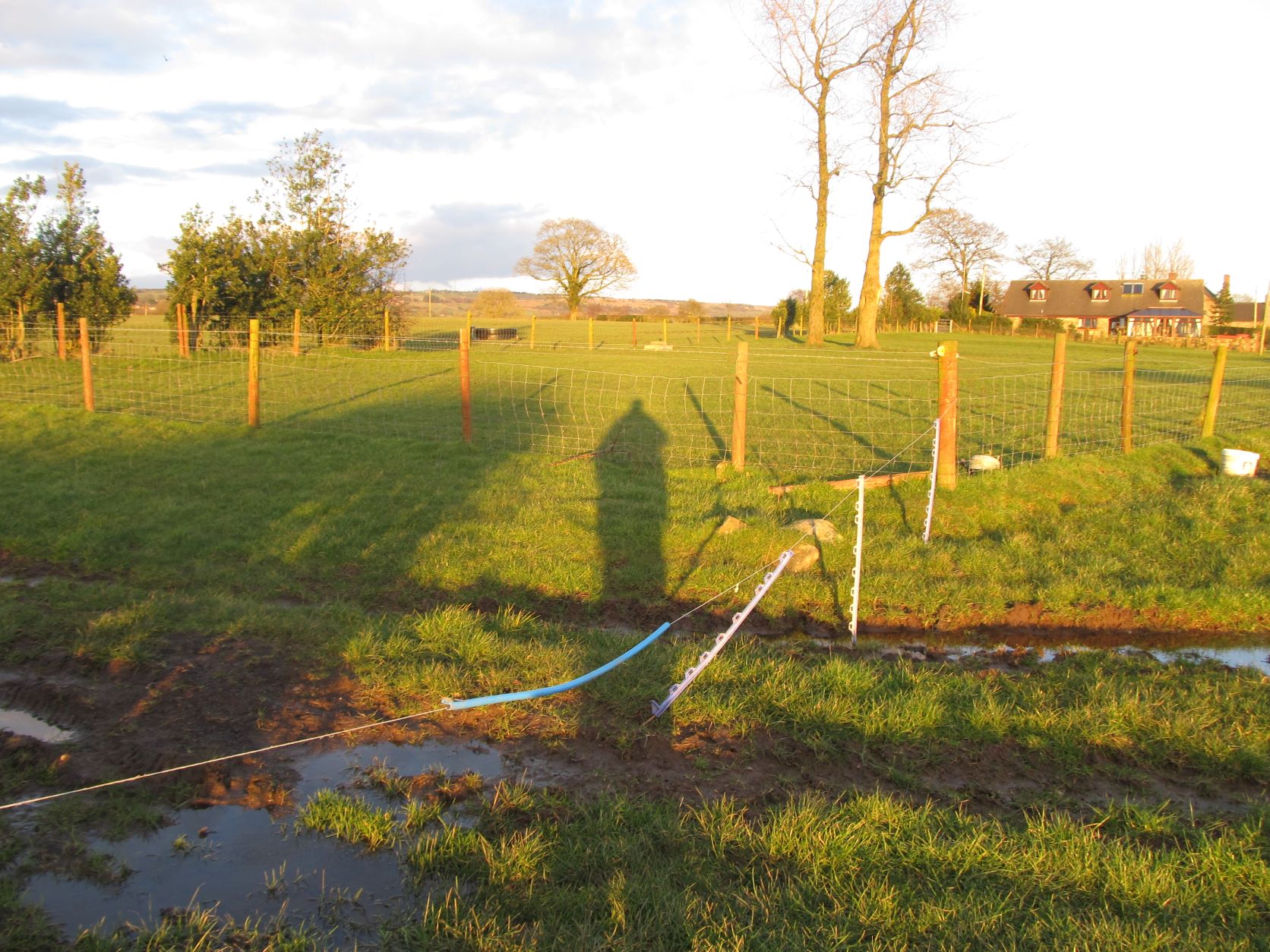
| 15:40, 27 August 2022 | Insulated Electric Fence stile 5675a.JPG (file) |  |
401 KB | {{Information | description=An electric fence covered with an insulating tube allowing walkers to cross it safely. Mapped as {{node|4044495448}} at [https://www.openstreetmap.org/#map=19/53.03775/-1.98466 this] location | source=User:SK53 | date=2016-03-05 | author=SK53 | permission=CC-BY-SA-4.0 | other_versions= }} | 1 |
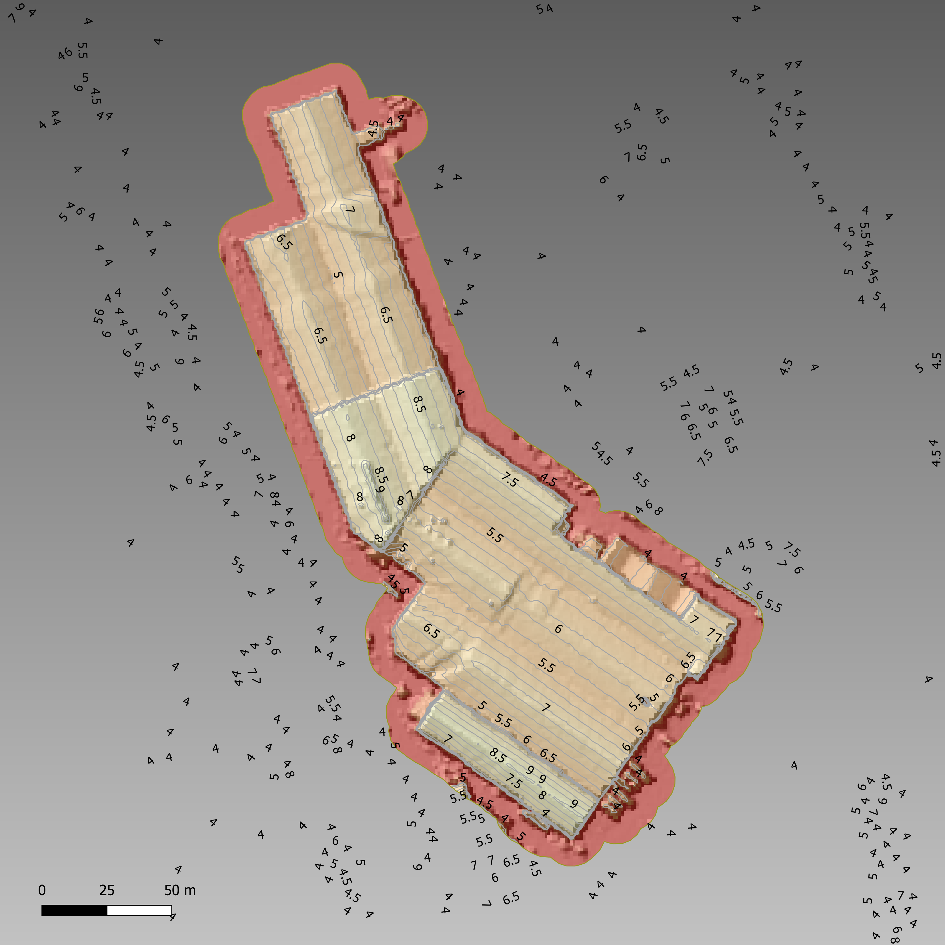
| 08:42, 25 August 2022 | Furntiture factory nrw lidar.png (file) |  |
1.55 MB | {{Information | description=Height profile of a furniture factory in Merthyr Tydfil from NRW Lidar data | source=NRW Lidar open data; own work | date=2022-08-20 | author=SK53 | permission=CC-BY-SA 4.0 | other_versions= }} | 1 |
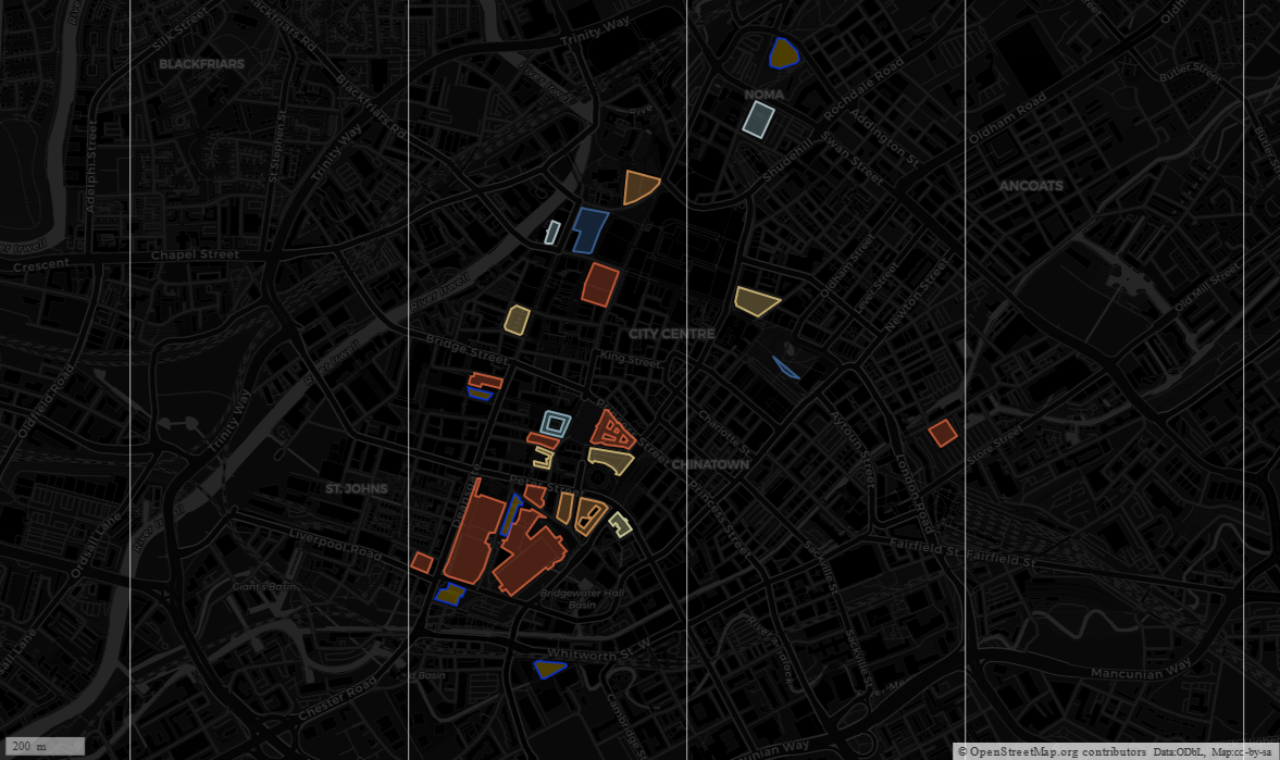
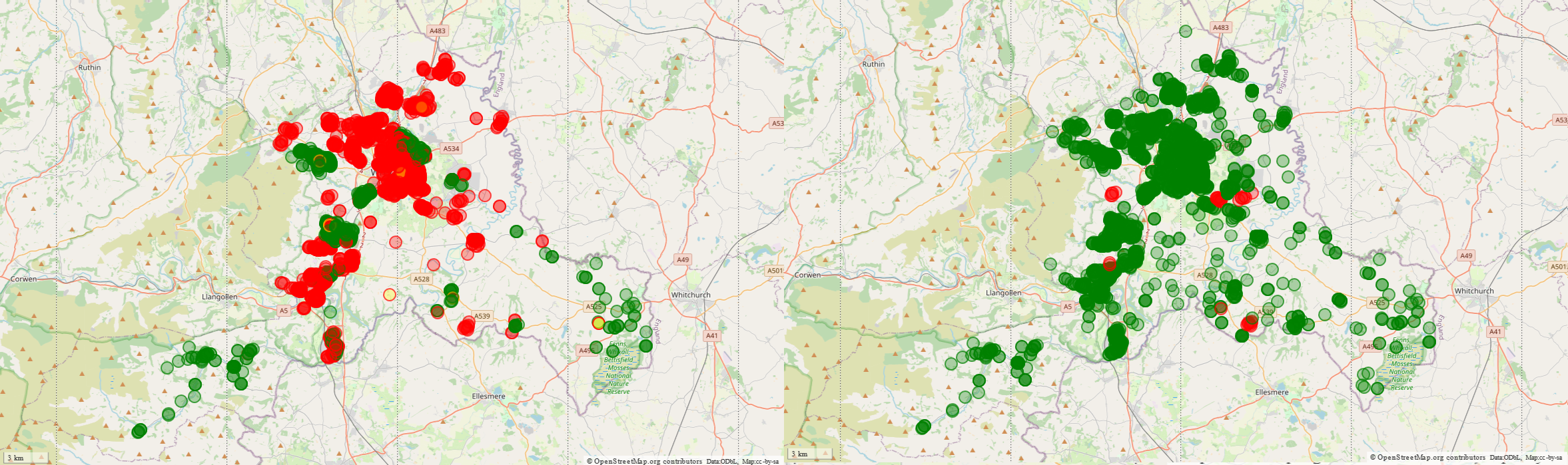
| 14:51, 12 August 2022 | Wrexham b&a.png (file) |  |
1.89 MB | {{Information | description=Solar power mapping in Wrexham June & August 2020 | source=OSM | date=2022-08-11 | author=SK53 | permission=OdBL | other_versions= }} | 1 |
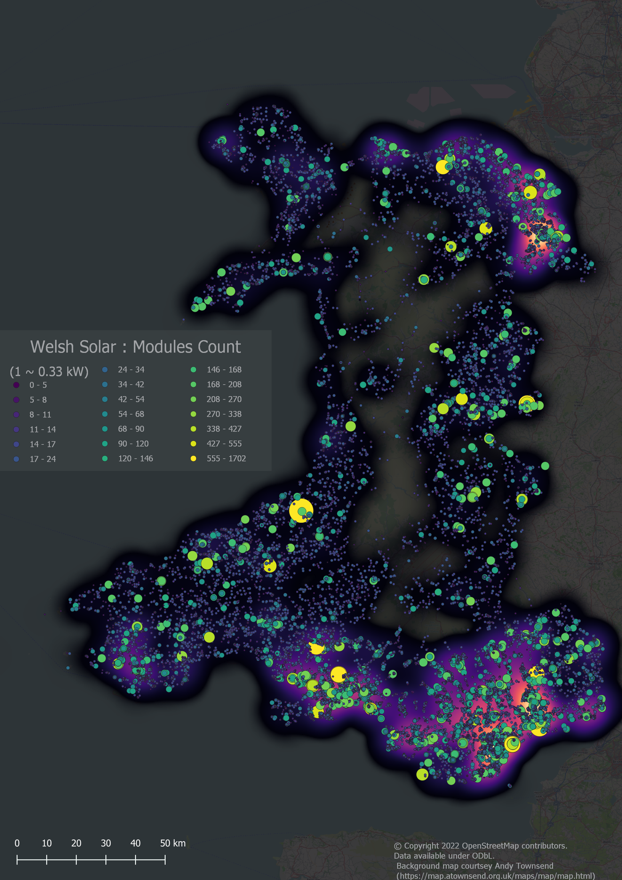
| 21:49, 8 August 2022 | Wales 20220808.png (file) |  |
3.48 MB | Moved legend, rescaled so 1 px = 100 m, added scale bar | 2 |
| 15:38, 10 April 2022 | Hothfield paths prow.png (file) |  |
2.98 MB | Hothfield area mapped paths on OSM & PRoW overlay, with Bing Maps aerial imagery. | 1 |
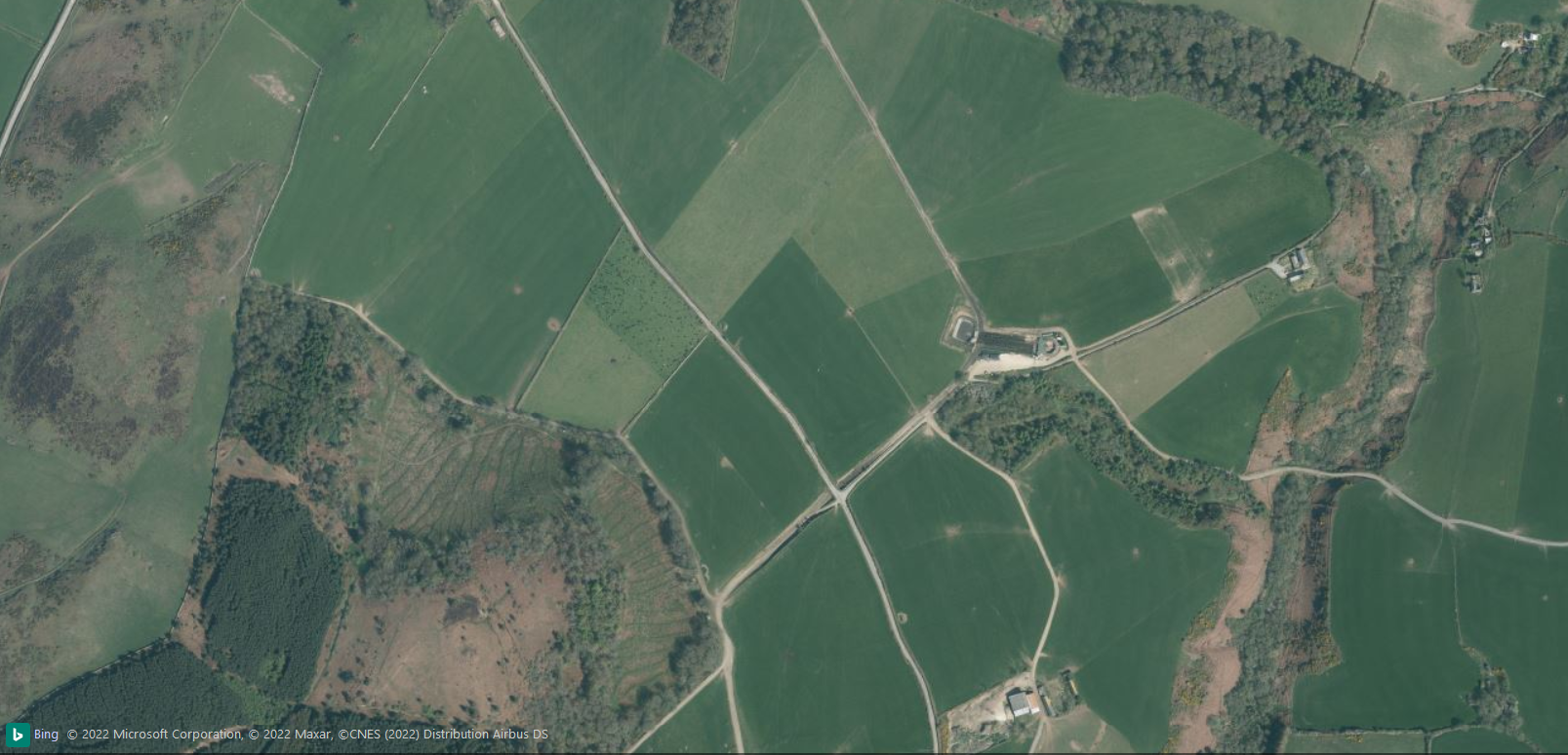
| 21:40, 23 January 2022 | Cefnamlwch milking parlour context.png (file) |  |
1.5 MB | Context of Cefnamlwch milking parlour showing extensive trackways to bring the cattle to be milked. | 1 |
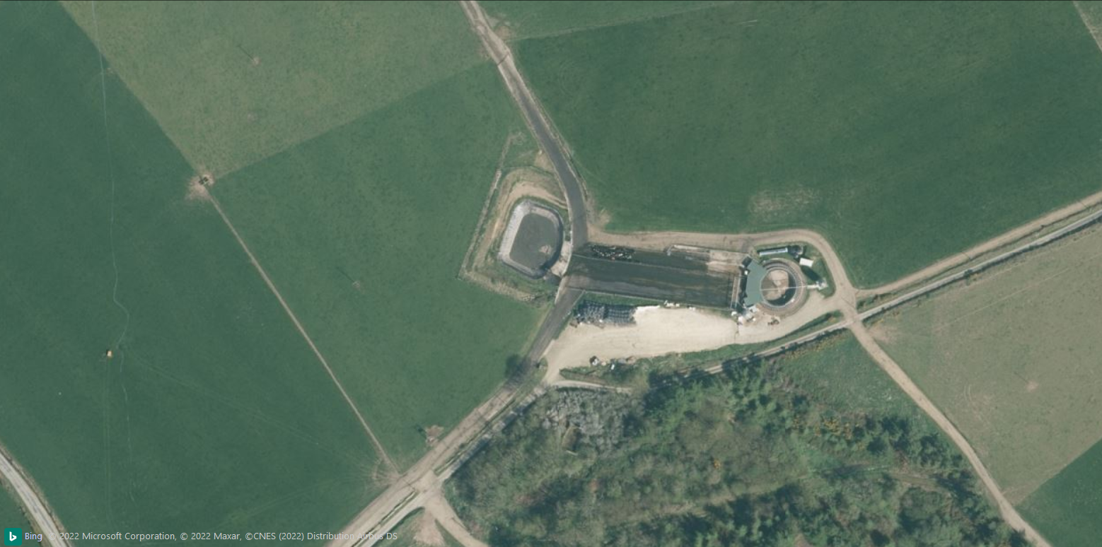
| 21:36, 23 January 2022 | Cefnamlwch milking parlour.png (file) |  |
1.19 MB | The Buches Cefnamlwch Dairy milking parlour area as seen on Bing. | 1 |
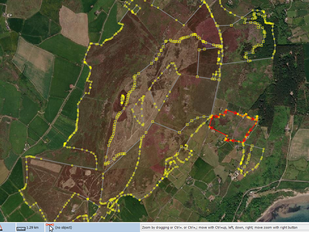
| 20:59, 18 November 2021 | Mynydd Rhiw Mapbox Imagery 2021Nov.jpg (file) |  |
431 KB | A screenshot of Mapbox Imagery of Mynydd Rhiw with Phase 1 heath polygons overlaid. This image was captured to enable discussion of some interpretation issues of the different imagery layers available. This imagery appears to be very similar, or identical to ESRI & Maxar layers, and therefore is probably sourced from Maxar. It appears to be earlier than 2018 because the forest area extends to the edge of the image but other dated layers from this year show no forest there. | 1 |
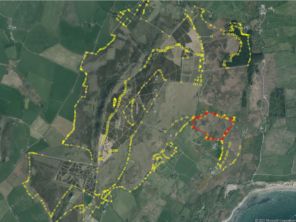
| 20:45, 18 November 2021 | Mynydd Rhiw Bing Imagery 2021Nov.jpg (file) |  |
405 KB | A screenshot of Bing Imagery in JOSM of Mynydd Rhiw with polygons from Phase 1 Habitat Survey of Wales overlaid. | 1 |
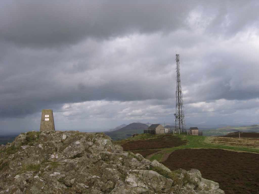
| 10:42, 16 November 2021 | Myndydd Rhiw.jpg (file) |  |
282 KB | Acid Heathland with Trig Point & communications station | 1 |
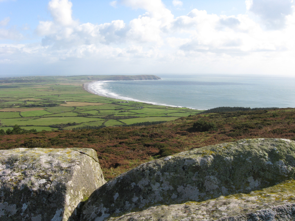
| 10:41, 16 November 2021 | View SE Mynydd Rhiw.jpg (file) |  |
375 KB | Porth Neigwl from Mynydd Rhiw. Heathland vegetation in foreground. The forestry in on the skyline to the right has been felled since 2008. This makes contrast between the heath and farmland very obvious. | 1 |
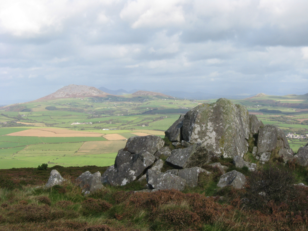
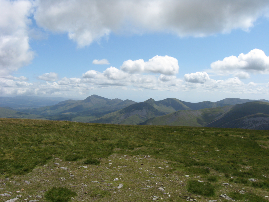
| 10:36, 16 November 2021 | View NE from Mynydd Rhiw.jpg (file) |  |
326 KB | A view looking NE along the main axis of Llŷn Peninsula shows the isolated hills created by granitic intrusions. Garn Fadryn & Garn Bach are the hills on the skyline, with Yr Eifl and other hills near Nefyn behind. The brown colour of heath vegetation (similar to that in the foreground) on these hills is obvious even at a distance. | 1 |
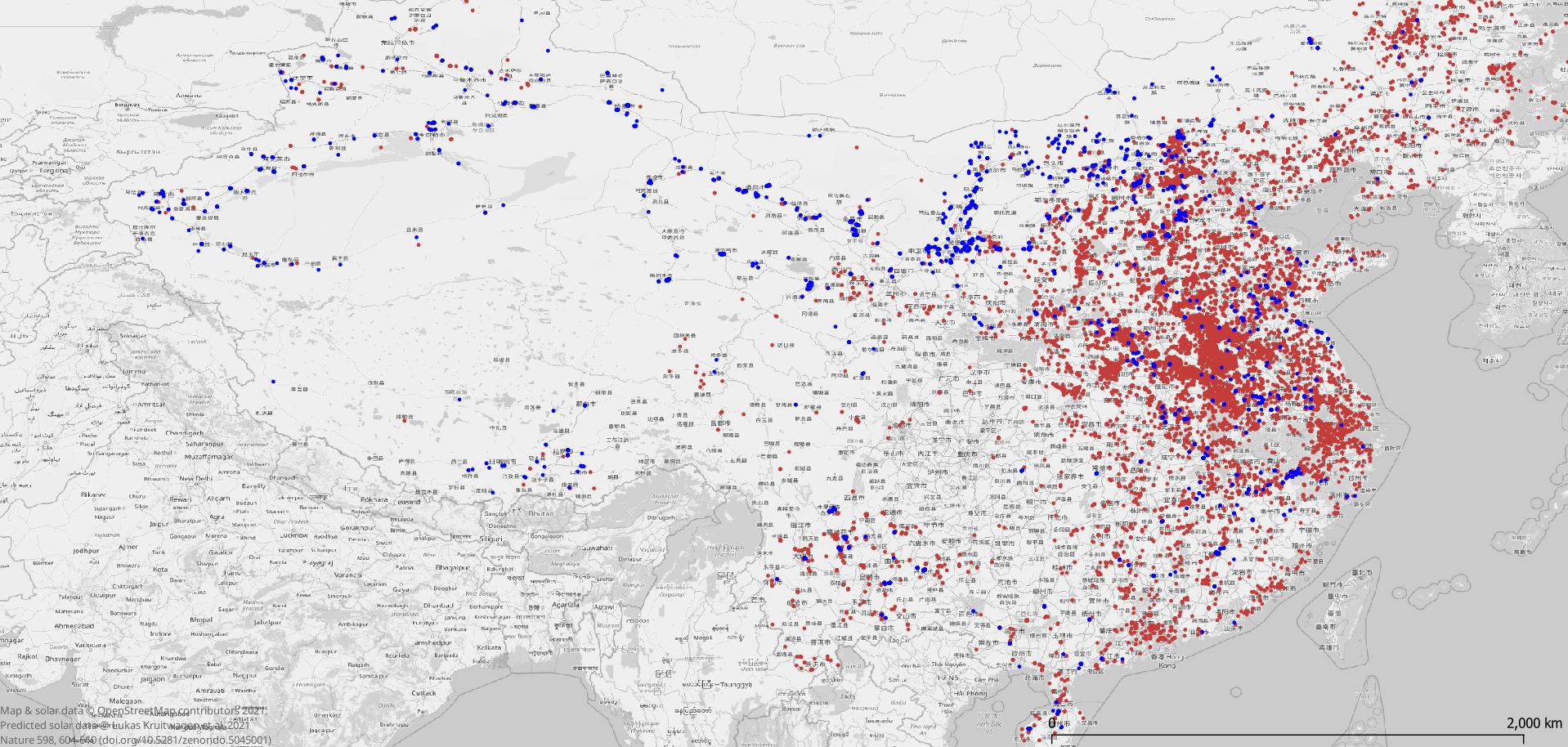
| 13:18, 12 November 2021 | China solar osm cf.png (file) |  |
1.59 MB | Comparison of solar power locations mapped on OSM on 2021-11-09 with the predicted solar power locations of Kruitwagen et al. (2021) Nature, 598, 604-610 ( © data CC-BY 4.0). Blue dots show predicted locations coincident with one or more OSM objects. Dark red dots are predicted location with no associated OSM solar power object. Roughly a third of locations are present in both datasets. No account has been taken of relative size. | 1 |
| 16:21, 26 October 2021 | Moel Eilio view 9297.jpg (file) |  |
319 KB | View from Moel Eilio, showing how extensive unimproved acid grasslands are in the mountains of North Wales | 1 |
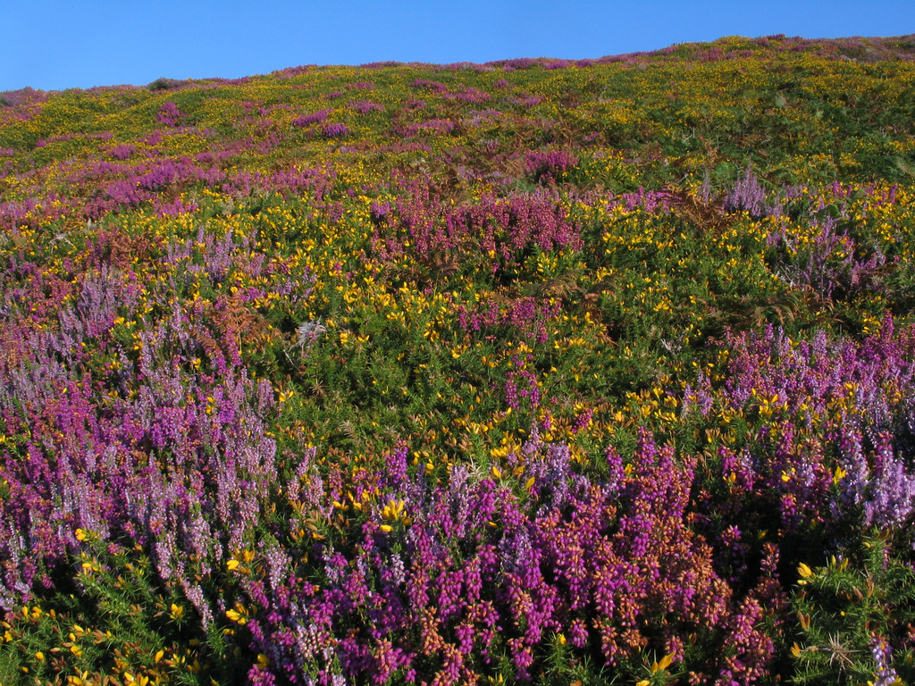
| 16:13, 26 October 2021 | South Stack heathland 30194.jpg (file) |  |
727 KB | Colourful low heath at South Stack, Holy Island, Anglesey | 1 |
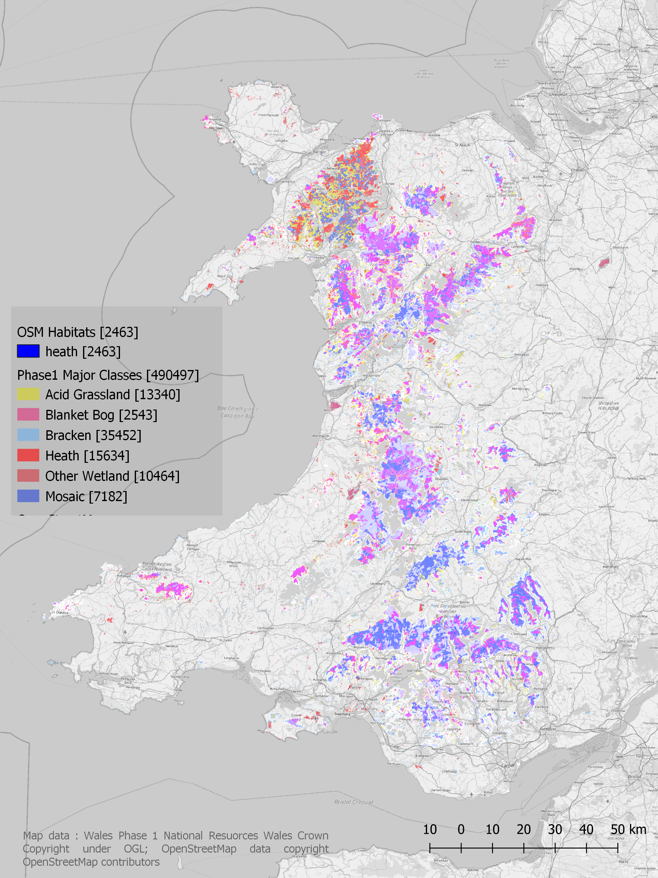
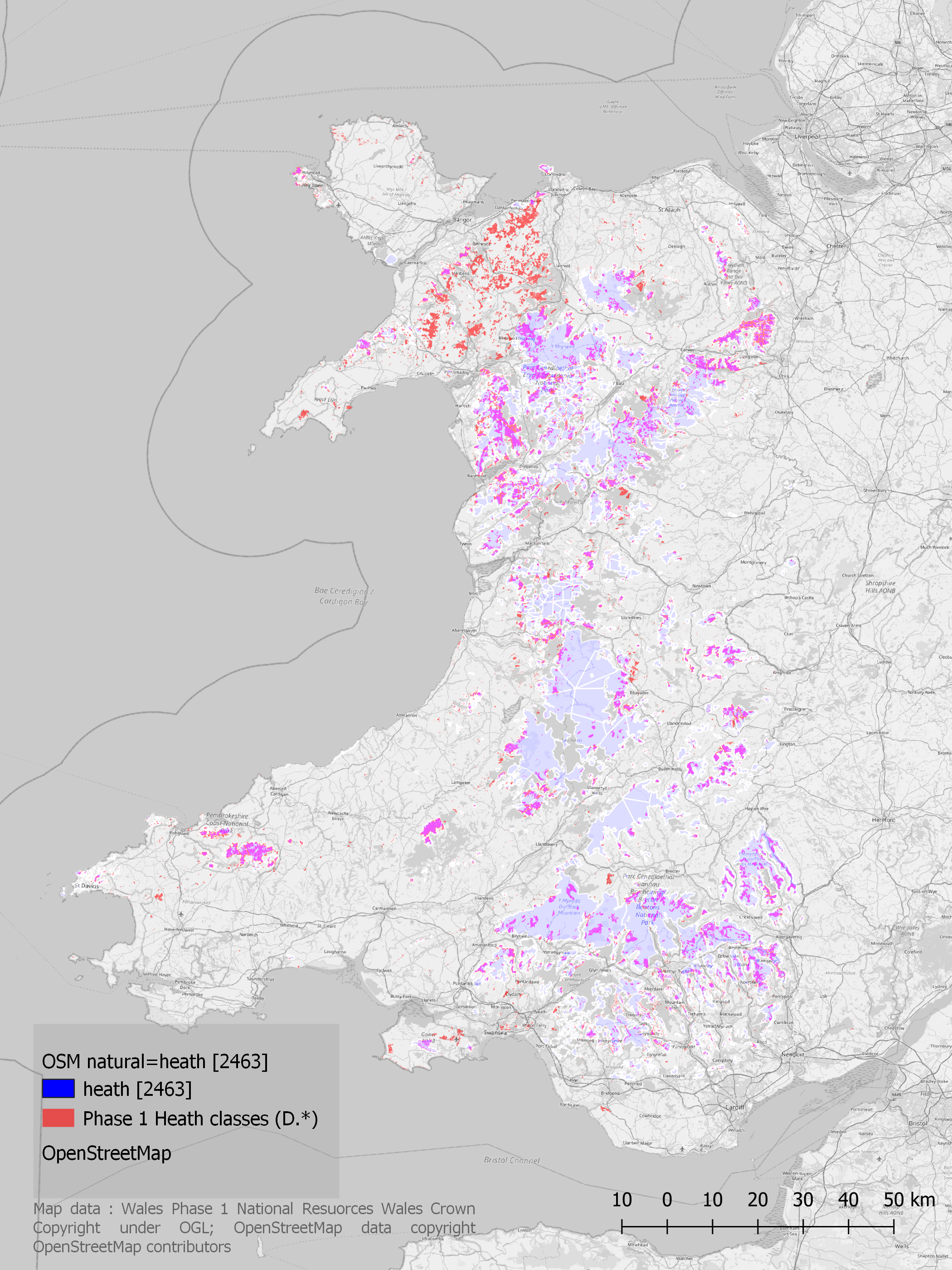
| 16:06, 26 October 2021 | Wales OSM Heath all p1codes.png (file) |  |
4.35 MB | Comparison of OSM natural=heath with Phase 1 codes identified as having a high fidelity of correspondence with natural=heath. Areas where colours are intensified show overlaps. | 1 |
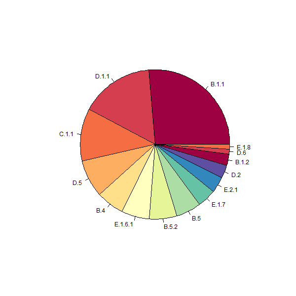
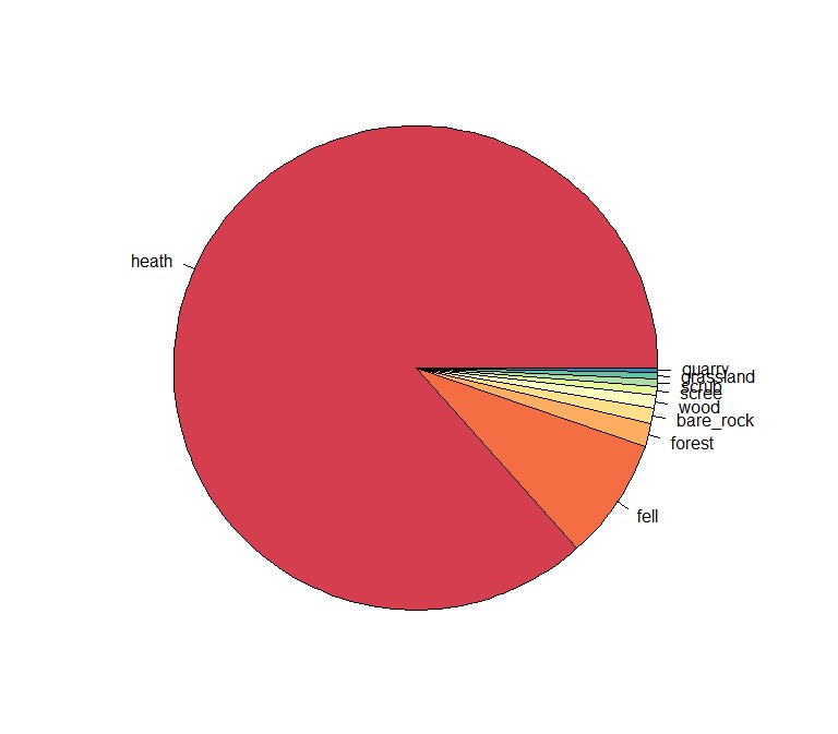
| 13:49, 26 October 2021 | Welsh heath p1 osm pie2.png (file) |  |
7 KB | Phase 1 habitat codes for areas tagged with natural=heath in Wales. Phase 1 data from Natural Resources Wales, Crown Copyright & database right under OGL | 1 |
| 13:39, 26 October 2021 | Welsh heath osm pie1.jpg (file) |  |
54 KB | Pie chart of OSM natural/landuse tags for heath ("D" prefix) polygons from Welsh Phase 1 data. Phase 1 data from Natural Resources Wales: Crown Copyright & database right under OGL. | 1 |
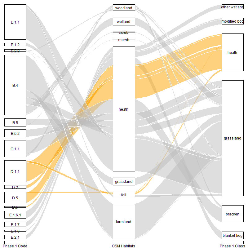
| 13:37, 26 October 2021 | Welsh heaths alluvial p1 osm.png (file) |  |
37 KB | Correspondences between Phase 1 Habitat codes & classes with grouped OSM natural and landuse habitats. Phase 1 data from Natural Resources Wales: Crown Copyright & database right. Released under OGL. | 1 |
| 09:34, 24 October 2021 | Welsh heath p1 osm overlay.png (file) |  |
3.65 MB | A comparison of heath habitats from the Phase 1 habitat survey of Wales (National Resources Wales) and the OSM {{tag|natural|heath}}. Colours are additive so where the two coincide the colours are intensified. | 1 |
| 16:31, 23 October 2021 | Phase1 osm cf1 wales.pdf (file) | 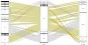 |
59 KB | Comparison of classification of heathland between OSM and NRW Phase 1 habitat survey for Wales. NRW Phase 1 data licenced under OGL, OSM data copyright OSM contributors. | 1 |
| 19:34, 22 October 2021 | Phase1 osm cf wales.pdf (file) | 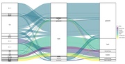 |
141 KB | A comparison of Phase 1 Habitat Analysis for Wales and OSM landuse/natural tags. The focus is on natural=heath, but all major habitats identified as being included in a significant way were included. The plot was made with ggalluvial (which has some limitations, but doing it in D3 seems a bit much right now). Phase 1 data licenced under OGL, OSM data Odbl. | 1 |
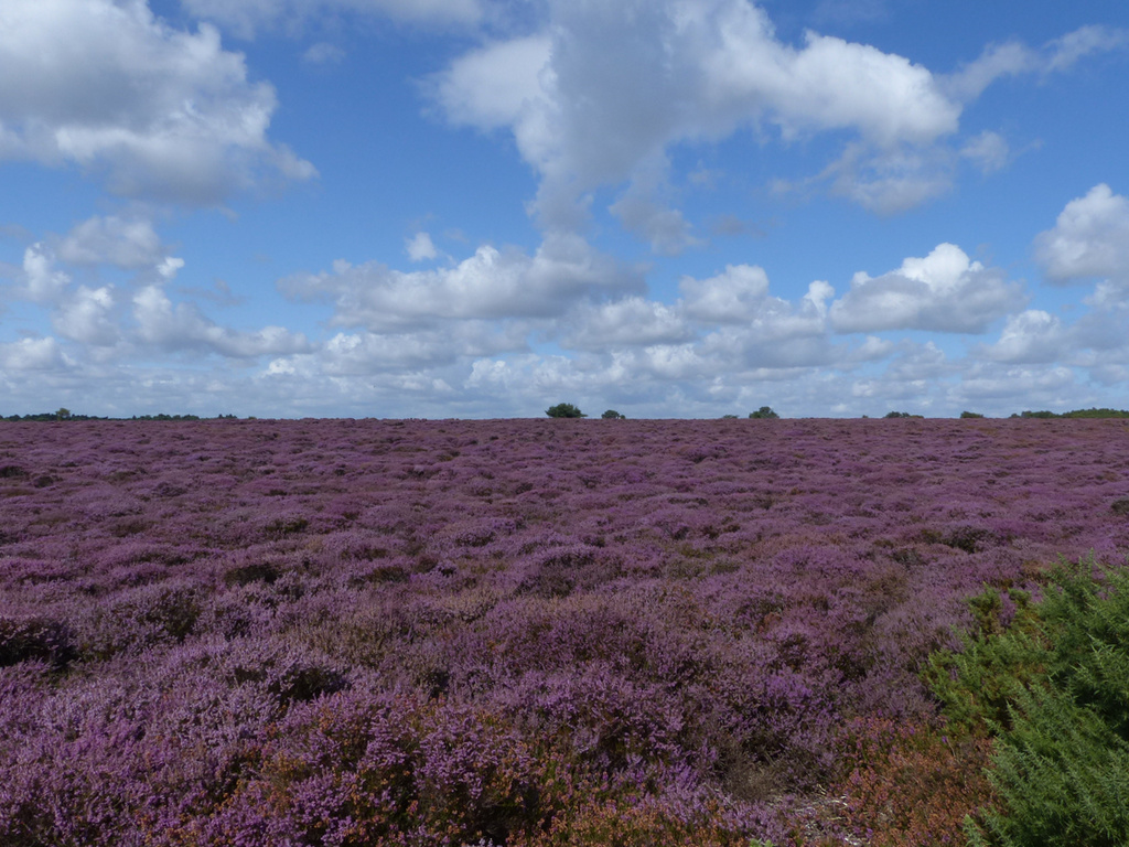
| 10:09, 16 September 2021 | Lowland dry acid heath Dunwich Heath.jpg (file) |  |
393 KB | Dunwich Common in mid-August with a huge expanse of heather in full bloom. This is a classic example of lowland dry heath in England, part of the Suffolk Sandlings one of the more extensive set of heaths in the country. | 1 |
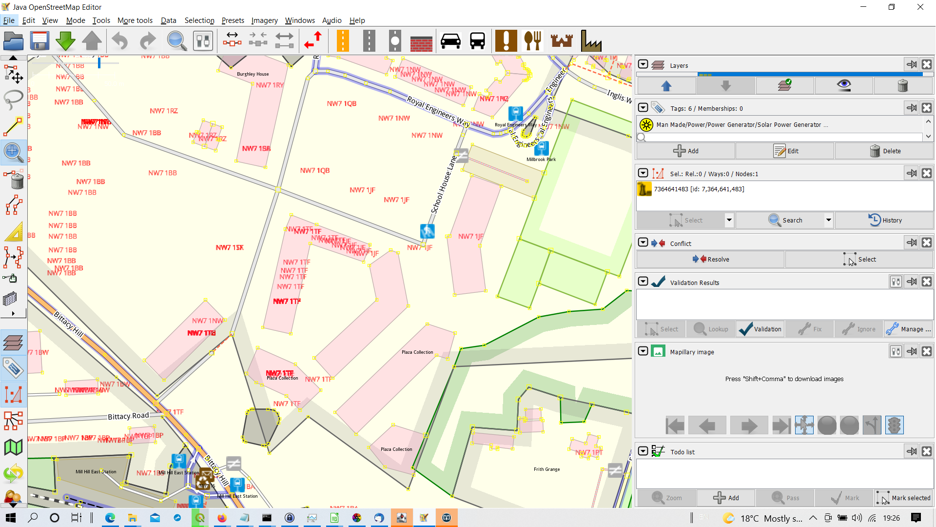
| 18:29, 29 July 2021 | Nsul postcode layer mill hill east.png (file) |  |
620 KB | Individual postcodes from NSUL for a new development on the former Royal Engineers Barracks at Mill Hill East. UK Government data , (c) crown copyright OGL. See July talk-gb list for detail for details | 1 |
| 13:25, 28 July 2021 | Dorket drive perforated kerbs.jpg (file) |  |
257 KB | A newly resurfaced Dorket Drive, Nottingham with the original kerbs replaced by a perforated kerb as part of an integrated kerb drain system. | 1 |