Uploads by Schadow1
Jump to navigation
Jump to search
This special page shows all uploaded files.
| Date | Name | Thumbnail | Size | Description | Versions |
|---|---|---|---|---|---|
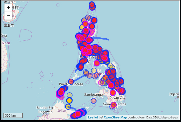
| 05:08, 5 October 2017 | Source schadow1.jpg (file) |  |
150 KB | Original mapping data contributed through the mapping expeditions of Schadow1 Expeditions as of October 2017. Data generated from Overpass Turbo | 1 |
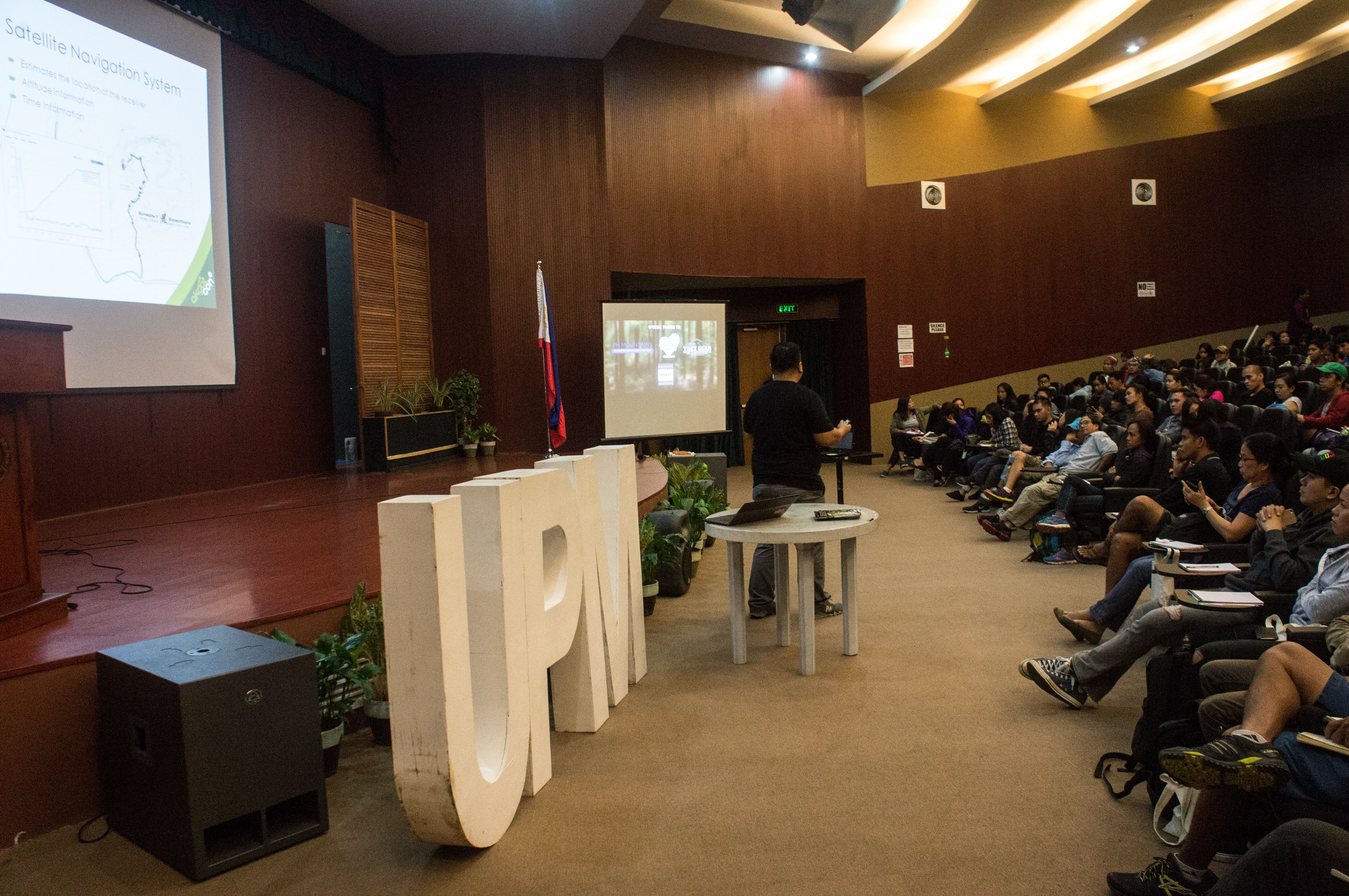
| 10:52, 29 July 2017 | Akyatcon2017.jpeg (file) |  |
4.67 MB | In congruence with the 40th anniversary of the UP (University of the Philippines) Mountaineers, the organization has held ""AkyatCon2.0"" (en: Climb Conference 2.0). User:Schadow1 and User:Banito_Pinoy has presented to over 100 attendees the im... | 1 |
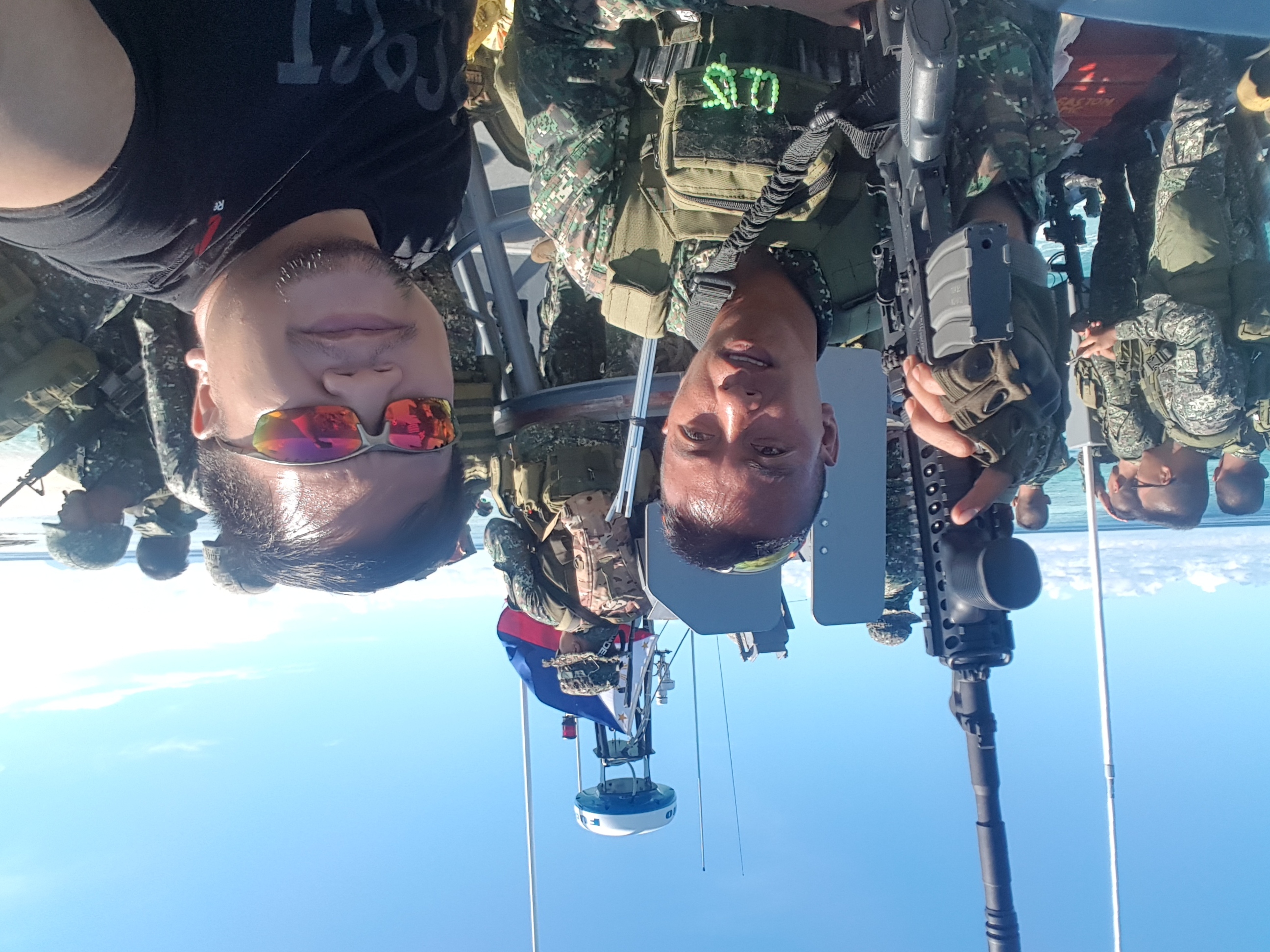
| 07:00, 6 June 2017 | TawiTawiPH mappingexpedition.jpg (file) |  |
1.83 MB | Upon the occupation of Marawi City in the Philippines, the Philippine President has declared martial law in the southern islands of Mindanao. User:Schadow1 together with a group of drone operators mapped the southernmost province of Tawi-Tawi for l... | 1 |
| 07:30, 3 March 2017 | Noahmapping-statsimage.jpg (file) |  |
167 KB | Building footprints mapping in the Philippines 2016-2017 Rendered using QGIS, changesets data extraction by Pascal Neis, Illustration by Ervin Malicdem | 1 |
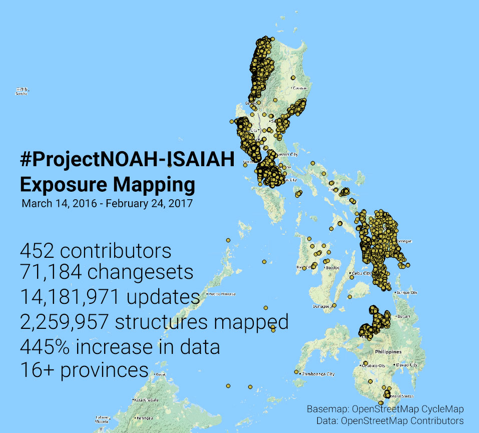
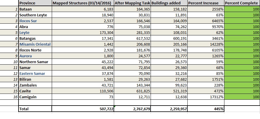
| 09:41, 28 February 2017 | Osmph-structures-noah.jpg (file) |  |
139 KB | Table shows the 16 provinces mapped through the Project NOAH initiative in the Philippines. Adding up over 2.2 million structures in OpenStreetMap or an increase of 445%. Generated through Spatial Query in QGIS using OSM admin boundaries through OSM ex... | 1 |
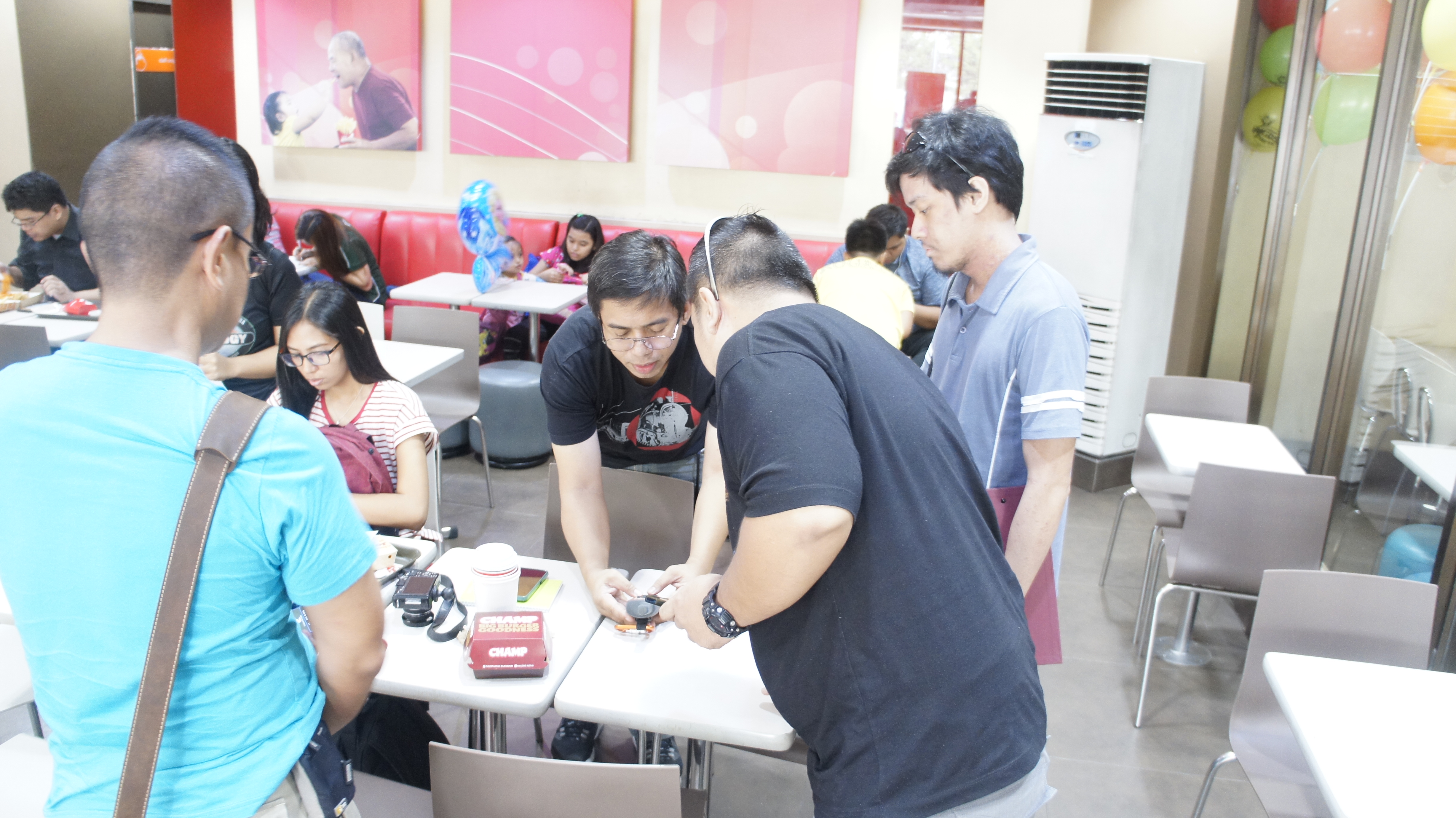
| 02:18, 11 May 2016 | UPVillageMapParty01.JPG (file) |  |
3.88 MB | Pre-mapping meeting for the UP Village Mapping Party of OSM-PH / Project NOAH | 1 |
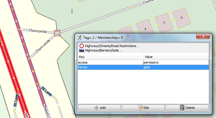
| 10:35, 25 August 2015 | Access-barrier.jpg (file) |  |
69 KB | Creating a barrier with an appropriate access tag along a road as a fix to a roads routability when you are inside a private road. | 1 |