Uploads by TomChance
Jump to navigation
Jump to search
This special page shows all uploaded files.
| Date | Name | Thumbnail | Size | Description | Versions |
|---|---|---|---|---|---|
| 08:26, 9 January 2011 | Oem logo.png (file) | 11 KB | OpenEcoMaps logo | 1 | |
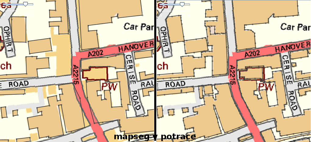
| 17:02, 1 July 2010 | Mapseg tc comparison.png (file) |  |
260 KB | 2 | |
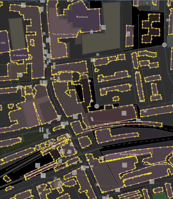
| 18:54, 27 June 2010 | Swk buildings shp.png (file) |  |
28 KB | 1 | |
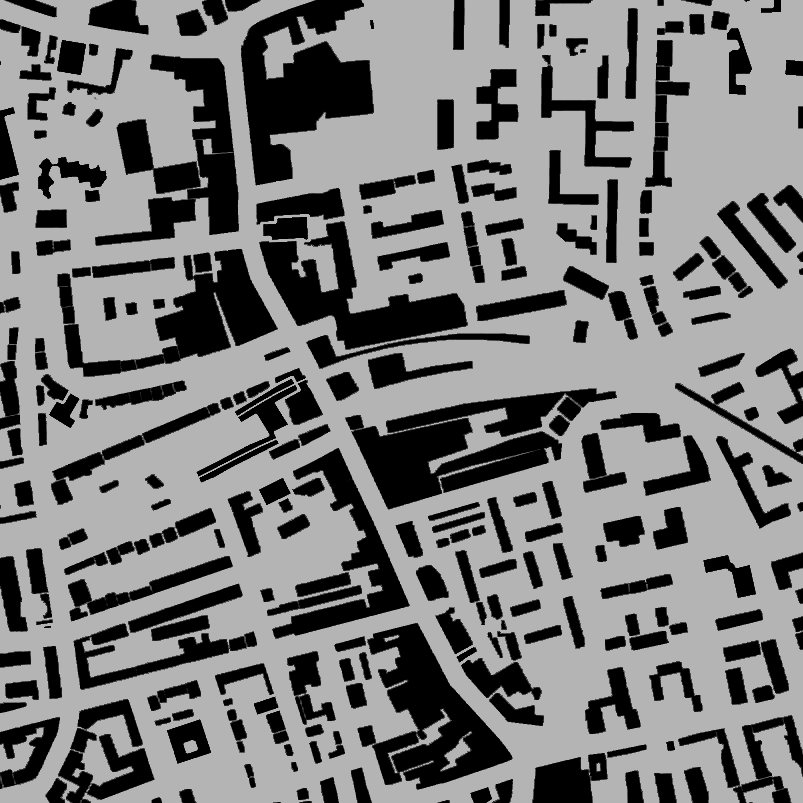
| 18:13, 27 June 2010 | Swk buildings osm.png (file) |  |
222 KB | 1 | |
| 17:59, 27 June 2010 | Swk buildings eps.png (file) |  |
103 KB | 1 | |
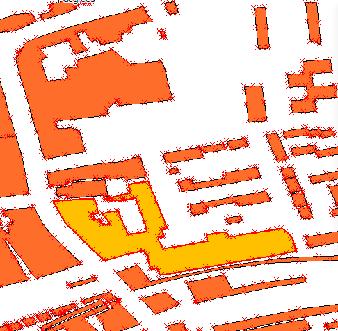
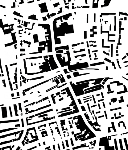
| 17:51, 27 June 2010 | Swk buildings sample.png (file) |  |
149 KB | Simplified from OS OpenData StreetView tiles. | 1 |
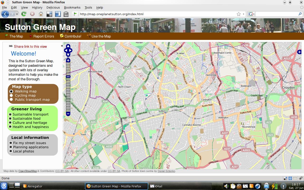
| 17:36, 27 June 2009 | Sgm mockup.png (file) |  |
929 KB | Mockup for Sutton Green Map web site. | 1 |
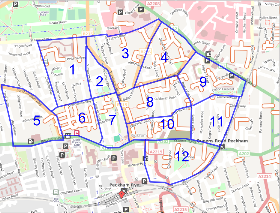
| 16:54, 20 May 2009 | Peckham cake 2009.png (file) |  |
581 KB | 2 | |
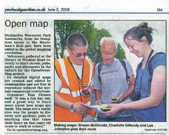
| 14:51, 6 June 2008 | Sutton wp article 20080606.jpg (file) |  |
131 KB | Article in the Sutton Guardian about the Worcester Park mapping party. | 1 |
| 09:15, 6 May 2008 | Worcester park cake.png (file) |  |
1.76 MB | 1 | |
| 16:00, 24 April 2008 | Sorcester park party A4 poster.pdf (file) |  |
757 KB | 1 | |
| 12:23, 15 March 2008 | Sutton party.png (file) |  |
288 KB | 1 | |
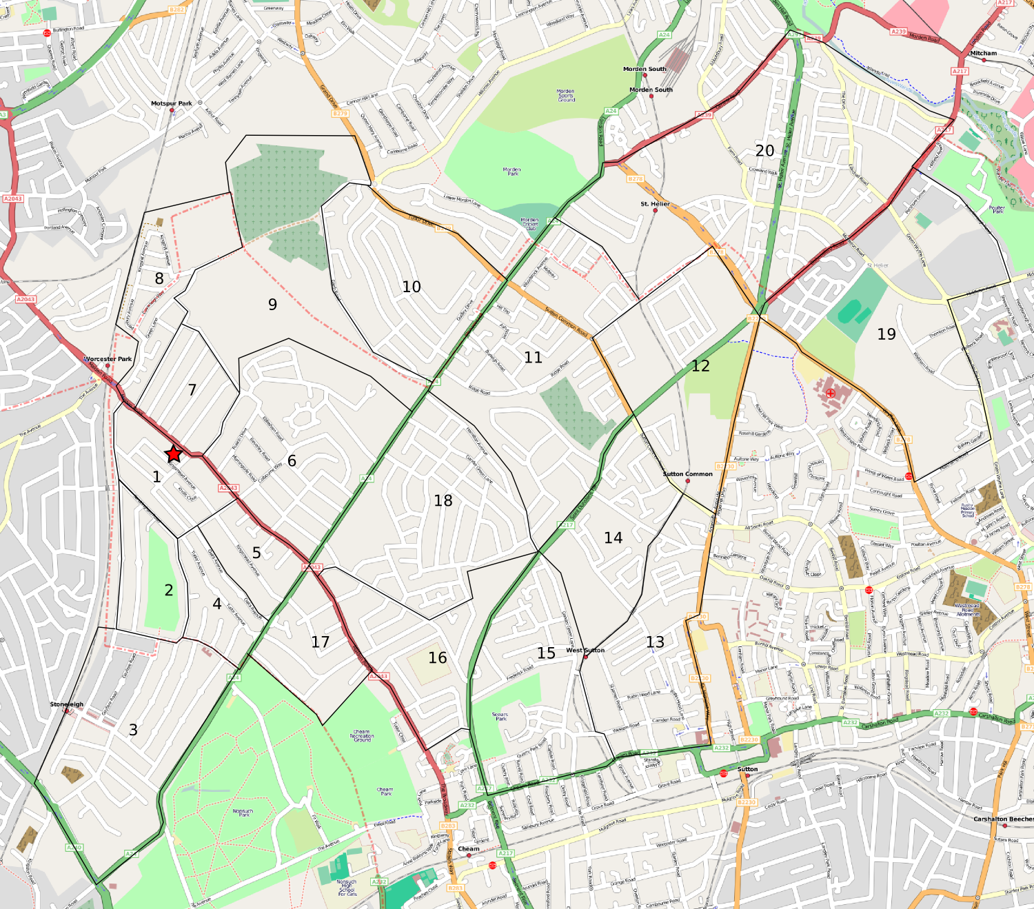
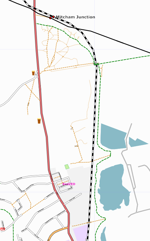
| 09:32, 7 February 2008 | Sutton 2008-02-07.jpg (file) |  |
173 KB | London Borough of Sutton mapping as of 7th Feb 2008. | 1 |
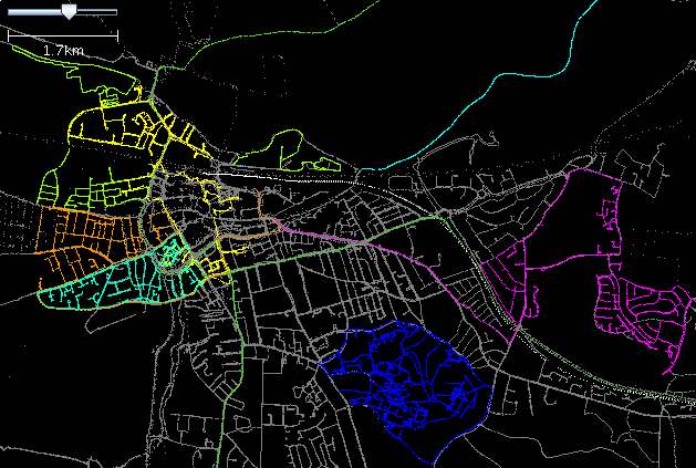
| 13:20, 14 September 2007 | UK criccieth status.png (file) |  |
37 KB | Extent of mapping in Criccieth, Wales, so far. | 1 |
| 08:18, 4 September 2007 | Strakers.jpg (file) |  |
5 KB | Photo of Strakers Road sign, Easter egg in several maps. | 1 |
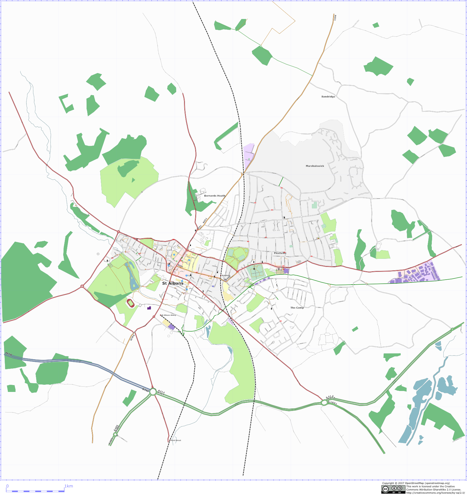
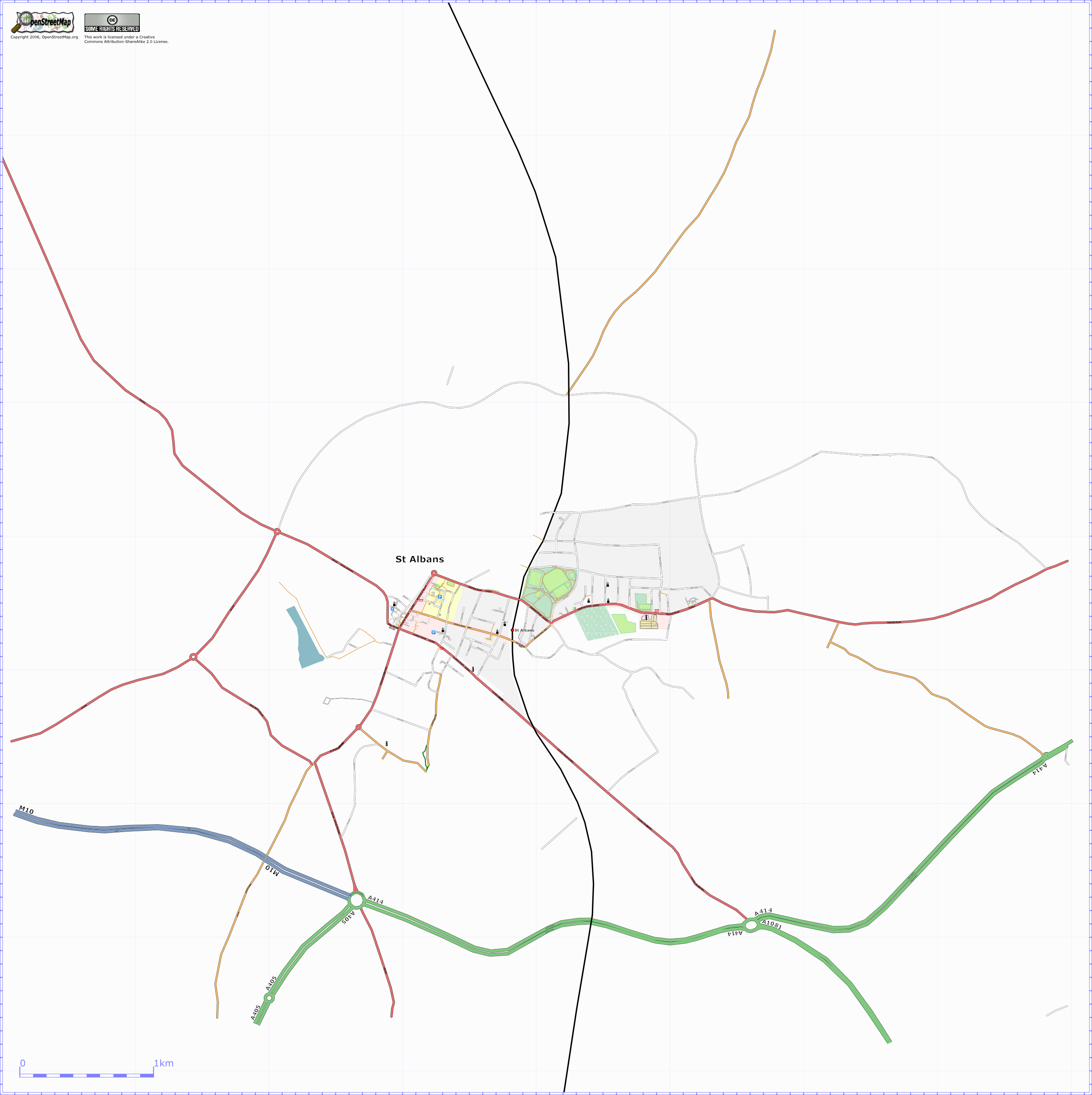
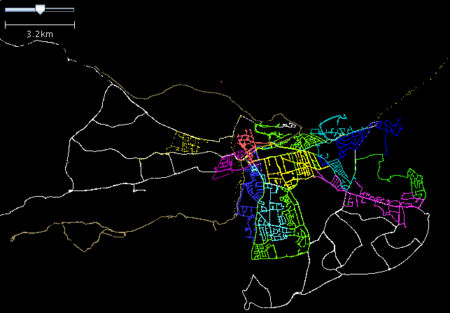
| 19:49, 21 March 2007 | UK stalbans status.png (file) |  |
716 KB | Osmarender of St Albans, UK. | 3 |
| 20:41, 11 March 2007 | Stalbans walala.png (file) |  |
686 KB | St Albans rendered in the style of Australian artist [http://www.jintaart.com.au/pass/jintayappa/walala_j/wj_08.htm Walala Japaltjarri] | 1 |
| 18:04, 11 March 2007 | Pofd.png (file) |  |
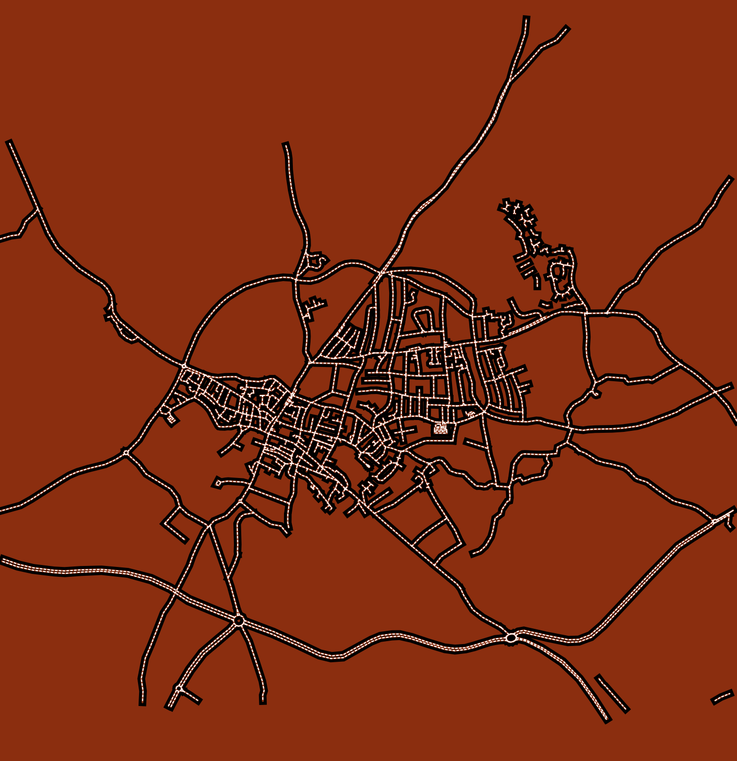
128 KB | First render of some pathways of desire. The green dashed lines are a cycle path (a well-surfaced track), the darker brown dashed lines are proper (though unofficial) footpaths, and the lighter brown lines are pathways of desire. Lots more remains to be d | 1 |
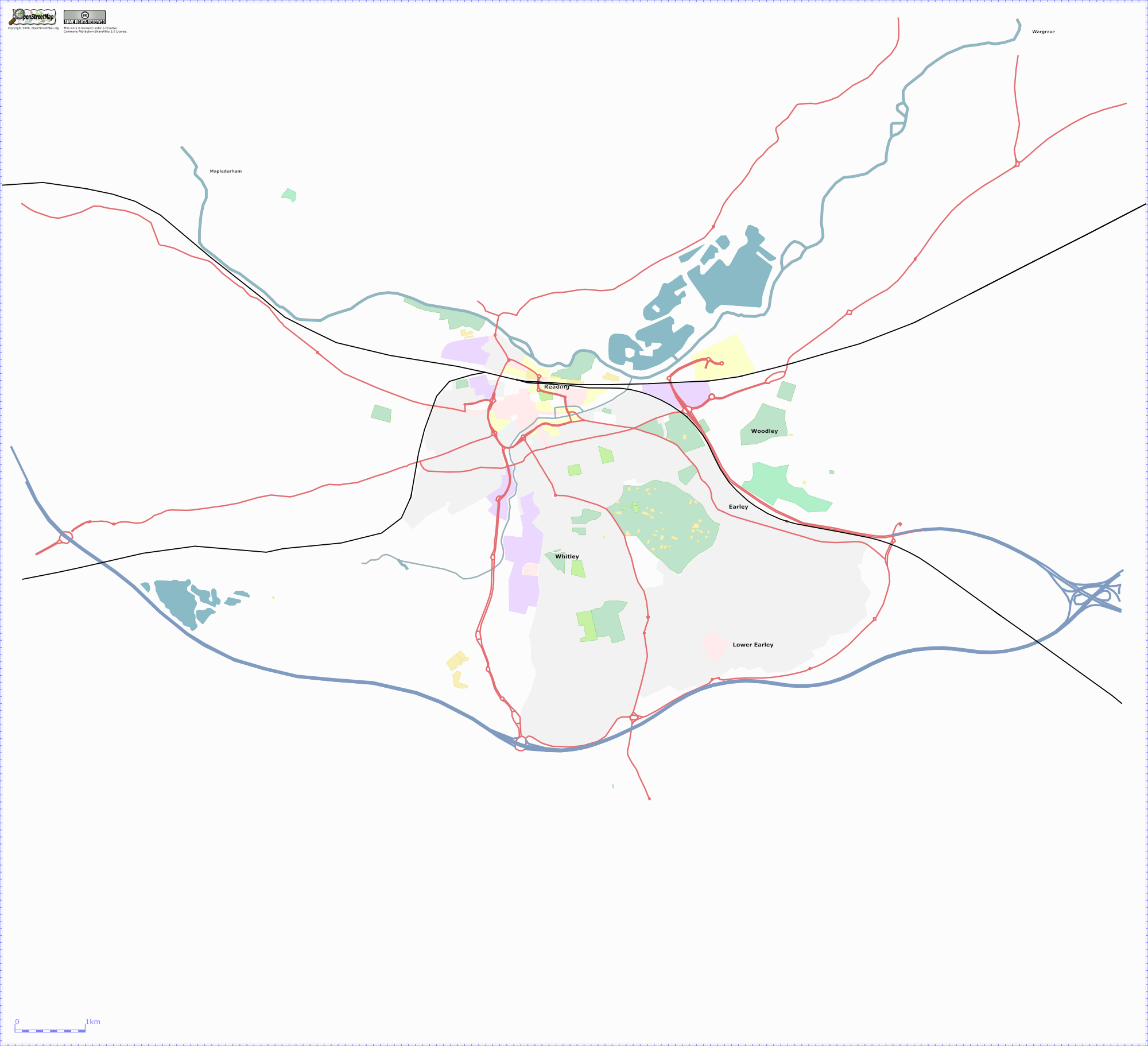
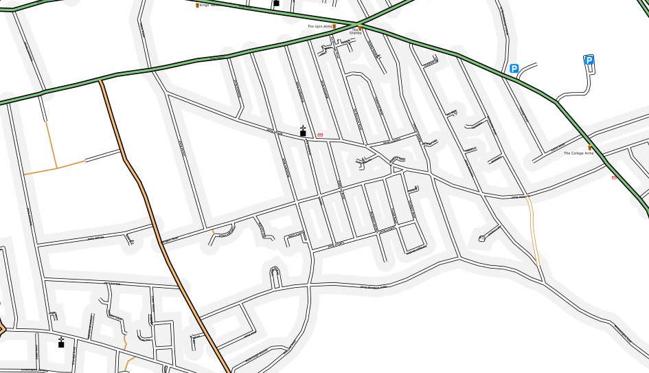
| 13:13, 9 November 2006 | Uk reading landuse.png (file) |  |
378 KB | A tweaked osmarender that shows landuse in Reading, with A roads, trunk roads, motorways and railways to clarify where stuff is. Lots and lots of landuse in Reading remains to be drawn in, especially West Reading, Woodley and Caversham (to the North of t | 1 |
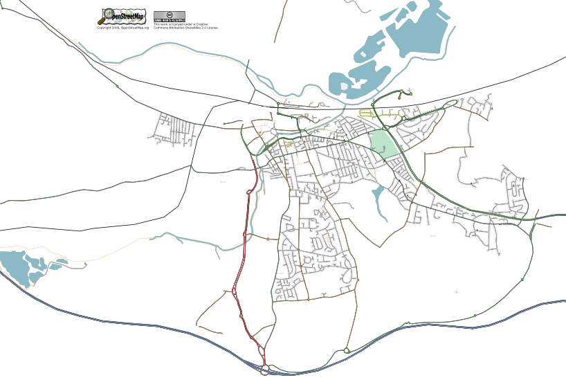
| 21:30, 31 October 2006 | Uk stalbans status.png (file) |  |
606 KB | Osmarender of St Albans, UK as of 20061031. N.B. the cemetery pattern was a manual tweak in Inkscape. | 3 |
| 12:34, 10 October 2006 | Courthouse.png (file) |  |
769 bytes | SVG symbol for courthouse | 1 |
| 12:34, 10 October 2006 | Civiccentre.png (file) |  |
547 bytes | SVG symbol for civic centre | 1 |
| 17:15, 21 September 2006 | Reading weekend 2.png (file) |  |
35 KB | Traces from the second mapping weekend overlayed on the complete raw GPS data. | 1 |
| 17:10, 21 September 2006 | Reading uni whiteknights campus.png (file) |  |
752 KB | Reading University's Whiteknights campus showing recycling points. | 1 |
| 17:02, 3 September 2006 | Uk reading 20060831.png (file) |  |
179 KB | Updated osmarender of Reading, UK. | 2 |
| 09:54, 30 August 2006 | Redlands.png (file) |  |
218 KB | Most of the Redlands ward in Reading, UK, produced with a modified osmarender (added pubs, parking and post offices, manually tweaked some positioning). | 1 |
| 09:50, 29 August 2006 | Weekend traces.png (file) |  |
18 KB | Traces gathered during the Reading mapping weekend, 26th-28th August 2006. | 1 |