WikiProject Sutton England/Mapping party
This is a past event
We have mapped an awful lot of Sutton, but we want to complete the entire Borough over this weekend! OpenStreetMap's coverage of Sutton is being used for a groundbreaking sustainability project; see the Sutton page for more information.
Dates: Sat 24th & Sun 25th May
Download and print off the poster if you're local!
Tag any photos on Flickr with 'worcesterparkmapping' for them to show up on our web site.
The plan - Saturday
New mappers will go out paired with a more experienced mapper to capture street data, or to add in detail like amenities to areas that already have basic road coverage. By the end of the weekend we hope to have as much of the area completed as possible, focusing on the following data:
- Basic street information
- Key amenities like post offices/boxes, local shops, cycle and car club parking, bus stops, community centres etc.
- Land use areas like residential, industrial, retail, allotments, parks, recreation grounds, etc.
We will also run two workshops for beginners at 11am and 2pm. Any help in running this would be very much appreciated!
Saturday venue: Worcester Park Library, Stone Place, Windsor Road, Worcester Park, Surrey, KT4 8ES (51.378059, -0.241682, map). We will be in the meeting room upstairs, with free wifi and desk space for laptops, from 10am - 5pm.
The plan - Sunday
We don't have the library on Sunday and the main organiser (Tom) can't be there, but other local mappers will probably still gather to finish the area off! Please add your name to the list below if you're interested, we can scout out a suitable location whilst mapping on Saturday.
Areas to do
Sections 12, 19 and 20 didn't get done on Saturday.
Area to map
This map shows a "cake" of the area, divided into parts that people can choose to map. Click on the image to see it full size.

Please come to the Worcester Park Library on the day to choose your part of the cake. We hope to have a fair number of new local mappers attending, including youngsters, so there are some pretty small areas immediately around the venue as well as much larger parts (19, 20).
Who came
Saturday
- TomChance
- Thomas Wood - I seem to remember that 9 has a nice new housing complex that's not yet on Yahoo. On my way to the venue in the morning, I'll try and complete LCN75, which I keep losing past Sutton.
- Sygopet
- Smsm1 Will bring the OSM Gekos (The NaviGPS are currently with Richard)
- TimSC (I want section 3 for sentimental reasons. I used to live in this area. I will be able to map much more than that though.)
- BlueSpecs
- steve8 Planning to come in afternoon. Aiming for at library for 2pm.
Sunday
- Thomas Wood
depending on the weather might try and finish up the remaining zones to the north-east of Sutton, will start from home, as trailing all the way across Sutton and back again is pointless.
Promotion
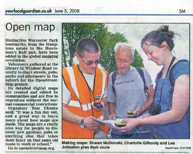
We got some coverage in the local Lib Dem leaflet and The Sutton Guardian:

The event has been mentioned by / promoted to:
- Councillor Roger Roberts, who has passed it on to the local scout group, various schools and others
- Worcester Park Library (poster up)
- Living Streets
- Smarter Travel Sutton
- Cyclism (local branch of the London Cycling Campaign)
- Geography dept. at Cheam High School
- Various staff at the council responsible for the local area/community
- Sutton Active
- Local blogs - Worcester Park blog, One Planet Sutton blog
- Local media
- CTC