Uploads by Wille
Jump to navigation
Jump to search
This special page shows all uploaded files.
| Date | Name | Thumbnail | Size | Description | Versions |
|---|---|---|---|---|---|
| 19:00, 15 March 2022 | Opendata-dourados-ms.jpg (file) |  |
63 KB | Autorização de uso dos dados de Dourados, MS, Brasil. | 1 |
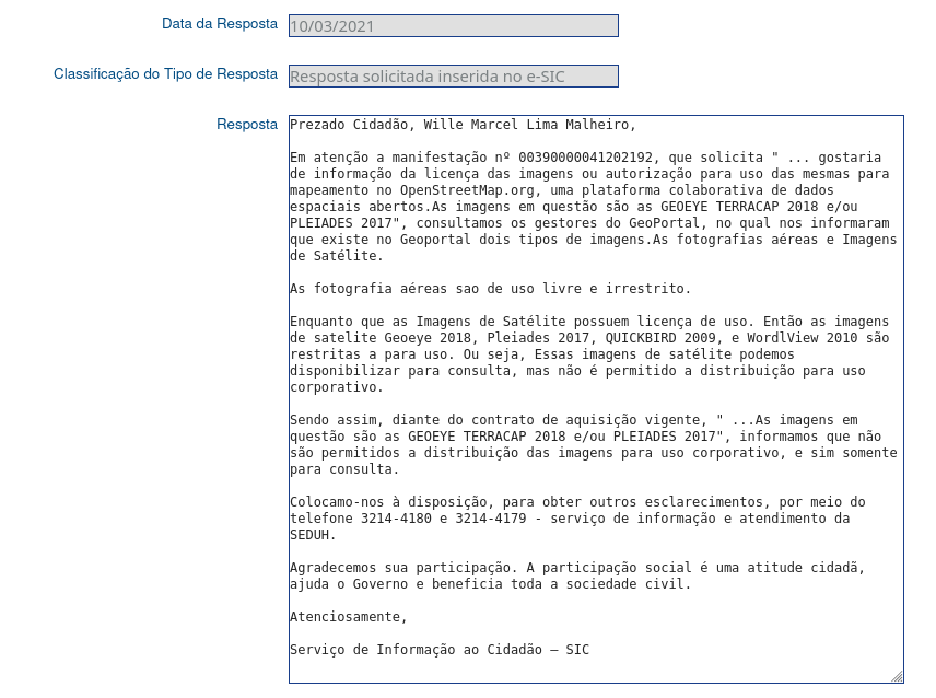
| 20:00, 10 March 2021 | LicenseInfo-GeoPortal-DF-Brazil.png (file) |  |
106 KB | Permission to use some images of GeoPortal DF on OSM | 1 |
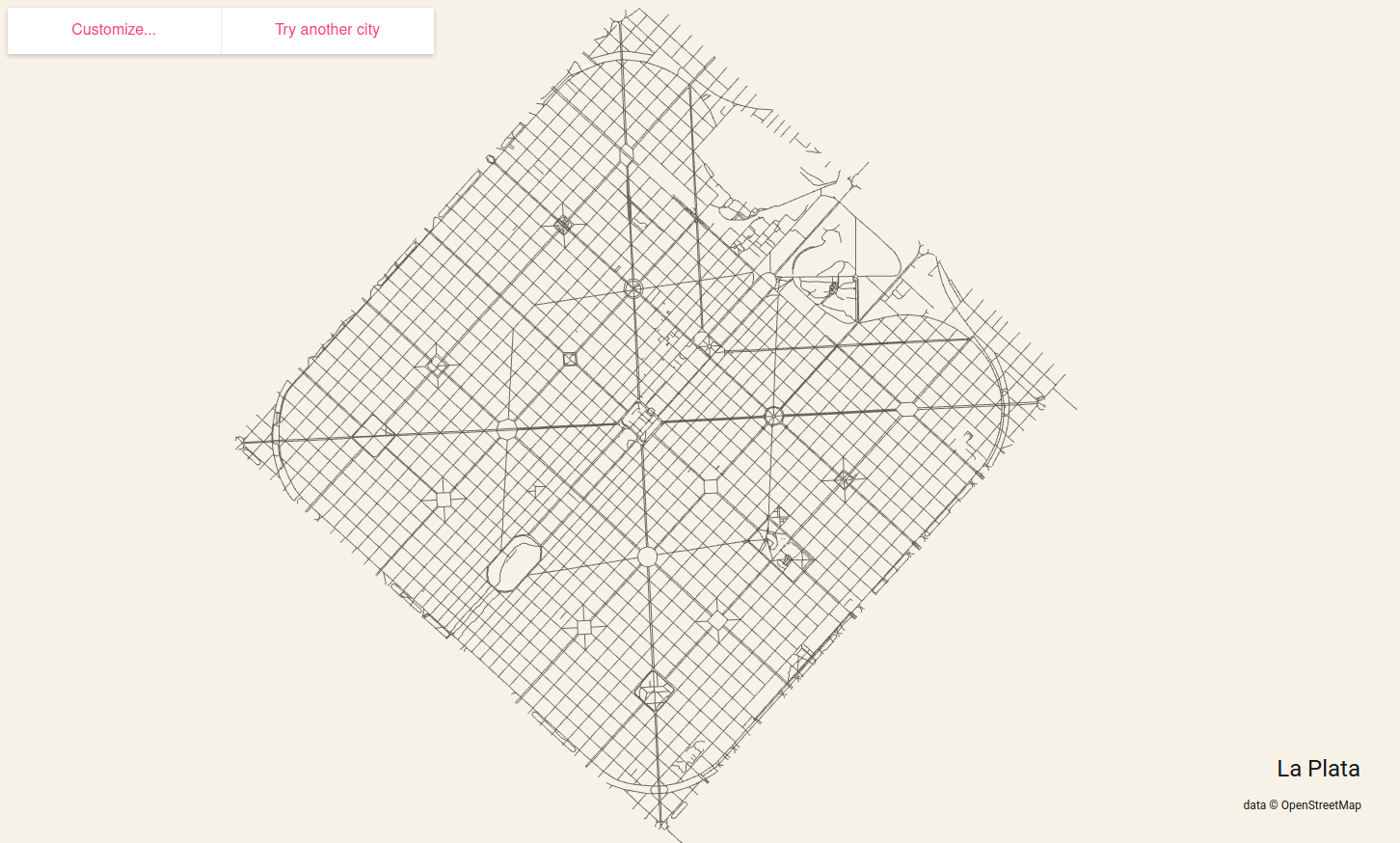
| 12:24, 24 January 2020 | City-roads.png (file) |  |
123 KB | City roads generates beautiful maps for printing based on the OpenStreetMap road data. https://anvaka.github.io/city-roads/ | 1 |
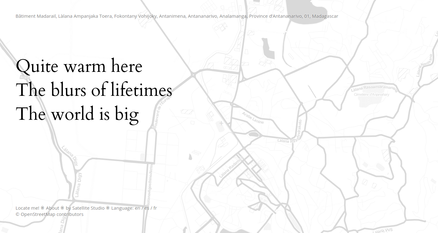
| 12:11, 24 January 2020 | Osm-haiku.png (file) |  |
233 KB | OpenStreetMap Haiku - https://satellitestud.io/osm-haiku/app/ | 1 |
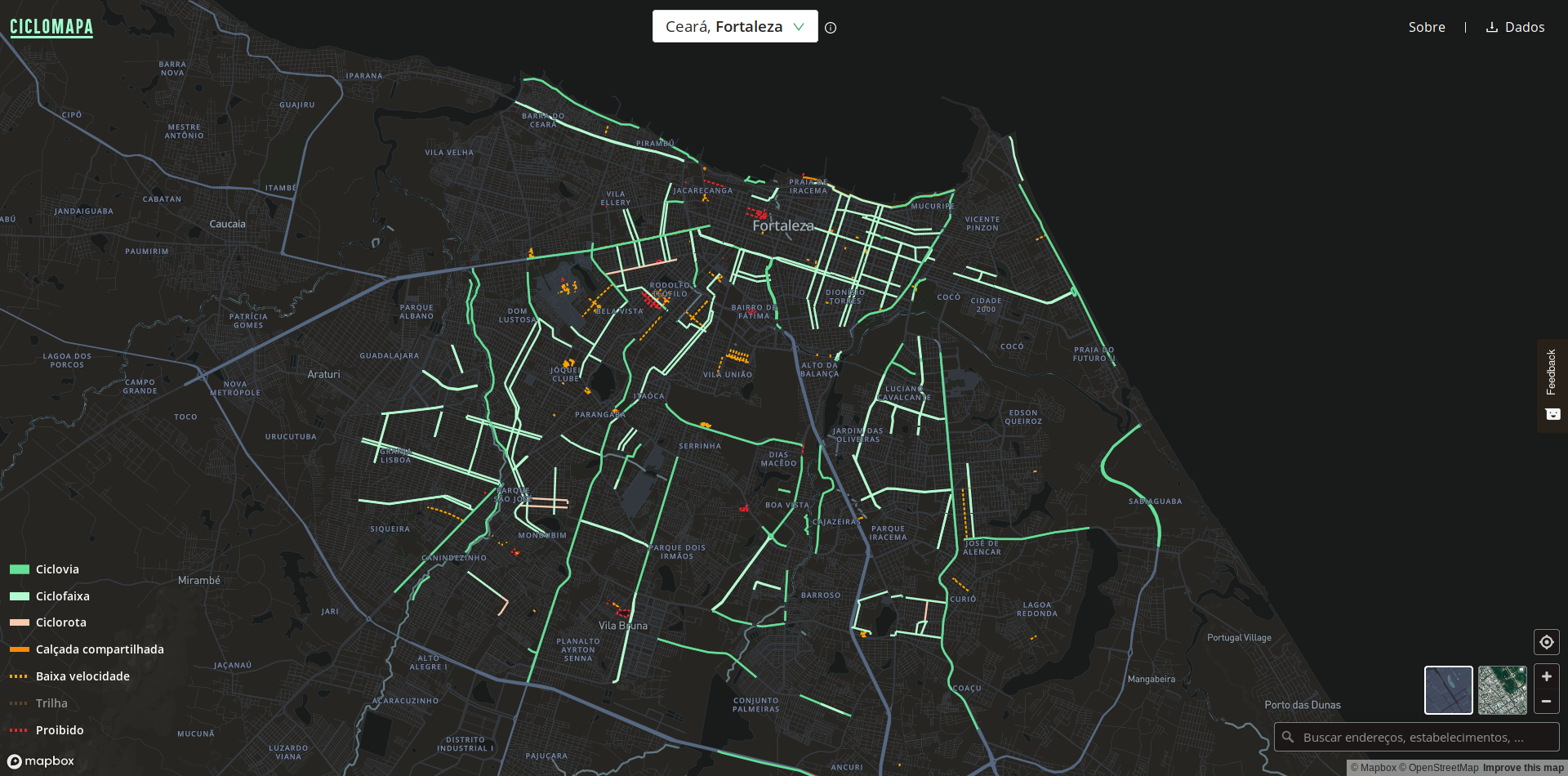
| 19:01, 23 October 2019 | Screenshot 2019-10-23 CicloMapa.png (file) |  |
1.1 MB | Ciclomapa project: https://ciclomapa.org.br/ | 1 |
| 21:03, 29 July 2019 | Ogre-mapathon-Latvia.jpg (file) |  |
520 KB | Map edit durin mapathon in Ogre, Latvia | 1 |
| 19:50, 29 December 2018 | Kopenhagen-map-Den-skyldige-movie.png (file) |  |
341 KB | The Kopenhagen map is featured on the Danish movie "Den skyldige" (The guilty). In the movie, a cop tries to find a kidnapped woman by tracking her phone location. In the [https://www.imdb.com/title/tt6742252/?ref_=ttrel_rel_tt trailer] you can see som... | 1 |
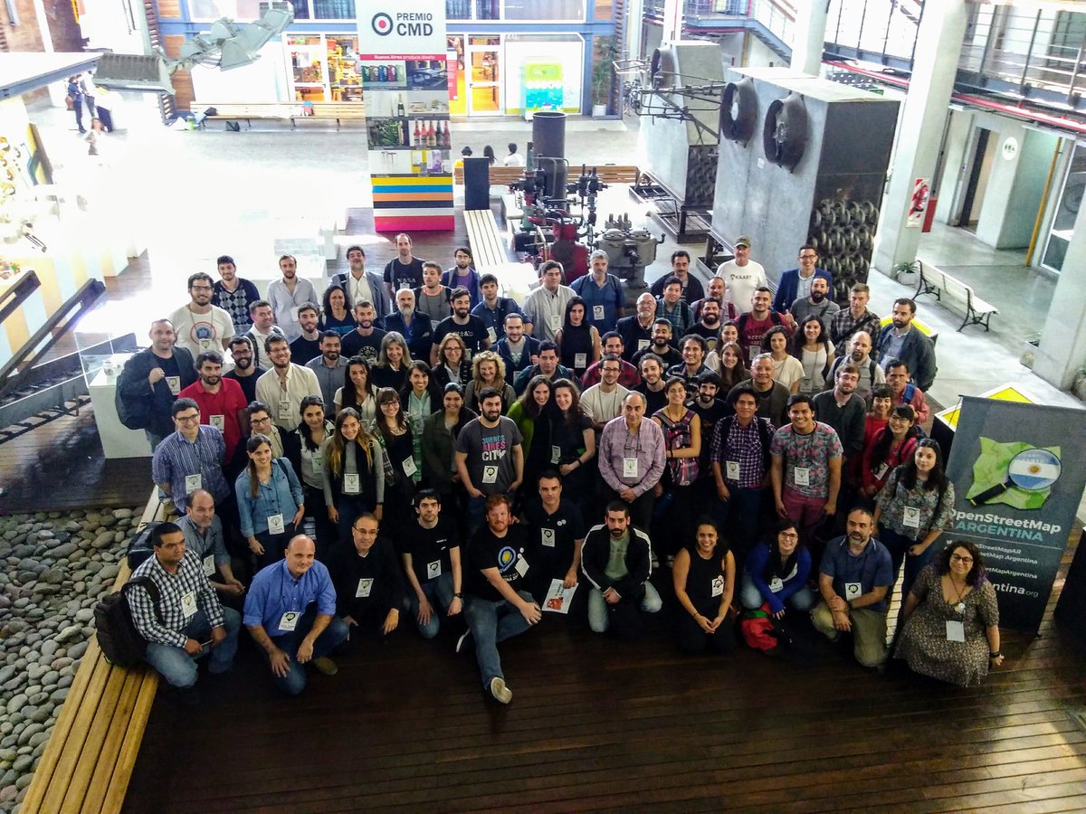
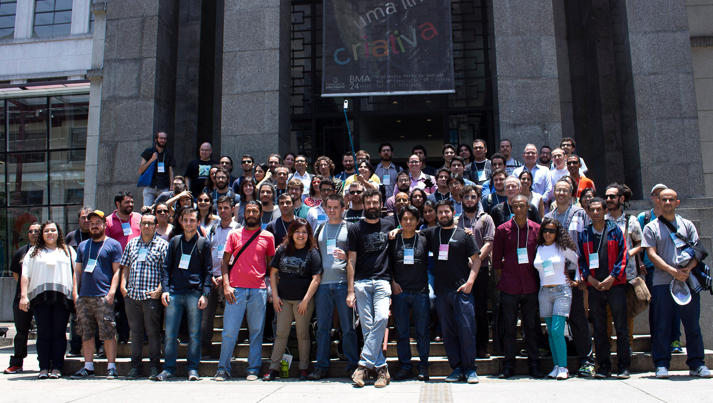
| 14:14, 27 September 2018 | Sotmlatam2018-group-photo.jpg (file) |  |
260 KB | SotM Latam 2018 took place in Buenos Aires, Argentina. October 24th, 2018 | 1 |
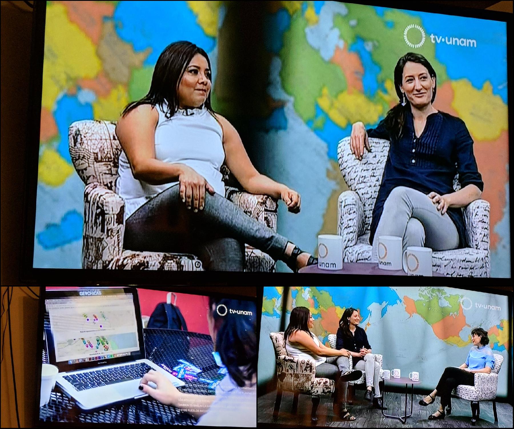
| 21:40, 4 August 2018 | Unam-mx.jpg (file) |  |
378 KB | Miriam Gonzales and Céline Jacquin, from the Mexican OpenStreetMap community, were interviewed by the TV UNAM (the TV channel of the main Mexico university). They talked about OSM, GeoChicas and humanitarian mapping. | 1 |
| 11:27, 8 July 2018 | Localize-se.pdf (file) | 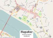 |
539 KB | 1 | |
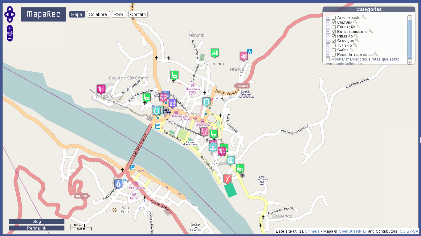
| 11:27, 8 July 2018 | Screen-Maparec.png (file) |  |
292 KB | screenshot do site do maparec | 1 |
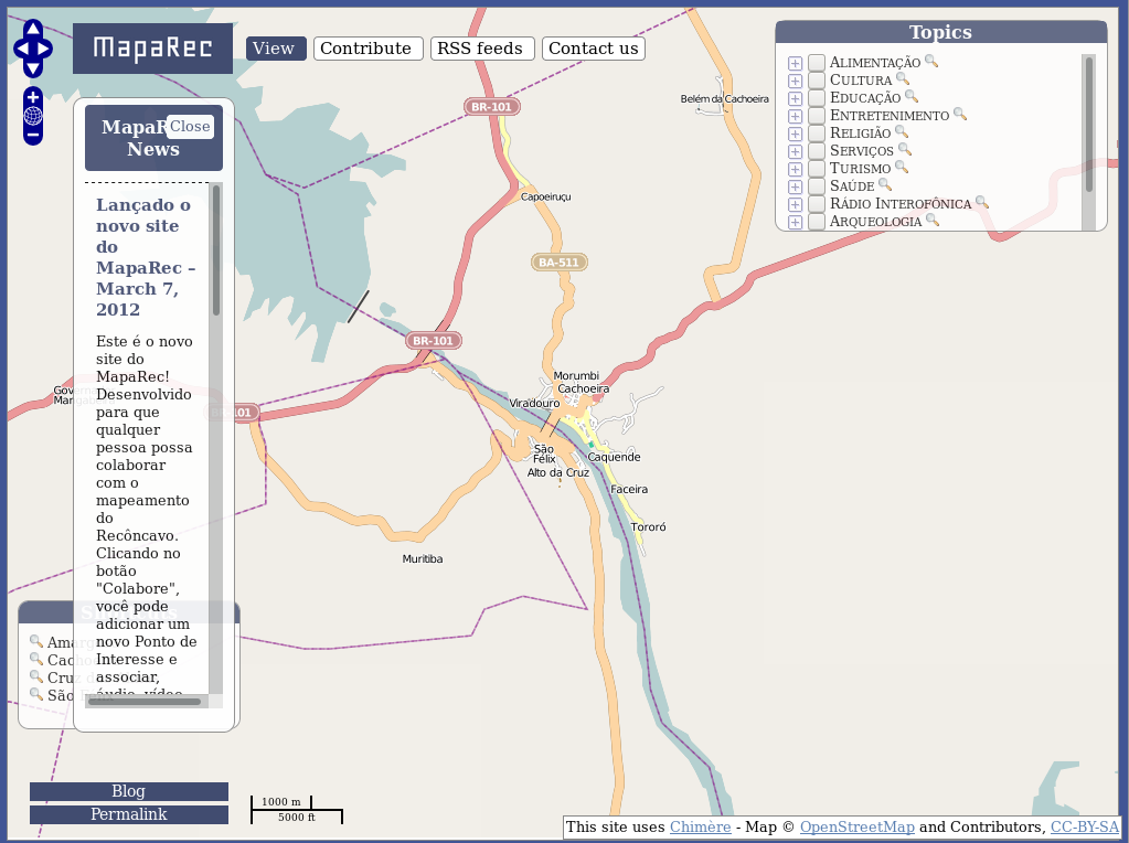
| 11:25, 8 July 2018 | Screenshot-Maparec.png (file) |  |
176 KB | screenshot do site do maparec | 1 |
| 11:21, 8 July 2018 | Mapeamento OSM.pdf (file) | 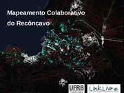 |
3.55 MB | Maparec mapeamento | 1 |
| 11:21, 8 July 2018 | MAPAREC.pdf (file) | 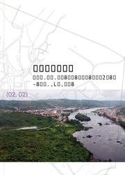 |
10.84 MB | Descrição do projeto Maparec | 1 |
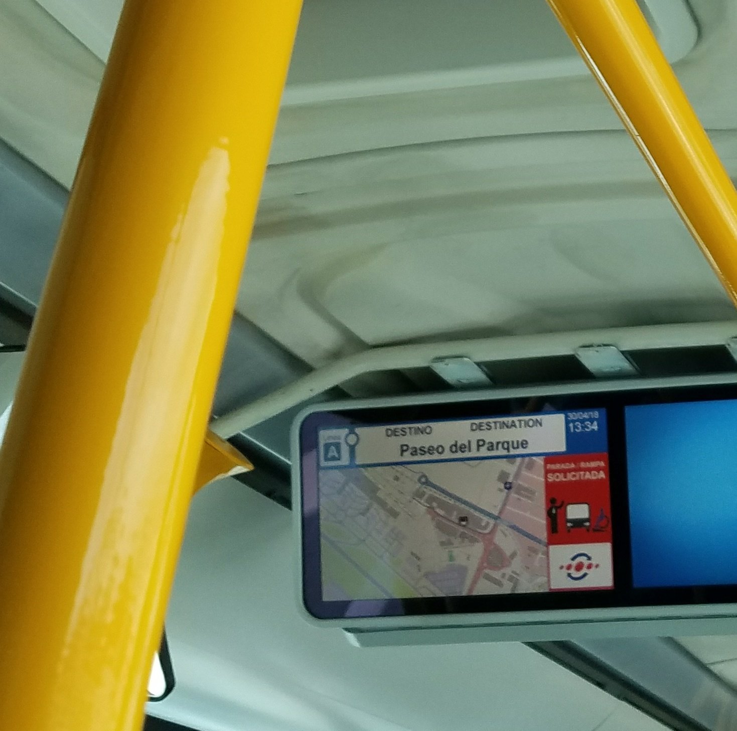
| 18:15, 1 May 2018 | Malaga-bus.jpg (file) |  |
227 KB | OpenStreetMap on a public bus in Málaga, Spain. Spotted by Nick Doiron. https://twitter.com/mapmeld/status/991230328911130625/ | 1 |
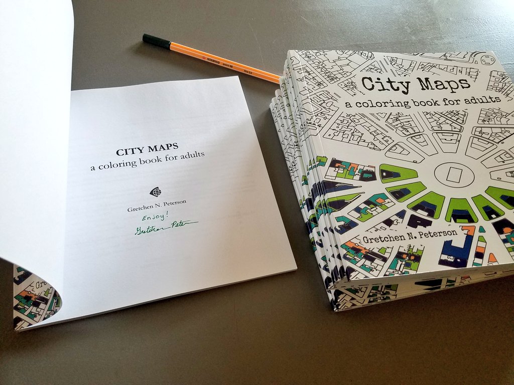
| 18:13, 1 May 2018 | Citymaps-coloring-book.jpg (file) |  |
152 KB | "City Maps - a coloring book for adults", by Gretchen Peterson is another creative use of OpenStreetMap data. Permission granted on https://twitter.com/PetersonGIS/status/991312620454952960 | 1 |
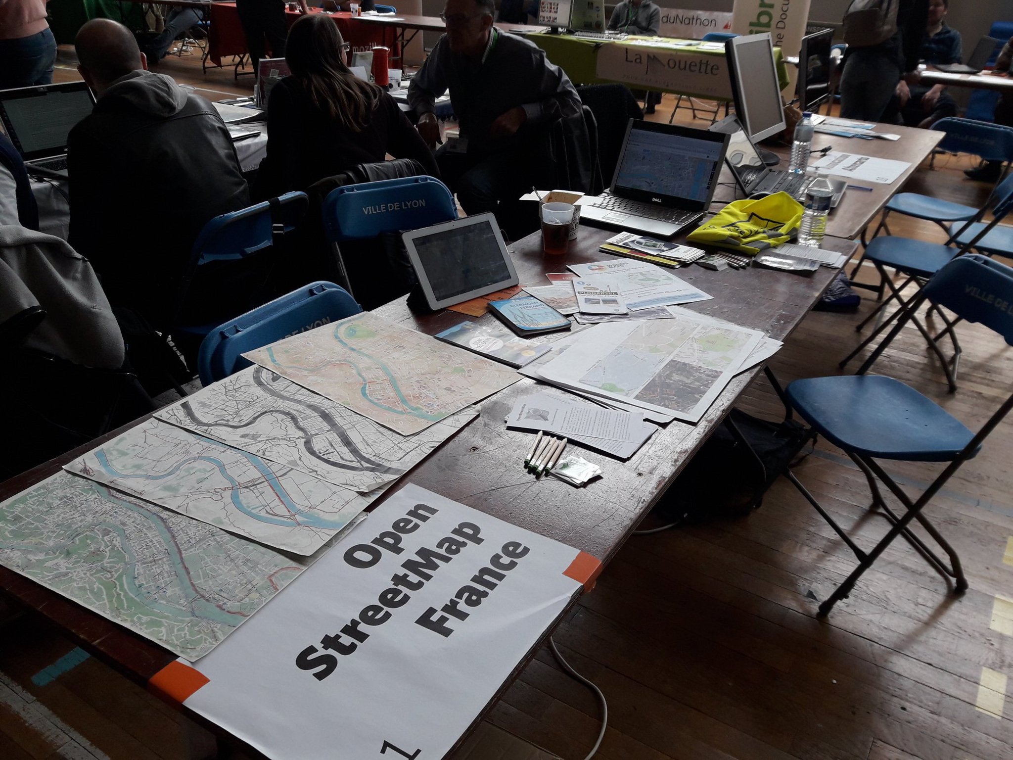
| 10:47, 27 March 2018 | OSMFR-JDLL-Lyon.jpg (file) |  |
501 KB | The OpenStreetMap France was present at the "Les Journées Du Logiciel Libre", a free software event that was held on Lyon on March 24/25th, 2018. Picture by Sylvain Maillard https://twitter.com/_Ecologeek/status/977892818537603073 | 1 |
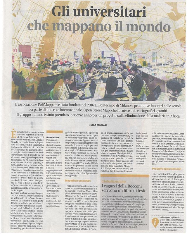
| 16:19, 23 March 2018 | Osm-corriere.jpg (file) |  |
145 KB | Corriere della Sera, one of the most important newspapers from Italy, published an article about Polimappers, a group of students from the Politecnico di Milano university that organize humanitarian mapping activities. | 1 |
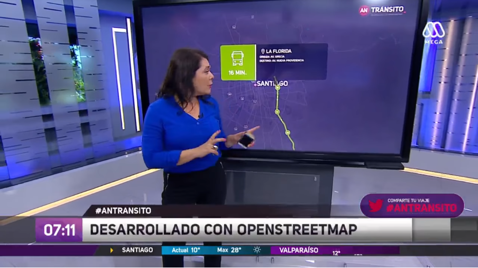
| 15:49, 23 March 2018 | Ahora-noticias.png (file) |  |
458 KB | TV News Channel "Ahora Noticias" from Santiago, Chile, has a traffic section at the mornings that shows map data from OpenStreetMap with an ultra visible copyright notice! | 1 |
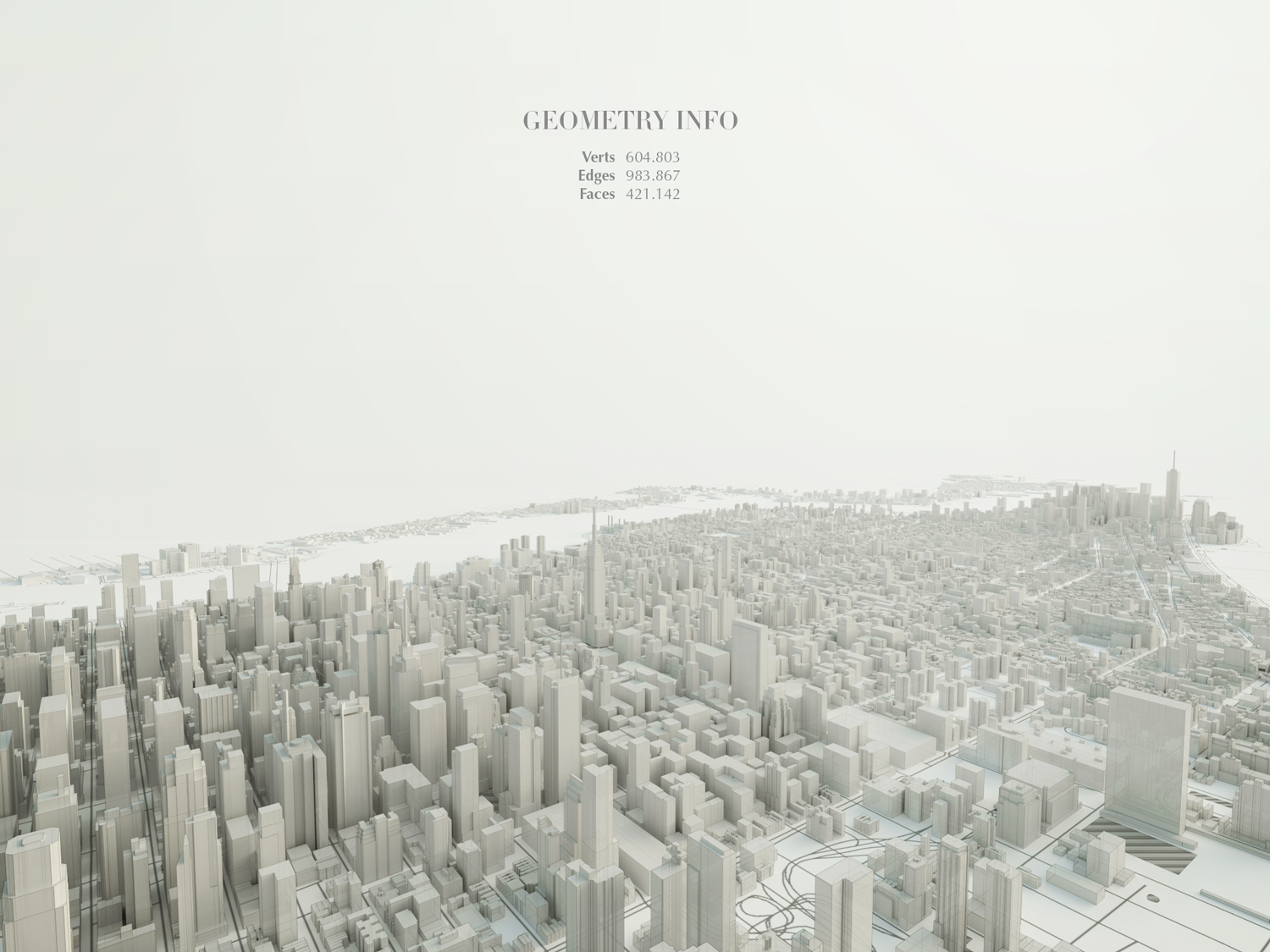
| 17:19, 23 February 2018 | Manhattan3DMatteoPrati.png (file) |  |
1.26 MB | Beautiful 3D visualization of Manhattan's OpenStreetMap data. Made by Matteo Prati using the open source software Blender. Check out other images in [https://www.matteoprati.com his website]. Permissions granted on this post: https://www.instagram.com... | 1 |
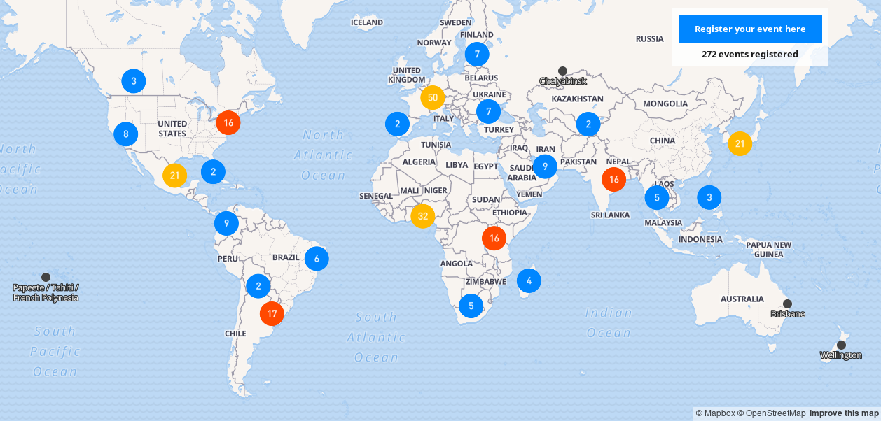
| 15:59, 23 February 2018 | Open Data Day2018Map.png (file) |  |
440 KB | Map of Open Data Day 2018 events | 1 |
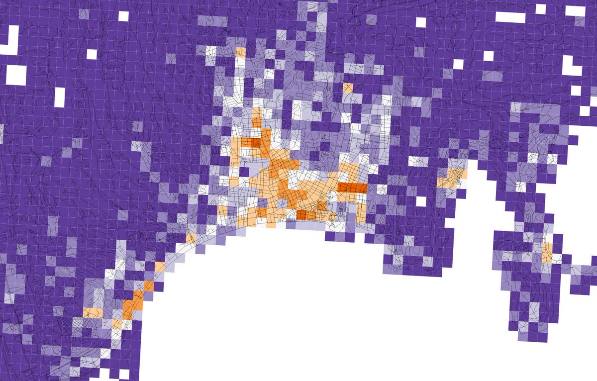
| 15:46, 23 February 2018 | NiceServicesDiversity.jpg (file) |  |
192 KB | Diversity of OpenStreetMap retail and services in Nice, France. Orange means high diversity of services and purple represents low diversity. | 1 |
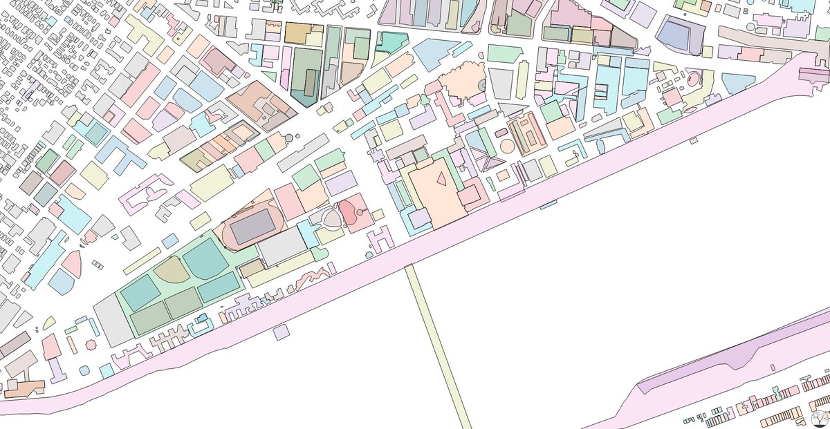
| 15:41, 23 February 2018 | MITCampusMap.jpg (file) |  |
168 KB | Colorful exploration of buildings data from OpenStreetMap. Produced by Curran Kelleher: https://datavis.tech/vis/2b0c1eb91bcd4e54b2d24aeb777740de | 1 |
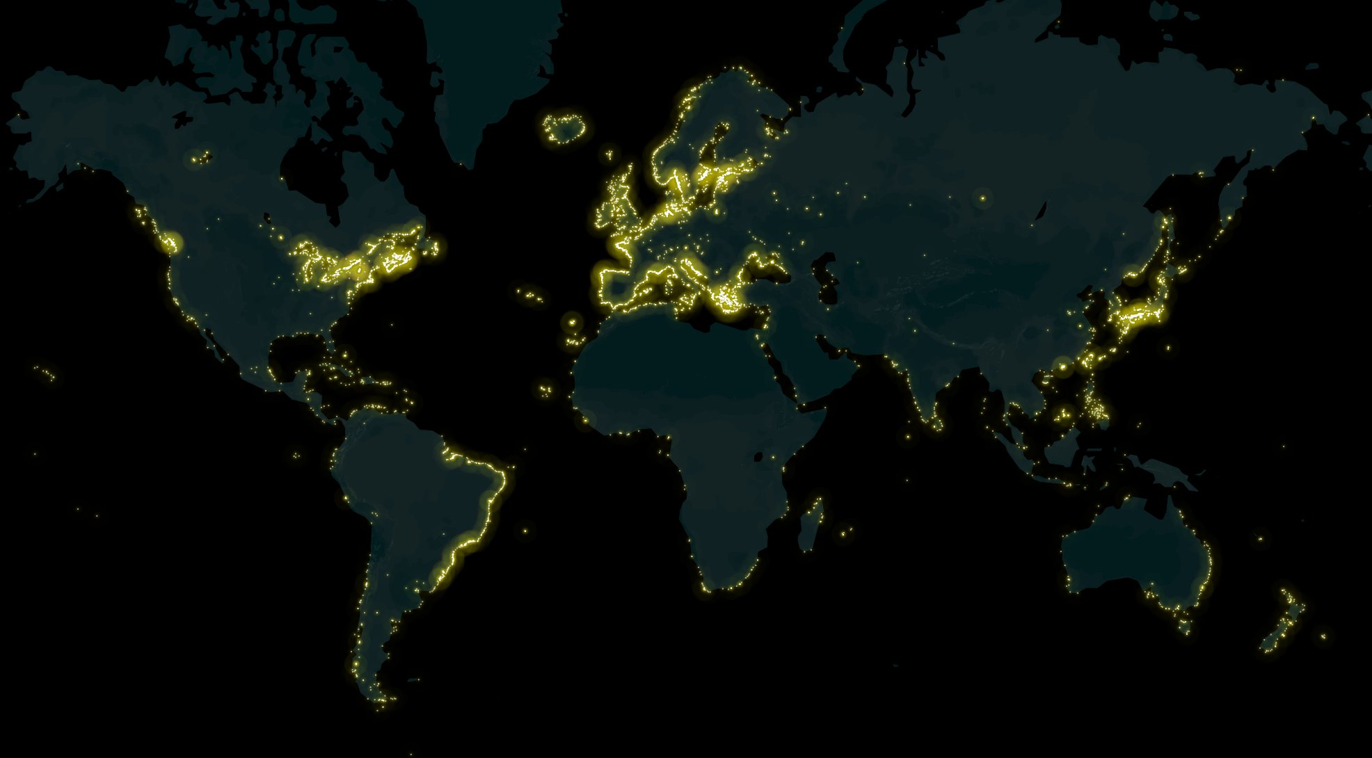
| 11:12, 4 February 2018 | Light-houses-osm-jan-2018.jpg (file) |  |
117 KB | A map of lighthouses all over the world mapped on OpenStreetMap, made by Arun Ganesh (planemad). Interactive map: https://api.mapbox.com/styles/v1/planemad/cjcdq00xd3tg82rpxkl4ojwp5.html?fresh=true&title=true&access_token=pk.eyJ1IjoicGxhbmVtYWQiLCJhIjo... | 1 |
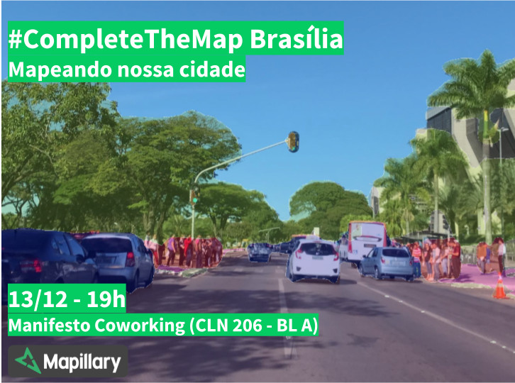
| 19:43, 6 December 2017 | Ctm-brasilia.jpg (file) |  |
125 KB | Complete the Map Brasília | 1 |
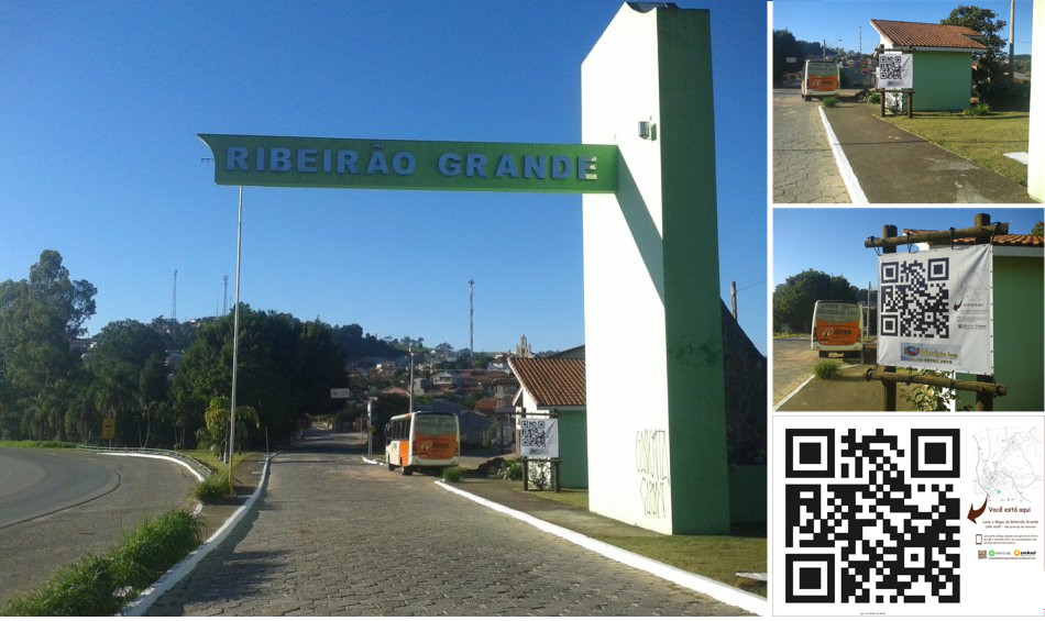
| 15:53, 24 November 2017 | Ribeirao-grande-map.jpg (file) |  |
138 KB | The town hall of Ribeirão Grande, Brazil, put a map and a big QR code in the town entrance. The map is made based on OpenStreetMap data and the QR code links to the coordinates of the town. | 1 |
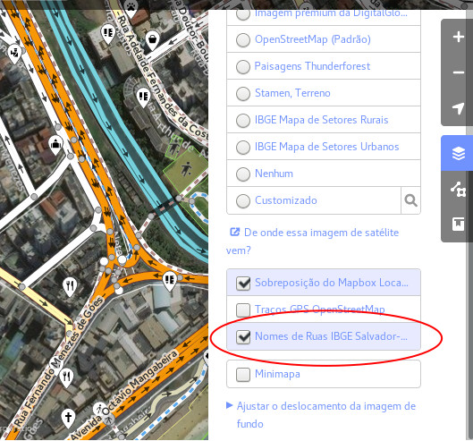
| 14:21, 16 November 2017 | Ibge-salvador-id-activate.jpg (file) |  |
121 KB | 1 | |
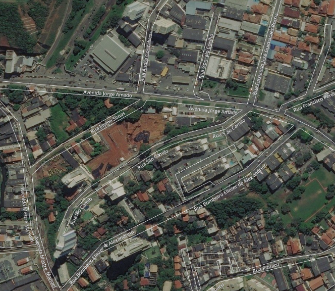
| 14:15, 16 November 2017 | Salvador-Bing-IBGE-data.png (file) |  |
1.11 MB | 1 | |
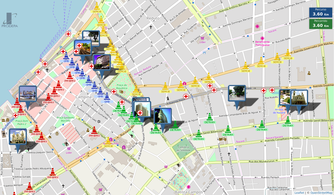
| 23:22, 8 October 2017 | CirioDeNazare.png (file) |  |
793 KB | The Círio de Nazaré is a religious festivity that occurs in many places of the world. In Belém do Pará, Brazil, it gathers more than 2 million of people on a dozen processions that occurs during 2 weeks of October. A governmental agency created a [... | 1 |
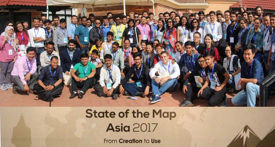
| 11:50, 6 October 2017 | SotM-Asia-2017.jpg (file) |  |
163 KB | State of the Map Asia 2017 took place in Kathmandu, Nepal from September 23 to 24th. | 1 |
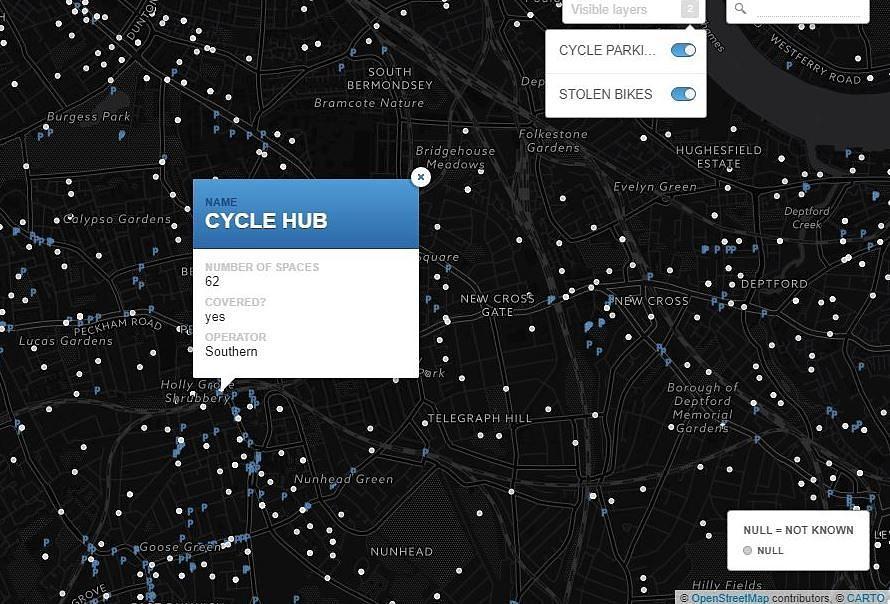
| 19:08, 26 September 2017 | StolenRide.jpg (file) |  |
108 KB | A [map made by Stolen Ride https://www.stolenride.co.uk/cycle-parking-map-london/] shows every London cycle parking location mapped on OpenStreetMap and an optional layer of police data with the places of reported stolen bikes. | 1 |
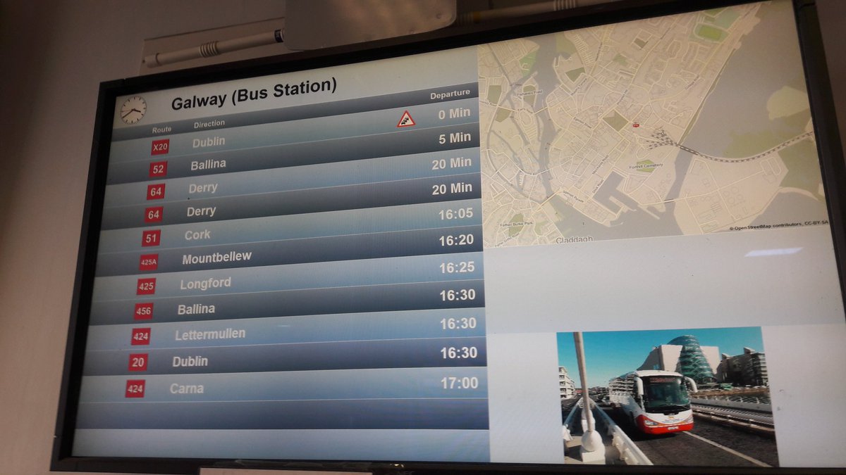
| 18:06, 19 August 2017 | Buseireann-panels.jpg (file) |  |
106 KB | OpenStreetMap in the Irish bus company Bus Éireann | 1 |
| 18:59, 26 June 2017 | Osm-furniture.jpg (file) |  |
480 KB | OSM Map based furniture in Telenav office in Cluj, Romania. Photo by Martin van Exel | 1 |
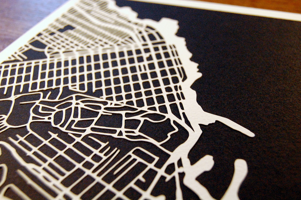
| 12:35, 24 April 2017 | Monterey CA papercut.jpg (file) |  |
521 KB | Kartegraphik has been doing handmade papercut maps based on OpenStreetMap data. The image presents the map of Monterey, California. See more at http://www.kartegraphik.com | 1 |
| 12:48, 16 April 2017 | Square-mile-street-networks.jpg (file) |  |
898 KB | Geoff Boeing created OSMnx, a software that uses OSM data to compare street networks and urban forms. See more at: http://geoffboeing.com/2017/04/urban-form-analysis-openstreetmap/ | 1 |
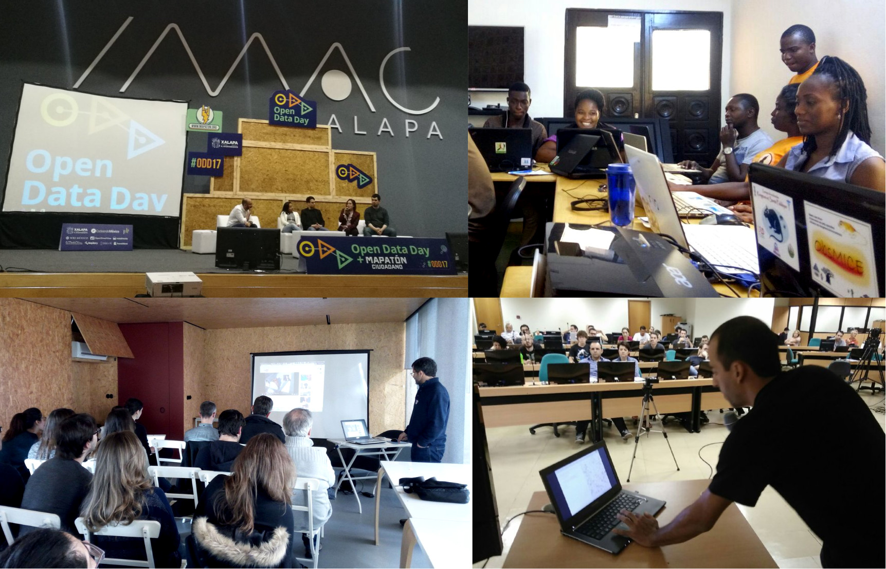
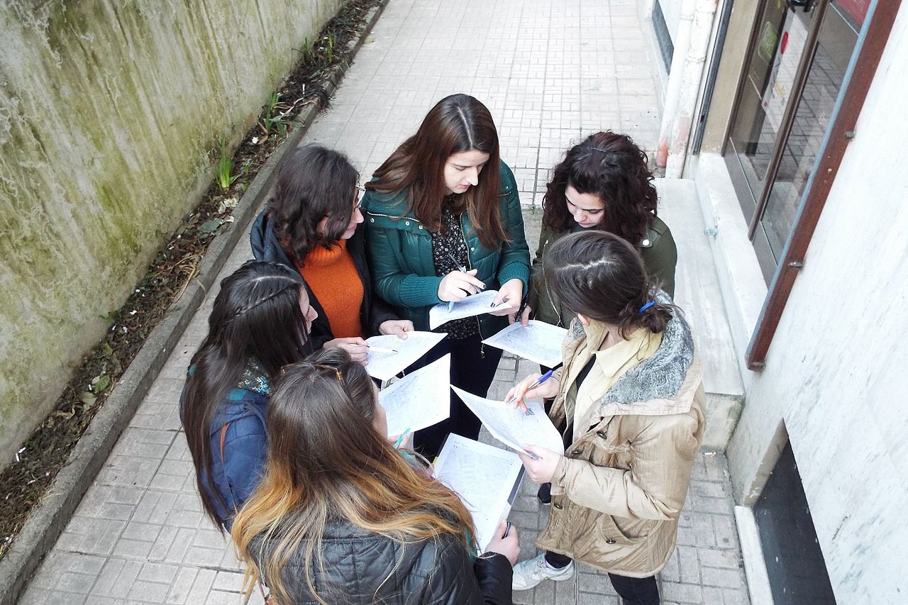
| 14:04, 7 March 2017 | Osm-in-opendataday-2017.jpg (file) |  |
461 KB | Some of the OpenStreetMap activities in the OpenDataDay 2017. Mexico (top left), Benin (top right), Portugal (bottom left) and Brazil (bottom right). | 1 |
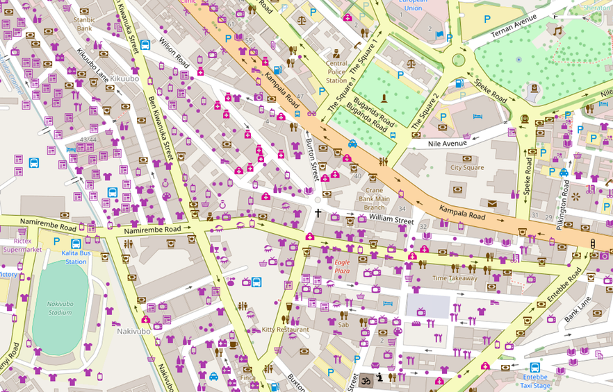
| 13:29, 7 March 2017 | Kampala-centre.png (file) |  |
797 KB | 1 | |
| 19:01, 18 February 2017 | OSM Mapathon in Albania 07.jpg (file) |  |
237 KB | OSM Mapathon at [https://openlabs.cc/en/ OpenLabs Albania], a hackerspace in the city of Tirana that has been doing a lot of activities related to OpenStreetMap, Wikipedia and FLOSS. In that mapathon they mapped with FieldPapers. Photo by [https://comm... | 1 |
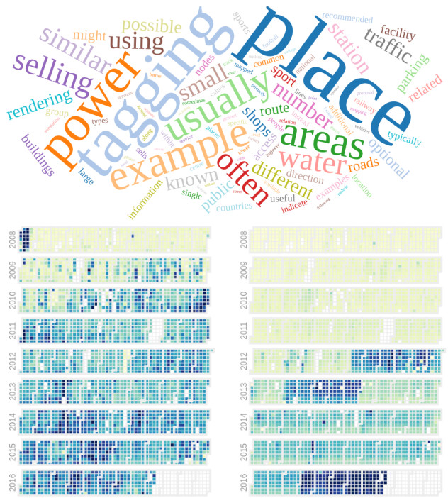
| 13:59, 18 January 2017 | Osmviz.jpg (file) |  |
202 KB | OSMvis is a collection of #visualizations related to OpenStreetMap. On the top image, you can see the most frequent words in the OSM Wiki. On the lower left side, the daily amount of new nodes and at the right, the quantity of new users per day. See mo... | 1 |
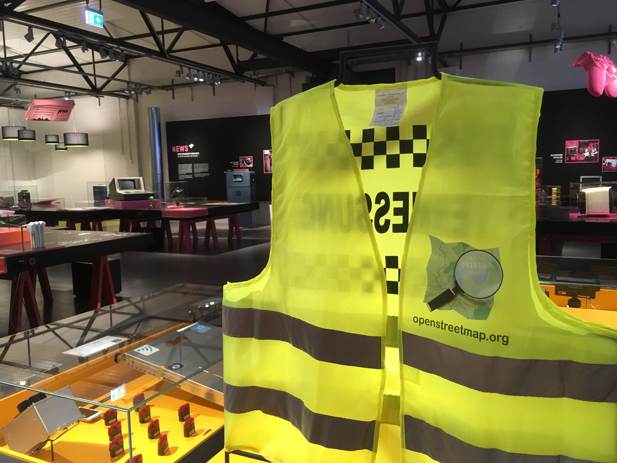
| 12:09, 11 January 2017 | OSM-in-German-Tech-Museum.jpg (file) |  |
166 KB | An OpenStreetMap jacket is in exhibition in the section "Who makes the map" at the German Museum of Technology. Photo by Johan (https://twitter.com/freenerd/status/818845313293283329 @freenerd). | 1 |
| 13:09, 4 December 2016 | SotM Latam2016.jpg (file) |  |
979 KB | Official photo of the State of the Map Latam 2016, São Paulo, Brazil | 1 |
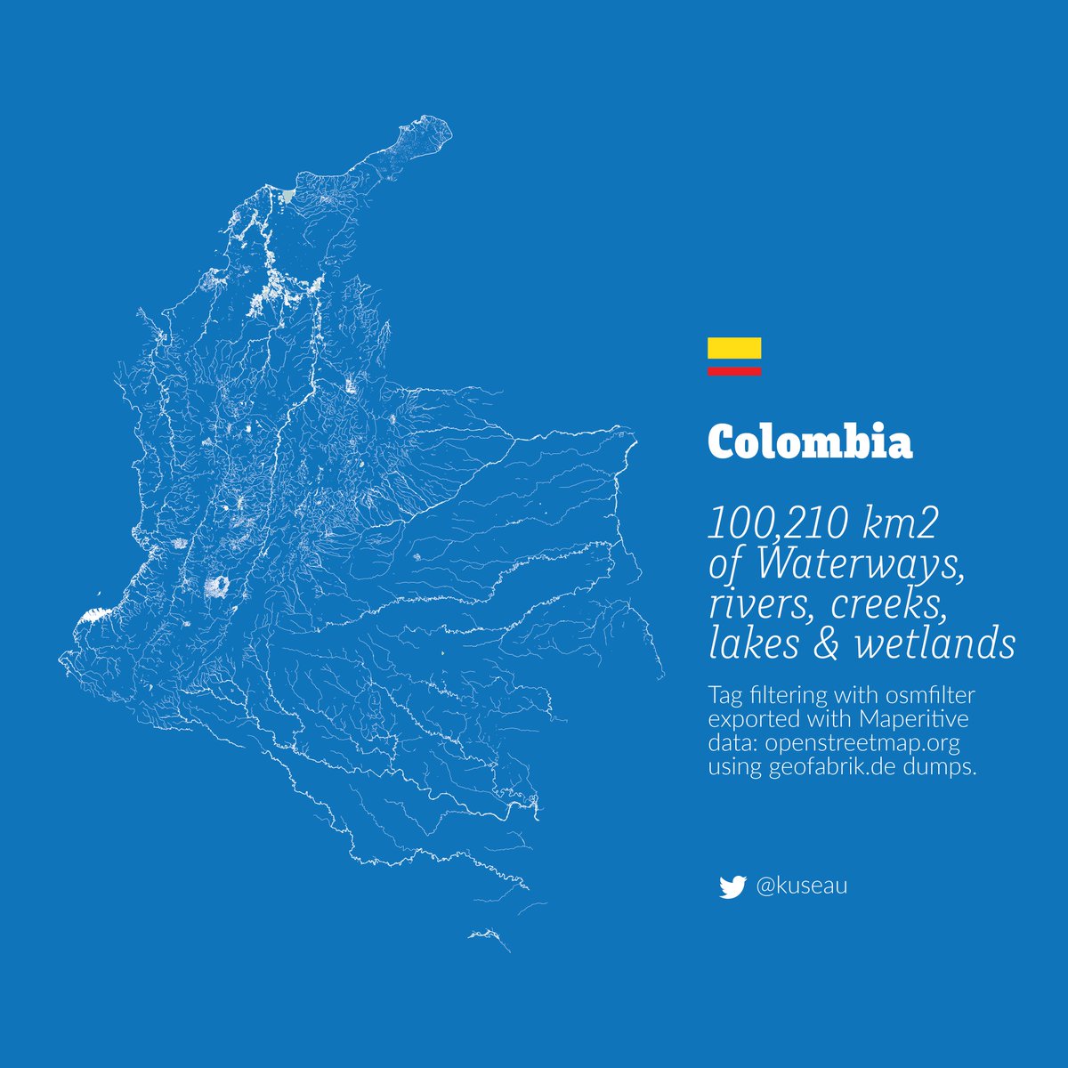
| 11:46, 19 October 2016 | Colombia-rivers.jpg (file) |  |
147 KB | Image showing all the rivers of Colombia, based on OpenStreetMap data. | 1 |
| 20:41, 28 September 2016 | OSM Lunch BSB Set2016.jpg (file) |  |
163 KB | OpenStreetMap Lunch Brasília 2016 | 1 |
| 01:54, 12 September 2016 | Screenshot osm-tile-access-log-viewer.png (file) |  |
90 KB | Tool created by the user User:tyr_asd allows to visualize stats abouth the OSM.org's Map Views http://osm-tile-access-log-viewer.raifer.tech | 2 |
| 16:56, 11 September 2016 | Luca Delucchi OSM-Italy.jpg (file) |  |
54 KB | Luca Delucchi presents the use of OSM in humanitarian field. The event was organized by the Wikimedia and OpenStreetMap communities in the City of Trento, Italy. Photo by Eusebia Parrotto. | 1 |
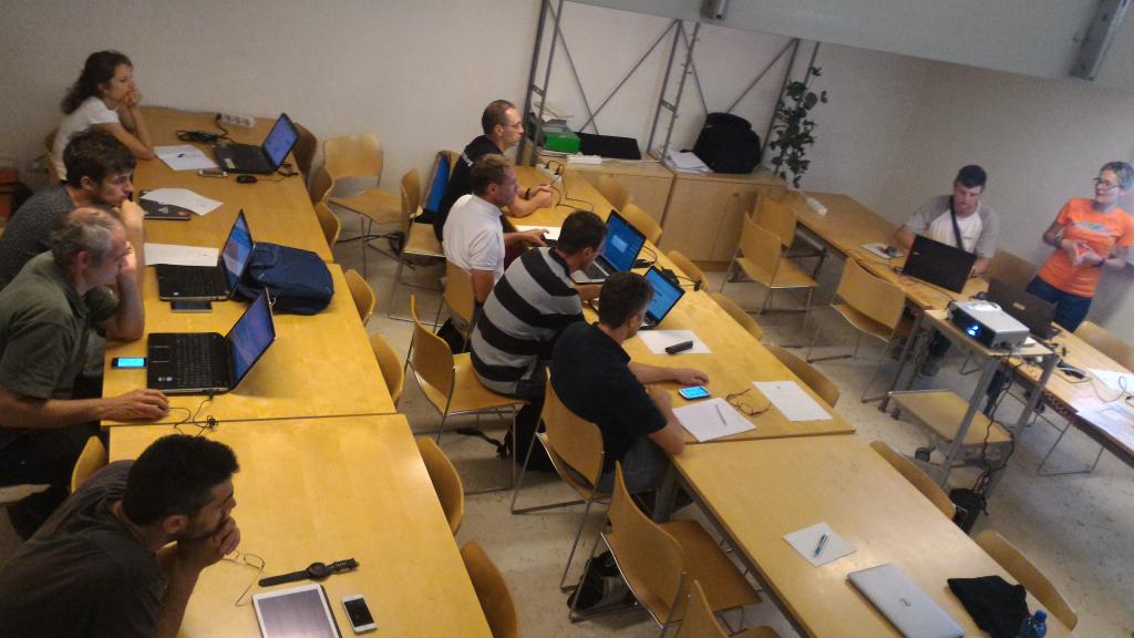
| 16:54, 11 September 2016 | Mapping Event Earthquake Italy.jpg (file) |  |
73 KB | Teaching new OSM users how to map the area hit by the Earthquake. The event was organized by the Wikimedia and OpenStreetMap communities in the City of Trento, Italy. | 1 |
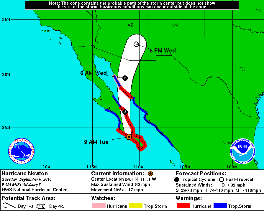
| 21:11, 6 September 2016 | Huracan newton.gif (file) |  |
26 KB | 1 | |
| 14:28, 28 June 2016 | Riocentro.jpg (file) |  |
102 KB | Riocentro e Parque dos Atletas | 1 |
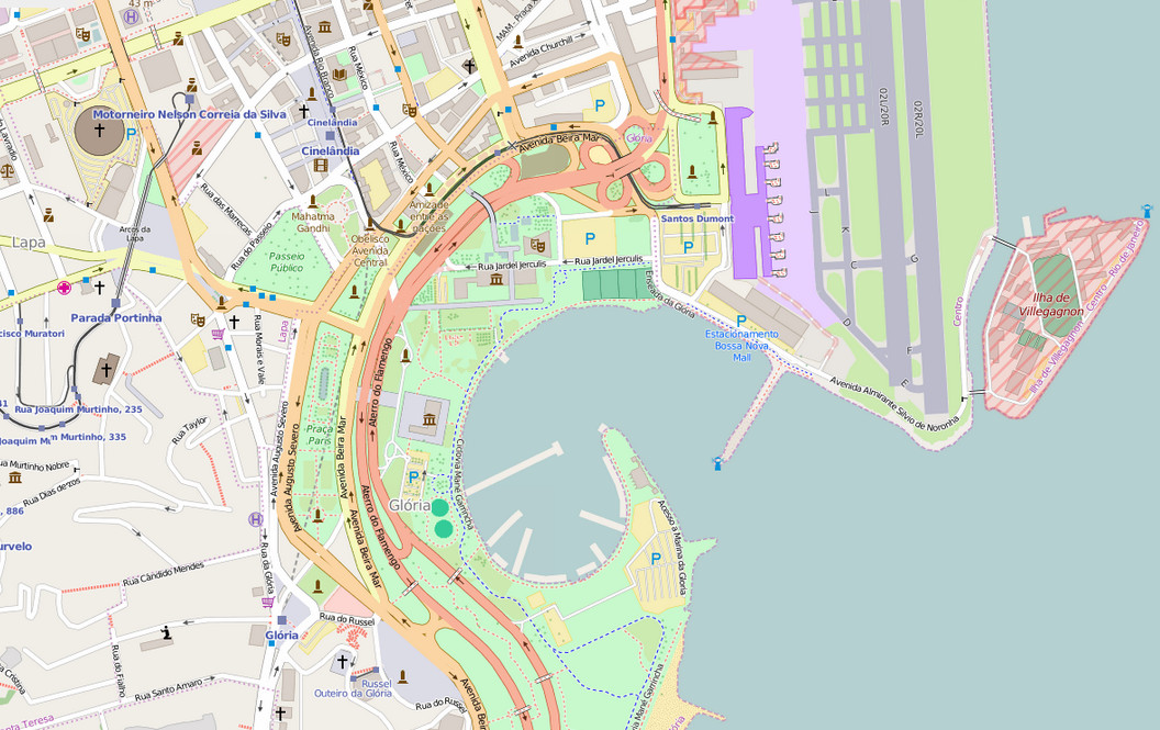
| 14:27, 28 June 2016 | Marina-da-Gloria.jpg (file) |  |
245 KB | Marina da Glória, Rio de Janeiro | 1 |
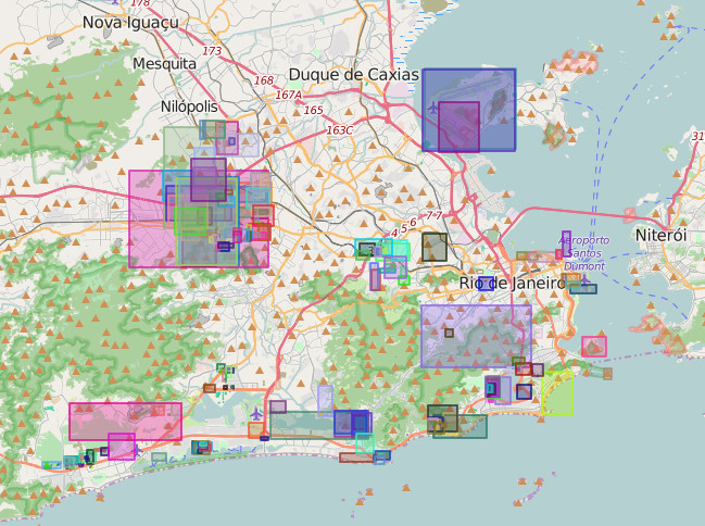
| 14:26, 28 June 2016 | RioOlympicsMappingEdits.jpg (file) |  |
149 KB | Changesets during the Rio Olympics Mapping event | 1 |