TERAS Community: Development of Women Farmer Groups Based on Agricultural Management Land Maps
The fulfillment of food at the individual level by utilizing natural, human, social, economic, and local wisdom resources in order to achieve food resilience and self-sufficiency is important. The role of women farmers in efforts to meet family food needs is crucial. The Women Farmers Group in Landawe Utama village is expected to be able to meet the food needs of the surrounding community. The fulfillment of family food needs is largely determined by the role of women farmers as household caregivers. Landawe Utama is a village whose administrative area partially overlaps with forest areas. The community has been utilizing the land for a long time but does not fully own the land. It is estimated that 50% of productive land is located within forest areas. Therefore, the community needs to map their village areas as productive agricultural land in order to change the status of the land from forest to community-owned and managed agricultural land that is sustainable and free from restrictions. Given this issue, it is necessary to develop the capacity of the Women Farmers Group in mapping their productive land. Efforts to encourage the Women Farmers Group to participate in mapping their agricultural land need support from the local government and other stakeholders to develop the capacity of the Women Farmers Group in Landawe Utama village, Wiwirano Sub-district, North Konawe Regency. This requires support from the local government and other stakeholders to develop the capacity of the Women Farmers Group in Landawe Utama village, Wiwirano Sub-district, North Konawe Regency. In addition, efforts to encourage the Women Farmers Group in participatory mapping of their agricultural land are also needed.
Solution
Through the thematic maps generated, the 30 members of the Women Farmers Group have the ability to identify their productive land. In addition, through the identification of productive land, this will also be one of the alternative solutions to address food vulnerability in Landawe Utama village. As an implementation, the OpenStreetMap (OSM) data that will be generated will not only serve as a reference for the Women Farmers Group, but also for the Landawe Utama village government and agricultural extension officers in both Landawe Utama village and Wiwirano Sub-district, for further support and strengthening efforts.
Mapping Training
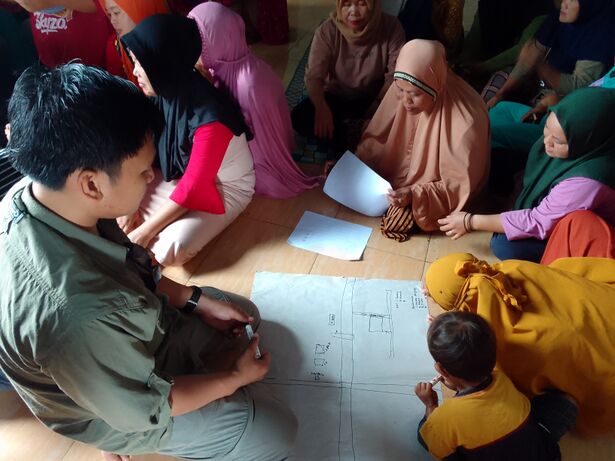
The preparation for the activities was carried out from January 12 to January 30, 2023, with various activities already implemented, including meetings, coordination with the village, development of training concepts, and arrangement of tasking tools. Meanwhile, the training was conducted from February 2 to February 5, 2023, with a total of 26 participants, consisting of the Teras Community, Women Farmers Group, and the village government represented by the Head of Landawe Utama village. The OSM training took place for one day with great enthusiasm from the Women Farmers Group and the village government. During the OSM training, the Women Farmers Group was introduced to the steps of data collection, data management, and data opening.
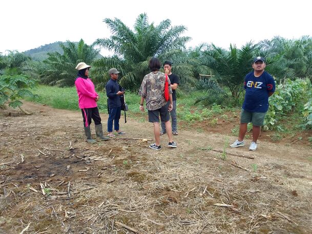
They were also introduced to GPS, including GPS introduction, operation, and field data collection techniques. In the simulation survey, the team only provided assistance, while the Women Farmers Group themselves conducted the survey in the field. The Women Farmers Group directly used GPS to collect data on land points, with support from the survey team. During this stage, data on the location of gardens, land area, types of crops, flagship crops, and landowners were collected from each Women Farmers Group.
Output and Outcome
At this stage, we are satisfied with the performance of the team and the enthusiasm shown by the Women Farmers Group and the Village Government of Landawe Utama. They are satisfied with the training as this is the first time it has been conducted for the Women Farmers Group in the village of Landawe Utama.
| Indicator | Contribution after February 28 2023 | Notes |
| Result | ||
| Output | ||
| #farmlandmapped | 11 areas | The area varies between ½ Ha, 1 Ha, and 2 Ha. |
| # Maleparticipants | ||
| # Femaleparticipants | 20 | |
| # age between 20 - 40 | 15 | |
| # age between 40 - 65 tahun | 5 | |
| # newmappers | 5 | has ability to use GPS |
Challenges
There were some challenges during the activity, such as the distance of the activity location from Kendari city where all the participants are located. The road conditions were also poor, requiring the team to be patient during the journey to the activity location. Additionally, the electricity and internet network in the village were unstable. So, the location of the activity was quite far and took half a day of travel time, resulting in the team having to stay overnight at the activity location.
During the progress of the activity, the team was indeed busy with other ongoing programs that were not yet completed. However, thanks to their determination, the team remained cohesive and carried out the activity. The training schedule was delayed due to the busy schedule of the Women Farmers Group (KWT) in the village, as they had to attend activities outside the village. Until now, data is still being collected from KWT and the survey team.
Sustainability
Since the preparation phase, through the training and data validation, the village government and agricultural extension officers who are assigned in Landawe Utama Village and Wiwirano District have been actively involved. This serves as a foundation for the sustainability of the activity and the continued use of the generated data or maps, as well as the dissemination of the methods to other villages. Additionally, the mapping results will also be published on the Komunitas Teras website for wider access and utilization by the broader community. The validation process involves the landowners and the Women Farmers Group. Currently, the team is collecting data obtained from the surveyors and data from the women farmers group.

