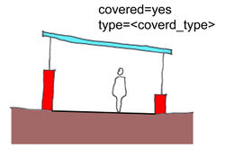
Tag:covered=yes
Jump to navigation
Jump to search
 |
| Description |
|---|
| To denote that an object is covered. |
| Group: properties |
| Used on these elements |
| Status: approved |
| Tools for this tag |
covered=yes is used to indicate that an object represented by a node, path or surface is covered.
covered=*indoor=yestunnel=building_passage