Talk:Andhra Pradesh
AP administrative boundaries upto sub district level
I remapped the administrative boundaries (admin_level=4,5,6).
Used data sources:
- (1) SOI map = https://indianopenmaps.fly.dev/soi/osm/{z}/{x}/{y}.webp
- (2) Bharatmaps = https://bharatmaps.gov.in/BharatMaps/Home/Map
There are 3 different cases :
a) (1) and (2) are the same. The boundary ways are newly mapped as in (1). (about 2700 ways)
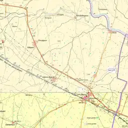
b) The ways exist in (1) and (2), but are different. I mapped in most cases the SOI version. Maybe (2) is correct. These ways now have the tag „fixme=boundary unclear“. (28 ways) https://overpass-turbo.eu/s/1OXH
c) The ways exist in (1) or (2), but it was not possible to find a good solution. I let these ways as they were mapped before. These ways now have the tag „fixme=boundary unprecise“. (69 ways) https://overpass-turbo.eu/s/1OXI
Additionally there are boundaries with admin_level>6, which have to be controlled.
Heinz_V ; July 2024 -- 17:12(IST), 30 July 2024 Heinz V
- @user:Heinz_V, Thanks for your initiative to improve the accuracy of boundaries. In my work, I noticed that some mandals had enclaves in adjacent mandals, apart from deviations from SOI map. I am assuming that you initial mapping was based on Bharatmaps.(Example: Kandukur subdistrict) Did you find any such subdistricts in your revision?--Arjunaraoc (talk) 07:18, 31 July 2024 (UTC)
- Yes, there are still unclear parts.
- Kandukur is difficult: I mapped the enclave and the exclave about 5 years ago; I did not change this. But now they are not in SOI map and not in Bharatmaps. I did not find other reliable data sources.
- The exclave of Kandukur is in this map:https://spsnellore.ap.gov.in/kandukur-division/
- If the enclave of Kandukur is an exclave of Zagurumalli, then it also is an exclave of Prakasam district.
- I think, we have to wait till the new census is completed in 1,2,3 years!! Heinz_V --06:54(IST), 1 August 2024 Heinz_V
- @user:Heinz_V, Yes. I hope that census also will release their maps in digital form next time.--Arjunaraoc (talk) 07:05, 1 August 2024 (UTC)
Vandalism of AP mandal headquarters which are villages as towns
I detected that AP mandal headquarters which are villages were vandalised as towns, ostensibly to give them more prominence. Example node. I have corrected after updating the list of statutory cities, towns in Wikidata and English Wikipedia and then made necessary updates. Example correction changeset. I made use of an ipython notebook for the same. This could be reused with minor modifications for any large scale tag updates (additions/corrections) for any state. Arjunaraoc (talk) 04:12, 28 May 2026 (UTC)