Talk:Colombia/Project-2010 floods/ImportMuni
Jump to navigation
Jump to search
Fixme requests
Regarding http://www.openstreetmap.org/browse/relation/1320710 = El Peñol
- there is a discrepancy between the Department that this Municipality resides in between OCHA and Wikipedia. --Ceyockey 01:32, 24 December 2010 (UTC)
OCHA boundary offset from Landsat and OSM data

from Ceyockey: The image at right shows the first example I've run into where the OCHA boundary data is significantly offset from either imagery or previously placed OSM data. Do you have recommendations on the best way to load and place the boundary data? Thanks. --21:38, 28 December 2010 (UTC)
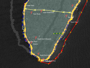
- See also a similar comparison overlay for the island pair Providentia and Santa Catalina. --00:06, 29 December 2010 (UTC)
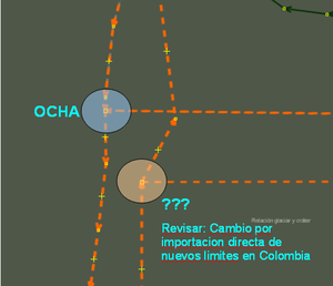
OCHA boundary versus previously loaded boundary data

from Ceyockey: The image at right shows discrepancy between OCHA-based municipality data and previously loaded boundary data. The question is whether OCHA data should replace the prior data or not. Options include
- delete old data in preference of new data
- merge old data into new data (to preserve some part of history)
- retain both
- create a new boundary which is a merged average of the two
My feeling is that option 1 would be the most practical way forward. --10:25, 30 December 2010 (UTC)