United Kingdom/Identifying Rights of Way
Jump to navigation
Jump to search
Introduction
The signs and waymarks used to indicate public rights of way in the United Kingdom vary from area to area. This page seeks aid the mapper by cataloguing the differing styles used by the various local authorities.
Note: For more information on tagging rights of way in the UK please refer to Access provisions in the United Kingdom.
Examples
England
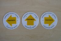
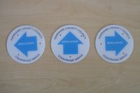
Although individual local authorities may differ the common colour scheme used is as follows:
| Colour | Use |
|---|---|
| Yellow | Footpath |
| Blue | Bridleway |
| Plum | Restricted Byway |
| Orange | Byway Open To All Traffic |
| White | Other (often public highways or permissive routes) |


