Mapping USA/2022
For the 2nd annual Mapping USA, OpenStreetMap US is partnering with WikiConference North America to host a virtual event celebrating the Wiki & OpenStreetMap communities across the country. The event will include a Mappy Hour on Thursday, a half day of talks on Friday, and a day of workshops, birds of a feather sessions, editing parties, and mapathons on Saturday. Saturday will also feature the global Local Chapters & Communities Congress. You can learn more about last year’s Mapping USA event here & the 2021 virtual WikiConference North America here.
Registration - Open!
Registration is open! This event will be free, but donations are welcome and appreciated. Link to register!
Program
Thursday, November 10 ~ 8 pm ET - 9 pm ET
Join us for a casual Mappy Hour for networking and socializing before the main event Friday & Saturday.
Friday, November 11 ~ 2 pm ET - 7 pm ET
| Time | Session Info | Link to Slides |
|---|---|---|
| 2:00 pm ET | Welcome to WikiConference NorthAmerica + Mapping USA | |
| Opening Keynote: The Case for Sister Projects
Minh Nguyễn
|
 notes | |
| 2:25 pm ET | Break | |
| 2:30 pm ET | At 18 years old, is OSM entering adulthood?
Jennings Anderson & Martijn van Exel
|
|
| Linking Wikimedia and OpenStreetMap/OpenHistoricalMap
Richard Welty
|
 | |
| Mapping the Virtual Border Wall with Public Records, Satellite Imagery, and Virtual Reality
Dave Maass
|
||
| 3:00 pm ET | Break | |
| 3:15 pm ET | Public Domain Map
Quincy Morgan & Jess Beutler
|
|
| Tips & Tricks for the Programs & Events Dashboard
Sage Ross, LiAnna Davis
* How to use this tool for editing events for all Wikimedia projects * Showcasing new Wikidata detailed stats * What the technical roadmap looks like * Potential connections for the Dashboard and OpenStreetMap. |
 | |
| Mall Mapping with Every Door
Martijn van Exel
|
 | |
| Diversifying Wikipedia's biographies
Ian Ramjohn
In this session, we will discuss the contributions of recent courses in the Scholars & Scientists program to diversifying Wikipedia's biographies by adding and expanding articles about women and underrepresented minorities. This program helps improve knowledge equity on Wikipedia. |
||
| Sound Logo
Mehrdad Pourzaki
|
||
| Building OSM Into the Elementary Classroom
Mike Jabot
|
||
| 3:45 pm ET | Break | |
| 4:00 pm ET | OSM US Trails Initiative
Jake Low & Diane Fritz |
|
| Data Modeling the Person
Lloyd Alimboyao Sy
|
||
| You can help us fix it: Learning new skills at the Philadelphia WikiSalon
Mary Mark Ockerbloom, Co-facilitator; Wikipedian in Residence, Annual Reviews and Doreva Belfiore, Co-facilitator, The Philadelphia WikiSalon In this lightning talk, Mary Mark Ockerbloom and Doreva Belfiore will introduce the work of the Philadelphia WikiSalon (https://en.wikipedia.org/wiki/Wikipedia:Meetup/Philadelphia), a Wikipedia Meetup that focuses on creating community while helping build Wiki skills among people of diverse interests and levels of expertise. We provide: * Alternating monthly format of demonstrations followed by practice review and reflection to maximize skill retention * Concise, no-frills format for presentations and demonstrations with an emphasis on building skills with easy-to-manage content blocks * Commitment to open access: everything uploaded to Wikimedia Commons, multiple demonstrations about US copyright and open access * Central repository for ongoing opportunities for editing in various projects (Wikipedia, Wikidata, Wikimedia Commons) in a variety of subject areas (sciences, art, history, craft) that dovetail with demonstrated skills * Guest speakers * Robust Q&A with topics of concern and interest to Wikipedia editors encompassing a wide range of expertise * Welcoming of all participants and celebration of community contributions * Crossover with WCNA, Art + Feminism and other related events |
 | |
| Utilizing Open-Source Software Tools in Evaluating Transportation Equity and Accessibility to Pediatric Vaccination Centers in 14 Ohio Counties
Ahmad Ilderim Tokey In urban America, people relying on public transport have lower accessibility to healthcare than people with private vehicles or access to rideshare. This work evaluates the accessibility to vaccine providers in 14 counties in Ohio from an equity perspective by utilizing a workflow with OpenTripPlanner (open-source multimodal trip planning software), OpenStreetMap data, and public transit system information. This research demonstrates the significance of open-source spatial resources to assist in policymaking for equitable pediatric vaccination in Ohio. |
||
| Fostering open knowledge by providing effective support to volunteers - an introduction to Wikimedia Foundation's Committee Support Team
Xeno (WMF) [Jack Glover]
The Affiliations Committee (formerly known as Chapters Committee, colloquially AffCom) is a Wikimedia community-run committee entrusted with advising the Wikimedia Foundation Board of Trustees on the approval of new movement affiliates: national and subnational chapters, thematic organisations, and user groups. ( From "Affiliations Committee" on Meta-Wiki ) An Arbitration Committee (sometimes abbreviated as "ArbCom") is a small group of trusted users who serve as the last step of dispute resolution on some individual Wikimedia Foundation projects. Originally set up on the English Wikipedia by Jimmy Wales to take over his role in resolving complex disputes between users, Arbitration Committees are now used on eleven Wikipedia versions and the English Wikinews. ( From "Arbitration Committee" on Meta-Wiki ) The lightning talk will also serve as a notice / reminder about the open call for applicants for the Ombuds commission and the Case Review Committee. The Ombuds commission (OC) works on all Wikimedia projects to investigate complaints about violations of the privacy policy, especially in use of CheckUser and Oversight (also known as Suppression) tools. The Commission mediates between the parties of the investigation and, when violations of the policies are identified, advises the Wikimedia Foundation on best handling. The Case Review Committee (CRC) reviews appeals of eligible Trust & Safety office actions. The CRC is a critical layer of oversight to ensure that Wikimedia Foundation office actions are fair and unbiased. They also make sure the Wikimedia Foundation doesn’t overstep established practices or boundaries. ( Both from "2023 OC and CRC appointments process on Meta-Wiki" ) The lightning talk will be delivered by Xeno (WMF) [Jack Glover], Senior Committee Support Manager at Wikimedia Foundation. |
||
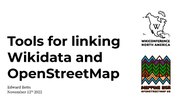
| Tools for linking Wikidata and OpenStreetMap
Edward Betts
https://osm.wikidata.link/ Mappers use the tool by searching for a place they are familiar with. The software downloads the details of Wikidata items within the bounds of the place and find matching objects in OpenStreetMap. The matcher compares places based on names, addresses and the type of object. The user is presented with a list of candidate matches, next to a map showing the matches. After the checks the matches are correct and then clicks a button to save the appropriate wikidata tags to OpenStreetMap. In the talk I will give details of a new version of the editing tool. |
||
| 4:30 pm ET | Break | |
| 4:40 pm ET | Come Here or Go Away?: Identifying Challenges to Scholarly Wikipedia Editing
Savannah Cragin, Dr. Jennifer Johnson
|
|
| Parks, Spawns, Nests and Pikachu: OpenStreetMap and Pokemon GO players
Christopher Greene-Szmadzinski
|
||
| Print an OSM Extract: Trailheads maps from OpenStreetMap
Rob Chohan Non-Profit land trusts have map needs. Docents want to lead a hike and describe where to meet for the monthly wildlife talk. Land trusts want to raise awareness via social media or for public presentations. Local educators want to get more students in the outdoors. A decent map stack & architecture for web, print & mobile can help solve all of these needs. We will discuss how we used FOSS4G tools to make a kiosk trailhead for the “Build Lebanon Trails” group in Lebanon, Oregon. The tools we used are OSM extracts, QGIS, and Cloud Optimized GeoTiff. See RobLabs.com/blt for print maps, live maps and maps for social media that we built for "Build Lebanon Trails". |
||
| Collaborative Corridors to Address OSM Underrepresentation
Bill Wetherholt
|
||
| 5:20 pm ET | Break | |
| 5:30 pm ET | Wikimedia New York City, Sure We Can
Wil540 art
|
 |
| Magic Wand: A Plugin for JOSM
Junior Flores
|
||
| Swiping into a love of OSM
Dan Joseph
|
||
| WikiCred 2022 Grant Cycle Overview
Ariel Cetrone (WMDC)
Applicants should expand on the ideas, themes, and work of past WikiCred projects. In short, applicants should think about how their tools, initiatives or events can generate momentum for themes and ideas behind 2020’s slate of successfully funded WikiCred projects.
|
||
| Future of North American Wikimedia affiliates
Peter B Meyer
|
||
| 5:55 pm ET | Break | |
| 6:00 pm ET | Closing Remarks
Announcements from OpenStreetMap US & WikConference North America |
|
| 6:15pm ET to 7:00pm ET | Open socializing
Use this time to socialize virtually, ask questions of speakers. The event platform will be moderated until 7:00 pm ET. |
Saturday, November 12 ~ 11:30 am ET - 5 pm ET
Immediately before the official schedule, all are welcome to join:
- Movement Charter Community Consultation: Ask Me Anything (outside Hopin) at 10:00 – 11:30am Eastern
- OpenStreetMap Local Chapters & Communities Congress 2022 (within Hopin) at 8:00 - 11:00 am Eastern
| Time | Track 1
Location: Green Room |
Track 2
Location: Red Room |
Track 3
Location: Stage |
Track 4
Location: Blue Room |
|---|---|---|---|---|
| 11:30 am ET - 12:00 pm ET | Better tagging, better bike lanes, better cities
We’ll be discussing a proposed schema for detailed tagging of bicycle lane protection. We’ll talk about how to improve the proposal and how to use it in practice. By promoting better data on bicycle ways, we won’t just help cyclists pick the safest route - we’ll help city planners across the country and the world create better cities.
|
Atlas of Surveillance: Building a crowdsource map of police technology
In this session, EFF researchers will explain some of the common surveillance technologies, then work with attendees to submit more data through our "Report Back" tool, which assigns micro research assignments to volunteers and students.
|
Tool Time!
Demos + Q&A for software including:
Wille Marcel OSM mappers always wished the possibility to find changesets that affect a certain type of feature. For example, a user would like to know all the changesets that created, changed or deleted restaurants in New York or a company could be interested in monitoring changes to the railway network in India. In partnership with Wikimedia Italia, Development Seed implemented that feature in OSMCha, one of the main OpenStreetMap validation tools. In this talk, we will show how Wikimedia and OSM contributors can benefit of this new OSMCha resource.
Mikro: Sustainable Approach to Community Mapping Chad Blevins Local communities have first hand knowledge of the places they live but may not have resources to regularly contribute to OSM. Mapping requires expensive hardware, reliable internet, and free time. Not everyone has access to these resources for mapping, or could scale their existing mapping campaign with better tools. Kaart is currently developing Mikro, a micropayment system that allows OSM mappers to get paid for their contributions compensating users for work that isn’t always fun but necessary for making great maps. Mikro is the tool local mappers need to sustain and scale their work.
Working with Daylight Open Data on AWS Mike Jeffe & Jennings Anderson Daylight Map is a distribution of OSM data that has undergone a series of quality and consistency checks to create a no-cost, stable, and simple-to-use street-scale global map. Updated with the latest changes from OSM each month, The Daylight Map Distribution is available at no cost on the Registry of Open Data on AWS. This talk will provide an overview of the Open Data repository on AWS including a quick demonstration on how anyone can begin working with Daylight today.
Sam Stephan, Lisa McCune-Noll At RoadBotics by Michelin, we create AI-powered maps that help those involved in infrastructure maintenance make objective decisions. In this talk, RoadBotics by Michelin Cartographer, Lisa McCune-Noll, will provide an overview of our applications of OpenStreetMap, including generating blueprints, identifying data collection routes, and creating custom maps for tracking project progress. Then, she’ll cover how we integrate other technologies, like artificial intelligence, with OSM data to transform images and videos into meaningful maps for governments and civil engineering firms worldwide.
Albert Gonzalo Bautista This talk centers on the introduction of the brand new launch of the Mapillary Mission Challenge United States Edition. Join this talk to learn about this challenge and how you can join and understand the motivations behind the Mapillary missions project .This challenge encourages you to collect imagery in mission areas, earn prizes, and compete on the leaderboard. This Challenge utilizes Mapillary Missions, a new feature that helps you to collect imagery in fast-changing areas.Earn prizes by completing Mapillary Missions in select cities in the United States for the Month of November.
Albert Gonzalo Bautista Mapillary is a collaborative platform for street-level images that makes it easy to collect, view, and share street-level imagery. Street-level imagery provides a multitude of real world use cases even more so when it is available as open data. This talk will specifically focus on the following:
Ruben Lopez Mendoza OSM Seed makes this easier by packaging the key tools in the OSM ecosystem, and allowing you to deploy an OSM system with a few Docker or Kubernetes commands. Having OSM software in our platform or server, could allow us to use all editing , export and processing tools for our data. |
Wikimedia Indiana: A New User Group Rooted in Cultural Heritage
Wikimedians in Indiana would like to use the occasion of WCNA to announce the formation of a new prospective user group, Wikimedia Indiana—currently being reviewed by the Affiliations Committee for affiliate status. This new group, led by several longtime Wikipedians active in the GLAM space, has been kickstarted by work centered on IUPUI University Library in Indianapolis and its many community partners. We are a small group, but we have already held several events and training in the past few months and would like to share our successes and invite others to collaborate. In 2022, Indiana University–Purdue University Indianapolis received a grant from the Central Indiana Community Foundation (CICF) Library Fund to increase public participation in Indiana’s history and cultural heritage by implementing two inter-related projects: 1.) contributing images to Wikimedia Commons from Indiana cultural heritage sites that take part in the Indiana Memory Project and 2.) fostering a community of Wikipedia contributors in Indiana with a campaign of public programs, training, and other outreach. Launched in June, the project has already resulted in over 10,000 uploads to Wikimedia Commons from 3 Indiana cultural institutions, 2 editathons (with 2 more scheduled on Nov. 1), 6 successful DYKs, and staff training at multiple local cultural institutions. With this core, funded project in motion, Wikimedians are invigorating a new community in Indiana with the hope that it can sustain activity and grow beyond the university library. During this presentation, we will discuss the Wikimedia community in Indiana, the state of the IUPUI project, the grant process, and advice from the team on starting new initiatives in areas of the country without much activity. The proposed session will also look to the project's future and discuss how the rest of the Wikimedia community, anywhere in North America, can help the effort.
|
| 12:00 pm ET - 1:00 pm ET | View it! tool: utilizing Structured Data on Commons for image discovery
View it! is a user script and Toolforge-hosted media search tool to show Wikimedia users (editors and readers) Wikimedia Commons depicting– or otherwise related to– the article they are viewing. View it! helps editors easily find and add relevant items to a given Wikimedia page and can be used across all Wikimedia projects and language versions. The tool allows users access to the full catalog of relevant, tagged images on Wikimedia Commons vs the finite, highly curated images you may find on a Wikipedia article or Wikidata item.
| |||
| 1:00 pm ET - 1:45 pm ET | Tagging Party
Come with examples of things you aren’t sure about how to tag in OpenStreetMap. Try to stump us with the gnarliest edge cases and most blatant gaps in our tagging system that you can think of. The rest of us will try our best to suggest a tag – or five. Afterwards, we’ll put together a list of what we’re stumped on and post it to a wider forum for ideas.
|
Wikimedia sued the National Security Agency for mass surveillance. Now what?
The US government engages in surveillance on a massive scale, including the communications of journalists, researchers, dissidents, artists, and human rights activists. Because Wikimedia projects are borderless and interconnected, US surveillance programs impact the projects. Mass surveillance impedes engagement with the projects and hinders our mission of sharing the sum of all human knowledge. The Foundation sued the National Security Agency, attempting to end one of these programs. We will also advocate in the US federal legislature to make meaningful changes to mass surveillance. We will discuss these effort and will be joined by experts from the American Civil Liberties Union and the Knight Foundation for the discussion.
|
100 Caribbean Leaders on Wikidata: Launching WikiCari's newest project
Caribbean leaders (including public servants, activists, labour leaders, and scientists) are under-represented on Wikidata and Wikipedia. Join Wikimedians of the Caribbean as we launch a project to add new Wikidata items for 100 Caribbean leaders as the first step in a new project to add 10,000 Caribbean people to Wikidata. The presentation will consist of a panel discussion featuring Sherry Antoine, Ian Ramjohn of WikiCari together with invited guests. We will discuss the current level of (under)representation of Caribbean people on Wikidata, and the importance of representation as a crucial knowledge equity goal.
|
OSM Education Birds of a feather
Listen to presentations from two educators, Jamie Dickinson & Celeste Reynolds on using OpenStreetMap in the Classroom, followed by a discussion for those sharing an interest in open mapping in education. The discussion is open but should focus on what the project needs to do to identify and remove obstacles to adoption by a broader community of educators in a broader variety of institutions. This could include new tools, tactics, and techniques to assist uptake by students of all stripes.
|
| 1:45 pm ET - 2:30 pm ET | Reclaiming the right to privacy with grassroots tactics
We are proposing a panel discussion followed by Q&A.The US government engages in surveillance on a massive scale, including the communications of Wikimedians. Although the Foundation has sued the National Security Agency, lawsuits and advocacy in the federal legislature are not enough to make meaningful changes to mass surveillance. In the past few years, grassroots organizing campaigns across the country have found creative ways to ensure that local communities can make demands that are heard so that they do not have to live under constant watch. This panel of activists and organizers will share their experiences and tips so that Wikimedians can fight for their right to privacy. Panelists will include: * WMF: Franziska Putz * Micah Epstein, Coveillance * Lia Holland, Fight for the Future * TBC, member of ACLU or AmnestyTech
|
Automatic citations in Wikipedia: how they work and how to fix them
References are one of Wikipedia's main pillars. However, inserting citations may be tedious. Fortunately, Wikipedia's visual editor includes a tool, Citoid, that generates citations automatically given a URL or other unique identifier. But this tool doesn’t work as expected all of the time. How often does this happen and why? Can we do something to fix it? For the last year at the Web2Cit project we worked to answer these questions. In this presentation we will first show how automatic citations in Wikipedia work and why they may fail. Then, we will present our research results showing how often this happens and where. Next, we will discuss how the project was conducted in as close cooperation as possible with the communities whose needs we were trying to address. And finally we will introduce the tools we developed and how they may be used to collaboratively improve automatic citations in Wikipedia.
| ||
| 2:30 pm ET - 3:15 pm ET | Catskill Park, NY forest landcover mapathon
Catskill Park is a popular tourist destination for people in New York State, and some OSMers have been there, it would be nice to make the map look better than what's on a trail map! There's already an OSM Tasking Manager task of it, which I will share during the session.
|
Digital platforms as repositories of shared knowledge about conflict
During this session, we aim to discuss the impact of technology on collective memory and to explore how open source platforms are increasingly becoming the dominant way to remember past atrocities. Similarly, this session is intended to broaden our understanding of how platforms such as Wikipedia can ensure that what happened in the past is not forgotten and become a primary vehicle for collective memory.
|
How Wiki Education supports 12,000 new editors a year
In this panel, three Wiki Education staff (Senior Program Manager, Wikipedia Student Program Helaine Blumenthal, Senior Wikipedia Expert Ian Ramjohn, and Chief Programs Officer LiAnna Davis) will explain how we successfully bring 12,000 new editors to the English Wikipedia each year through our Wikipedia Student Program. We'll cover: * How do we find new instructors to join the program, particularly those who teach in diverse subject areas or at diverse institutions, to promote our movement strategy of knowledge equity? * How do we communicate with the thousands of instructors who have now taught with Wikipedia, and who we want to encourage to participate in the program again? What technical tools do we use? * What tools do we use to get instructors who've never edited Wikipedia up to speed on how to teach with Wikipedia? * How do we provide Wikipedia training for that many students using technical tools? * How can we possibly track what that many new editors are doing at once?! * Why do we use paid staff and not volunteers for our work? * How do we evaluate the quality of the work students add to Wikipedia? * What are some examples of the types of content student editors add to Wikipedia through our Wikipedia Student Program? * How do we encourage courses that added great content to participate again? * And some open time for audience questions! We'll focus on how we've scaled up our impact, from supporting 200 students initially to routinely supporting 12,000 student editors and growing. People who attend this session can expect to learn how Wiki Education harnesses the power of technical tools like the Dashboard, Salesforce, and Pardot to scale the impact of our program. Participants are encouraged to ask questions and learn more about how Wiki Education works!
|
Wiki99 and the global canon
"Wiki99 as the canon for global discourse presents *Wiki99, a project to encourage Wikipedia translation *Module:Wiki99, the tool which supports the project *the concept of the global canon, which Wiki99 produces
 |
| 3:15 pm ET - 4:00 pm ET | Tools for linking Wikidata and OpenStreetMap
I describe an editing tool for adding links from OpenStreetMap objects to the corresponding Wikidata items. https://osm.wikidata.link/ Mappers use the tool by searching for a place they are familiar with. The software downloads the details of Wikidata items within the bounds of the place and find matching objects in OpenStreetMap. The matcher compares places based on names, addresses and the type of object. The user is presented with a list of candidate matches, next to a map showing the matches. After the checks the matches are correct and then clicks a button to save the appropriate wikidata tags to OpenStreetMap. In the talk I will give details of a new version of the editing tool.
 |
Wikifunctions - a new Wikimedia project
Wikifunctions is a new Wikimedia project we are working on with the goal of allowing a community to create and maintain a library of functions. The main goal of Wikifunctions is to support the creation of Abstract Wikipedia, a Wikipedia where the content is created and maintained only once, but can be read in any of the more than 300 languages Wikipedia supports, and can be edited in any of those languages. But Wikifunctions explicitly aims for a wider goal: to provide a library of functions for many different use cases. Functions answer questions. And as such, functions are an integral part of knowledge for a modern world. Besides the functions necessary to support the goals of Abstract Wikipedia, i.e. functions which allow for natural language generation, we envision also to support functions for other domains. Maps and geographical data provide a rich environment for the application of functions. We will be able to use functions in order to ensure constraints on the geographical data in Wikidata or in projects such as OpenStreetMaps, or to use the data in novel ways and thus also to encourage the creation of more data. Wikidata has still large gaps regarding for example historical maps of former countries, distribution maps of species, or for describing the geographical extension of climates or ecosystems. In this talk we will present Wikifunctions, the current state of the project, and the plans regarding Abstract Wikipedia. We will also present some possibilities regarding how geodata can be used and leveraged with Wikifunctions, in order to start a conversation with the community, collect ideas and to see how interesting certain use cases might be. More information about Wikifunctions and Abstract Wikipedia can be found here: https://meta.wikimedia.org/wiki/Abstract_Wikipedia Previous presentations and articles about the project can be found here: https://meta.wikimedia.org/wiki/Abstract_Wikipedia/Papers,_press,_and_videos
|
WW, WWWWW (Wikiproject Witches, Who, What, When, Where, Why) & A Woman of the Century
| |
| 4:00 pm ET - 5:00 pm ET | Wikidata's tenth birthday
Help celebrate the occasion of Wikidata turning 10 years old as of the end of October 2022. Facilitator: Andrew Lih The session will quickly describe Wikidata's history and how the birthday has been celebrated around the world. Then a panel of discussants will discuss the impact of Wikidata in the last decade and what's to come.
Facilitator: Andrew Lih | |||

Sunday, November 13 ~ 1:00 pm ET - 5:30 pm ET
WCNA 2022 will continue their programming on Sunday, November 13. See program for Sunday here.
Platform
This will be an online event hosted on HopIn. Learn more about the Hopin platform here.
In-Person Events
Hosting a gathering in your area during the conference? Please share the details here!
| Event Name | Location | Date | Details | Organizer |
|---|---|---|---|---|
| WikiConference North America 2022
Local Meetup in Indianapolis |
Indianapolis, IUPUI Library | See wiki page for more details! | Indiana Wikimedians User Group | |
| WikiConference North America in New York City | BPL Central Library, Brooklyn, NY | Details on Wikipedia | Wikimedia New York City | |
| WikiConference North America 2022
Local Meetup in Washington, DC |
Washington DC | Friday, November 11, 2022, 11:30 - 7pm
Possibly dinner on Sunday, November 13 too. |
Details on Wikipedia | Washington DC-area chapter (Wikimedia DC) |
Sponsor or Donate
OpenStreetMap US is seeking sponsors to help keep our online events free. Is your company interested? Email us at events@openstreetmap.us to learn more.
Code of Conduct
A Code of Conduct exists to support a healthy and sustainable community where diversity and inclusion can thrive. Towards that end, Mapping USA + WikiConference North America is governed by a Safe Space Policy, acting as a guide to make it easier to enrich all of us and the community in which we participate. Read the Safe Space Policy here.
OpenStreetMap US is committed to providing a friendly, safe, and welcoming environment for all, regardless of level of experience, gender identity and expression, sexual orientation, physical abilities, neurodiversity, personal appearance, body size, race, ethnicity, age, religion, national origin, and socio-economic background.