United States/Map style proposal/Holistic design
< United States | Map style proposal(Redirected from United States/Map style/Holistic design)
Jump to navigation
Jump to search
This is a draft of holistic design for Americana map, with OSM-Carto tiles depicted for comparison. Note that the tile zoom numbering system for raster tiles and vector tiles are offset by one; don't succumb to fencepost errors when thinking about this style's design goals!
Whole world: z<0-1>
- Purpose: Show the World at glance.
- Feature to show: Continent names, Oceans names
- Features not to show: Names of countries, borders
| openstreetmap-carto | |
|---|---|
| vector zoom = 0
raster zoom = 1 |

|
Continents: z<1-3>
- Purpose: Show countries
- Feature to show: Country borders and Names, Capitals or very large cities?
- Features not to show: Continent names, Oceans names
| openstreetmap-carto | |
|---|---|
| vector zoom = 1
raster zoom = 2 |

|
| vector zoom = 2
raster zoom = 3 |

|
| vector zoom = 3
raster zoom = 4 |

|
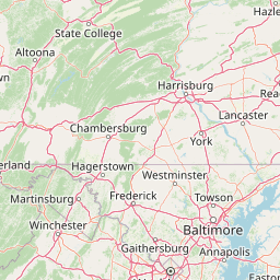
Countries: z<3-7>
- Purpose: Show details of countries and their main infrastructure
- Feature to show: States names (until z4) and borders, motorway class highways (from z4), major rivers and lakes, major railway corridors??, Capital cities, Regional Capitals, national parks with names,
- Features not to show: short rivers
| openstreetmap-carto | |
|---|---|
| vector zoom = 3
raster zoom = 4 |
|
| vector zoom = 4
raster zoom = 5 |

|
| vector zoom = 5
raster zoom = 6 |

|
| vector zoom = 6
raster zoom = 7 |
|
| vector zoom = 7
raster zoom = 8 |
|
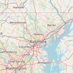
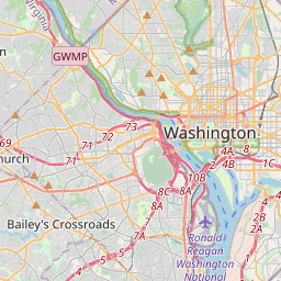
Regional details: z<7-11>
- Purpose: Overview of a city and broader surroundings.
- Feature to show: motorways, Interstate shields, primary roads, secondary roads, all rivers with names, names of lakes and reservoirs, major and minor protected areas
- Features not to show: buildings, residential roads, service roads, driveways, paths and sidewalks, streams
| openstreetmap-carto | |
|---|---|
| vector zoom = 7
raster zoom = 8 |
|
| vector zoom = 8
raster zoom = 9 |
|
| vector zoom = 9
raster zoom = 10 |
|
| vector zoom = 10
raster zoom = 11 |
|
| vector zoom = 11
raster zoom = 12 |

|
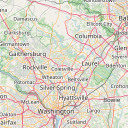
City details: z<12-17>
- Purpose: Give detail view of a city and ideas where to go when you are there for the first time
- Feature to show: all roads, residential roads with names, motorways+primary+secondary roads shields, parking lots and parking houses, public parks, town hall, courts, libraries, museums, hotels?, hospitals, police, railway station, bus station, university/college and high school campuses, Names of parts of towns/cities, major powerlines (switchable?)
- Features not to show: No businesses yet only public infrastructure
| openstreetmap-carto | |
|---|---|
| vector zoom = 12
raster zoom = 13 |

|
| vector zoom = 13
raster zoom = 14 |

|
| vector zoom = 14
raster zoom = 15 |

|
| vector zoom = 15
raster zoom = 16 |

|
| vector zoom = 16
raster zoom = 17 |

|
| vector zoom = 17
raster zoom = 18 |

|
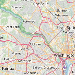
Micromapping details: z<17-22>
- Purpose: Show high details of cities of driving or walking to amenities + switchable features for mappers.
- Feature to show: area:highway, manhole covers (switchable), sidewalks, parks details (benches, trees, street lamps, emergency phones), public transport stops with names, buildings, restaurants, shops, other businesses, traffic lights and crossings (switchable?), golf course details, utility poles (switchable), trash bins (switchable), driveways
- Features not to show: house numbers (or switchable?)
| openstreetmap-carto | |
|---|---|
| vector zoom = 17
raster zoom = 18 |
|
| vector zoom = 18
raster zoom = 19 |

|
| vector zoom = 19
raster zoom = 20 |
(not rendered) |
| vector zoom = 20
raster zoom = 21 |
(not rendered) |
| vector zoom = 21
raster zoom = 22 |
(not rendered) |
| vector zoom = 22
raster zoom = 23 |
(not rendered) |