User:Gubaer/GeoEye
GeoEye is a satellite imagery provider who're collecting and releasing imagery of Haiti.
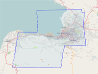
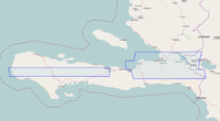
OSM has permission to use the GeoEye image providing we acknowledge the source. Currently it covers all the way to Carrefour and the general area now, but we haven't imported that data beyond Port-au-Prince.
| Image set | Boundary | Use in JOSM | Use in Potlatch |
|---|---|---|---|
| GeoEye1
Date: 2010/01/16 Copyright: (c) GeoEye, 2010 Update: daily |
 |
Use the following WMS URL in JOSM (see how to configure):
http://hypercube.telascience.org/cgi-bin/mapserv?map=/geo/haiti/mapfiles/4326.map&layers=geoeye-01-16-4326&request=GetMap&version=1.0.0&styles=&format=image/jpeg&service=WMS& |
Launch Potlatch with the following URL (see how to configure):
http://hypercube.telascience.org/tiles/1.0.0/geoeye-geoeye-20100116-900913/!/!/!.jpg |
| Ikonos
Date: 2010/01/14-2010/01/15 Copyright: (c) GeoEye, 2010 Update: daily |
 |
Use the following WMS URL in JOSM (see how to configure):
http://hypercube.telascience.org/cgi-bin/mapserv?map=/geo/haiti/mapfiles/4326.map&layers=ikonos-01-14-4326&request=GetMap&version=1.0.0&styles=&format=image/jpeg&service=WMS& |
Launch Potlatch with the following URL (see how to configure):
http://hypercube.telascience.org/tiles/1.0.0/geoeye-ikonos-20100115-900913/!/!/!.jpg |