User:Keichwa
Jump to navigation
Jump to search
I'm an active mapper in and around Nuremberg (Nürnberg) and occasionally around Kassel. Most of my GPS tracks I acquire going by feet, bicycle, or public transportation systems (tram, bus, and train), but I do not hesitate to switch on my GPS equipment if somebody gives me a lift.
Apropos GPS equipment. Since the beginning of the year 2008 I'm a proud owner of a Nokia N810 Internet tablet. Nokia granted a promotion key to me and I have had to pay 99 Euro plus shipping only.

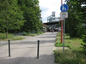
highway=footway bicycle=yes
and add more details such as
traffic_sign=z239; z1022-10

width=5m

surface=paved tracktype=grade1