User:Lkmapper
Who
I'm Niluka Sandaruwan Weerasinghe [1].
My relationship with OSM
I am a OSM Mapper and Trainer at the World Bank OpenDRI Sri Lanka Project and I am familiar with,
- JOSM
- iD
- HOT Exports
- Quantum GIS
- Fieldpapers
- InaSAFE
- GeoNode
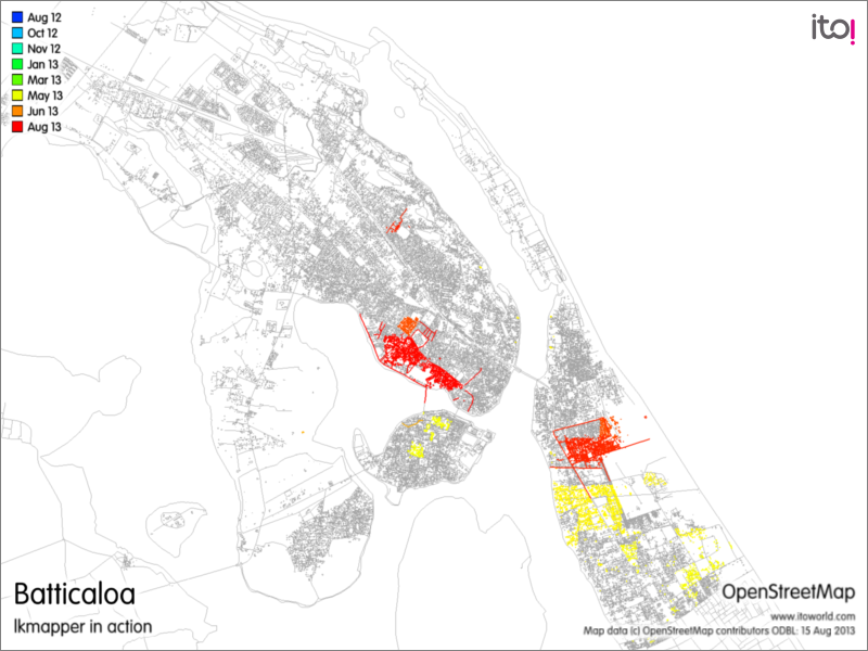
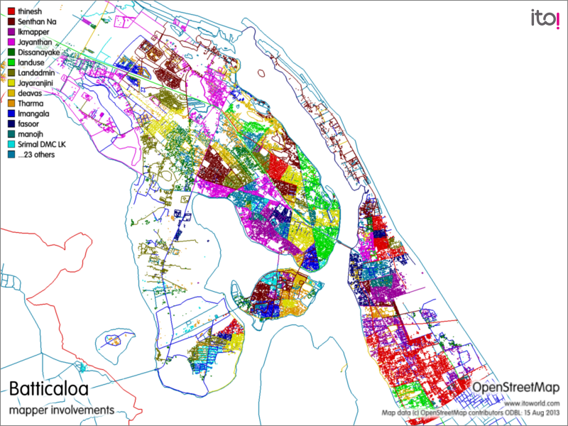
I am working as a team member of OpenDRI Sri Lanka project (Batticaloa chapter). The final goal of the project is to build up the community resilience and disaster risk reduction in the Batticaloa area. We prepared a questionnaire to be filled by conducting a field survey by discussing with relevant officers of relevant government organizations. Then digitized all the features of the area on the OpenStreetMap by using JOSM based on Bing satellite images. Then we extracted the shape files of the area by using http://export.hotosm.org/ . QGIS was used to produce the A3 size layout maps for the particular GN divisions which is the lowest level administrative boundary of Sri Lanka. For a given GN division, we prepared two layout maps one with a Bing satellite base map and the other one with the OpenStreetMap base map. For the field surveys, we prepared field papers from http://fieldpapers.org/ by dividing GN divisions in to several A4 size sheets with the base map of OpenStreetMap. Then the field surveys were conducted and the questionnaires were filled with the help of above mentioned two layout maps and field papers. After that the data was feed to the OpenStreetMap by using JOSM. For that, we have developed a custom preset for the JOSM that is similar to the questionnaire. For quality checking I have developed a methodology using PostgreSQL, PostGIS and QGIS. After finalizing the data feeding to the JOSM we can extract the shape files with attribute data of the area by using the same method and then using QGIS and InaSafe plugin we can predict the results for different disaster types. Finally data can be shared on GeoNode as a Spatial Data Infrastructure (SDI)
Contribution to the OpenDRI Sri Lanka Batticaloa Chapter
Education
I am a proud son of premier Buddhist School Mahinda College Galle [2]. And currently reading for my masters in GIS and Remote Sensing at the Faculty of Graduate Studies of University of Sri Jayewardenepura [3].
Meditation
For those who are interested in, I would like to recommend Niwandora [4].
Contact
You can contact me at
I support the license
upgrade to ODbL v 1.0


