User:Mclaeysb/HOT Mapping Tips
Hi there. This page features some mapping tips for HOT projects I'm part of.
Artisanal mining sites
Many mining sites in central Africa are small scale, artisanal sites. There have been recent efforts to regulate the activities, the miners and the sites, but they don't cover all existing mines. Hence, for most mines its difficult to say whether they are legal or not. One type of mines is however clearly illegal: those inside protected areas, such as national parks and reserves. They attract miners from outside the park which rival indigenous inhabitants. Often armed groups find their way to these illegal sites, and 'protect' them, in exchange for taxation.
For this reason, HOT tasks have been set up to map out artisanal mining sites in parks. They should be mapped as polygons using the landuse=quarry tag.
Images
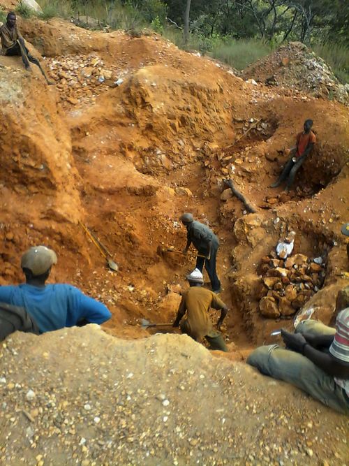
This is what an artisanal mining site in central Africa typically looks like at eye level:
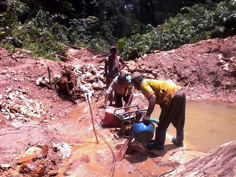
Some sites are built along the river ('Alluvial sites') and operate with dredges. A photograph of dredges used for small scale mining in DRC can be found here.
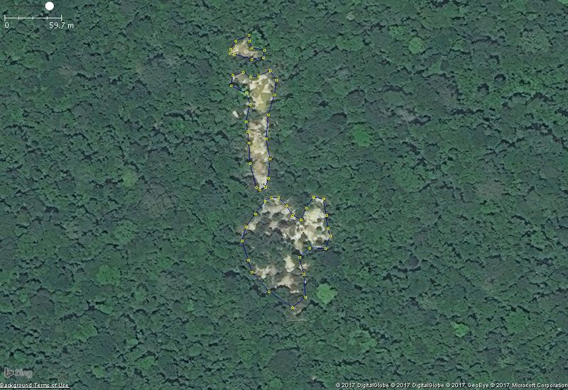
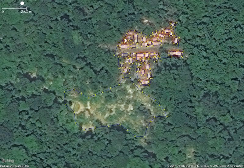
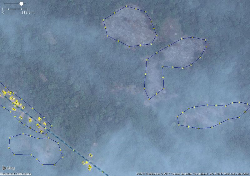
A similar site seen from satellite imagery looks like this:
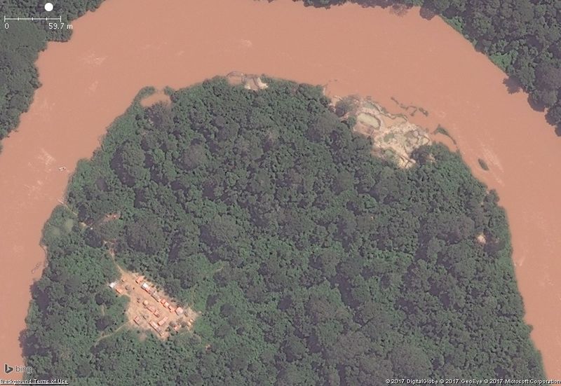
Sometimes the support camp is visible:
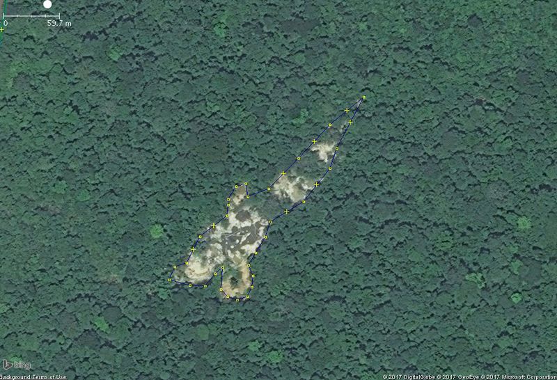
Sites along the river ('Alluvial sites') look like this:
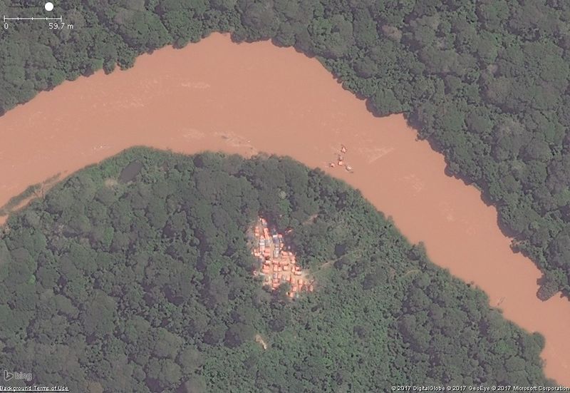
Sometimes the dredges can be spotted:
Properties
Here are some properties that can help you distinguish it:
- Most sites are surface mining sites, with multiple holes visible from above and looking like exposed ground. Only some types of sites feature galleries.
- Sites are typically small. Most sites measure 10 to 100 meters across. Some larger sites exist as well.
- Sites often occur next to one another, for example lining up along geological features.
- Water is often used on sites during the processing phase, for example in older hole where water has accumulated. Some sites are built along rivers which provide water an easier access to mineral layers.
- In surface mining, holes are often dug with straight borders, sometimes even yielding rectangular shapes.
- Support camps can sometimes be found in the neighbourhood. They should be tagged as buildings.
- Sometimes machinery can be spotted on the site. At sites along a river, sometimes
False positives
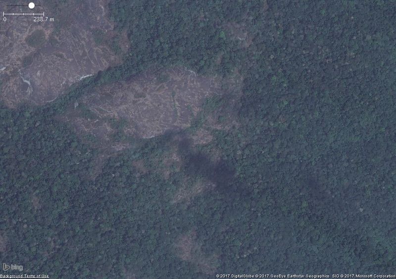
Sometimes natural rock formations can look a lot like mining sites. Don't mistake them!
These rock formations can be recognised as follows:
- Often occurring in larger groups, with some rock being much wider then 100 meters.
- They often have parallel lines or geological layers.
Deforestation due to logging
Small scale logging occurs across Africa. The wood is typically used for local purposes. Similar to mining, logging is forbidden in parks. Sometimes the recovered land is used for farming later.
Pieces of land that have recently been logged, can be mapped using the landuse=logging tag.
Images
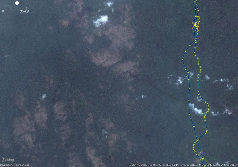
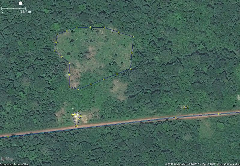
This is what small scale logging in central Africa typically looks like from satellite imagery:
Properties:
Here are some properties that can help you distinguish it:
- Logged areas can be recognised by some trees still laying on the ground.
- Logging often occurs in incremental patches. Patches can be round or straight in shape, but the border between a logged patch and the forest is often clearly visible.
- Recently recovered land is often brown, as its not yet covered by grass or vegetation.
- Logging often occurs near residential areas and roads.
