User:SK53/United Kingdom/Pubs
Pubs have been part of what OSM mapping in the UK from the outset. There is, unsurprisingly, a rich set of tags & practices associated with pubs. This page is a draft discussing some of these issues.
Area of the pub
When pubs are mapped as areas there are two schools of thought. Some just place the name on the actual pub building (perhaps with the rest of the site also mapped, but not named, as landuse=retail), others place the name on the entire pub site (building, outdoor seating, beer garden, car park etc) using a landuse=retail tag.
Gardens & Outdoor Seating
Mapping outdoor facilities has become particularly important because of covid-19 pandemic associated restrictions.
Although often referred to as beer gardens we can discriminate between outdoor seating (tables, benches etc) usually on a hard surface, and beer gardens proper (much of the area covered with grass, perhaps with fruit trees for shade). Tagging for these is not entirely resolved, but a useful discussion took place on the talk-gb list in April 2021.
Beer Garden style

Beer Garden - Bull Inn, West Tansfield

Royal Oak, nr Wivelsfield, Sussex


Outdoor Seating style

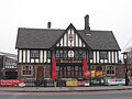
Bar Three, Wetherby

Black Bull, Wetherby
Rose & Crown, Lenton, Nottingham
.jpg)
_001.jpg)
.jpg)