User:SherbetS/Uploading OsmAnd traces from iOS
This is a guide on how to upload a trace from OsmAnd for iOS to the OpenStreetMap Server without the use of a computer.
Prerequisites
OsmAnd for iOS, unlike it's android counterpart, does not have an option to upload directly from the app, however, you are able to use the mobile editor Go Map!! to upload traces to the server.
For this guide, you will use both OsmAnd to record your trace, and Go Map!! to upload it.
Process
OsmAnd
to start, open the OsmAnd app. you can have any map profile app active at this time.
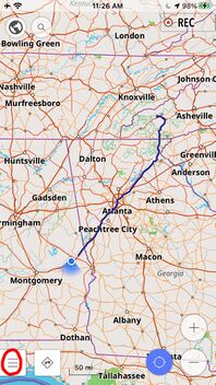
Once on the map screen, press the menu icon in the bottom right hand corner of the screen.
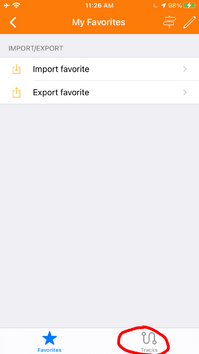
In the menu, navigate to the tab labeled "My Places."
In this tab, press the button in the bottom right hand side of the screen labeled "Tracks."
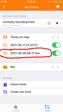
Press on the track that you recorded and intend to upload to the server.
Note:
If your track is not visible on the map, you may have to navigate to its folder to be able to upload it.
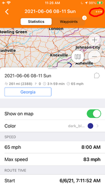
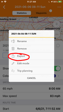
in the track screen, select the three dots in the top right hand corner.
this will open the options for your track.
In the options, select the button titled "Export."
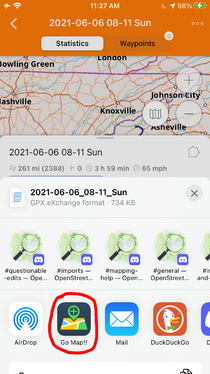
In the export menu, Select the Go Map!! app as the target of the export.
Go Map!!
You have now completed the OsmAnd Section of this guide. You may close OsmAnd and open Go Map!! to continue and upload to the server.
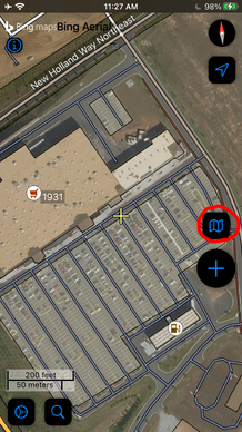
Once you have Go Map!! Open, press the map icon in the middle right hand side of the screen.
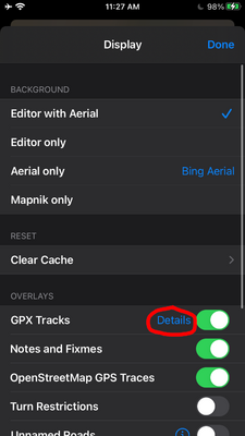
In the Display menu, Press the button labeled "Details" next to "GPX Tracks" underneath "Overlays."
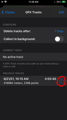
In the GPX Tracks menu, Press the upload icon next to the trace you imported from OsmAnd.
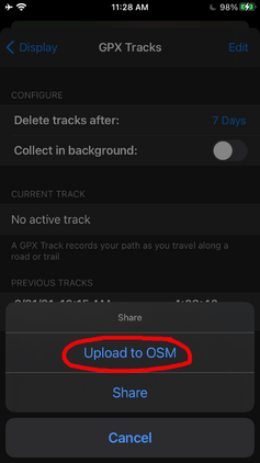
After pressing the upload icon, press the button titled "Upload to OSM," and your trace will be uploaded to the OpenStreetMap server with Public visibility.
