User:Ve6srv
| About Me | |||||||||
|---|---|---|---|---|---|---|---|---|---|
| |||||||||
| Babel user information |
|---|
| Users by language |
March 2008
Started mapping in Strathcona County, immediately east of Edmonton, Alberta. Sherwood Park is the major urban node in Strathcona County, where most of my focus was during the month of March, 2008.
Sherwood Park roads are mostly mapped out, along with most of the road grid in the county. Still need to get GPS tracks for all the rural subdivisions that are outside of the Yahoo Imagery.
Have been mapping out highways between Edmonton and Fort McMurray, as well as adding roads to Fort McMurray little by little. Also mapped out some highways to Camrose, Edson, Rocky Mountain House, and into the foothills.
Traced out Millwoods roadways to get that area filled in a little as there were no local users taking on the task.
Aug 2012
Adding pages for software using OSM
Extending Sightlines to Reduce GPS Error
When trying to capture the outline of a building, many people try to just walk around the building. This usually results in less than stellar results. Being close to a building can block the GPS receiver's view of the satellites, reducing accuracy of an already less than perfectly accurate device. By moving away from the building, you can get a better sky view, and better accuracy, but how does that tell us where the building is located?
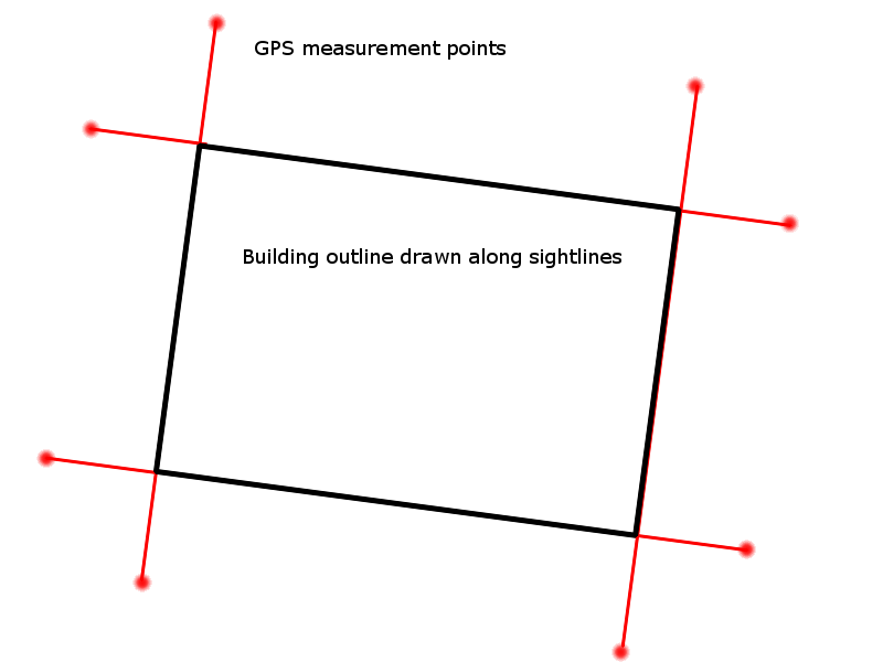
Walk away from the building, but line yourself up along the wall. Look at the building wall, and get yourself in line with the wall so you can see the far corner and the near corner right in line. Capture that GPS location. Go to the opposite end of that same wall, and walk away from the building again, keeping lined up with the wall. Capture that GPS location. If you put those two points into your OSM editor, you can draw a line between them that will define the plane of the measured wall. You can't determine where the corners of the building are, but you know where the wall should be.
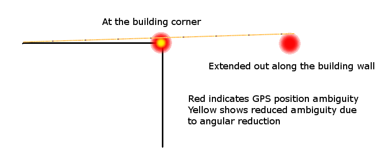
By extending the length of the wall, you can reduce the position error of the wall due to the geometry involved. Th further away from the building you get, the less position error you will get in the final location derived, simply due to the angles involved. 5 metres of position error at a distance or 100 metres has the same angular error as 2.5 metres of position error at a distance of 50 metres. If you measure a 10 metre long wall, but gather a position 100 metres from the far corner, your position error on the close corner will be reduced to 0.5 metres.
Measure enough points to define the plane of all 4 walls of a rectangular structure, and you can create the rectangle that defines the structure within those 4 planes.

