Yorkshire and the Humber
Jump to navigation
Jump to search
Regions in England – North West · North East · Yorkshire and the Humber · East Midlands · West Midlands · South West · South East · East · Greater London
| V・T・E |
| latitude: 54.134066918934316, longitude: -0.8107480469631645 |
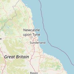
| Browse map of Yorkshire and the Humber 54°08′02.64″ N, 0°48′38.69″ W |
| Edit map |
|
External links:
|
| Use this template for your locality |
Yorkshire and the Humber is a region in England, United Kingdom at latitude 54°08′02.64″ North, longitude 0°48′38.69″ West.

|
Yorkshire and the Humber (151012![]() 151012) is a Government Office region and European electoral area in England. It is made up of the ceremonial counties of the East Riding of Yorkshire, South Yorkshire and West Yorkshire, and parts of North Yorkshire and Lincolnshire.
151012) is a Government Office region and European electoral area in England. It is made up of the ceremonial counties of the East Riding of Yorkshire, South Yorkshire and West Yorkshire, and parts of North Yorkshire and Lincolnshire.