All in one Garmin Map
| This map has not been produced any more since January 2014. The required style and TYP files to create the map yourself using Mkgmap are available on GitHub. |
On this page you will find some documentation and download links to a garmin map made with Mkgmap. The goal is to show a great many features from OSM on the map. There are too few garmin default types so a type file is needed. If you have questions or remarks feel free to discuss or write me a message. Christoph
The original page is in German. DE:All_in_one_Garmin_Map - there you will find some more information.
News
- 2013-05-28
The map of Germany has not being updated since late January 2013 although it is recalculated every day. (Does anyone know the reason? What should be done that it is being updated again? What about the Europe map? --Thesurveyor (talk) 15:59, 2 June 2013 (UTC)). (translated --Nakaner (talk) 12:03, 13 June 2013 (UTC)).
The DACH+ map and the Germany map have especially with access values problems to calculate routes with some new firmware versions.
Pictures
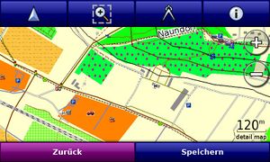
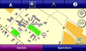
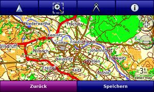
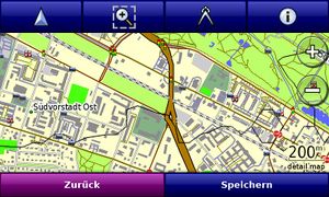
You see some pictures of the map on an Xperia X1 with Garmin Mobile, it looks similar on most Garmin units.
Download
The maps consist of the routable basemap with lots of OSM features, contour lines (only Germany at the moment), openstreetbugs (only Germany at the moment), FIXMEs, notes, housenumbers and boundaries. You can switch layers on and off by going to the map setup menu. Under the information tab you will find all map tiles in a drop down list. If you press the menu button again you are able to show or hide the single layers. This is useful if you live in a well mapped area with all house numbers tagged and you can't see anything else. So you can disable the "Adressen" layer if you want to. You can download all maps combined in one gmapsupp.img ready to store on your GPS device or you can download every single map layer to open in QLandkarteGT or MapSource (maybe with mapsettoolkit).
Please use the gwdg-mirror, because the fossgis-server is under heavy load! You can find the links below.
Thanks to the new servers sponsored by Strato the All-in-One-Map is updated daily now. You can find all the downloads here:
original fossgis-server:
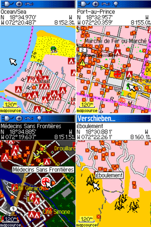
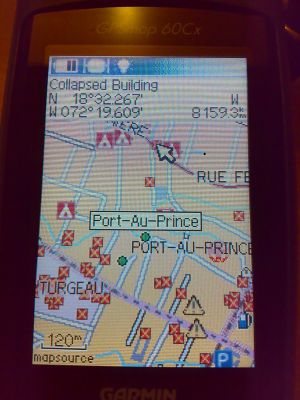
Haiti
Updated every day. Since 2010-01-27, this includes a Damage layer which shows extra information very similar to http://haiti.openstreetmap.nl (impassable roads, collapsed buildings, spontaneous camps, obstacles, damaged infrastructure, fords, and landslides)
There are two ways to get this data onto your Garmin device:
- Connect it as a hard drive to your Computer and copy the file http://dev.openstreetmap.de/aio/regions/haiti/gmapsupp.img into the
Garminfolder. Done. - If you are on Windows, there are separate MapSource installers for the basemap (http://dev.openstreetmap.de/aio/regions/haiti/OSM-AllInOne-HT-basemap.exe) and the damage layer (http://dev.openstreetmap.de/aio/regions/haiti/OSM-AllInOne-HT-damage.exe). Merge them in MapSource and transfer them to the device.
- If you need contourlines of Haiti, check out the mapsource installer (http://dev.openstreetmap.de/aio/regions/haiti/OSM-AllInOne-HT-contourlines.exe) or the gmapsupp.img (http://dev.openstreetmap.de/aio/regions/haiti/contourlines.img.gz) which you have to load additionally to your other maps.
(For reference, http://labs.geofabrik.de/haiti/latest.osm.bz2 (updated every 5 mins) from Geofabrik is used as source data.)
Europe
You can have a look how the splitter has tiled the osm-data and which tile-ids there are at:
The combined map with all type files integrated as gmapsupp.img:
- Europe (gmapsupp_europe.img.zip) (OLD!) and MD5-checksum
Download (as of 2010-07-23): 2.13GiB (extracted size: 3.03GiB)
Will be updated every day.
The single maps:
- OSM-Basemap: gbasemap.tar.gz
- OSM-Adresslayer: gaddr.tar.gz
- OSM-Fixmelayer: gfixme.tar.gz
- OSM-Boundarylayer: gboundary.tar.gz
- OSM-Maxspeedlayer: gmaxspeed.tar.gz
European Countries and Regions
If you are interested to download a European country or German federal state please have a look into the download directory and choose your country:
ftp://ftp5.gwdg.de/pub/misc/openstreetmap/download.openstreetmap.de/aio/regions/
European cross-border Regions
A list of cross-border OSM-Basemaps of some European regions with the option to ask for more under: Regions.
Germany
The combined map with all type files integrated as gmapsupp.img:
Will be updated every day.
other areas or continents
OSM-Basemaps
| area | weekday | folder | image | image compressed | tile coverage |
|---|---|---|---|---|---|
| Germany | daily | germany | gmapsupp.img | gmapsupp.img.7z | |
| Europe | Monday/Friday | europe | gmapsupp.img | ||
| Asia | Tuesday | asia | gmapsupp.img | gmapsupp.img.7z | |
| Australia and Oceania | Wednesday | australia and oceania | gmapsupp.img | gmapsupp.img.7z | |
| Central America | Thursday | central america | gmapsupp.img | gmapsupp.img.7z | |
| Canada | Friday | canada | gmapsupp.img | gmapsupp.img.7z | |
| Canary Islands | Freitag | canary islands | gmapsupp.img | gmapsupp.img.7z | |
| South America | Saturday | south america | gmapsupp.img | gmapsupp.img.7z | |
| Africa | Sunday | africa | gmapsupp.img | gmapsupp.img.7z |
Styles
Don't forget to add the typefiles if you download individual mapsets. The type- and style files of the map are here:
I have created a git repository to edit the styles together with other people and track the changes. Please feel free to check it out and if you are interested to contribute and change styles define new types and icons just give me your ssh-public-key and edit the styles or send me patches.
If you want just to checkout the git repository use:
git clone git://github.com/aiomaster/aiostyles.git
