File:Orm-frankfurt-2013-09-21.png
Jump to navigation
Jump to search

Size of this preview: 800 × 465 pixels. Other resolutions: 320 × 186 pixels | 640 × 372 pixels | 934 × 543 pixels.
Original file (934 × 543 pixels, file size: 372 KB, MIME type: image/png)
Summary
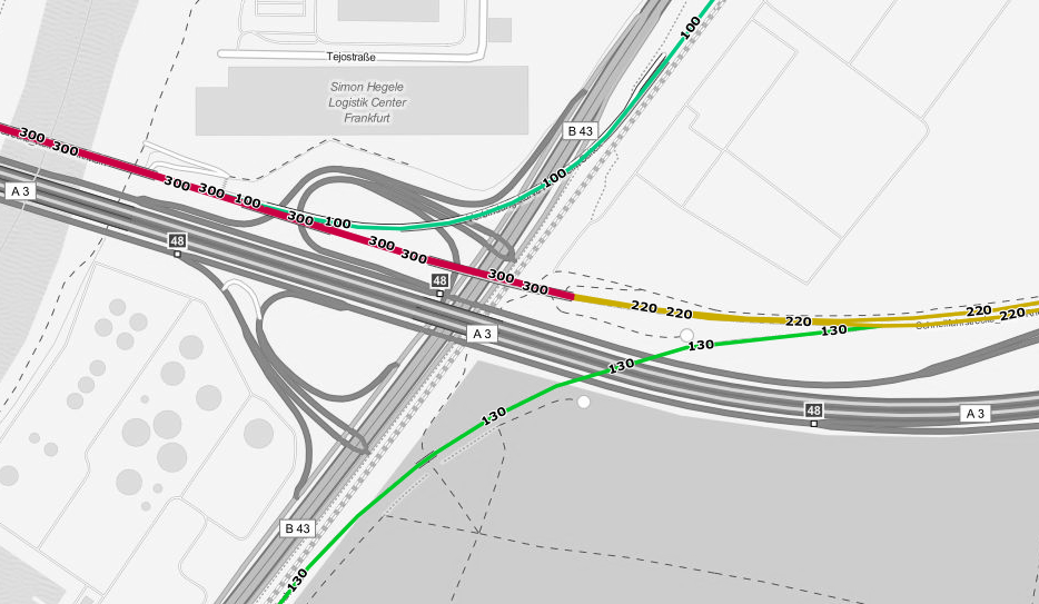
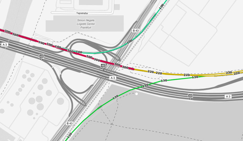
Permissible speeds at Cologne-Frankfurt high-speed railway line near Frankfurt Airport, with two connecting curves (based on the speed layer from http://www.openrailwaymap.org/?lang=de&lat=50.026290558168036&lon=8.478473424911499&zoom=16, taken on 2013-09-21).
Licensing
| Contains map data © OpenStreetMap contributors, made available under the terms of the Open Database License (ODbL).
The ODbL does not require any particular license for maps produced from ODbL data, produced maps may be subject also to other licences. |
File history
Click on a date/time to view the file as it appeared at that time.
| Date/Time | Thumbnail | Dimensions | User | Comment | |
|---|---|---|---|---|---|
| current | 11:46, 21 September 2013 | | 934 × 543 (372 KB) | Bigbug21 (talk | contribs) | Permissible speeds at Cologne-Frankfurt high-speed railway line near Frankfurt Airport, with two connecting curves (based on the speed layer from http://www.openrailwaymap.org/?lang=de&lat=50.026290558168036&lon=8.478473424911499&zoom=16, taken on 2013... |
You cannot overwrite this file.
File usage
The following 21 pages use this file:
- Cs:OpenRailwayMap
- Gl:Empregando OpenStreetMap
- Ko:Using OpenStreetMap
- List of OSM-based services
- Mr:Using OpenStreetMap
- Pl:OpenRailwayMap
- Pt:List of OSM-based services
- Tr:Using OpenStreetMap
- Uk:List of OSM-based services
- Using OpenStreetMap
- Zh-hans:Using OpenStreetMap
- DE:List of OSM-based services
- DE:OpenStreetMap benutzen
- ES:Lista de servicios basados en OSM
- ES:Usando OpenStreetMap
- NL:List of OSM-based services
- NL:OpenRailwayMap
- NL:Using OpenStreetMap
- RU:List of OSM-based services
- RU:OpenRailwayMap
- RU:Использование данных OSM