Forward & backward, left & right

|
| Description |
| Used to describe position or direction relative to a way. |
| Tags |
|
When adding details to highways or other ways, it is often important to differentiate between the direction of travel or the side of the way. To do this we define the four terms forward, backward, left and right, which all depend on the direction in which the way is drawn in OpenStreetMap.
Definition
It is important to know the difference between the terms forward / backward and left / right when they are used as tag key suffixes (or in some tag values) indicating a direction or side relative to a way.
Forward and backward
The tag values (or key suffixes) forward and backward describe a direction along a way, but not a side of the way. The code forward means the direction in which the way is drawn in OpenStreetMap, while backward means the opposite direction.
The oneway=yes tag is a good example of a direction-dependent feature: if this tag is added to a way, it becomes a one-way in the forward direction, but the oneway=-1 tag means the same way drawn in the reverse direction so that the one-way is in the backward direction.
The lanes=* tag is another good example of a direction-dependent feature: A road with several lanes can have a different number of lanes for traffic in each direction. A common case is for example lanes=3, lanes:forward=1, lanes:backward=2,
The third option both_ways is used for the lane in the middle of the road that is used in both directions (e.g. a centre turn lane). This should not be used to mean "forward and backward", as this is the default meaning of all un-suffixed keys. Under certain circumstances an additional forward or backward behind both_ways is needed.
If used as a suffix, it is placed at the end of the key but still in front of the suffix of the Conditional restrictions syntax.
Left and right
The tag values (or key suffixes) left and right describe a side of a way, but not a direction along the way. left means the left-hand side of the way when looking in the forward direction (as defined above), while right means the right-hand side also when looking in the same direction.
To explicitly mark a feature to be present on both sides of the road, both is used.
Is used as a key suffix, it is placed right after the main key, in front of all other subkeys or other suffixes.
Tagging
Note: Using forward and backward on ![]() nodes is disputed as splitting the way or connecting a crossing way at these nodes is not possible with this tagging. A better alternative is direction=* with angle or cardinal direction as value.
nodes is disputed as splitting the way or connecting a crossing way at these nodes is not possible with this tagging. A better alternative is direction=* with angle or cardinal direction as value.
As part of the key
Forward, backward, left and right are often appended as a namespace to a tag's key. This is done by adding a colon and the desired direction or side to the key.
Note: :both as suffix is used to explicitly say it applies to both side (as without it e.g. cycleway=lane might mean that there is a cycleway lane on the right side only, or on a left side only, or on both sides)
Examples include:
- maxspeed:forward=* - maximum speed which only applies in forward direction
- destination:lanes:forward=* - destination per lane in forward direction
- lanes:backward=* - number of lanes in backward direction
- change:lanes:backward=* - lane change restrictions for each lane in backward direction
- change:lanes:forward=no|not_left|not_right|no – asymmetric lane change restrictions for each lane in forward direction.
- turn:lanes:forward=* - turn indications for each lane in the forward direction
- cycleway:left=* - a cycleway on the left side of the road
- sidewalk:right:surface=* - surface of the sidewalk on the right-hand side.
- parking:both=* - a parking lane on both sides of the road
- name:left=*, name:right=* - e.g. when street name is different on the right and left side
- maxspeed:hgv:forward=* - maxspeed restriction for heavy goods vehicles in forward direction - note that direction suffix is added after main tag "maxspeed:hgv" that in itself is suffixed tag
- sidewalk:left:bicycle:backward=* - access restriction for bicycles in backward direction on the sidewalk on the left-hand side
- lanes:both_ways=1 turn:lanes:both_ways=left – centre turn lane, also known as a centre lane or two-way left turn lane
- hgv:both_ways:forward=no - rare example of access restrictions for heavy goods vehicles only in forward direction on the centre lane used for traffic in both directions.
- turn:both_ways:backward=merge_to_right - rare example of turn indication only in backward direction on the centre lane used for traffic in both directions.
As value
Forward, backward, left and right are also sometimes used as a tag's value. In this case, no additional namespace is added to the key of the tag.
Examples include:
- sidewalk=left - the side(s) of the road where sidewalks are present
- traffic_signals:direction=forward - the direction of travel affected by traffic signals
Identifying the direction of a way
iD
In iD the direction of a selected way is indicated by the triangular midpoints half way between each pair of nodes on a way (note that clicking and dragging these midpoints will add a new node to the selected way). Furthermore grey arrows are shown on the way (even when not selected) if it is tagged with a oneway=* tag. The arrow direction is the opposite of the way direction if it is tagged oneway=-1.
Potlatch 2
In Potlatch 2 the direction of a selected way is shown ...
- ... in the toolbox in the bottom right hand corner (the arrow will rotate to indicate the selected way's direction, calculated by using the first and last node, arrowhead at last node equivalent).
 In Potlatch 2 the direction of a selected way is shown in the toolbox.
 - ... if you choose the "Enhanced" map view in Potlatch 2 the direction is indicated by small, light grey arrows on the way itself. This only works if the way is tagged with key highway, railway or waterway (+ maybe also some other keys) and is currently not tagged as oneway street (reason follows).
- If ways are tagged as oneway streets then they always show bigger, grey arrows which indicate the allowed oneway direction (which is the opposite of the way direction if it is tagged
oneway=-1).
JOSM
In JOSM arrows are shown on the selected way. To show arrows for all ways, go to menu Edit → Preferences → Display Settings page → "OSM Data" tab: check "Draw Direction Arrows".
Merkaartor
In Merkaartor, you can switch way direction display between always-on, always-off, and only-oneways in the view menu.
Data view on osm.org
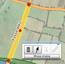
The node list of a way in the data view on osm.org is sorted with the top/first node in the list being the start/first node of the way respectively the bottom/last node in the list being the end/last node of the way. Example way data view![]() Example way data view. The data layer helps you to get to such a page.
Example way data view. The data layer helps you to get to such a page.
See also
- Category:Way Direction Dependent - Category of tags that depend on way direction
- The proposal page for ':right' and ':left' - Proposed features/right left
- Proposed features/Suffix both ways
- driving_side=* - Defines which side of the road vehicles must legally use