Key:mtb:scale
 |
| Description |
|---|
| A classification scheme for the difficulty of trails for mountainbiking. |
| Group: bicycles |
| Used on these elements |
| Requires |
|
|
| Useful combination |
| Status: approved |
| Tools for this tag |
|
mtb:scale=* provides a classification scheme for difficulty of trails suitable for mountain-biking. Since difficulty of going uphill and downhill is different for mountainbikes, mtb:scale=* applies to downhill and flat trails. Use mtb:scale:uphill=* for uphill.
Due to the subjective nature of the overall scale, this key has been criticized as lacking verifiability. This can be improved by tagging specific characteristics including surface=*, incline=*, and additional scales such as smoothness=* and tracktype=* – though these two tags are also somewhat subjective.
Applies to
Less often used with highway=cycleway and highway=footway.
How to map
The main key to be used is mtb:scale=0 to 6. This is used for classifying the level of difficulty of using a way that is generally level or downnill (no inclination). Additionally, one can tag mtb:scale:uphill=0 to 5 to specify the difficulty of cycling uphill. It is best used with incline=* key, to express the direction, steepness or both.
If a finer separation is needed than provided by the 7 classes, "+" or "-" can be added to the value. E.g. mtb:scale=1+ for ways on the upper difficulty of "1", but not yet "2".
Specific tags can be added to show the characteristics which contribute to the overall difficulty: surface=*, incline=*, smoothness=*, and tracktype=*.
Crux spots or very difficult single places
mtb:scale=* applies primarily to ways. The value should be based on the general difficulty over a longer stretch of a way.
If there are places where the difficulty is significantly higher than the way in general (e.g. one full grade), they may be mapped by placing a node on the way with the appropriate difficulty value. It is also possible to map permanent obstacles with tags such as barrier=log.
Values
The main tagging scale.
| Value | Description | Maximum gradient | STS equivalent | Example Picture |
|---|---|---|---|---|
0
|
Gravel or packed earth. No particular difficulties. Mostly forest and meadow paths (highway=path). Sections with steps, rocks, or roots are not expected. Wide curves, easy to moderate slope. No special skills are needed to ride this.
For very easy ways you can use |
- | S0 | 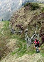
|
1
|
Smaller obstacles like roots and small stones. Erosion damage may increase difficulty. Soil may be loose in places. Tight turns, but no hairpin turns. Riding requires care and attention, but no special skill. Obstacles can be ridden over.
|
<40% (22°) | S1 | 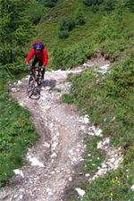
|
2
|
Obstacles such as large rocks and stones. Soil is often loose. Steps are expected. Wider hairpin turns, steepness of up to 70%. Requires some advanced riding skills.
|
<70% (35°) | S2 | 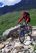
|
3
|
Many sections with large obstacles such as boulders and large roots. Many hairpin and off-balance turns. Slippery surface and talus sections may be found. The surface may be very slippery. Constant concentration and very good skills needed.
|
>70% (35°) | S3 | 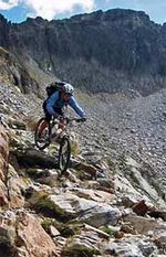
|
4
|
Very steep and difficult, with sections having large boulders and roots. Frequent loose debris. Very steep sections with very tight hairpin turns and high steps that will cause the chainring to hit the ground. Some trials techniques will be necessary.
|
>70% (35°) | S4 | 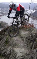
|
5
|
Very steep and difficult with big boulder fields and debris, and landslides. Speed must be carried for counter-ascents. If at all only short passages are available for accelerating and braking. Fallen trees may make very steep passages even more difficult. Very few Mountainbikers can actually ride at this level.
|
>70% (35°) | S5 | 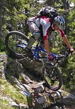
|
6
|
Classify ways with 6 that are not rideable at all for a mtbiker. E.g. Chains or stemples (metal rungs) on a via ferrata or simply unsecured alpine pathes that are not even partly rideable for the very best mtbikers (using trial techniques). Steepness is often >45°.
If used for single points, then this highlights exceptionally difficult spots. Often spotting is impossible and falling may be lethal.
|
>100% (45°) |
mtb:scale:uphill=0-5
In the case you want to be more specific about the difficulty for going uphill. Please don't forget to also use the key incline=* on such ways so that routing software can make the way oneway. Especially for mtb:scale:uphill=4 and mtb:scale:uphill=5.
| Tag | Description | Average incline | Maximum incline | Obstacles |
|---|---|---|---|---|
mtb:scale:uphill=0
|
Graveled or hardened earth. Good Grip. Usually a highway=track. Even unskilled mountainbikers can ride up here easily. Cars with good tire clearance can go down or up without problems. | <10% | <15% | None |
mtb:scale:uphill=1
|
Graveled or hardened earth. Good Grip so wheelspin (also when standing) does not happen when taking care. Steep forest track or easy to ride footpath. | <15% | <20% | Some loose objects may lay on the trail but are avoidable |
mtb:scale:uphill=2
|
Mostly stable, unsurfaced, partly washed out, steady pedalling and balance needed. With good technique and reasonable fitness this should be still doable however. | <20% | <25% | Fistsize loose rocks, roots or rocky underground |
mtb:scale:uphill=3
|
Variable Surface, tight corners, small steps, surface is rocks, earth or grass. Very good balance and steady, round pedalling needed. Without very good skills mtbikers have to push their bike uphill | <25% | <30% | Fistsize loose rocks, roots and branches or rocky surface |
mtb:scale:uphill=4
|
Way is very steep, or in bad condition for pedalling uphill. Steps, trees, roots and tight corners are present and even good and strong mountainbikers will have to push or carry their bike for parts of the way | <30% | <40% | Big loose rocks, big branches across the trail, rocky or loose surface |
mtb:scale:uphill=5
|
Way is too steep and/or difficult to ride uphill. We need this level for signalling to other mtbikers that on this part they have to push and carry the bike. | - | - | - |
Notes to Usage of the scales
Notes
- "Equivalent to STS" means equivalency to the German Singletrail-Skala v1.4 as found here [1]; upon which this scale is based.
You may also find a more in-depth description of the scale on that page, with more photos (just click on S0 to S5 in the upper bar to get more detailed descriptions and pictures for each level).
- The example photos of the STS scales are from http://www.singletrail-skala.de/ and may be reused under cc-by-sa-2 or cc-by-sa-3.
- If you click on the STS Equivalency links, you are linked to the respective difficulty grades on www.singletrail-skala.de. There are more pictures for each scale to give a better visual impression about each grade.
- Note
mtb:scale=*only applies to the technical difficulty of mountain biking on a trail. It says nothing regarding the legal situation. For trails where cycling/mountain biking is explicitly forbidden add bicycle=no. For trails where mountain biking/cycling is implicitly forbidden there is no key yet.- There was a Finnish mountain biking map MTB-kartta which advocated the use of
mtb:scale=-1to mean that either cycling was not possible or cycling was forbidden (which is better expressed as bicycle=no). The documentation of Trailmap, the successor to MTB-kartta, does not recommend the use ofmtb:scale=-1any more.
- There was a Finnish mountain biking map MTB-kartta which advocated the use of
Usage examples
If only one condition is met, the respecting scale should be used. E.g.
- a way with gradient 50% has to be tagged
mtb:scale=2or higher. Additional to signal to everyone that this way is steepmtb:scale:uphill=5is needed. - a way with loose surface possible, small roots and stones that goes flat is still
mtb:scale=1and not lowermtb:scale=0.mtb:scale:uphill=*is not needed. - a way with loose surface possible, small roots and stones that goes at an average incline of 25% is
mtb:scale=1andmtb:scale:uphill=3. This is a good example for a way that is quite easy to go down, but very difficult to go up.
mtb:scale:imba=0-4
Relation to SAC_scale for hikers
There is no one-to-one correspondence between sac_scale and mtb_scale. A relatively easy hiking trail can present a lot of difficulties for bikers (for example winding steps). Mappers should always map both based on survey if they are knowledgeable enough and when both tags are appropriate. However, for consumers like routers that want for some reason avoid too difficult trails and one of the scales is mising , some implications mostly hold:
- If you want to avoid trails that are only (and maybe even not that) passable by experienced mountain bikers, for sure ignore anything that has sac_scale of at least alpine_hiking and probably also anything that is above hiking.
- If you want to avoid trails potentially difficult for casual hikers (anything above hiking), consider ignoring anything above mtb:scale=2 or 3.
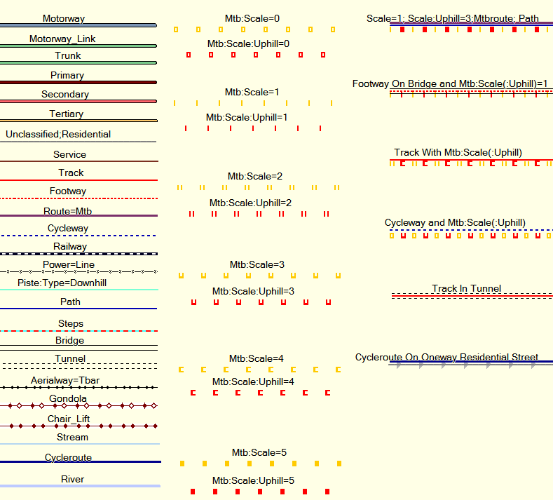
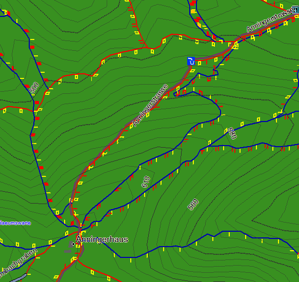
Example rendering of the mtb:scale using Garmin Mapsource
See also
- Approved features/mtb:scale
- Mountain biking – General page on how to tag ways appropriate for mountain biking.
class:bicycle=*- a classification scheme for cycling in generaldirtbike:scale=*- a classification scheme for the difficulty of trails for off-road motorcyclessac_scale=*– a classification scheme for hiking trailstrail_visibility=*– a classification scheme for trail (not route) visibility and way-finding skill requiredsmoothness=*tracktype=*surface=*incline=*
