Proposed Tagging Standard for Bangladesh
Embed tag lists in OpenStreetMap wiki
These are frequently used tags in Bangladesh. For any suggestion or query please communicate with via any recommended communication channel for a coordinated approach.
Highway Based On RHD/LGED/LGI Classification
All Tags are based on ROAD PAVMENT DESIGN MENUAL 1999, Pavement Design Catalogue 2003, Road Design Standards 2004, Road Design Standards Rural Roads 2005, Planning Guidelines for Rural Road Master Plan 2010, Maintenance Guidelines for Rural Road 2010
Easily Highway Map
OR
https://github.com/josmbd/highways_bangladesh/archive/refs/heads/main.zip
Copy this link and add presets manually.
| RHD/LGED/LGI Classification | Government Definition | OSM Tag | OSM Definition | Element | image | Map Rendering |
|---|---|---|---|---|---|---|
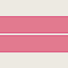
| AH | Highways connecting National capital with Divisional HQs or seaports or land ports or Asian Highway | highway=motorway | A restricted access major divided highway, normally with 2 or more running lanes plus emergency hard shoulder. Equivalent to the Freeway, Autobahn, etc. |  |
| |
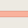
| N | Highways connecting National capital with Divisional HQs or sea ports or land ports | highway=trunk | The most important roads in a country's system that aren't motorways. (Need not necessarily be a divided highway.) |  |
| |
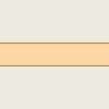
| R | Highways connecting District HQs or main river or land ports or with each other not connected by national Highways. | highway=primary | The next most important roads in a country's system. (Often link larger towns.) |  |
| |
| Z | Roads connecting District HQ/s with Upazila HQ/s or connecting one Upazila HQ to another Upazila HQ by a single main connection with National/Regional Highway, through shortest distance/ route. | highway=secondary | The next most important roads in a country's system. (Often link towns.) |  |
| |
| B,R1 |
|
highway=tertiary | The next most important roads in a country's system. (Often link smaller towns and villages) |  |
| |
| R2,R3 |
|
highway=unclassified | The least important through roads in a country's system – i.e. minor roads of a lower classification than tertiary, but which serve a purpose other than access to properties. (Often link villages and hamlets.) |  |
|
Other Most Used Highway Tags
Others road types
Building
| Key | Value | Element | Comment | Rendering | Photo | |
|---|---|---|---|---|---|---|
Tags for individual houses | ||||||
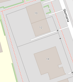
| addr:housenumber | user defined | The house number (may contain letters, dashes or other characters). Addresses describes ways to tag a single building with multiple addresses. Please do not only tag addr:housenumber=*, but also add at least addr:street=* or addr:place=* for places without streets (or map the belonging to a street with a relation using associatedStreet relation or street relation.) |
|
|||
| addr:housename | user defined | The name of a house. This is sometimes used in some countries like England, Spain, Portugal, Latvia instead of (or in addition to) a house number. |
||||
| addr:flats | user defined | The unit numbers (a range or a list) of the flats or apartments located behind a single entrance door. | 
|

| ||
| addr:conscriptionnumber | user defined | This special kind of housenumber relates to a settlement instead of a street. Conscription numbers were introduced in the Austro-Hungarian Empire and are still in use in some parts of Europe, sometimes together with street-related housenumbers which are also called orientation numbers. | ||||
| addr:street | user defined | The name of the respective street. If the street name is very long or nonexistent, the ref of the respective street. A way with highway=* or a square with place=square and the corresponding name should be found nearby. The belonging to a street can alternatively be represented by a associatedStreet relation or street relation. The keys addr:housenumber=* and addr:street=* in principle are the only necessary ones if there are valid border polygons. If you are not sure if it is so, just add addr:city=*, addr:postcode=* and addr:country=*. |
||||
| addr:place | user defined | This is part of an address which refers to the name of some territorial zone (usually a place=* like island, square or very small village) instead of a street (highway=*). Should not be used together with addr:street=*. | ||||
| addr:postcode | user defined | The postal code of the building/area. Some mappers prefer to rely on boundary=postal_code | ||||
| addr:city | user defined | The name of the city as given in postal addresses of the building/area. (In some places the city in the address corresponds to the post office that serves the area rather than the actual city, if any, in which the building is located.) Some mappers assume it can be derived from a boundary=administrative relation. | ||||
| addr:country | user defined | The ISO 3166-1 alpha-2 two letter country code in upper case. Example: "DE" for Germany, "CH" for Switzerland, "AT" for Austria, "FR" for France, "IT" for Italy. Caveat: The ISO 3166-1 code for Great Britain is "GB" and not "UK". More or less favoured in different national communities. |
||||
| addr:postbox | user defined | Use this for addressing postal service Post Office Box (PO Box, BP - Boîte Postale, CP - Case Postale, Поштански преградак, Поштански фах, Поштански претинац) as alternative to addressing using street names. Example: "PO Box 34" | ||||
| addr:full | user defined | Use this for a full-text, often multi-line, address if you find the structured address fields unsuitable for denoting the address of this particular location. Examples: "Fifth house on the left after the village oak, Smalltown, Smallcountry", or addresses using special delivery names or codes (possibly via an unrelated city name and post code), or PO Boxes. Beware that these strings can hardly be parsed by software: "1200 West Sunset Boulevard Suite 110A" is still better represented as addr:housenumber=1200 + addr:street=West Sunset Boulevard + addr:unit=110A. |
||||
For countries using hamlet, subdistrict, district, province, state, county | ||||||
| addr:hamlet | user defined | The hamlet of the object. In France, some addresses use hamlets instead of street names, use the generic addr:place instead. | ||||
| addr:suburb | user defined | If an address exists several times in a city. You have to add the name of the settlement. See Australian definition of suburb. | ||||
| addr:subdistrict | user defined | The subdistrict of the object. | ||||
| addr:district | user defined | The district of the object. | ||||
| addr:province | user defined | The province of the object. For Canada, uppercase two-letter postal abbreviations (BC, AB, ON, QC, etc.) are used. In Russia a synonym {{{key:addr:region}}} is widely used | ||||
| addr:state | user defined | The state of the object. For the US, uppercase two-letter postal abbreviations (AK, CA, HI, NY, TX, WY, etc.) are used. | ||||
| addr:county | user defined | The county of the object. | ||||
Tags for interpolation ways | ||||||
| addr:interpolation | all/even/odd/ alphabetic | How to interpolate the house numbers belonging to the way along the respective street. See detailed description. |
||||
| addr:interpolation | Number n | Every nth house between the end nodes is represented by the interpolation way. | ||||
| addr:inclusion | actual/estimate/potential | Optional tag to indicate the accuracy level of survey used to create the address interpolation way. See detailed description. |
||||
Amenity
Office
Man made
Advertising
man_made=advertising, advertising=*
Shop
Craft
Leisure
Historic
Landuse
Tourism
Boundary
Some important Tagging Issues
Proposed features Link industrial
Proposed features talk Link Talk
Proposed Tag Coming soon..
| Key | Value | Element | Description | Image |
|---|---|---|---|---|
| key=office | marriage_register | proposed |


