Tag:natural=scree
| Description |
|---|
| Unconsolidated angular stones formed by rockfall and weathering from adjacent rockfaces |
| Rendering in OSM Carto |

|
| Group: natural |
| Used on these elements |
| See also |
| Status: de facto |
| Tools for this tag |
|
Scree is an accumulation of unconsolidated angular stones. See scree on Wikipedia.
More specifically scree is formed by rockfall from adjacent rock faces and often accumulates in the form of sloped cones called talus. Scree consists of rock fragments with sharp edges that can vary in size from millimetres to meters.
Distinguish from a blockfield on Wikipedia created by volcanic or glacial activity; tagged with natural=blockfield.
Do not use this tag for loose rounded gravel on beaches or in river beds; in those cases use natural=shingle instead.
This tag is usually not used for man-made features (e.g. gravel depots, railway track ballast).
How to map
![]() To map an area of scree you can just draw a line closing on itself, marking the area of scree and tag it natural=scree. To map large scree covered areas you can use relation:multipolygon with the same tag.
To map an area of scree you can just draw a line closing on itself, marking the area of scree and tag it natural=scree. To map large scree covered areas you can use relation:multipolygon with the same tag.
The rock face above the scree deposit can be mapped using natural=bare_rock or natural=cliff.
Examples
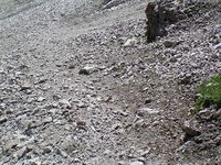
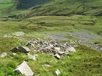
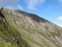
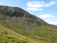
Various screes above the Nant Ffrancon valley in North Wales, showing that scale and location of screes are dependant on the rock from which they are formed.
Rendering
Currently rendered in OSM Carto in bright gray-brown colour with a dot pattern at high zoom levels.
See also
- natural=blockfield
- natural=shingle
- natural=bare_rock
- natural=sand
- natural=cliff
- hazard=falling_rocks for signposted falling rocks hazards
| ||||||||||||||||||||||||||||||||


