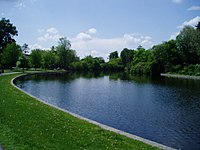
Tag:water=pond
Jump to navigation
Jump to search
| Description |
|---|
| A small body of standing water, man-made in most cases |
| Group: water |
| Used on these elements |
| Requires |
| Useful combination |
|
| See also |
| Status: approved |
| Tools for this tag |
|
A pond: a body of standing water, man-made in most cases, that is usually smaller than a water=lake.
This tag is non-specific. Check if there is another more specific tag which could be used instead:
- Natural or semi-natural areas of still water are usually tagged with water=lake or water=oxbow
- Salt evaporation ponds should be tagged with landuse=salt_pond
- Other evaporation ponds should be tagged with basin=evaporation
- Open-air man-made swimming pools are tagged with leisure=swimming_pool
- Artificial lakes and ponds are also tagged with water=reservoir if they are formed by a dam across a valley or natural depression
- water=basin and landuse=basin are used for an area of land artificially graded to hold water
- water=reflecting_pool - a water feature found in gardens, parks, and at memorial sites which consists of a shallow pool of water, undisturbed by fountain jets, for a calm reflective surface.
- water=wastewater - A clarifier/settling basin of a wastewater treatment plant.
- water=fountain - the water area of a decorative or recreational fountain.
How to map
Draw the outline ![]() of the pond and add natural=water + water=pond.
of the pond and add natural=water + water=pond.
Very small pond can be mapped with a node ![]() .
.
