Template:Da:Map Features:natural
Jump to navigation
Jump to search
Natur (natural)
Anvendes til at beskrive fysiske landskabsfeatures inklusivt de, som er ændret af menneskelig aktivitet. Se Natural for en introduktion.
| Nøgle(key) | Værdi | Element | Kommentar | Rendering | Foto |
|---|---|---|---|---|---|
Vegetation | |||||
| natural | fell | Habitat above the tree line covered with grass, dwarf shrubs and mosses. | No, see #545. | ||
| natural | grassland | Græsland, naturligt græsdækket område. | |||
| natural | heath | Hede, område bevokset med lyng eller andre lave buske. | |||
| natural | moor | Don't use, see wikipage. Upland areas, characterised by low-growing vegetation on acidic soils. | currently not rendered by OSM Carto | ||
| natural | scrub | Krat, område bevokset med buske eller lave træer. | |||
| natural | shrubbery | An area of shrubbery that is actively maintained or pruned by humans. A slightly wilder look is also possible | currently not rendered by OSM Carto | ||
| natural | tree | Træ, især markant eller fritstående træ. | |||
| natural | tree_row | A line of trees. | |||
| natural | tree_stump | A tree stump, the remains of a cut down or broken tree. | |||
| natural | tundra | Habitat above tree line in alpine and subpolar regions, principally covered with uncultivated grass, low growing shrubs and mosses and sometimes grazed. | |||
| natural | wood | Naturlig skov, urskov, skov, der ikke plejes af mennesker. For plejet skov, se landuse=forest. | |||
|
| |||||
| natural | bay | Bugt. | |||
| natural | beach | Strand, sand-, grus- eller stendækket område ved kysten. | |||
| natural | blowhole | An opening to a sea cave which has grown landwards resulting in blasts of water from the opening due to the wave action | |||
| natural | cape | A piece of elevated land sticking out into the sea or large lake. Includes capes, heads, headlands and (water) promontories. | |||
| natural | coastline | Kystlinie. Skal tegnes med uret omkring vand og mod uret omkring land, dvs land til venstre og vand til højre. Som eneste undtagelse behøver kystlinier ikke at danne en lukket polygon, de skal bare at være forbundet med hinanden, enden af en linie til starten af den næste, således at linierne tilsammen danner en lukket polygon. | |||
| natural | crevasse | A large crack in a glacier | |||
| natural | geyser | A spring characterized by intermittent discharge of water ejected turbulently and accompanied by steam. | |||
| natural | glacier | Gletcher, Bræ, Indlandsis, permanent isdækket land. | |||
| natural | hot_spring | A spring of geothermally heated groundwater | |||
| natural | isthmus | A narrow strip of land, bordered by water on both sides and connecting two larger land masses. | |||
| natural | mud | Mudder. | |||
| natural | peninsula | A piece of land projecting into water from a larger land mass, nearly surrounded by water | |||
| natural | reef | A feature (rock, sandbar, coral, etc) lying beneath the surface of the water | |||
| natural | shingle | An accumulation of rounded rock fragments on a beach or riverbed | |||
| natural | shoal | An area of the sea floor near the sea surface (literally, becomes shallow) and exposed at low tide. See natural=sand as well. | |||
| natural | spring | Kilde, et sted hvor grundvandet naturligt kommer til overfladen | |||
| natural | strait | A narrow area of water surrounded by land on two sides and by water on two other sides. | |||
| natural | water | Sø eller anden vandflade. For brede vandløb se waterway=riverbank. | |||
| natural | wetland | Vådområde, typen kan angives med wetland=*. | |||
|
| |||||
| natural | arch | A rock arch naturally formed by erosion, with an opening underneath. | currently not rendered by OSM Carto | ||
| natural | arete | An arête, a thin, almost knife-like, ridge of rock which is typically formed when two glaciers erode parallel U-shaped valleys. | |||
| natural | bare_rock | An area with sparse/no soil or vegetation, so that the bedrock becomes visible. | |||
| natural | blockfield | A surface covered with boulders or block-sized rocks, usually the result of volcanic activity or associated with alpine and subpolar climates and ice ages. | Currently not rendered by OSM Carto | ||
| natural | cave_entrance | Huleindgang. | |||
| natural | cliff | Klippevæg, klint, hvis klinten tegnes som en linie, skal toppen af klinten være til venstre og bunden til højre set i liniens retning. | |||
| natural | dune | A hill of sand formed by wind, covered with no or very little vegetation. See also natural=sand and natural=beach | currently not rendered by OSM Carto | ||
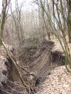
| natural | earth_bank | Large erosion gully or steep earth bank | |||
| natural | fumarole | A fumarole is an opening in a planet's crust, which emits steam and gases | |||
| natural | gully | Small scale cut in relief created by water erosion | |||
| natural | hill | A hill. | currently not rendered by OSM Carto | ||
| natural | peak | Bjergtop, bakketop. | |||
| natural | ridge | A mountain or hill linear landform with a continuous elevated crest | |||
| natural | rock | A notable rock or group of rocks attached to the underlying bedrock. | currently not rendered by OSM Carto | ||
| natural | saddle | The lowest point along a ridge or between two mountain tops | |||
| natural | sand | Sand, sanddækket område uden eller kun med ubetydelig bevoksning. Se også natural=beach. | |||
| natural | scree | Urer, område med løs klippe, ofte nedenfor stejle bjergsider. | |||
| natural | sinkhole | A natural depression or hole in the surface topography. | currently not rendered by OSM Carto | ||
| natural | stone | Fritstående sten, f.eks. kampesten efterladt efter istiden. | currently not rendered by OSM Carto | ||
| natural | valley | A natural depression flanked by ridges or ranges of mountains or hills | currently not rendered by OSM Carto | ||
| natural | volcano | Vulkan, enten slumrende, udslugt eller aktiv. | |||
| natural | user defined | Se Taginfo[1] siden for andre ofte anvendte værdier | |||
This table is a wiki template with a default description in English. Editable here.

