Arkansas/PAgis
< Arkansas
Pulaski Area Geographic Information System is an independent government agency specializing in the acquisition, maintenance and distribution of GIS related data within Pulaski County, Arkansas. It shares several GIS datasets with Arkansas GIS Office.
License
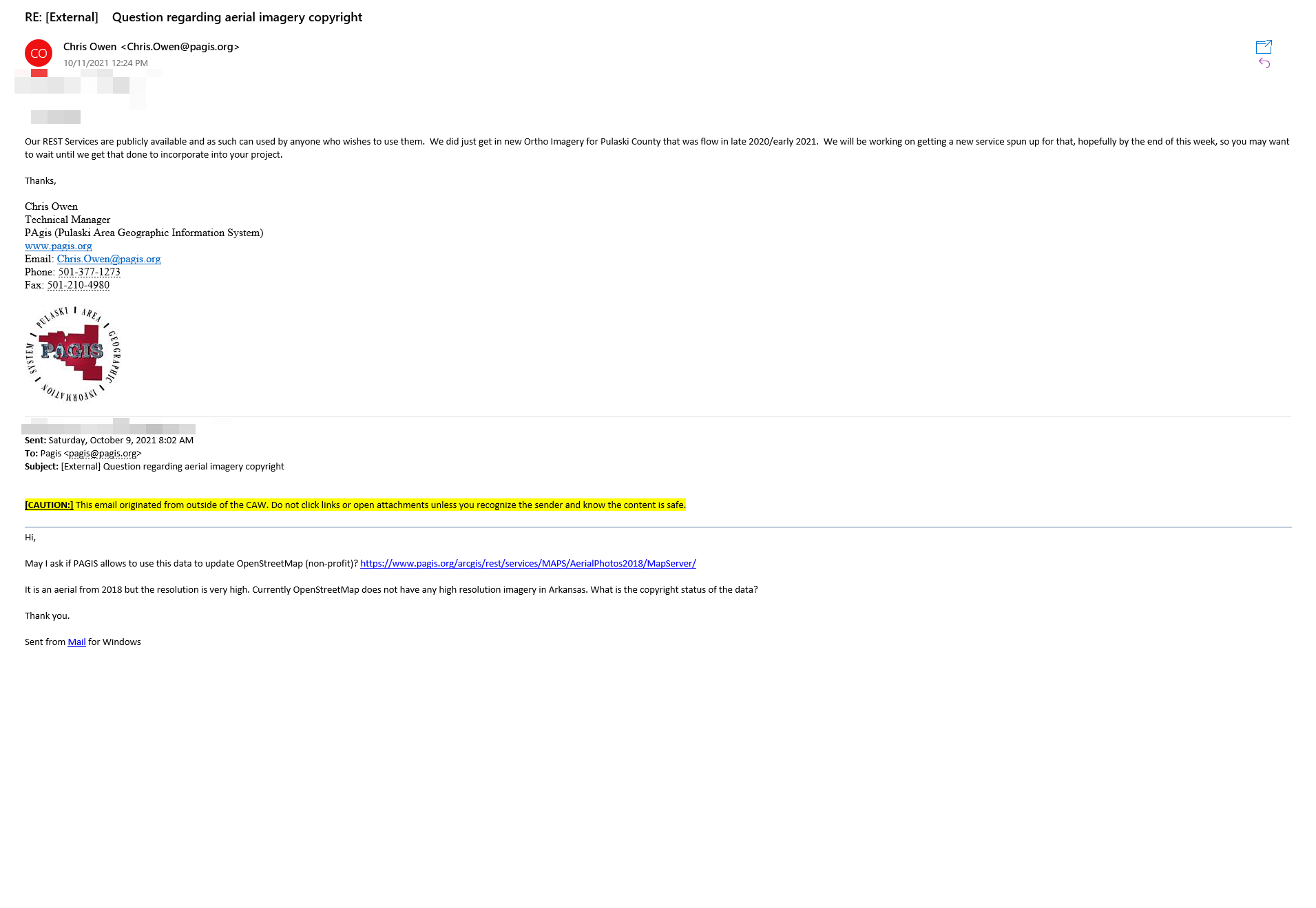
PAgis Technical Manager Chris Owen has approved the imagery usage in OpenStreetMap. A proof has been obtained and uploaded to the OpenStreetMap Wiki. 
Usage
If you wish to use PAgis aerial imagery out of iD, please follow the instruction at https://github.com/osmlab/editor-layer-index.