Category:OSM Carto screenshots
Jump to navigation
Jump to search
Screenshots of OpenStreetMap data in OSM Carto style.
Please add new files to this category using {{OSM Carto screenshot}} template.
Use {{OSM Carto screenshot||old_license}} for maps uploaded before September 12, 2012 (adds CC-BY-SA-2.0 license instead of ODbL)
See also: Category:OSM Carto icons, Category:OSM Carto rendering examples
Subcategories
This category has the following 2 subcategories, out of 2 total.
A
- Animated OSM Carto screenshots (123 F)
Media in category "OSM Carto screenshots"
The following 200 files are in this category, out of 589 total.
(previous page) (next page)-
 1b.png 1,463 × 870; 566 KB
-
 2013-08-07-crema.png 1,170 × 750; 0 bytes
-
 2013-08-13Chongqing South Road.jpg 429 × 676; 70 KB
-
 20131028 akabane.png 2,103 × 1,374; 1.05 MB
-
 20150823 000-jazheng.png 1,630 × 847; 495 KB
-
 20150823 000-Zhongho-POI.png 1,631 × 836; 789 KB
-
 2016-05-30 Karte Oppingen.PNG 1,258 × 1,133; 202 KB
-
 2019-02-23 100228 Lisboa.png 1,198 × 1,128; 1.52 MB
-
 20190706Inamuragasaki.jpg 1,181 × 787; 171 KB
-
 20190706kamakura.jpg 1,181 × 787; 250 KB
-
 20190802kamakura.jpg 1,181 × 787; 325 KB
-
 20190802namuragasaki.jpg 1,181 × 787; 213 KB
-
 2019nagasaki.jpg 729 × 438; 40 KB
-
 2022-12-17-mapping party Reezekne RTA.png 613 × 265; 143 KB
-
 2023-11-07 OSM Rīgā, norises vieta.png 283 × 315; 67 KB
-
 21-03.jpg 818 × 543; 61 KB
-
 25kv-substation-mapnik.png 286 × 285; 14 KB
-
 2a.png 291 × 145; 31 KB
-
 2b.png 293 × 173; 21 KB
-
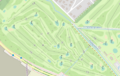
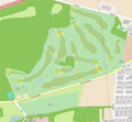
 3 golf courses.png 729 × 447; 287 KB
-
 380kv-bleiswijk-mapnik.png 279 × 187; 13 KB
-
 3a.png 1,456 × 778; 809 KB
-
 3b.png 1,457 × 863; 557 KB
-
 4a.png 293 × 138; 30 KB
-
 4b.png 296 × 174; 22 KB
-
 6a.png 299 × 158; 32 KB
-
 700nagasaki01.jpg 700 × 902; 112 KB
-
 Abzweig Mainz-Hechstheim-Ost.png 969 × 543; 156 KB
-
 Accuracy vs existing housing traces.png 1,885 × 1,204; 738 KB
-
 Addr-housenumber rendering.png 280 × 316; 29 KB
-
 Addr-street rendering.png 219 × 172; 19 KB
-
 Address import tool Flanders 2014-11.png 704 × 694; 299 KB
-
 After 0202.png 470 × 577; 122 KB
-
 After hibara10.png 1,000 × 606; 90 KB
-
 After hibara11.png 1,000 × 606; 74 KB
-
 After Mapping Kuningan.png 381 × 256; 52 KB
-
 After numazu 20140524.png 1,148 × 705; 436 KB
-
 Afterdigi1.png 266 × 356; 76 KB
-
 Afterdigi2.png 946 × 379; 141 KB
-
 Airports-dense.png 1,097 × 528; 673 KB
-
 Aizu higashiyama02.png 1,150 × 774; 108 KB
-
 Aizuiimori.png 1,000 × 745; 164 KB
-
 Aizust mapnik.png 1,236 × 822; 204 KB
-
 Alexander-archipelago.png 803 × 845; 173 KB
-
 AlmaRoadRedevelopment.png 647 × 901; 502 KB
-
 Angra ESJEdA.png 388 × 325; 82 KB
-
 Ankara 3D.png 1,145 × 889; 266 KB
-
 Anzob after base mapping.png 1,872 × 903; 239 KB
-
 Anzob before.png 1,872 × 913; 167 KB
-
 Archive-Carte-GE-Centre-2019.png 4,014 × 2,402; 13.55 MB
-
 Area highway intersection example.png 1,680 × 738; 407 KB
-
 Arizona.png 726 × 731; 131 KB
-
 Artuch after base mapping.png 1,872 × 903; 601 KB
-
 Artuch before.png 1,872 × 913; 393 KB
-
 Atlas-4h75e2ag Page 30.jpg 10,087 × 7,133; 2 MB
-
 Auloh alt.png 1,145 × 933; 287 KB
-
 Auloh neu.png 1,154 × 944; 397 KB
-
 Autoestrada Render Exemplo.png 1,369 × 868; 154 KB
-
 Averitt Express Map.PNG 455 × 448; 54 KB
-
 Ayuthaya map.png 1,634 × 1,296; 599 KB
-
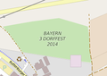 B3DorffestAltdorf2014.png 280 × 198; 19 KB
-
 Baclaran and Pasay Rotunda - in Standard map layer.png 431 × 446; 331 KB
-
 Bad-import.png 1,526 × 986; 143 KB
-
 Ballart border.jpg 3,507 × 2,480; 805 KB
-
 Barbara-channel-openstreetmap-carto-current.png 518 × 373; 112 KB
-
 Bare rock osm.jpg 549 × 394; 35 KB
-
 Barrier hedge on area.png 455 × 398; 49 KB
-
 Baustelle Kita Schneckenhaus.png 648 × 412; 47 KB
-
 Bb better geometry 11.png 944 × 335; 17 KB
-
 Beach osm.jpg 866 × 637; 88 KB
-
 Beandrarezona residential area.png 562 × 517; 853 KB
-
 Before hibara7.png 1,000 × 606; 65 KB
-
 Before Mapping Kuningan.png 383 × 242; 43 KB
-
 Before numazu 20140524.png 1,222 × 762; 470 KB
-
 Belgium - 20161221T1459.png 796 × 623; 1,011 KB
-
 Bendigo border.jpg 3,507 × 2,480; 701 KB
-
 Bildschirmfoto 2018-12-05 12-25-59.png 299 × 208; 19 KB
-
 Blooddonation possible rendering.png 1,200 × 900; 372 KB
-
 Bogota ParqueMetropolitanoSimonBolivar natural tree.png 1,055 × 850; 732 KB
-
 Bossons.png 1,342 × 1,922; 224 KB
-
 Brandenburg 2014-12-10T11.29.46.png 692 × 770; 276 KB
-
 Brandenburg 2014-12-19T11.30.06.png 1,116 × 1,250; 746 KB
-
 Bricklayers' Arms Subways.png 640 × 480; 302 KB
-
 Bridge outline render.jpg 439 × 488; 42 KB
-
 Brigade de gendarmerie nationale française.JPG 632 × 572; 48 KB
-
 Brownfields, 400-600 East Biddle Street, Baltimore, MD, USA.png 611 × 332; 101 KB
-
 BSB-10-2015-After.jpg 933 × 572; 98 KB
-
 BSB-10-2015-Before.jpg 933 × 572; 74 KB
-
 Building-in-water.png 480 × 281; 45 KB
-
 Buildings and parcels.png 1,063 × 644; 168 KB
-
 Busway Parkway Ramp.png 728 × 667; 211 KB
-
 California.png 573 × 606; 126 KB
-
 CaliforniaRoundabout.png 939 × 609; 140 KB
-
 Camouflage mapping.png 930 × 901; 416 KB
-
 Canberra border.jpg 3,507 × 2,480; 871 KB
-
 CAPT NICE-tourisme 2018-10.jpg 1,950 × 1,355; 615 KB
-
 Captura OSM arbol.png 354 × 355; 17 KB
-
 Captura OSM arbol2.png 421 × 431; 7 KB
-
 Captura OSM namecorrecto1.png 463 × 429; 15 KB
-
 Captura OSM namecorrecto2.png 449 × 482; 21 KB
-
 Captura OSM nameincorrecto1.png 478 × 488; 35 KB
-
 Captura OSM nameincorrecto2.png 751 × 549; 27 KB
-
 Captura OSM nombre incorrecto.png 359 × 338; 69 KB
-
 Captura OSM nombre incorrecto2.png 446 × 481; 180 KB
-
 Captura OSM Parque.png 766 × 541; 46 KB
-
 Captura OSM parque2.png 515 × 458; 83 KB
-
 Capture d'écran du WebSIG des DRC, EV4.png 923 × 572; 429 KB
-
 Carto screenshot of footway=link in use.png 339 × 245; 105 KB
-
 Cemetery osm.jpg 1,875 × 1,540; 166 KB
-
 Chern15-130426.png 1,280 × 768; 614 KB
-
 Chern15-130603.png 1,280 × 768; 627 KB
-
 Chicago, Zoom 11, 20201109.png 1,366 × 768; 1.14 MB
-
 Chicago.png 749 × 781; 679 KB
-
 Chil-Dukhtaron after base mapping.png 1,872 × 903; 231 KB
-
 Chil-Dukhtaron before.png 1,872 × 913; 152 KB
-
 Chongqing South Road 20130908.png 420 × 642; 92 KB
-
 Chungho20130330.png 497 × 572; 100 KB
-
 Chungho4park.svg 674 × 759; 470 KB
-
 Ciudad de Victoria 07262014.png 1,280 × 1,024; 281 KB
-
 Cles - Default Map Style.png 500 × 500; 63 KB
-
 Commercial osm.jpg 1,279 × 1,107; 101 KB
-
 Dale-swamp.png 833 × 769; 260 KB
-
 Darmstadt, Halt Berliner Allee - Carto.png 768 × 441; 124 KB
-
 Derby Avenue with false maxspeed 100.png 3,833 × 1,902; 1.7 MB
-
 DetailedMapOfUzice.png 973 × 825; 839 KB
-
 Doublewayrail.png 578 × 476; 89 KB
-
 Doublewaytram.png 829 × 460; 145 KB
-
 Dr-Georg-Frank-Altenhilfe-Stiftung.png 1,024 × 768; 216 KB
-
 Durres 03.01.2013 .png 602 × 672; 230 KB
-
 E Biddle St Brownfields OSM Carto.png 1,441 × 713; 441 KB
-
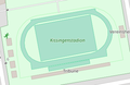
 Ecological district 2012.png 696 × 676; 199 KB
-
 Elbasan 03.01.2013 .png 600 × 669; 226 KB
-
 ERA render example.png 532 × 511; 117 KB
-
 Estrada Nacional Render Exemplo.png 978 × 833; 141 KB
-
 Examination-Yuan-20131015 .png 486 × 251; 30 KB
-
 Examination-yuan-and-temple-20131111.png 877 × 530; 151 KB
-
 Example dog park.png 250 × 250; 21 KB
-
 Example golf hole Carto.png 484 × 307; 161 KB
-
 Example golf hole.jpg 479 × 302; 47 KB
-
 Example leisure track.png 334 × 217; 23 KB
-
 Example render highway motorway.jpeg 762 × 580; 34 KB
-
 Example render highway primary.jpeg 797 × 503; 41 KB
-
 Example render highway secondary.jpeg 787 × 648; 26 KB
-
 Example render highway tertiary.jpeg 627 × 393; 25 KB
-
 Example render highway trunk.jpeg 623 × 818; 38 KB
-
 Example rendering of parking spaces on openstreetmap.org.png 611 × 412; 79 KB
-
 Example Secondary link 03.jpg 156 × 212; 9 KB
-
 Example summer toboggan.jpg 221 × 179; 9 KB
-
 Example-highway link.png 125 × 125; 28 KB
-
 Example-highway pedestrian.png 125 × 125; 33 KB
-
 Example2-S58.png 748 × 578; 136 KB
-
 ExampleHotel.png 200 × 200; 12 KB
-
 F3DBbridgeOldApproach.JPG 1,585 × 495; 372 KB
-
 Falls church before.png 738 × 483; 294 KB
-
 Farmland mapnik 51.00 14.16.png 240 × 240; 17 KB
-
 Ferry terminal mapnik.png 384 × 326; 39 KB
-
 Fier 03.01.2013 .png 597 × 666; 194 KB
-
 Firefox 9lEQPRuT0H.png 862 × 576; 165 KB
-
 Fix1.png 337 × 583; 21 KB
-
 Flyover.jpg 629 × 612; 76 KB
-
 Fongshan premapping.png 1,090 × 672; 194 KB
-
 Forest grassland.png 338 × 296; 28 KB
-
 Forest human readable parcel.png 378 × 424; 91 KB
-
 Forest name ref.png 499 × 288; 65 KB
-
 Forest swamp.png 345 × 340; 50 KB
-
 Frontage road example 1.png 462 × 276; 53 KB
-
 Frontage road example 2.png 544 × 353; 71 KB
-
 Frontage road example 3.png 448 × 275; 49 KB
-
 Frontage road example 4.png 245 × 423; 24 KB
-
 Fukuyama mp 20120401.jpg 1,024 × 768; 358 KB
-
 Furtmühle.png 513 × 322; 33 KB
-
 Gandaria Dhaka.png 1,709 × 2,319; 2.63 MB
-
 Gardens of Ludwigsburg Palace.png 1,264 × 840; 358 KB
-
 Gare et abords.png 876 × 766; 173 KB
-
 Ghazza after base mapping.png 1,872 × 903; 340 KB
-
 Ghazza before.png 1,872 × 913; 224 KB
-
 Gjirokaster 03.01.2013 .png 591 × 659; 124 KB
-
 Gliwice Wschód.png 768 × 768; 337 KB
-
 Gold Coast border.jpg 3,507 × 2,480; 666 KB
-
 Golf cartpaths.png 473 × 331; 17 KB
-
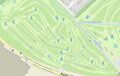
 Golfclub Leitershofen.png 1,082 × 1,000; 331 KB
-
 Good-import.png 1,526 × 986; 165 KB
-
 Grassland osm.jpg 1,598 × 1,209; 107 KB
-
 Hakimi after base mapping.png 1,872 × 903; 194 KB
-
 Hakimi before.png 1,872 × 913; 101 KB
-
 Hamilton border.jpg 3,507 × 2,480; 783 KB
-
 Harpoon-brewery.png 278 × 388; 31 KB
-
 Hartford-forests.png 794 × 571; 104 KB
-
 Harz Mountains.png 371 × 373; 74 KB
-
 Hausnummern in name tag.png 495 × 411; 33 KB
-
 Healthamenity-type-osm-germany.png 2,608 × 1,656; 1.32 MB
-
 Healthcare=* rendering in Carto..png 2,278 × 882; 1.57 MB
-
 Hermelijnvlinderdijk.png 1,060 × 699; 191 KB
-
 Highway=busway in z19.jpg 1,280 × 700; 81 KB
-
 Highway=proposed across Bering Strait.png 622 × 465; 59 KB
-
 Highway=service + access=no + bus=designated in z18.jpg 1,280 × 841; 124 KB
-
 Hong-Kong-en-zh-223.png 256 × 256; 20 KB
-
 Hong-Kong-Zh-En.png 238 × 180; 56 KB
-
 Housenumber-karlsruhe-de.png 470 × 458; 98 KB
-
 Hualian mapping before.png 1,040 × 1,040; 291 KB


