Category:OSM Carto rendering examples
Jump to navigation
Jump to search
Rendering examples in OSM Carto style.
This category is for simple geometric shapes having no (or almost no) data from OSM contributors. Most of them are used in infoboxes.
Please add new files to this category using {{OSM Carto example}} template.
See also: Category:OSM Carto icons, Category:OSM Carto screenshots
Subcategories
This category has only the following subcategory.
O
Media in category "OSM Carto rendering examples"
The following 200 files are in this category, out of 291 total.
(previous page) (next page)-
 62719.png 130 × 30; 2 KB
-
 Aerialway gondola render.png 125 × 125; 580 bytes
-
 Aerialway goods.png 125 × 125; 409 bytes
-
 Airstrips rendered identically to aerodromes.png 1,468 × 1,302; 292 KB
-
 Area amenity=place of worship.png 125 × 125; 388 bytes
-
 Area amenity=prison.png 125 × 125; 270 bytes
-
 Area building=yes.png 125 × 125; 276 bytes
-
 Area golf minigolf.png 125 × 125; 356 bytes
-
 Area leisure=playground.png 125 × 125; 302 bytes
-
 Area military equals danger area.png 125 × 125; 537 bytes
-
 Area parking.png 125 × 125; 400 bytes
-
 Area police fire station.png 125 × 125; 388 bytes
-
 Area power.png 125 × 125; 303 bytes
-
 Area tourism=campsite.png 125 × 125; 356 bytes
-
 Area tourism=zoo.png 125 × 125; 6 KB
-
 Area transportation.png 125 × 125; 407 bytes
-
 Bare rock-125.png 125 × 125; 24 KB
-
 Barrier fence mapnik.png 125 × 125; 342 bytes
-
 Barrier hedge.png 125 × 125; 343 bytes
-
 Base layer land.png 125 × 125; 97 bytes
-
 Base layer water.png 125 × 125; 150 bytes
-
 Boundary aboriginal lands.png 125 × 125; 2 KB
-
 Carto entrance main.png 100 × 100; 1 KB
-
 Carto entrance service.png 100 × 100; 7 KB
-
 Carto entrance yes access no.png 100 × 100; 1 KB
-
 Carto entrance yes access yes.png 100 × 100; 2 KB
-
 Carto entrance yes.png 100 × 100; 1,000 bytes
-
 Chair-lift-rendering.png 125 × 125; 426 bytes
-
 City-wall-render-eg1.png 125 × 125; 340 bytes
-
 Cliff sample1 render.png 514 × 388; 12 KB
-
 Cliff sample2 render.png 229 × 197; 15 KB
-
 Cliff2.png 78 × 16; 2 KB
-
 Cutline map.png 150 × 100; 5 KB
-
 Cycleway mapnik.png 300 × 300; 9 KB
-
 Cycleway osm.png 100 × 75; 1 KB
-
 Dam area 100.png 100 × 100; 308 bytes
-
 Example aerialway station.png 125 × 125; 5 KB
-
 Example fjord.png 392 × 218; 24 KB
-
 Example peninsula.png 205 × 201; 7 KB
-
 Example sport center swimming.png 100 × 100; 5 KB
-
 Example swimming pool.png 100 × 75; 4 KB
-
 Example-highway footway.png 125 × 125; 27 KB
-
 Example-highway path.png 125 × 125; 23 KB
-
 Example-highway service.png 125 × 125; 28 KB
-
 Example-highway track.png 125 × 125; 22 KB
-
 Garages-area.png 125 × 125; 302 bytes
-
 Glacier-area.png 125 × 125; 300 bytes
-
 Golf-rough.png 126 × 126; 3 KB
-
 Hedge-rendering.png 253 × 250; 2 KB
-
 Hedgeonmap.png 223 × 375; 16 KB
-
 Highway living street area.png 125 × 125; 382 bytes
-
 Highway pedestrian footway path area.png 125 × 125; 387 bytes
-
 Highway service residential unclassified area.png 125 × 125; 381 bytes
-
 Highway track area.png 125 × 125; 389 bytes
-
 Highway track.png 96 × 69; 3 KB
-
 Highway=raceway mapnik.png 200 × 200; 2 KB
-
 Landuse cemetery christian.png 125 × 125; 432 bytes
-
 Landuse cemetery jewish.png 125 × 125; 627 bytes
-
 Landuse grass.png 125 × 125; 357 bytes
-
 Landuse plant nursery.png 125 × 125; 440 bytes
-
 Landuse-allotments.png 125 × 125; 487 bytes
-
 Landuse-cemetery muslim.png 125 × 125; 659 bytes
-
 Landuse-cemetery.png 125 × 125; 461 bytes
-
 Landuse-commercial.png 125 × 125; 2 KB
-
 Landuse-flowerbed.png 125 × 125; 7 KB
-
 Landuse-forest.png 125 × 125; 4 KB
-
 Landuse-industrial.png 125 × 125; 2 KB
-
 Landuse-recreation ground.png 125 × 125; 302 bytes
-
 Landuse-retail.png 125 × 125; 2 KB
-
 Landuse-vineyard.png 125 × 125; 2 KB
-
 Leaftype broadleaved.png 125 × 125; 1 KB
-
 Leaftype leafless.png 125 × 125; 828 bytes
-
 Leaftype mixed.png 125 × 125; 1 KB
-
 Leaftype needleleaved.png 125 × 125; 1 KB
-
 Leisure dog park 100.png 100 × 100; 1 KB
-
 Leisure ice rink 100.png 100 × 100; 1 KB
-
 Lineas-VE-01.png 883 × 460; 13 KB
-
 Living street osm.png 125 × 125; 2 KB
-
 Man made embankment.jpg 200 × 200; 6 KB
-
 Man made embankment.png 125 × 125; 515 bytes
-
 Mapnik-Motorway-Junction.png 242 × 218; 9 KB
-
 Mapnik-tracktype-grade1.png 100 × 75; 1 KB
-
 Mapnik-tracktype-grade2.png 100 × 75; 2 KB
-
 Mapnik-tracktype-grade3.png 100 × 75; 2 KB
-
 Mapnik-tracktype-grade4.png 100 × 75; 1 KB
-
 Mapnik-tracktype-grade5.png 100 × 75; 1 KB
-
 Mapnik-tracktype-not-set.png 100 × 75; 1 KB
-
 Mapping-Features-Mini-Roundabout.png 100 × 75; 2 KB
-
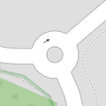 Mapping-Features-Roundabout-Simple.png 178 × 178; 6 KB
-
 Mapping-Features-Turning-Circle.png 100 × 75; 980 bytes
-
 Mini-railway-mapnik.png 125 × 40; 2 KB
-
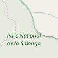 National park.png 125 × 125; 7 KB
-
 Natural cliff-125.png 125 × 125; 588 bytes
-
 Natural reef-100.png 100 × 100; 4 KB
-
 Natural wetland bog-125.png 125 × 125; 2 KB
-
 Natural wetland mangrove-125.png 125 × 125; 3 KB
-
 Natural wetland marsh-125.png 125 × 125; 3 KB
-
 Natural wetland reed-125.png 125 × 125; 4 KB
-
 Natural wetland saltern.png 100 × 100; 775 bytes
-
 Natural wetland saltmarsh.png 100 × 100; 9 KB
-
 Natural wetland swamp-125.png 125 × 125; 2 KB
-
 Natural wetland water.png 100 × 100; 780 bytes
-
 Natural-arete-125.png 125 × 125; 2 KB
-
 Natural-Grassland.png 125 × 125; 389 bytes
-
 Natural-ridge-125.png 125 × 125; 2 KB
-
 Natural-scrub 100.png 100 × 100; 767 bytes
-
 Orchard.png 125 × 125; 2 KB
-
 OSM Barrier stile.jpg 492 × 388; 12 KB
-
 OSM Duong bac thang.PNG 105 × 46; 3 KB
-
 OSM Duong dat.PNG 117 × 44; 3 KB
-
 OSM Duong di bo.PNG 115 × 49; 4 KB
-
 OSM Duong hem.PNG 151 × 66; 11 KB
-
 OSM Duong huyen.PNG 135 × 58; 4 KB
-
 OSM Duong mon.PNG 137 × 60; 4 KB
-
 OSM Duong pho.PNG 134 × 57; 6 KB
-
 OSM Duong thon.PNG 159 × 51; 4 KB
-
 OSM Duong tinh.PNG 131 × 52; 3 KB
-
 OSM Duong xa.PNG 139 × 49; 3 KB
-
 OSM Duong xe dap.PNG 105 × 44; 4 KB
-
 OSM Pho di bo.PNG 130 × 49; 3 KB
-
 OSM Pho sinh hoat.PNG 112 × 53; 2 KB
-
 OSM rendering entrances.svg 44 × 8; 3 KB
-
 OSM-AntenasVE-01.png 149 × 135; 4 KB
-
 OSM-VE level 4.png 125 × 125; 23 KB
-
 OSM-VE level 6.png 125 × 125; 21 KB
-
 OSM-VE level 7.png 125 × 125; 21 KB
-
 OSM-VE level 8.png 125 × 125; 21 KB
-
 Osmarender-apron.png 125 × 125; 387 bytes
-
 Osmose-eg-error-1050.png 245 × 244; 20 KB
-
 Path osm.png 100 × 75; 1 KB
-
 Peak.png 80 × 40; 762 bytes
-
 Pedestrian with area osm.png 125 × 125; 2 KB
-
 Place of worship area.png 125 × 125; 150 bytes
-
 Power line.png 125 × 125; 348 bytes
-
 Power minor line.png 125 × 125; 342 bytes
-
 Power-tower mapnik.png 100 × 86; 1 KB
-
 Render weir2.jpg 204 × 188; 7 KB
-
 Rendering admin level 2.png 201 × 168; 3 KB
-
 Rendering natural tree row.png 178 × 120; 4 KB
-
 Rendering order in openstreetmap-carto.png 502 × 309; 13 KB
-
 Rendering railway.jpg 397 × 317; 13 KB
-
 Rendering security guard building.png 166 × 159; 7 KB
-
 Rendering security office building.png 169 × 164; 6 KB
-
 Rendering security office node.png 85 × 99; 4 KB
-
 Rendering slide.png 277 × 237; 26 KB
-
 Rendering-adminlevel 10-mapnik.png 125 × 125; 392 bytes
-
 Rendering-adminlevel 2-mapnik.png 125 × 125; 361 bytes
-
 Rendering-adminlevel 3-mapnik.png 125 × 125; 403 bytes
-
 Rendering-adminlevel 4-mapnik.png 125 × 125; 405 bytes
-
 Rendering-adminlevel 5-mapnik.png 125 × 125; 407 bytes
-
 Rendering-adminlevel 6-mapnik.png 125 × 125; 405 bytes
-
 Rendering-adminlevel 7-mapnik.png 125 × 125; 401 bytes
-
 Rendering-adminlevel 9-mapnik.png 125 × 125; 392 bytes
-
 Rendering-aeroway area.png 125 × 125; 6 KB
-
 Rendering-aeroway runway line.png 125 × 125; 184 bytes
-
 Rendering-aeroway runway.png 256 × 256; 9 KB
-
 Rendering-aeroway taxiway line.png 125 × 125; 182 bytes
-
 Rendering-aeroway taxiway.png 256 × 256; 8 KB
-
 Rendering-amenity-cinema-mapnik.png 36 × 36; 1 KB
-
 Rendering-amenity-kindergarten.png 125 × 50; 1 KB
-
 Rendering-amenity-school.png 125 × 50; 847 bytes
-
 Rendering-amenity-university.png 125 × 50; 4 KB
-
 Rendering-area-amenity-college.png 125 × 125; 353 bytes
-
 Rendering-area-amenity-school.png 125 × 125; 353 bytes
-
 Rendering-area-amenity-university.png 125 × 125; 353 bytes
-
 Rendering-area-beach-gravel.png 125 × 125; 16 KB
-
 Rendering-area-beach-sand.png 125 × 125; 11 KB
-
 Rendering-area-landuse farmyard-mapnik.png 125 × 125; 2 KB
-
 Rendering-area-landuse greenfield-mapnik.png 125 × 125; 302 bytes
-
 Rendering-area-landuse-residential.png 125 × 125; 2 KB
-
 Rendering-area-leisure-garden.png 125 × 125; 443 bytes
-
 Rendering-area-leisure-park.png 256 × 256; 103 bytes
-
 Rendering-area-natural-beach.png 125 × 125; 387 bytes
-
 Rendering-area-natural-coastline.png 125 × 125; 5 KB
-
 Rendering-area-natural-heath-yellow.png 125 × 125; 360 bytes
-
 Rendering-area-natural-marsh-osmarender.png 125 × 125; 836 bytes
-
 Rendering-area-natural-scrub.png 125 × 125; 1 KB
-
 Rendering-area-natural-wood.png 125 × 125; 4 KB
-
 Rendering-area-railway turntable-mapnik.png 94 × 94; 4 KB
-
 Rendering-area-sand.png 125 × 125; 557 bytes
-
 Rendering-attraction water slide.png 125 × 125; 694 bytes
-
 Rendering-golf-green.png 125 × 125; 355 bytes
-
 Rendering-highway bridleway.png 100 × 75; 1 KB
-
 Rendering-highway construction living street carto.png 125 × 125; 645 bytes
-
 Rendering-highway construction misc ways carto.png 125 × 125; 1 KB
-
 Rendering-highway construction motorway carto.png 125 × 125; 655 bytes
-
 Rendering-highway construction pedestrian carto.png 125 × 125; 648 bytes
-
 Rendering-highway construction primary carto.png 125 × 125; 661 bytes
-
 Rendering-highway construction road raceway carto.png 125 × 125; 645 bytes
-
 Rendering-highway construction secondary carto.png 125 × 125; 675 bytes
-
 Rendering-highway construction service carto.png 125 × 125; 599 bytes
-
 Rendering-highway construction tertiary carto.png 125 × 125; 599 bytes
-
 Rendering-highway construction trunk carto.png 125 × 125; 654 bytes
-
 Rendering-highway destination.png 125 × 125; 794 bytes
-
 Rendering-highway footway.png 100 × 75; 1 KB
-
 Rendering-highway motorway carto.png 125 × 125; 518 bytes
-
 Rendering-highway motorway link.png 125 × 125; 518 bytes
-
 Rendering-highway path bridge yes-mapnik.png 94 × 10; 2 KB
-
 Rendering-highway path.png 125 × 125; 368 bytes
-
 Rendering-highway primary carto.png 125 × 125; 1 KB


