File:190123 TKM-smaller.jpg
Jump to navigation
Jump to search


Size of this preview: 800 × 569 pixels. Other resolutions: 320 × 228 pixels | 640 × 455 pixels | 1,024 × 728 pixels | 1,280 × 910 pixels | 2,560 × 1,821 pixels | 25,309 × 18,000 pixels.
Original file (25,309 × 18,000 pixels, file size: 21.76 MB, MIME type: image/jpeg)
Summary
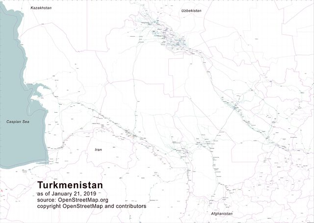
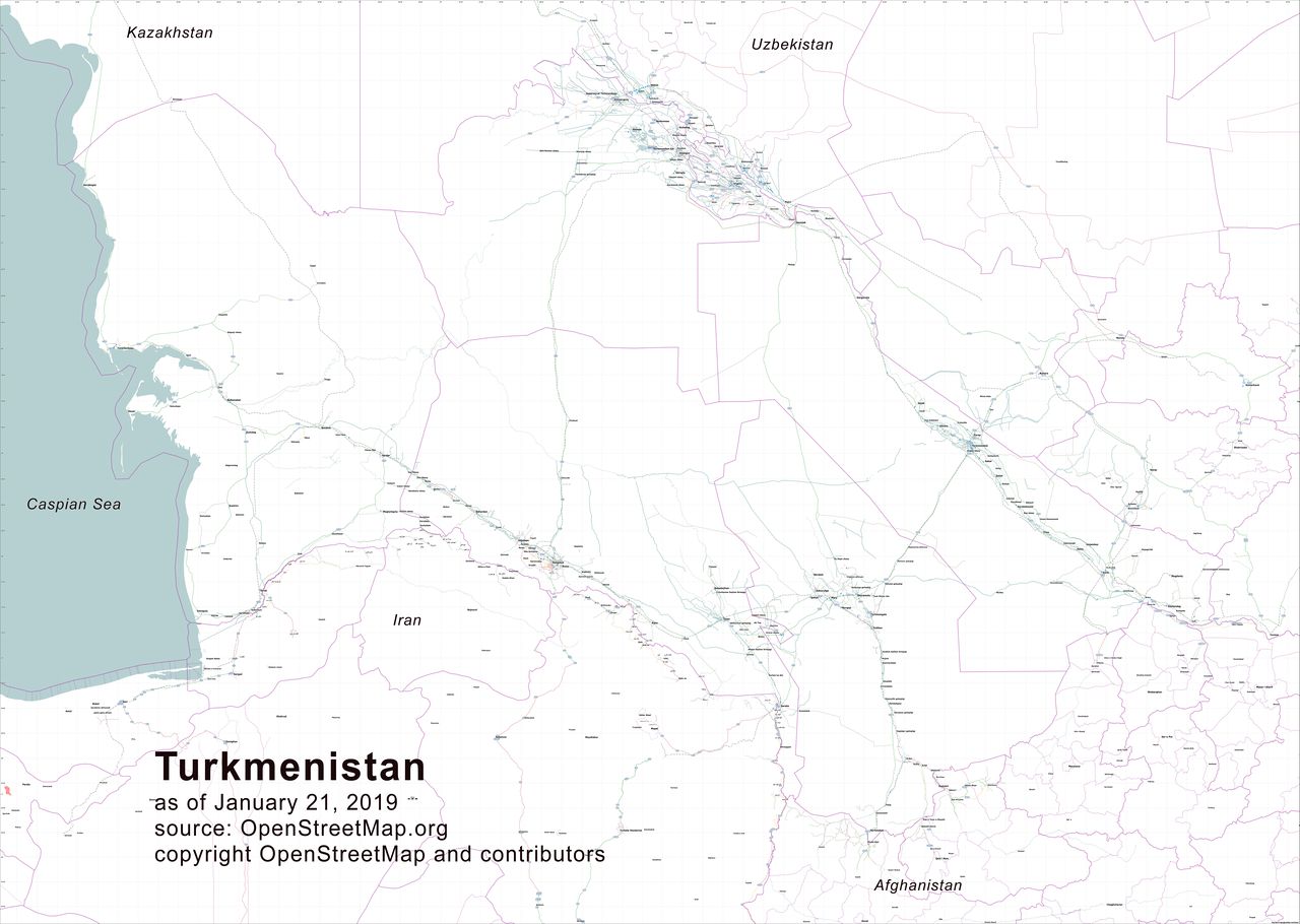
| Description | Map of Turkmenistan as of 21 January 2019 depicting trunk, primary, secondary, and tertiary highways; cities, towns, and selected villages; gas stations; and railways. Generated using Osmosis, Maperitive, and Corel Photo Paint by Allan Mustard. |
|---|---|
| Author | OpenStreetMap contributors, Apm-wa |
| Source | OpenStreetMap Data, own work |
| Date | 2019-01-23 |
Licensing
| Contains map data © OpenStreetMap contributors, made available under the terms of the Open Database License (ODbL).
The ODbL does not require any particular license for maps produced from ODbL data, produced maps may be subject also to other licences. |
File history
Click on a date/time to view the file as it appeared at that time.
| Date/Time | Thumbnail | Dimensions | User | Comment | |
|---|---|---|---|---|---|
| current | 16:11, 23 January 2019 | | 25,309 × 18,000 (21.76 MB) | Apm-wa (talk | contribs) | Map of Turkmenistan as of 21 January 2019 depicting trunk, primary, secondary, and tertiary highways; cities, towns, and selected villages; gas stations; and railways. Generated using Osmosis, Maperitive, and Corel Photo Paint by Allan Mustard. |
You cannot overwrite this file.
File usage
There are no pages that use this file.